 Block
Warrenville, Connecticut
29 topographic sheets cover this place, the earliest surveyed in 1892 and the latest in 1994. It stands in Ashford town. It lies in ZIP code area 06278. It stands on Gardner Brook. The Survey maps it on the Spring Hill quadrangle. It stands 381 feet above sea level.
On record in Warrenville
Buildings and businesses the archive holds for this place. Each opens its own page, with the source record it came from.
On the National Register within a mile 2 records
The National Register names another town for these. They stand within one mile of this settlement's coordinate.
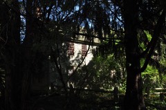 Mixer Tavernlisted 1994 · 0.2 miles away
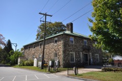 Knowlton Memorial Halllisted 1994 · 0.6 miles away
Topographic sheets covering this place
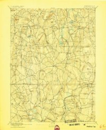
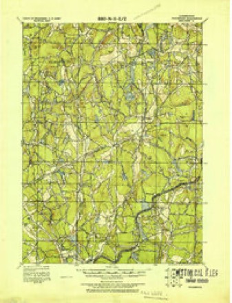
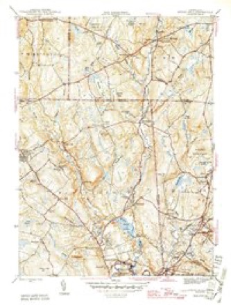
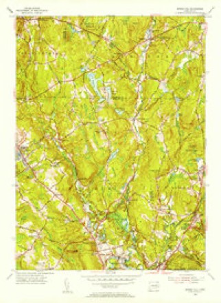
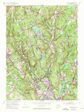
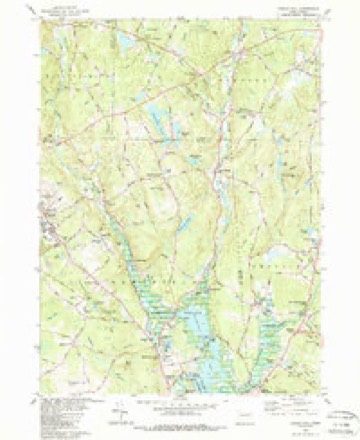
13 surveys from 29 printed sheetsMatched by testing this settlement's coordinate against the published boundary of every sheet in the United States Geological Survey's historical collection. Each opens the scanned sheet at the Survey.
- 1892 USGS Woodstock quadrangle1:62500, 6 printings
- 1921 USGS Woodstock quadrangle1:62500
- 1945 USGS Spring Hill quadrangle1:31680, 2 printings
- 1947 USGS Hartford quadrangle1:250000, 2 printings
- 1948 USGS Hartford quadrangle1:250000, 2 printings
- 1953 USGS Spring Hill quadrangle1:31680
- 1953 USGS Spring Hill quadrangle1:24000, 3 printings
- 1961 USGS Hartford quadrangle1:250000
- 1962 USGS Hartford quadrangle1:250000, 3 printings
- 1965 USGS Hartford quadrangle1:250000, 2 printings
- 1983 USGS Spring Hill quadrangle1:24000, 3 printings
- 1986 USGS Hartford quadrangle1:100000
- 1994 USGS Hartford quadrangle1:100000, 2 printings







In the county-history sources
25,487 words on this townshipHistory of Windham County, Connecticut .., published 1889 names this settlement in its chapter on Ashford Town. These are the passages that mention it, exactly as the scans read.
At this time representations had been made to the general court of Connecticut upon wliich that body on the 9th of May, 1706, granted to " such good people as shall be willing to settle thereon," a township eight miles square, and appointed a committee of its own members to lay out the township by actual survey, also to lay out home lots and other divisions of land, to order and manage the affairs of the town and to admit and settle all such inhabitants as should be approved, and who should pay their proportionate share of the expense of surveying and settling the same. This action of the court aroused Major Fitch to action, and he at once began to push the sale of lands Avhich he claimed. In 1707, a tract five miles in length and three in width was purchased for £110, by John Gushing, Samuel Clap and David Jacob, of Scituate, and laid out on the west of the Stoddard tract, and was called the New Scituate Plantation. Captain John Chandler soon purchased a large part of this tract and a strip of land adjacent, and became the chief proprietor of New Scituate. The whole remaining territory of original Ashford, comprising 21,400 acres, was sold by Major Fitch to James Corbin, of Woodstock, in 1708, and he conveyed the same to David Jacob, Job Randall and twelve others, residents of Scituate, Hingham and Andover, Mr. Corbin retaining an equal share in the land and managing the affairs of the company. These tracts were laid out as rapidly as possible, and efforts made to initiate a settlement in advance of the government. The proprietors had but partial confidence in the validity of their titles. The first actual settlement upon this land appears to have been by John Mixer, of Canterbury, who for four pounds purchased a tract of one hundred acres, the deed to which containing the stipulation that if the proprietors' right should be proven invalid the four pounds should be returned to the purchaser. His land lay on the river at a place called Mount Hope, where the present village of Warrenville is situated. This was in January, 1710. A few months later, in April, John Perry, of Marlborough, bought three hundred and fifty acres near the present site of Eastford village, and settled upon it.
Passage source: History of Windham County, Connecticut .., published 1889.
In May, 1725, James Corbin petitioned the general assembly for a patent of confirmation for certain lands in Ashford in place of lands which had been taken from him by the annexation of a strip of Ashford land to the town of Willington. The annexation of that strip to that town had prevented his taking up the twenty-five hundred acres assigned him in the settlement of his claim with Ashford.. On the other hand the NewScituate tract, which was now held by Colonel John Chandler, contained 2,476 acres more than the deed called for. Corbin now petitioned that this surplus might be granted to him. A committee appointed by the general court found that the New f^cituate land was over measured, and that body on hearing the case decided that the petition of Corbin should be granted, with the proviso, "that all the claimers that have regulated themselves according to the order of the committee in 1719 shall not be prejudiced thereby."
Passage source: History of Windham County, Connecticut .., published 1889.
November 26th, 1718, a church was formally organized in Ashford by Reverend Josiah Dwight, Mr. Samuel Whiting and Joseph Meacham, of Coventry. Mr. Hale was ordained pastor, and the following men subscribed to the articles of covenant: James Hale, John Mixer, William Ward, Joseph Green, Isaac Magoon, Matthew Thompson, William Chapman, Benjamin Russel, Daniel Fuller, Isaac Kendall, John Pitts, Nathaniel Fuller and John Perry. On December 9th following the female members named hereafter were added to the number of original names: Sarah Hale, Abigail Mixer, Judith Ward, Mary Fuller, Mary Russel, Elizabeth Squier, Mary Fuller, Mrs. William Chapman and the Widow Dimick. December 21st, Elinor Kendall and Sarah Bugbee were added to the number. John Mixer was made the first deacon. In September, 1721, he being about to remove from the town, his place was filled by the election of Isaac Kendall and Joseph Bugbee. " Brother John Perry " was at this time chosen " to set the psalm with respect to public singing." The meeting house had been finished sufficiently to afford a place to hold services in, but it remained unfinished inside until 1723, when it was decided as desirable to finish with " plaster and whitewash all the lower part of the meeting house to the lower girth." Among the furniture of the house was an hour-glass, for which Nathaniel Fuller was allowed two shillings. The finish of the interior, however, was delayed many years, and the privileges of pews and the orderly seating of the congregation according to the ideas and usages of those days, were questions frequently under discussion and subject to various and often opposing decisions. It was evidently a hard struggle for existence with the first church of Ashford. There were discordant elements in the population, and a factor of ignorance laid obstacles in the way. Taxes were laid, school questions were set aside, remarkable privileges were granted, all to help forward the matter of church and minister's house and support, the South church of Boston donated fifteen pounds to help this church, but with all the means used and efforts made the work was backward.
Passage source: History of Windham County, Connecticut .., published 1889.
Machine-read from a century-old scan, so expect the errors a machine makes: misspelled names, dropped words, stray characters.
Read the whole chapter on Ashford Town - it names this place 15 more 15 times.
Fires near this place
48 since 2006Regional context, not property-specific evidence. The federal wildfire occurrence database lists 48 fires within 5 miles of Warrenville between 2006 and 2020, burning about 77 acres in total. None started naturally. None was recorded as arson. Distance is straight-line from the map coordinates, so a fire counted here may appear on a neighbouring settlement's page as well.
| Reported cause | Fires |
|---|---|
| Missing data/not specified/undetermined | 36 |
| Debris and open burning | 5 |
| Recreation and ceremony | 4 |
| Smoking | 3 |
The most recent of them, most recent first, with the day each was reported and the service that recorded it.
| Date | Cause | Size | Reported by | Name on the report |
|---|---|---|---|---|
| 23 September 2020 | Missing data/not specified/undetermined | 1.0 acres | Connecticut Division of Forestry | 100 PUMPKIN HILL ROAD |
| 19 September 2020 | Missing data/not specified/undetermined | under an acre | Connecticut Division of Forestry | 100 PUMPKIN HILL ROAD |
| 16 September 2020 | Recreation and ceremony | under an acre | Connecticut Division of Forestry | 15 PUMPKIN HILL ROAD |
| 17 August 2020 | Missing data/not specified/undetermined | under an acre | Connecticut Division of Forestry | 13 BUELL DRIVE |
| 13 August 2020 | Missing data/not specified/undetermined | under an acre | Connecticut Division of Forestry | CHAPLIN ST./ PALMER RD. |
| 26 June 2015 | Missing data/not specified/undetermined | under an acre | Connecticut Division of Forestry | not named |
| 17 June 2016 | Missing data/not specified/undetermined | under an acre | Connecticut Division of Forestry | 36 TOWER HILL RD, CHAPLIN CT |
| 21 May 2008 | Debris and open burning | under an acre | Connecticut Division of Forestry | not named |
Settlements close enough to share some of these fires:
Mines and quarries near this place
1 within 5 milesRegional context, not property-specific evidence. The federal mineral resources record lists 1 working within 5 miles of Warrenville: 1 past producer. None of them still produces. What was taken out: Sand and Gravel, Construction. Distance is straight-line from the map coordinates, so a quarry counted here may appear on a neighbouring settlement's page as well.
| Where | Site | Commodity | Status | Recorded |
|---|---|---|---|---|
| Latham Pit | Sand and Gravel, Construction | Past Producer |
Storms near this place
4 since 1998Regional context, not property-specific evidence. The National Weather Service names Warrenville in 4 storm reports between 1998 and 2024: 2 flash flood, 2 thunderstorm wind. No death or injury is recorded in these reports. Each account below is quoted exactly as the forecast office filed it, from the NOAA Storm Events Database, and each date opens the federal record of that event.
| When | Event | Place named | Harm | What the report says |
|---|---|---|---|---|
| July 2021 | Flash Flood | Warrenville | $3,000 | In the Warrenville portion of Ashford, flash flooding closed Route 44 over the Mt. Hope River between Route 74 and Route 89. Rainfall totals by early evening included 4.95 inches in Pomfret, 4.75 inches in 2.5 hours in Ashford, and 3.42 inches in Woodstock. |
| July 2020 | Thunderstorm Wind | Warrenville | $1,000 | In Ashford, a large tree was down on Route 89, north of Route 44. |
| July 2024 | Thunderstorm Wind | Warrenville | $500 | In Ashford, a tree and wires were down on Slade Rd. |
| March 1998 | Flash Flood | Warrenville | - | no account filed |
Nearest settlements
The eight closest, with where each one stands in the county. Distances are straight-line, computed from the Geographic Names Information System coordinates.
| Map | Place | Distance | Sheets |
|---|---|---|---|
| West Ashford | 1.0 miles | 29 | |
| Ashford | 2.3 miles | 28 | |
| Westford | 4.0 miles | 28 | |
| Phoenixville | 4.2 miles | 28 | |
| Natchaug (historical) | 4.5 miles | 28 | |
| Chaplin | 5.1 miles | 29 | |
| Eastford | 5.1 miles | 28 | |
| Lake Chaffee | 5.6 miles | 28 |
Elsewhere
Matched on this settlement's Geographic Names Information System number rather than its name, so it cannot be a different place of the same name in another state.
| Wikidata item Q123371558 | The structured record the population and elevation above come from. Public domain (CC0). |
Provenance
This settlement is recorded in the Geographic Names Information System as feature 211824. The sheet list is computed by point-in-boundary test against the United States Geological Survey's historical topographic inventory. Both are works of the United States government and carry no copyright under 17 U.S.C. 105.
Wildfire. Short, Karen C. 2022. Spatial wildfire occurrence data for the United States, 1992-2020 [FPA_FOD_20221014]. 6th Edition. Fort Collins, CO: Forest Service Research Data Archive. https://doi.org/10.2737/RDS-2013-0009.6 Collected with United States Government funding and usable without additional permissions or fees.
Mines and quarries. USGS Mineral Resources Data System (MRDS) https://mrdata.usgs.gov/mrds/ A work of the United States government, no copyright under 17 U.S.C. 105.
Storms. NOAA National Centers for Environmental Information, Storm Events Database https://www.ncei.noaa.gov/stormevents/ A work of the United States government, no copyright under 17 U.S.C. 105. Narratives are quoted verbatim from the National Weather Service report and are not edited or summarised.