 Block
Berlin, Connecticut
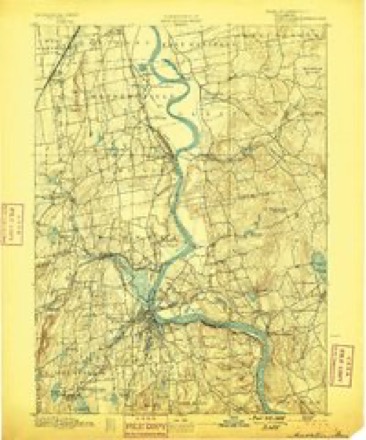
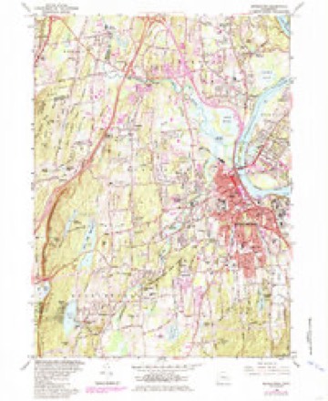
36 topographic sheets cover this place, the earliest surveyed in 1893 and the latest in 1994. It stands in Berlin town. It lies in ZIP code area 06037. It lies near Worthington Ridge. The Survey maps it on the Middletown quadrangle.
On record in Berlin
Buildings and businesses the archive holds for this place. Each opens its own page, with the source record it came from.
On the National Register 4 records
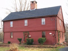 Ezekiel Kelsey Houselisted 1977
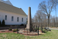 Kensington Soldier's Monumentlisted 2013
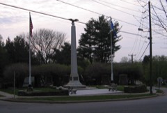 Worthington Ridge Historic Districtlisted 1989
- Kensington Grammar School-Jean E. Hooker High Schoollisted 2012
Topographic sheets covering this place
14 surveys from 36 printed sheetsMatched by testing this settlement's coordinate against the published boundary of every sheet in the United States Geological Survey's historical collection. Each opens the scanned sheet at the Survey.
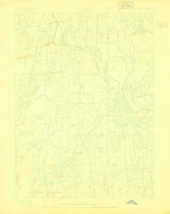
- 1893 USGS Middletown quadrangle1:62500, 10 printings
- 1906 USGS Farmington quadrangle1:125000, 2 printings
- 1928 USGS Cromwell quadrangle1:24000
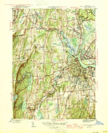
- 1945 USGS Middletown quadrangle1:31680, 2 printings
- 1947 USGS Hartford quadrangle1:250000, 2 printings
- 1948 USGS Hartford quadrangle1:250000, 2 printings
- 1952 USGS Middletown quadrangle1:24000
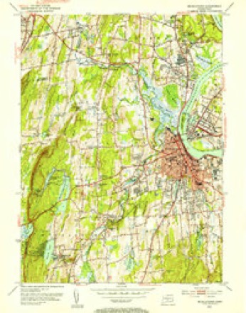
- 1952 USGS Middletown quadrangle1:31680, 2 printings
- 1961 USGS Hartford quadrangle1:250000
- 1962 USGS Hartford quadrangle1:250000, 3 printings
- 1965 USGS Hartford quadrangle1:250000, 2 printings
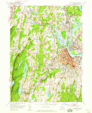
- 1965 USGS Middletown quadrangle1:24000, 5 printings
- 1986 USGS Hartford quadrangle1:100000
- 1994 USGS Hartford quadrangle1:100000, 2 printings








In the county-history sources
7,187 words on this townshipThe Memorial History of Hartford County, Connecticut, 1633-1884;, published 1886 names this settlement in its chapter on Berlin Town. These are the passages that mention it, exactly as the scans read.
In January, 168G, the General Court of the Colony of Connecticut granted to the towns of '^ Middletown, Wethersfield, and Farmington all the vacant lands between their bounds and the bounds of Wallingford" (which then included what is now the township of Meriden), for the purpose of establishing a new plantation. The grant covered the tract of land now belonging to Berlin and Ne^v Britain.
Passage source: The Memorial History of Hartford County, Connecticut, 1633-1884;, published 1886.
The first settler was Richard Beckley. He appears to have been one of the early planters of New Haven, and to have removed to Wethersfield in 1668. The records of the colony of Connecticut show that in that year the General Court granted to Sergeant Richard Beckley three hundred acres of land lying by Mattabesitt River. The records of lands for Wetlicrsfield inform us also that he i)urchased his grounds of " Terramoogus [Indian], with the consent of the Court and the town of Wethersfield." This tract of land, thus granted to Richard Beckley, on which he probably settled in 1668 or soon after, is in the northeast part of the town of Berlin, in what from time immemorial has been called "- Beckley Quarter." The Indian of whom he purchased the land belonged to the Mattabesitt tribe, and this was a part of their hunting-ground. Other settlers soon gathered about Beckley, and so the settlement of the Wethersfield part of this toM'U began.
Passage source: The Memorial History of Hartford County, Connecticut, 1633-1884;, published 1886.
This I'ich basin to which the settlers had come received from them the name of Great Swamp, on account of its low situation. An Ecclesiastical Society was organized in Great Swamj) in 1705. The new society, including in its territorial limits the greater part of the present towns of New Britain and Berlin, was called the Second Society of Farmington. It received the name Kensington by act of the General Assemljly, on the petition of its inhabitants, in May, 1722. Beckley Quarter, which in 1712 was assigned to the new West Society in Wethersfield, since called Newington, was in 1715 annexed to the Great Swamp Society ; and so Beckley Quarter became a part of the Second Society of Farmington.
Passage source: The Memorial History of Hartford County, Connecticut, 1633-1884;, published 1886.
Machine-read from a century-old scan, so expect the errors a machine makes: misspelled names, dropped words, stray characters.
Read the whole chapter on Berlin Town - it names this place 22 more 22 times.
Fires near this place
26 since 1993Regional context, not property-specific evidence. The federal wildfire occurrence database lists 26 fires within 5 miles of Berlin between 1993 and 2020, burning about 58 acres in total. None started naturally. 4 were recorded as arson. Distance is straight-line from the map coordinates, so a fire counted here may appear on a neighbouring settlement's page as well.
| Reported cause | Fires |
|---|---|
| Missing data/not specified/undetermined | 11 |
| Recreation and ceremony | 5 |
| Arson/incendiarism | 4 |
| Debris and open burning | 2 |
| Smoking | 2 |
| Equipment and vehicle use | 2 |
The most recent of them, most recent first, with the day each was reported and the service that recorded it.
| Date | Cause | Size | Reported by | Name on the report |
|---|---|---|---|---|
| 4 August 1999 | Recreation and ceremony | 6.0 acres | Connecticut Division of Forestry | not named |
| 22 August 1995 | Smoking | under an acre | Connecticut Division of Forestry | not named |
| 14 August 2006 | Recreation and ceremony | under an acre | Connecticut Division of Forestry | not named |
| 25 July 2016 | Recreation and ceremony | 1.2 acres | Connecticut Division of Forestry | RAGGED MOUNTAIN |
| 19 July 2016 | Missing data/not specified/undetermined | 1.0 acres | Connecticut Division of Forestry | ROUTE 9 SOUTHBOUND |
| 7 May 2006 | Recreation and ceremony | 3.0 acres | Connecticut Division of Forestry | not named |
| 6 May 2007 | Missing data/not specified/undetermined | under an acre | Connecticut Division of Forestry | not named |
| 30 May 1993 | Recreation and ceremony | 2.0 acres | Connecticut Division of Forestry | not named |
Settlements close enough to share some of these fires:
Mines and quarries near this place
10 of 46 shownRegional context, not property-specific evidence. The federal mineral resources record lists 46 workings within 5 miles of Berlin: 39 past producers, 4 producers, 2 occurrences, 1 unknown. 4 still produce. What was taken out: Stone, Crushed/Broken, Stone, Dimension, Sand and Gravel, Construction, Clay. Distance is straight-line from the map coordinates, so a quarry counted here may appear on a neighbouring settlement's page as well.
| Where | Site | Commodity | Status | Recorded |
|---|---|---|---|---|
| Amethyst, Bitumen Vein Quartz Occurrence No. Dj-036 | Gemstone, Rock Asphalt | Occurrence | Amethyst, Calcite, Quartz | |
| Barite Occurrences No. Cj-070 | Barium-Barite, Calcium, Quartz | Occurrence | Void Fill | |
| Copper Mine | Copper | Past Producer | ||
| Limestone Quarry No. Dj-002 | Limestone, General, Fluorine-Fluorite | Past Producer | Limestone | |
| Mattabesset River Lead Mine | Lead, Zinc, Iron, Sulfur, Barium-Barite | Past Producer | Barite, Galena, Pyrite, Sphalerite | |
| Berlin Moore's Mill Barite Mine | Barium-Barite | Past Producer | Breccia Fill Along Fault | |
| Lead Mine | Lead | Past Producer | ||
| Charles Genoni Pit | Clay | Past Producer | ||
| Yard Number 2 Pit | Clay | Past Producer | Sedimentary | |
| Yard Number 2 Pit and Plant | Clay | Producer |
Storms near this place
9 since 1996Regional context, not property-specific evidence. The National Weather Service names Berlin in 9 storm reports between 1996 and 2023: 3 hail, 2 flash flood, 2 thunderstorm wind, 1 lightning. No death or injury is recorded in these reports. Each account below is quoted exactly as the forecast office filed it, from the NOAA Storm Events Database, and each date opens the federal record of that event.
| When | Event | Place named | Harm | What the report says |
|---|---|---|---|---|
| September 2003 | Flash Flood | Berlin | $25,000 | no account filed |
| July 2012 | Thunderstorm Wind | Berlin | $10,000 | Several trees and branches were downed by thunderstorm winds, including one on New Britain Road. Part of a screen was blown off a screen door. |
| June 2001 | Lightning | Berlin | $10,000 | no account filed |
| August 2023 | Thunderstorm Wind | East Berlin | $500 | In Berlin, power lines were down partially blocking Mill Rd. |
| May 2015 | Flood | Berlin | - | The Lower Lane area of Berlin experienced localized flooding. |
| May 2010 | Hail | Berlin | - | no account filed |
| July 2010 | Hail | Berlin | - | no account filed |
| July 2006 | Hail | Berlin | - | no account filed |
| April 1996 | Flash Flood | Berlin | - | no account filed |
Nearest settlements
The eight closest, with where each one stands in the county. Distances are straight-line, computed from the Geographic Names Information System coordinates.
| Map | Place | Distance | Sheets |
|---|---|---|---|
| Kensington | 1.6 miles | 38 | |
| East Berlin | 1.7 miles | 36 | |
| Turkey Hill | 2.2 miles | 37 | |
| New Britain | 3.3 miles | 38 | |
| Elm Hill | 3.7 miles | 37 | |
| Mount Pleasant Housing | 4.5 miles | 38 | |
| Newington | 5.4 miles | 37 | |
| Corbin Heights Housing | 5.7 miles | 38 |
Provenance
This settlement is recorded in the Geographic Names Information System as feature 205454. The sheet list is computed by point-in-boundary test against the United States Geological Survey's historical topographic inventory. Both are works of the United States government and carry no copyright under 17 U.S.C. 105.
Wildfire. Short, Karen C. 2022. Spatial wildfire occurrence data for the United States, 1992-2020 [FPA_FOD_20221014]. 6th Edition. Fort Collins, CO: Forest Service Research Data Archive. https://doi.org/10.2737/RDS-2013-0009.6 Collected with United States Government funding and usable without additional permissions or fees.
Mines and quarries. USGS Mineral Resources Data System (MRDS) https://mrdata.usgs.gov/mrds/ A work of the United States government, no copyright under 17 U.S.C. 105.
Storms. NOAA National Centers for Environmental Information, Storm Events Database https://www.ncei.noaa.gov/stormevents/ A work of the United States government, no copyright under 17 U.S.C. 105. Narratives are quoted verbatim from the National Weather Service report and are not edited or summarised.