 Block
East Berlin, Connecticut
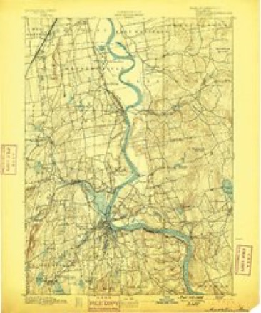
36 topographic sheets cover this place, the earliest surveyed in 1893 and the latest in 1994. It stands in Berlin town. It lies in ZIP code area 06023. It stands on Spruce Brook. The Survey maps it on the Middletown quadrangle.
On record in East Berlin
Buildings and businesses the archive holds for this place. Each opens its own page, with the source record it came from.
On the National Register within a mile 1 record
The National Register names another town for these. They stand within one mile of this settlement's coordinate.
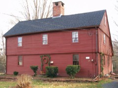 Ezekiel Kelsey Houselisted 1977 · 0.8 miles away
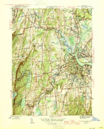
Topographic sheets covering this place
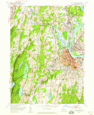
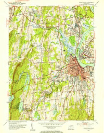
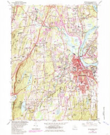
14 surveys from 36 printed sheetsMatched by testing this settlement's coordinate against the published boundary of every sheet in the United States Geological Survey's historical collection. Each opens the scanned sheet at the Survey.
- 1893 USGS Middletown quadrangle1:62500, 10 printings
- 1906 USGS Farmington quadrangle1:125000, 2 printings
- 1928 USGS Cromwell quadrangle1:24000
- 1945 USGS Middletown quadrangle1:31680, 2 printings
- 1947 USGS Hartford quadrangle1:250000, 2 printings
- 1948 USGS Hartford quadrangle1:250000, 2 printings
- 1952 USGS Middletown quadrangle1:24000
- 1952 USGS Middletown quadrangle1:31680, 2 printings
- 1961 USGS Hartford quadrangle1:250000
- 1962 USGS Hartford quadrangle1:250000, 3 printings
- 1965 USGS Hartford quadrangle1:250000, 2 printings
- 1965 USGS Middletown quadrangle1:24000, 5 printings
- 1986 USGS Hartford quadrangle1:100000
- 1994 USGS Hartford quadrangle1:100000, 2 printings








In the county-history sources
7,187 words on this townshipThe Memorial History of Hartford County, Connecticut, 1633-1884;, published 1886 names this settlement in its chapter on Berlin Town. These are the passages that mention it, exactly as the scans read.
The author of D wight's Travels tells us that immediately after the war with Great Britain, which closed in 1815, " ten thousand boxes of tinned plates were manufactured into culinary vessels in the town of Berlin in one year." A few years later, the business in this place began to decline. Now there are two shops, in each of which two or three hands are employed, - one in the village of Worthington, and the other in East Berlin.
Passage source: The Memorial History of Hartford County, Connecticut, 1633-1884;, published 1886.
There are other manufacturing interests of some importance in the town, - two carriage-shops, one in East Berlin and one in Kensington; three grist-mills, two saw-mills, six blacksmith-shops. W. W. Mildrum is doing a considerable business in East Berlin as watch and clock repairer, and in cutting and polishing agates as jewels for ship-surveyors' compasses, etc. The agates are mostly found in the trap ledges of Berlin. On Belcher's Brook the Blair Manufacturing Company formerly made planters' hoes, garden-rakes, etc. The building is now occupied by Hart, Burt, & Co., wood-turners, who employ seven hands. The Mattabesitt River, where it runs through East Berlin, was utilized more than eighty years ago by Shubael Patterson and Benjamin Wilcox for spinning cotton yarn, which was put out to women to be woven on hand-looms. Afterward Elishama Brandegee engaged in the same business. The buildings next passed into the hands of a joint-stock corporation which made tinners' tools and machines. The Roys & Wilcox Company took the business in 1845. The establishment was burned in 1846, and not loug after rebuilt. In 1870 the premises passed to the Peck, Stow, & Wilcox Company, which employs in this factory one hundred and twenty-five hands. The corporation has now a capital of a million and a half, and employs fifteen hundred hands in its factories in eight towns. Mr. Samuel C. Wilcox, of this company, is a native and a resident of Berlin, a good business man and a public-spirited citizen.
Passage source: The Memorial History of Hartford County, Connecticut, 1633-1884;, published 1886.
The Berlin Iron Bridge Company, formerly the Corrugated Metal Company, also doing business on the Mattabesett River, in East Berlin, was founded bv Franklin Rovs for the manufacture of corrugated shino-les and afterward made fire-proof shutters, doors, and roofs. It now makes parabolic truss bridges. S. C. Wilcox is president of the company, an* C. M. Jarvis cliief engineer and superintendent. It is doino- a thriving business, employing from fifty to seventy-five hands, and tuniino- out from ^00,000 to $200,000 worth of iron-work in a year.
Passage source: The Memorial History of Hartford County, Connecticut, 1633-1884;, published 1886.
Machine-read from a century-old scan, so expect the errors a machine makes: misspelled names, dropped words, stray characters.
Read the whole chapter on Berlin Town - it names this place 4 more 4 times.
Fires near this place
37 since 1993Regional context, not property-specific evidence. The federal wildfire occurrence database lists 37 fires within 5 miles of East Berlin between 1993 and 2020, burning about 94 acres in total. None started naturally. 6 were recorded as arson. Distance is straight-line from the map coordinates, so a fire counted here may appear on a neighbouring settlement's page as well.
| Reported cause | Fires |
|---|---|
| Missing data/not specified/undetermined | 21 |
| Arson/incendiarism | 6 |
| Recreation and ceremony | 4 |
| Debris and open burning | 2 |
| Smoking | 2 |
| Equipment and vehicle use | 2 |
The most recent of them, most recent first, with the day each was reported and the service that recorded it.
| Date | Cause | Size | Reported by | Name on the report |
|---|---|---|---|---|
| 30 September 2007 | Debris and open burning | under an acre | Connecticut Division of Forestry | not named |
| 5 August 2007 | Missing data/not specified/undetermined | 1.0 acres | Connecticut Division of Forestry | not named |
| 4 August 1999 | Recreation and ceremony | 6.0 acres | Connecticut Division of Forestry | not named |
| 22 August 1995 | Smoking | under an acre | Connecticut Division of Forestry | not named |
| 14 August 2006 | Recreation and ceremony | under an acre | Connecticut Division of Forestry | not named |
| 19 July 2016 | Missing data/not specified/undetermined | 1.0 acres | Connecticut Division of Forestry | ROUTE 9 SOUTHBOUND |
| 7 May 2006 | Recreation and ceremony | 3.0 acres | Connecticut Division of Forestry | not named |
| 6 May 2007 | Missing data/not specified/undetermined | under an acre | Connecticut Division of Forestry | not named |
Settlements close enough to share some of these fires:
Mines and quarries near this place
10 of 44 shownRegional context, not property-specific evidence. The federal mineral resources record lists 44 workings within 5 miles of East Berlin: 38 past producers, 3 producers, 2 occurrences, 1 unknown. 3 still produce. What was taken out: Stone, Crushed/Broken, Stone, Dimension, Sand and Gravel, Construction, Clay. Distance is straight-line from the map coordinates, so a quarry counted here may appear on a neighbouring settlement's page as well.
| Where | Site | Commodity | Status | Recorded |
|---|---|---|---|---|
| Amethyst, Bitumen Vein Quartz Occurrence No. Dj-036 | Gemstone, Rock Asphalt | Occurrence | Amethyst, Calcite, Quartz | |
| Barite Occurrences No. Cj-070 | Barium-Barite, Calcium, Quartz | Occurrence | Void Fill | |
| Mattabesset River Lead Mine | Lead, Zinc, Iron, Sulfur, Barium-Barite | Past Producer | Barite, Galena, Pyrite, Sphalerite | |
| Berlin Moore's Mill Barite Mine | Barium-Barite | Past Producer | Breccia Fill Along Fault | |
| Lead Mine | Lead | Past Producer | ||
| Charles Genoni Pit | Clay | Past Producer | ||
| Portland Brownstone Quarries | Flagstone | Past Producer | ||
| Sandstone Quarry | Flagstone | Past Producer | ||
| Sandstone Quarry | Flagstone | Past Producer | ||
| Yard Number 2 Pit | Clay | Past Producer | Sedimentary |
Storms near this place
1 since 2023Regional context, not property-specific evidence. The National Weather Service names East Berlin in 1 storm report in 2023: 1 thunderstorm wind. No death or injury is recorded in these reports. Each account below is quoted exactly as the forecast office filed it, from the NOAA Storm Events Database, and each date opens the federal record of that event.
| When | Event | Place named | Harm | What the report says |
|---|---|---|---|---|
| August 2023 | Thunderstorm Wind | East Berlin | $500 | In Berlin, power lines were down partially blocking Mill Rd. |
Nearest settlements
The eight closest, with where each one stands in the county. Distances are straight-line, computed from the Geographic Names Information System coordinates.
| Map | Place | Distance | Sheets |
|---|---|---|---|
| Berlin | 1.7 miles | 36 | |
| Kensington | 3.1 miles | 38 | |
| Turkey Hill | 3.8 miles | 37 | |
| Elm Hill | 4.2 miles | 37 | |
| New Britain | 4.6 miles | 38 | |
| Rocky Hill | 5.1 miles | 37 | |
| Newington | 5.5 miles | 37 | |
| Griswoldville | 5.7 miles | 37 |
Elsewhere
Matched on this settlement's Geographic Names Information System number rather than its name, so it cannot be a different place of the same name in another state.
| Wikipedia article on East Berlin | An encyclopaedic summary. Its text is share-alike, so it is linked here rather than copied. |
| Wikidata item Q5327866 | The structured record the population and elevation above come from. Public domain (CC0). |
Provenance
This settlement is recorded in the Geographic Names Information System as feature 206779. The sheet list is computed by point-in-boundary test against the United States Geological Survey's historical topographic inventory. Both are works of the United States government and carry no copyright under 17 U.S.C. 105.
Wildfire. Short, Karen C. 2022. Spatial wildfire occurrence data for the United States, 1992-2020 [FPA_FOD_20221014]. 6th Edition. Fort Collins, CO: Forest Service Research Data Archive. https://doi.org/10.2737/RDS-2013-0009.6 Collected with United States Government funding and usable without additional permissions or fees.
Mines and quarries. USGS Mineral Resources Data System (MRDS) https://mrdata.usgs.gov/mrds/ A work of the United States government, no copyright under 17 U.S.C. 105.
Storms. NOAA National Centers for Environmental Information, Storm Events Database https://www.ncei.noaa.gov/stormevents/ A work of the United States government, no copyright under 17 U.S.C. 105. Narratives are quoted verbatim from the National Weather Service report and are not edited or summarised.