 Block
East Hartford, Connecticut
35 topographic sheets cover this place, the earliest surveyed in 1892 and the latest in 1994. It stands in East Hartford town. It lies in ZIP code area 06108. It lies near Wickham Hill. The Survey maps it on the Manchester quadrangle. 51,045 people lived here at the 2020 count. It stands 49 feet above sea level.
On record in East Hartford
Buildings and businesses the archive holds for this place. Each opens its own page, with the source record it came from.
On the National Register 9 records
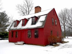 Makens Bemont Houselisted 1982
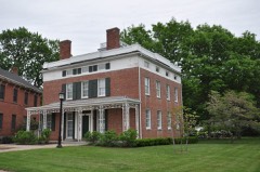 Selden Brewer Houselisted 1979
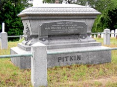 Central Avenue-Center Cemetery Historic Districtlisted 1993
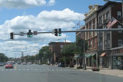 Downtown Main Street Historic Districtlisted 1996
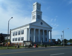 First Congregational Church of East Hartford and Parsonagelisted 1982
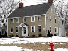 Gilman-Hayden Houselisted 1984
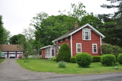 Naubuc Avenue-Broad Street Historic Districtlisted 1998
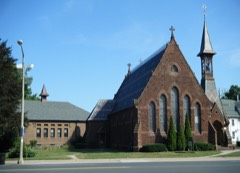 St. John's Episcopal Churchlisted 1983
- Garvan-Carroll Historic Districtlisted 1991
Population over time
2 figuresEast Hartford fell from 51,252 to 51,045 between 2010 and 2020. These are the recorded population figures Wikidata holds for this place, reached through the Geographic Names Information System number this page is keyed on rather than by name, so they belong to this place and not to another of the same name. Most are census counts, but not all are: an early figure may be a founding or settlement estimate, and an estimate published within five years of a census is left out. The change column is computed, and is left blank where more than 20 years separate a figure from the one before it, because a gap that long is not a change between two counts.
| Year | People | Change |
|---|---|---|
| 2010 | 51,252 | |
| 2020 | 51,045 | -207 (-0%) |
Topographic sheets covering this place
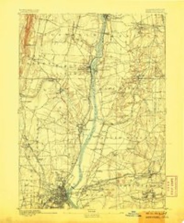
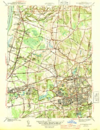
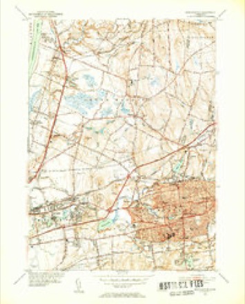
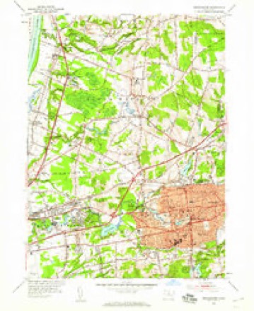
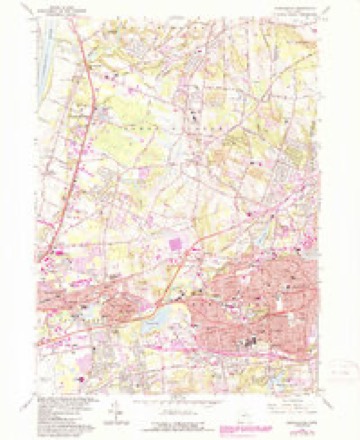
14 surveys from 35 printed sheetsMatched by testing this settlement's coordinate against the published boundary of every sheet in the United States Geological Survey's historical collection. Each opens the scanned sheet at the Survey.
- 1892 USGS Hartford quadrangle1:62500, 8 printings
- 1906 USGS Farmington quadrangle1:125000, 2 printings
- 1928 USGS Manchester quadrangle1:24000
- 1944 USGS Manchester quadrangle1:31680, 3 printings
- 1947 USGS Hartford quadrangle1:250000, 2 printings
- 1948 USGS Hartford quadrangle1:250000, 2 printings
- 1952 USGS Manchester quadrangle1:31680, 2 printings
- 1952 USGS Manchester quadrangle1:24000
- 1961 USGS Hartford quadrangle1:250000
- 1962 USGS Hartford quadrangle1:250000, 3 printings
- 1963 USGS Manchester quadrangle1:24000, 5 printings
- 1965 USGS Hartford quadrangle1:250000, 2 printings
- 1986 USGS Hartford quadrangle1:100000
- 1994 USGS Hartford quadrangle1:100000, 2 printings








In the county-history sources
8,320 words on this townshipThe Memorial History of Hartford County, Connecticut, 1633-1884;, published 1886 names this settlement in its chapter on East Hartford Town. These are the passages that mention it, exactly as the scans read.
The town of Hartford once included in its l)oundaries the territory of the present towns of East Hartford and Manchester. Deeds from the Indians of all its land have been preserved, excepting of the territory now covered by East Hartford. A deed of this was probably given, as allusions to its purchase occur in the records of early lay-outs and distributions of the land. The history of this territory (long known as the " three miles " tract), and of the " five miles " purchase, made later, is included in that of Hartford until 1783, when these two sections were made a separate town, Avith bounds extending from the Great River to the Bolton town line, and known as East Hartford. The original boundary of the town of Plartford on this side the river on the south waj5 " att the' mouth of Pewter pott Brooke att the lower side of Hoccano, and there to run due east into the Country 3 miles;" and on the north, at " the Riverett's mouth [l)y the Indians called Podanke] that falls into the saide greate River of" Conectecott, and there the said Hartford is to runn due east into the Countrey."
Passage source: The Memorial History of Hartford County, Connecticut, 1633-1884;, published 1886.
The petition of the inhal)itants asking for the " liberty of a minister" among them was dated May, 1694, and in October of that year permission was given. The society was known as the Third Ecclesiastical Society of Hartford, and included all of the town of Hartford on this side the Great River, - now the towns of East Hartford and Manchester. All persons living on this side were to pay their rates toward its maintenance. The earliest preserved record of a meeting is of one held Dec. 29, 1699, wdien a committee was appointed " to see about the meeting-house" - probably already begun. A rate of threepence in the pound was laid, - one penny payalde in corn, the rest in work if any chose. The meetinii-house was built on a little hill which once hlled the triangle formed by the roads at the north end of the Hockanum causeway. It was not fully completed for several years. In 1707 a rate of <£45 was voted for -' seating- and sealing- " the meeting-house, two thirds payable in timber delivered at the water side of the meeting-house. In 1713 galleries were built, and in 1718 four green casements ordered for the south windows. The structure was very plain, and was used until about 1740. A minister's house was begun in 1699, and a rate of £200 was laid to com]:)leto it. It was built on the west side of Main Street, not far from the meeting-house.
Passage source: The Memorial History of Hartford County, Connecticut, 1633-1884;, published 1886.
The Hockanum and its tributaries, and several smaller streams in the present towns of East Hartford and Manchester, furnished a number of good water-powers, and these were early made use of by the settlers in preparing their abundant timber for building, and in grinding their grain for food and flax-seed for oil. Large grants of timber were made to those who established mills. William Goodwin and John Crow set up the first saw and grist mill on the north side of the lower fall at Burnside, in 1639. This mill was afterward owned by the Pitkins, who also acquired the contiguous sites, and the locality became known as Pitkin's Falls. The Pitkins used a part of the lower fall for a fulling-mill, the old grist-mill there having been constantly maintained until within a few years. Opposite the grist-mill, on the south end of the dam, a mill used first for nail-cutting, but soon afterward as a saw-mill, stood from 1808 to 1869. The title of these mills passed to George Goodwin & Co. in 1826. They used part of the power for papermaking. It is now owned by the Hanmer & Forbes Company, who manufacture manila paper.
Passage source: The Memorial History of Hartford County, Connecticut, 1633-1884;, published 1886.
Machine-read from a century-old scan, so expect the errors a machine makes: misspelled names, dropped words, stray characters.
Read the whole chapter on East Hartford Town - it names this place 5 more 5 times.
Fires near this place
14 since 1992Regional context, not property-specific evidence. The federal wildfire occurrence database lists 14 fires within 5 miles of East Hartford between 1992 and 2020, burning about 214 acres in total. None started naturally. 4 were recorded as arson. Distance is straight-line from the map coordinates, so a fire counted here may appear on a neighbouring settlement's page as well.
| Reported cause | Fires |
|---|---|
| Missing data/not specified/undetermined | 5 |
| Arson/incendiarism | 4 |
| Debris and open burning | 2 |
| Recreation and ceremony | 1 |
| Smoking | 1 |
| Power generation/transmission/distribution | 1 |
The most recent of them, most recent first, with the day each was reported and the service that recorded it.
| Date | Cause | Size | Reported by | Name on the report |
|---|---|---|---|---|
| 9 August 2020 | Power generation/transmission/distribution | under an acre | Connecticut Division of Forestry | NAUBUC AVENUE |
| 20 August 2020 | Missing data/not specified/undetermined | under an acre | Connecticut Division of Forestry | 311 OLCOTT STREET (LANDFILL) |
| 9 May 2007 | Smoking | under an acre | Connecticut Division of Forestry | not named |
| 7 May 1992 | Arson/incendiarism | 1.5 acres | Connecticut Division of Forestry | not named |
| 4 May 1993 | Missing data/not specified/undetermined | 25 acres | Connecticut Division of Forestry | not named |
| 1 May 1999 | Arson/incendiarism | 44 acres | Connecticut Division of Forestry | not named |
| 30 April 1992 | Arson/incendiarism | 50 acres | Connecticut Division of Forestry | not named |
| 23 April 2017 | Missing data/not specified/undetermined | under an acre | Connecticut Division of Forestry | OFF THE RAIL TRAIL BEHIND BOULDER'S CONCRETE |
Settlements close enough to share some of these fires:
Mines and quarries near this place
10 of 24 shownRegional context, not property-specific evidence. The federal mineral resources record lists 24 workings within 5 miles of East Hartford: 14 past producers, 8 producers, 1 plant, 1 unknown. 9 still produce. What was taken out: Sand and Gravel, Construction, Clay, Stone, Dimension, Flagstone. Distance is straight-line from the map coordinates, so a quarry counted here may appear on a neighbouring settlement's page as well.
| Where | Site | Commodity | Status | Recorded |
|---|---|---|---|---|
| Abbott Ball Co/ Hartford, Ct. | Corundum | Plant | ||
| K-F Pit | Clay, Stone, Crushed/Broken | Producer | ||
| South Windsor | Bloating Material | Past Producer | Sedimentary | |
| Buckland Sandstone Quarries | Flagstone | Past Producer | ||
| Sandstone Quarry #Ci-009 | Flagstone | Past Producer | ||
| Clay Pits No. Ci-007 | Clay | Producer | Clay | |
| Claypits No. Ci-008 | Clay | Producer | Clay | |
| K-F Pit | Clay | Past Producer | Sedimentary | |
| Sandstone Rock Quarry No. Ci-009 | Stone, Dimension | Past Producer | Conglomerate, Sandstone | |
| Sandstone Rock Quarry No. Ci-010 | Stone, Dimension | Past Producer | Conglomerate, Sandstone |
Storms near this place
8 since 1996Regional context, not property-specific evidence. The National Weather Service names East Hartford in 8 storm reports between 1996 and 2021: 5 thunderstorm wind, 3 flash flood. No death or injury is recorded in these reports. Each account below is quoted exactly as the forecast office filed it, from the NOAA Storm Events Database, and each date opens the federal record of that event.
| When | Event | Place named | Harm | What the report says |
|---|---|---|---|---|
| September 2021 | Flash Flood | East Hartford | $100,000 | In East Hartford, Willow Brook went out of its banks, inundating parking lots and roadways at Rentschler Field at Pratt & Whitney Stadium. Roads and buildings also were flooded elsewhere in town, including several homes. |
| August 2021 | Flash Flood | East Hartford | $25,000 | In East Hartford, Governor Street was closed due to flash flooding, with cars stuck in the waters. |
| July 2005 | Flash Flood | East Hartford | $20,000 | no account filed |
| July 2006 | Thunderstorm Wind | East Hartford | $15,000 | no account filed |
| June 2021 | Thunderstorm Wind | East Hartford | $1,000 | In Hartford at 247 PM EDT (147 PM EST), two trees were down on Jennings Road. |
| April 2008 | Thunderstorm Wind | East Hartford | $500 | Five inch diameter tree limbs were downed on Burnside Avenue in East Hartford. |
| July 1997 | Thunderstorm Wind | East Hartford | - | no account filed |
| July 1996 | Thunderstorm Wind | East Hartford | - | no account filed |
Nearest settlements
The eight closest, with where each one stands in the county. Distances are straight-line, computed from the Geographic Names Information System coordinates.
| Map | Place | Distance | Sheets |
|---|---|---|---|
| Burnside | 0.3 miles | 35 | |
| Coachlight Village | 0.4 miles | 35 | |
| Burnham | 1.2 miles | 35 | |
| Mayberry Village | 1.4 miles | 35 | |
| Tudor Village | 2.2 miles | 35 | |
| Forest Village | 2.5 miles | 37 | |
| Oxford Village | 2.8 miles | 35 | |
| South Windsor | 2.9 miles | 35 |
Elsewhere
Matched on this settlement's Geographic Names Information System number rather than its name, so it cannot be a different place of the same name in another state.
| Wikidata item Q5816681 | The structured record the population and elevation above come from. Public domain (CC0). |
Provenance
This settlement is recorded in the Geographic Names Information System as feature 206819. The sheet list is computed by point-in-boundary test against the United States Geological Survey's historical topographic inventory. Both are works of the United States government and carry no copyright under 17 U.S.C. 105.
Wildfire. Short, Karen C. 2022. Spatial wildfire occurrence data for the United States, 1992-2020 [FPA_FOD_20221014]. 6th Edition. Fort Collins, CO: Forest Service Research Data Archive. https://doi.org/10.2737/RDS-2013-0009.6 Collected with United States Government funding and usable without additional permissions or fees.
Mines and quarries. USGS Mineral Resources Data System (MRDS) https://mrdata.usgs.gov/mrds/ A work of the United States government, no copyright under 17 U.S.C. 105.
Storms. NOAA National Centers for Environmental Information, Storm Events Database https://www.ncei.noaa.gov/stormevents/ A work of the United States government, no copyright under 17 U.S.C. 105. Narratives are quoted verbatim from the National Weather Service report and are not edited or summarised.