 Block
Danielson, Connecticut
30 topographic sheets cover this place, the earliest surveyed in 1889 and the latest in 1984. It stands in Killingly town. It lies in ZIP code area 06239. It stands on Fivemile River. The Survey maps it on the Danielson quadrangle. 4,155 people lived here at the 2020 count. It stands 223 feet above sea level.
On record in Danielson
Buildings and businesses the archive holds for this place. Each opens its own page, with the source record it came from.
On the National Register 1 record
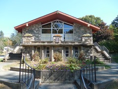 Temple Beth Israellisted 2013
Population over time
2 figuresDanielson grew from 4,051 to 4,155 between 2010 and 2020. These are the recorded population figures Wikidata holds for this place, reached through the Geographic Names Information System number this page is keyed on rather than by name, so they belong to this place and not to another of the same name. Most are census counts, but not all are: an early figure may be a founding or settlement estimate, and an estimate published within five years of a census is left out. The change column is computed, and is left blank where more than 20 years separate a figure from the one before it, because a gap that long is not a change between two counts.
| Year | People | Change |
|---|---|---|
| 2010 | 4,051 | |
| 2020 | 4,155 | +104 (+3%) |
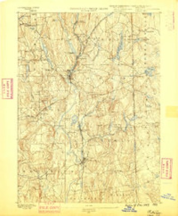
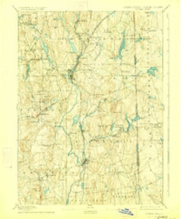
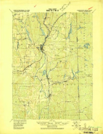
Topographic sheets covering this place
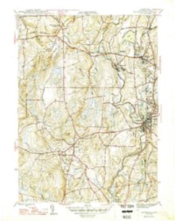
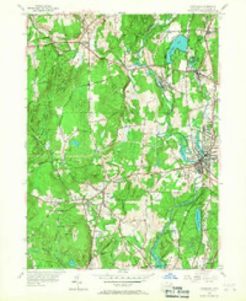
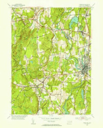
13 surveys from 30 printed sheetsMatched by testing this settlement's coordinate against the published boundary of every sheet in the United States Geological Survey's historical collection. Each opens the scanned sheet at the Survey.
- 1889 USGS Putnam quadrangle1:62500
- 1893 USGS Putnam quadrangle1:62500, 8 printings
- 1919 USGS Putnam quadrangle1:62500
- 1943 USGS Putnam quadrangle1:125000
- 1946 USGS Danielson quadrangle1:31680, 2 printings
- 1947 USGS Providence quadrangle1:250000, 5 printings
- 1948 USGS Providence quadrangle1:250000
- 1955 USGS Danielson quadrangle1:24000, 6 printings
- 1955 USGS Danielson quadrangle1:31680
- 1957 USGS Providence quadrangle1:250000
- 1958 USGS Providence quadrangle1:250000
- 1963 USGS Providence quadrangle1:250000
- 1984 USGS Providence quadrangle1:100000







In the county-history sources
42,294 words on this townshipHistory of Windham County, Connecticut .., published 1889 names this settlement in its chapter on Killingly Town. These are the passages that mention it, exactly as the scans read.
THE town of Killingly lies in the eastern central part of Windham county, on the Rhode Island border. In territory, population and business importance it is one of the largest towns of the county. Its territory, which originally embraced the whole northeast corner of Connecticut east of tbe Quinebaug and north of Plainfield, has been diminished by the formation of Thompson and Putnam in part from its territory. It is bounded by Putnam on the north, Rhode Island on the east. Sterling and Plainfield on the south, and Brooklyn and Pomfret on the west. Much of its surface is hilly and but moderately adapted to agriculture. It is well drained by the Assawaga or Five Mile river and its tributary, the Whetstone branch, and the Quinebaug, into which the former empties. The last named stream forms its entire western boundary. These waters afford power for a number of mills and manufacturing concerns, this town being one of the large manufacturing towns of the county. Alexander's Lake, a handsome sheet of water a mile in length by a half mile in breadth, lies in the northwest part, and Chaubamaug pond, a narrow body a mile and a half long, lies near the eastern border. The town is about nine miles long from north to south, and an average width of six miles from east to west. Thus it has an area of about fifty-foursquare miles. The Norwich & Worcester railroad runs along its western border the length of the town. The post offices of Danielsonville, Ballouville, Killingly, East Killingly and South Killingly are in this town. A small part of the borough of Danielsonville extends
Passage source: History of Windham County, Connecticut .., published 1889.
The first to take possession of land in the Whetstone country under these grants were Major James Fitch and Captain John Chandler. A grant of " fifteen hundred acres, to be taken up together and lyeing beyond ISTew Roxbury, near the northeast corner of the Colony line," was confirmed to Major Fitch by the general court, in October, 1690. With his usual dispatch and discrimination. Fitch at once selected and had laid out to him the best land in the whole section - the interval between the Quinebaug and the Assawaga, extending from their junction at Acquiunk to Lake Mashapaug, and also the valley east of the Assawaga, as far north as Whetstone brook. Captain John Chandler of Woodstock, was next in the field, buying up land granted to soldiers for services in the Narragansett war. Two hundred acres purchased by hitn from Lieutenant HoUister were laid out at Nashaway, the point of land between the Quinebaug and French rivers, and confirmed to him by the general court in 1691. A great part of the valley land adjoining French river, and a commanding eminence two miles east of the Quinebaug, then known as Rattlesnake hill, afterward Killingly hill, were speedily appropriated by Captain Chandler. The other grantees, less familiar with the country, and less experienced in land grabbing, found more difficulty in taking up their grants. The country was not easy to explore. Lack of roads, swelling streams, deep marshes, tangled forests and refractory Indians, all conspired to make the task of locating land claims at that time particularly laborious and hazardous. The Reverend Samuel Andrews succeeded in having his grant of two hundred acres laid out in 1692, west of Rattlesnake hill, bounded on three sides by wilderness.
Passage source: History of Windham County, Connecticut .., published 1889.
The first white settler, as far as is known, came to Killingly in 1693. He was Richard Evans from Rehoboth. He had purchased of the Reverend James Pierpont a two hundred acre grant, for twenty pounds. Little is known of him, and the bounds of his farm cannot now be identified. It was in what was subsequently called the South Neighborhood of Thompson, and is now included in Putnam. In those early days his establishment served as a landmark, by which many other purchases were located.
Passage source: History of Windham County, Connecticut .., published 1889.
Machine-read from a century-old scan, so expect the errors a machine makes: misspelled names, dropped words, stray characters.
Read the whole chapter on Killingly Town - it names this place 33 more 33 times.
Fires near this place
196 since 1992Regional context, not property-specific evidence. The federal wildfire occurrence database lists 196 fires within 5 miles of Danielson between 1992 and 2020, burning about 243 acres in total. None started naturally. 27 were recorded as arson. Distance is straight-line from the map coordinates, so a fire counted here may appear on a neighbouring settlement's page as well.
| Reported cause | Fires |
|---|---|
| Missing data/not specified/undetermined | 113 |
| Arson/incendiarism | 27 |
| Recreation and ceremony | 25 |
| Debris and open burning | 13 |
| Misuse of fire by a minor | 8 |
| Smoking | 7 |
| Railroad operations and maintenance | 2 |
| Equipment and vehicle use | 1 |
The most recent of them, most recent first, with the day each was reported and the service that recorded it.
| Date | Cause | Size | Reported by | Name on the report |
|---|---|---|---|---|
| 8 September 1995 | Missing data/not specified/undetermined | 2.0 acres | Connecticut Division of Forestry | not named |
| 7 September 1995 | Arson/incendiarism | 2.5 acres | Connecticut Division of Forestry | not named |
| 19 September 2020 | Missing data/not specified/undetermined | under an acre | Connecticut Division of Forestry | 1 CAPRON STREET |
| 16 September 2020 | Recreation and ceremony | under an acre | Connecticut Division of Forestry | ALAN HILL ROAD* |
| 16 September 2020 | Missing data/not specified/undetermined | 1.5 acres | Connecticut Division of Forestry | 525 WHITETAIL WAY |
| 16 September 2020 | Recreation and ceremony | under an acre | Connecticut Division of Forestry | 76 ROCK AVE |
| 15 September 2020 | Recreation and ceremony | under an acre | Connecticut Division of Forestry | ROCK AVE |
| 10 September 2016 | Missing data/not specified/undetermined | under an acre | Connecticut Division of Forestry | 1050 N MAIN ST, KILLINGLY |
Settlements close enough to share some of these fires:
Mines and quarries near this place
10 of 14 shownRegional context, not property-specific evidence. The federal mineral resources record lists 14 workings within 5 miles of Danielson: 7 past producers, 6 producers, 1 unknown. 6 still produce. What was taken out: Sand and Gravel, Construction, Stone, Crushed/Broken, Stone, Dimension, Granite. Distance is straight-line from the map coordinates, so a quarry counted here may appear on a neighbouring settlement's page as well.
| Where | Site | Commodity | Status | Recorded |
|---|---|---|---|---|
| Strouse Brothers Quarry | Flagstone | Past Producer | ||
| Wauregan Quarry | Granite | Past Producer | Granite | |
| Connecticut Flatstone Quarry | Stone, Dimension | Producer | ||
| Hughes Quarry | Stone, Dimension | Producer | ||
| Quarry | Stone, Dimension | Past Producer | ||
| Connecticut Flat | Stone, Crushed/Broken | Past Producer | ||
| Hughes Stone Company | Stone, Crushed/Broken | Past Producer | ||
| Strouse Brothers Quarry | Stone, Crushed/Broken | Past Producer | Sedimentary | |
| Wauregan Pit and Quarry | Stone, Crushed/Broken, Sand and Gravel, Construction | Producer | ||
| Danielson Mine | Sand and Gravel, Construction | Producer |
Storms near this place
6 since 2006Regional context, not property-specific evidence. The National Weather Service names Danielson in 6 storm reports between 2006 and 2023: 6 thunderstorm wind. No death or injury is recorded in these reports. Each account below is quoted exactly as the forecast office filed it, from the NOAA Storm Events Database, and each date opens the federal record of that event.
| When | Event | Place named | Harm | What the report says |
|---|---|---|---|---|
| July 2006 | Thunderstorm Wind | Danielson | $5,000 | no account filed |
| August 2020 | Thunderstorm Wind | Danielson | $3,500 | In Danielson, a tree was down on a house on Franklin Street. |
| May 2021 | Thunderstorm Wind | Danielson | $800 | In Danielson, a tree and wires were down on Cady Street, as reported by the Quinebaug Valley Emergency Center. |
| November 2021 | Thunderstorm Wind | Danielson | $600 | In Danielson, wires were down on a car on Garrick Street. Also, wires were down on Main Street at Peckham Lane. |
| September 2023 | Thunderstorm Wind | Danielson | $500 | In Danielson, a tree was downed near the intersection of Wescott and Cranberry Bog Rd. |
| July 2023 | Thunderstorm Wind | Danielson | $500 | In South Killingly, trees and wires were downed near the intersection of Westcott and Korpita Rd. |
Nearest settlements
The eight closest, with where each one stands in the county. Distances are straight-line, computed from the Geographic Names Information System coordinates.
| Map | Place | Distance | Sheets |
|---|---|---|---|
| Quebec | 0.3 miles | 30 | |
| East Brooklyn | 0.7 miles | 30 | |
| Acquidaneck (historical) | 1.4 miles | 30 | |
| Elmville | 2.1 miles | 30 | |
| Killingly Center | 2.6 miles | 30 | |
| Rogers | 2.8 miles | 30 | |
| South Killingly | 2.9 miles | 30 | |
| Dayville | 3.0 miles | 30 |
Elsewhere
Matched on this settlement's Geographic Names Information System number rather than its name, so it cannot be a different place of the same name in another state.
| Wikipedia article on Danielson | An encyclopaedic summary. Its text is share-alike, so it is linked here rather than copied. |
| Wikidata item Q2430894 | The structured record the population and elevation above come from. Public domain (CC0). |
Provenance
This settlement is recorded in the Geographic Names Information System as feature 206590. The sheet list is computed by point-in-boundary test against the United States Geological Survey's historical topographic inventory. Both are works of the United States government and carry no copyright under 17 U.S.C. 105.
Wildfire. Short, Karen C. 2022. Spatial wildfire occurrence data for the United States, 1992-2020 [FPA_FOD_20221014]. 6th Edition. Fort Collins, CO: Forest Service Research Data Archive. https://doi.org/10.2737/RDS-2013-0009.6 Collected with United States Government funding and usable without additional permissions or fees.
Mines and quarries. USGS Mineral Resources Data System (MRDS) https://mrdata.usgs.gov/mrds/ A work of the United States government, no copyright under 17 U.S.C. 105.
Storms. NOAA National Centers for Environmental Information, Storm Events Database https://www.ncei.noaa.gov/stormevents/ A work of the United States government, no copyright under 17 U.S.C. 105. Narratives are quoted verbatim from the National Weather Service report and are not edited or summarised.