 Block
Dayville, Connecticut
30 topographic sheets cover this place, the earliest surveyed in 1889 and the latest in 1984. It stands in Killingly town. It lies in ZIP code area 06241. It stands on Dayville Brook. The Survey maps it on the Danielson quadrangle. 631 people lived here at the 2020 count. It stands 249 feet above sea level.
On record in Dayville
Buildings and businesses the archive holds for this place. Each opens its own page, with the source record it came from.
On the National Register within a mile 1 record
The National Register names another town for these. They stand within one mile of this settlement's coordinate.
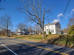 Dayville Historic Districtlisted 1988 · 0.1 miles away
Topographic sheets covering this place
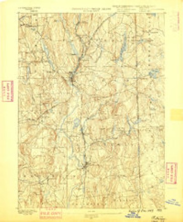
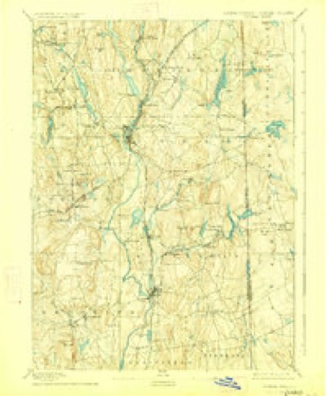
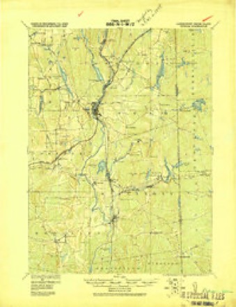
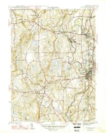
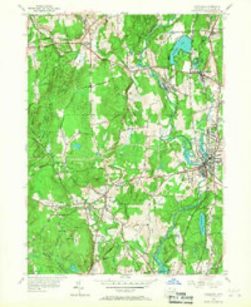
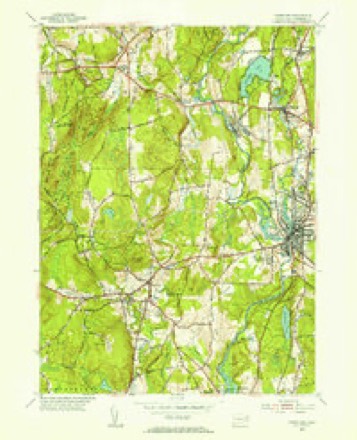
13 surveys from 30 printed sheetsMatched by testing this settlement's coordinate against the published boundary of every sheet in the United States Geological Survey's historical collection. Each opens the scanned sheet at the Survey.
- 1889 USGS Putnam quadrangle1:62500
- 1893 USGS Putnam quadrangle1:62500, 8 printings
- 1919 USGS Putnam quadrangle1:62500
- 1943 USGS Putnam quadrangle1:125000
- 1946 USGS Danielson quadrangle1:31680, 2 printings
- 1947 USGS Providence quadrangle1:250000, 5 printings
- 1948 USGS Providence quadrangle1:250000
- 1955 USGS Danielson quadrangle1:24000, 6 printings
- 1955 USGS Danielson quadrangle1:31680
- 1957 USGS Providence quadrangle1:250000
- 1958 USGS Providence quadrangle1:250000
- 1963 USGS Providence quadrangle1:250000
- 1984 USGS Providence quadrangle1:100000







In the county-history sources
42,294 words on this townshipHistory of Windham County, Connecticut, published 1880; History of Windham County, Connecticut .., published 1889 names this settlement in its chapter on Killingly Town. These are the passages that mention it, exactly as the scans read.
Growth and business expansion in this town are not confined to Danielsonville. Dayville is a lively and thrifty village with various mills aud interests. Mr. Ezekiel Webster followed the railroad track, building a hotel and many private dwellings. He engaged largely in lumber trade, introducing a steam mill and lumber- working machinery. In 1846, Mr. John Day put up a new brick factory and carried on manufacturing till the destruction of the building in 1858, when privilege and accommodations were purchased by Messrs. S. and II. Sayles, who built up extensive woolen manufacturing establishments. Other industries were developed, stores opened, churches built up. The Dayville Congregational church was organized May 23, 1849. Its constittitent members were mostly dismissed from the three Killingly churches. Rev. Uoswell Whitmore* officiated as pastor till 1857, thus ministering to a pait of his former flock. Suitable houses of worship were provided for Congregational and Catholic churches. Schools received needful attention, and are accommodated by ^^a nice house with ample play-ground around it." The neighboring Williamsville Factory has been re|>eatedly enlarged. In 1849 the company was reorganized, and after refitting the mill with new machinery of the best workmanship, turned out the '* Williamsville fine sheetings," so favorably known to connoisseui*s in cotton fabrics. Williamsville like Wauregan is '' a close corporation," owned and controlled by a single company and interest - a pleasant, isolated working village, wellmanaged and orderly. Enlightened self-interest as well as public spirit and philanthropy have eflected great improvement in the administration of factory villages. Sanitary conditions are studie<l and observed. Evil influences are kept in abeyance. Compelled by the State to educate tlie children, they voluntarily in many cases jMovide for tlie instruction and innocent entertainment of adults by libraries, reading-rooms, lectures, <fec. A fine ball has been built by the Williarasville Company for religious purposes and lectures. Attawaugan and some of the smaller factories are maintained on former sites. Rist Killingly has been aided by increasing centralization and the construction of a capacious reservoir which enables the enterprising little Whetstone to run its mills throughout the year. Messrs. Thomas Pray and Henry Westcott were among the many owners who have helped build up Chestnut Hill villages. Lemuel Elliott, Esq., of Providence, improveil another privilege and had a pleasant country seat at the foot of Breakneck. The mineral treasures of Mashentuck and Breakneck are as yet neatly undeveloped, waiting for the construction of the '* Ponoganset Railroad ** or some kindred enterprise. The well of " porcelain clay " formerly so vaunted has been tested and found lacking in quantity. The East Killingly and Free-Will Baptist churches have maintained their standing under a succession of pastors. lievs. Austin Robbins and David Williams, formerly laborers in both these churches, died on successive days at their homes in East Killingly. Uev. Hubbel Loomis, well-known in the Baptist ministry, compile<] an historical sketch while pastor of the former church. The church in South Killingly after reaching the verge of dissolution, was hn))pily revived, and under an efficient ministry has quite renewed its youth. Its house of worship has been remodeled and much pains ex[)ended upon Sabbath school and temperance training. The village has recently Bufiered the loss of its much respected physician. Dr. Daniel L. Ilovey, who had pursued his calling there for nearly half a century. He was the oldest member of the County Medical Society at the time of his decease. Having no manufacturing interests, this village is gradually wasting. Killingly's strength lies in her rocks and rivers. Extensive Brick Works have been carried on near Dayville for many years by Colonel L. D. Alexander. The " Nashawaug Farm " and privilege of Hon. Elisha Dyer, promises to bring new business and prosperity to the south of the town.
Passage source: History of Windham County, Connecticut, published 1880.
The first to take possession of land in the Whetstone country under these grants were Major James Fitch and Captain John Chandler. A grant of " fifteen hundred acres, to be taken up together and lyeing beyond ISTew Roxbury, near the northeast corner of the Colony line," was confirmed to Major Fitch by the general court, in October, 1690. With his usual dispatch and discrimination. Fitch at once selected and had laid out to him the best land in the whole section - the interval between the Quinebaug and the Assawaga, extending from their junction at Acquiunk to Lake Mashapaug, and also the valley east of the Assawaga, as far north as Whetstone brook. Captain John Chandler of Woodstock, was next in the field, buying up land granted to soldiers for services in the Narragansett war. Two hundred acres purchased by hitn from Lieutenant HoUister were laid out at Nashaway, the point of land between the Quinebaug and French rivers, and confirmed to him by the general court in 1691. A great part of the valley land adjoining French river, and a commanding eminence two miles east of the Quinebaug, then known as Rattlesnake hill, afterward Killingly hill, were speedily appropriated by Captain Chandler. The other grantees, less familiar with the country, and less experienced in land grabbing, found more difficulty in taking up their grants. The country was not easy to explore. Lack of roads, swelling streams, deep marshes, tangled forests and refractory Indians, all conspired to make the task of locating land claims at that time particularly laborious and hazardous. The Reverend Samuel Andrews succeeded in having his grant of two hundred acres laid out in 1692, west of Rattlesnake hill, bounded on three sides by wilderness.
Passage source: History of Windham County, Connecticut .., published 1889.
The first white settler, as far as is known, came to Killingly in 1693. He was Richard Evans from Rehoboth. He had purchased of the Reverend James Pierpont a two hundred acre grant, for twenty pounds. Little is known of him, and the bounds of his farm cannot now be identified. It was in what was subsequently called the South Neighborhood of Thompson, and is now included in Putnam. In those early days his establishment served as a landmark, by which many other purchases were located.
Passage source: History of Windham County, Connecticut .., published 1889.
Machine-read from a century-old scan, so expect the errors a machine makes: misspelled names, dropped words, stray characters.
Read the whole chapter on Killingly Town - it names this place 13 more 13 times.
Fires near this place
183 since 1992Regional context, not property-specific evidence. The federal wildfire occurrence database lists 183 fires within 5 miles of Dayville between 1992 and 2020, burning about 262 acres in total. None started naturally. 26 were recorded as arson. Distance is straight-line from the map coordinates, so a fire counted here may appear on a neighbouring settlement's page as well.
| Reported cause | Fires |
|---|---|
| Missing data/not specified/undetermined | 107 |
| Arson/incendiarism | 26 |
| Recreation and ceremony | 18 |
| Debris and open burning | 15 |
| Misuse of fire by a minor | 9 |
| Smoking | 5 |
| Railroad operations and maintenance | 2 |
| Equipment and vehicle use | 1 |
The most recent of them, most recent first, with the day each was reported and the service that recorded it.
| Date | Cause | Size | Reported by | Name on the report |
|---|---|---|---|---|
| 8 September 1995 | Missing data/not specified/undetermined | 2.0 acres | Connecticut Division of Forestry | not named |
| 7 September 1995 | Arson/incendiarism | 2.5 acres | Connecticut Division of Forestry | not named |
| 19 September 2020 | Missing data/not specified/undetermined | under an acre | Connecticut Division of Forestry | 1 CAPRON STREET |
| 16 September 2020 | Missing data/not specified/undetermined | 1.5 acres | Connecticut Division of Forestry | 525 WHITETAIL WAY |
| 16 September 2020 | Recreation and ceremony | under an acre | Connecticut Division of Forestry | 76 ROCK AVE |
| 15 September 2020 | Recreation and ceremony | under an acre | Connecticut Division of Forestry | ROCK AVE |
| 15 September 2020 | Missing data/not specified/undetermined | under an acre | Connecticut Division of Forestry | 15 RIDGE ROAD |
| 10 September 2016 | Missing data/not specified/undetermined | under an acre | Connecticut Division of Forestry | 1050 N MAIN ST, KILLINGLY |
Settlements close enough to share some of these fires:
Mines and quarries near this place
9 within 5 milesRegional context, not property-specific evidence. The federal mineral resources record lists 9 workings within 5 miles of Dayville: 4 producers, 4 past producers, 1 unknown. 4 still produce. What was taken out: Sand and Gravel, Construction, Stone, Dimension, Stone, Crushed/Broken. Distance is straight-line from the map coordinates, so a quarry counted here may appear on a neighbouring settlement's page as well.
| Where | Site | Commodity | Status | Recorded |
|---|---|---|---|---|
| Connecticut Flat | Stone, Crushed/Broken | Past Producer | ||
| Hughes Stone Company | Stone, Crushed/Broken | Past Producer | ||
| Connecticut Flatstone Quarry | Stone, Dimension | Producer | ||
| Hughes Quarry | Stone, Dimension | Producer | ||
| Quarry | Stone, Dimension | Past Producer | ||
| Garvey Pit | Sand and Gravel, Construction | Past Producer | Sedimentary | |
| Garvey Pit | Sand and Gravel, Construction | Producer | ||
| R.A. Rawson Sand & Gravel, Inc. | Sand and Gravel, Construction | Unknown | ||
| Townfarm Road Pit | Sand and Gravel, Construction | Producer |
Storms near this place
3 since 2022Regional context, not property-specific evidence. The National Weather Service names Dayville in 3 storm reports between 2022 and 2025: 3 thunderstorm wind. No death or injury is recorded in these reports. Each account below is quoted exactly as the forecast office filed it, from the NOAA Storm Events Database, and each date opens the federal record of that event.
| When | Event | Place named | Harm | What the report says |
|---|---|---|---|---|
| August 2022 | Thunderstorm Wind | Dayville | $2,000 | In Killingly, 12- to 14-inch diameter trees were blown down in the median of Hartford Pike in the Dayville section of town. |
| July 2022 | Thunderstorm Wind | Dayville | $1,000 | In Killingly, two trees were down on Route 101...one at the intersection with Upper Maple Street and the other at the intersection with Otis Street. |
| July 2025 | Thunderstorm Wind | Dayville | $500 | In Killingly, the northbound side of I-395 between mile marker 37 and 38 had a large tree blocking the right lane. |
Nearest settlements
The eight closest, with where each one stands in the county. Distances are straight-line, computed from the Geographic Names Information System coordinates.
| Map | Place | Distance | Sheets |
|---|---|---|---|
| Rogers | 1.1 miles | 30 | |
| Killingly Center | 1.1 miles | 30 | |
| Elmville | 1.2 miles | 30 | |
| Attawaugan | 1.5 miles | 30 | |
| Ballouville | 2.5 miles | 23 | |
| Pomfret Landing | 2.6 miles | 30 | |
| Danielson | 3.0 miles | 30 | |
| Elliotville (historical) | 3.1 miles | 30 |
Elsewhere
Matched on this settlement's Geographic Names Information System number rather than its name, so it cannot be a different place of the same name in another state.
| Wikipedia article on Dayville | An encyclopaedic summary. Its text is share-alike, so it is linked here rather than copied. |
| Wikidata item Q106670421 | The structured record the population and elevation above come from. Public domain (CC0). |
Provenance
This settlement is recorded in the Geographic Names Information System as feature 206628. The sheet list is computed by point-in-boundary test against the United States Geological Survey's historical topographic inventory. Both are works of the United States government and carry no copyright under 17 U.S.C. 105.
Wildfire. Short, Karen C. 2022. Spatial wildfire occurrence data for the United States, 1992-2020 [FPA_FOD_20221014]. 6th Edition. Fort Collins, CO: Forest Service Research Data Archive. https://doi.org/10.2737/RDS-2013-0009.6 Collected with United States Government funding and usable without additional permissions or fees.
Mines and quarries. USGS Mineral Resources Data System (MRDS) https://mrdata.usgs.gov/mrds/ A work of the United States government, no copyright under 17 U.S.C. 105.
Storms. NOAA National Centers for Environmental Information, Storm Events Database https://www.ncei.noaa.gov/stormevents/ A work of the United States government, no copyright under 17 U.S.C. 105. Narratives are quoted verbatim from the National Weather Service report and are not edited or summarised.