 Block
Essex, Connecticut
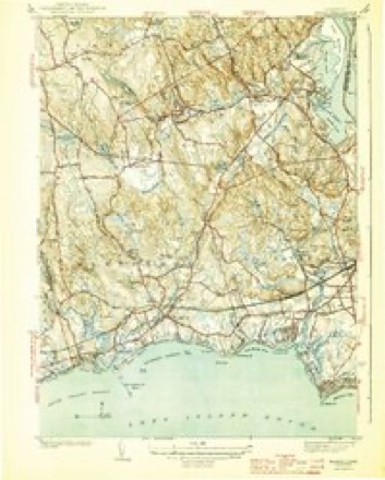
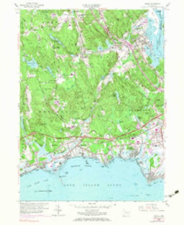
28 topographic sheets cover this place, the earliest surveyed in 1893 and the latest in 1983. It stands in Essex town. It lies in ZIP code area 06426. It lies near Stumpet Hill. The Survey maps it on the Essex quadrangle.
On record in Essex
Buildings and businesses the archive holds for this place. Each opens its own page, with the source record it came from.
On the National Register 8 records
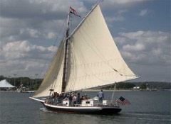 CHRISTEEN (oyster sloop)National Historic Landmark · listed 1991
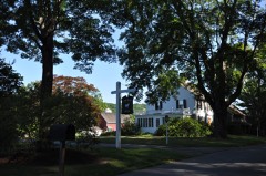 Benjamin Bushnell Farmlisted 1990
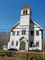 Centerbrook Congregational Churchlisted 1987
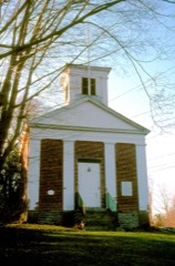 Hill's Academylisted 1985
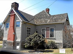 Ivoryton Historic Districtlisted 2014
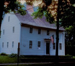 Pratt Houselisted 1985
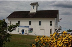 Steamboat Dock Sitelisted 1982
- Caleb Pratt Houselisted 2024
Topographic sheets covering this place
9 surveys from 28 printed sheetsMatched by testing this settlement's coordinate against the published boundary of every sheet in the United States Geological Survey's historical collection. Each opens the scanned sheet at the Survey.
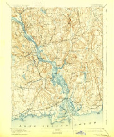
- 1893 USGS Saybrook quadrangle1:62500, 8 printings
- 1944 USGS Essex quadrangle1:31680, 3 printings
- 1947 USGS Hartford quadrangle1:250000, 2 printings
- 1948 USGS Hartford quadrangle1:250000, 2 printings
- 1958 USGS Essex quadrangle1:24000, 5 printings
- 1961 USGS Hartford quadrangle1:250000
- 1962 USGS Hartford quadrangle1:250000, 3 printings
- 1965 USGS Hartford quadrangle1:250000, 2 printings
- 1983 USGS New Haven quadrangle1:100000, 2 printings






In the county-history sources
35,861 words on this townshipHistory of Middlesex County, Connecticut, with Biographical Sketches of Its Prominent Men, published 1884 names this settlement in its chapter on Essex Town. These are the passages that mention it, exactly as the scans read.
Book Hill is an elevation of about 200 feet, northwest from Essex village, near the north line of the town. Beaver Pond lies on or near the south line of the town. It was once a beaver pond, and had a dam across it which was constructed by those industrious animals. In 1705, the proprietors granted John Clarke liberty to dig out the stream that ran through it, the pond then being a sort of marsh. At that time, the dam was there, and the records show that it lay below or south of Clarke's land. It has long been known as a quagmire, the ooze of which was of unknown depth. In olden times, cattle used to go astray, and sometimes never return or be found, and it was supposed that they had wandered into this marsh and sunk out of sight in its ooze. The Rev. Thomas Buckingham, one of the corporators of Yale College, settled on the border of this pond, and tradition says that he made something of a business of trapping beavers, which were numerous here then, and their skins were valuable.
Passage source: History of Middlesex County, Connecticut, with Biographical Sketches of Its Prominent Men, published 1884.
The name Potapaug is variously spelled, but most commonly it appears in the old records as it is here spelled. It is of Indian origin, and is said to mean " bulging out of the land or jutting of the water inland." It was applied by the Indians to the point upon which the village of Essex stands, but was early applied by the white settlers to the whole region known as the Quarter, which then covered the land of the present towns of Essex, Saybrook, and Chester.
Passage source: History of Middlesex County, Connecticut, with Biographical Sketches of Its Prominent Men, published 1884.
The Eight Mile Meadow Quarter included the territory now occupied by the towns of Chester, Saybrook, and Essex. It was also called the Potapaug Quarter. The earliest record that can now be found indicates that the setting apart of the quarter referred to was about the middle of the 17th century. A memorandum of the proprietary records bears date January 4th 1648, and reads as follows:
Passage source: History of Middlesex County, Connecticut, with Biographical Sketches of Its Prominent Men, published 1884.
Machine-read from a century-old scan, so expect the errors a machine makes: misspelled names, dropped words, stray characters.
Read the whole chapter on Essex Town - it names this place 47 more 47 times.
Fires near this place
190 since 1992Regional context, not property-specific evidence. The federal wildfire occurrence database lists 190 fires within 5 miles of Essex between 1992 and 2020, burning about 250 acres in total. None started naturally. 4 were recorded as arson. Distance is straight-line from the map coordinates, so a fire counted here may appear on a neighbouring settlement's page as well.
| Reported cause | Fires |
|---|---|
| Missing data/not specified/undetermined | 92 |
| Debris and open burning | 40 |
| Recreation and ceremony | 27 |
| Misuse of fire by a minor | 8 |
| Smoking | 8 |
| Power generation/transmission/distribution | 6 |
| Arson/incendiarism | 4 |
| Railroad operations and maintenance | 4 |
| Equipment and vehicle use | 1 |
The most recent of them, most recent first, with the day each was reported and the service that recorded it.
| Date | Cause | Size | Reported by | Name on the report |
|---|---|---|---|---|
| 9 September 2007 | Recreation and ceremony | 5.0 acres | Connecticut Division of Forestry | not named |
| 5 September 2016 | Missing data/not specified/undetermined | under an acre | Connecticut Division of Forestry | 1 HONEY HILL LANE LYME |
| 27 September 2007 | Missing data/not specified/undetermined | under an acre | Connecticut Division of Forestry | not named |
| 25 September 2010 | Missing data/not specified/undetermined | 1.0 acres | Connecticut Division of Forestry | not named |
| 24 September 2020 | Missing data/not specified/undetermined | under an acre | Connecticut Division of Forestry | 112 NECK ROAD |
| 21 September 2015 | Missing data/not specified/undetermined | under an acre | Connecticut Division of Forestry | not named |
| 16 September 2017 | Missing data/not specified/undetermined | under an acre | Connecticut Division of Forestry | 2 DENNISON RD |
| 16 September 2007 | Missing data/not specified/undetermined | under an acre | Connecticut Division of Forestry | not named |
Settlements close enough to share some of these fires:
Mines and quarries near this place
10 of 14 shownRegional context, not property-specific evidence. The federal mineral resources record lists 14 workings within 5 miles of Essex: 14 past producers. None of them still produces. What was taken out: Granite, Stone, Dimension, Stone, Sand and Gravel, Construction. Distance is straight-line from the map coordinates, so a quarry counted here may appear on a neighbouring settlement's page as well.
| Where | Site | Commodity | Status | Recorded |
|---|---|---|---|---|
| Deep River Sand and Gravel Pit | Sand and Gravel, Construction | Past Producer | ||
| Biotite Granite Gneiss Quarries No. Bk-005 | Stone | Past Producer | ||
| Granitic Gneiss Rock Quarry No. Bk-004 | Stone | Past Producer | Gneiss | |
| Bethel Pegmatite Quarry | Stone, Dimension | Past Producer | ||
| Joshua Granite Gneiss Rock Quarry | Stone, Dimension | Past Producer | ||
| Selden Neck Granite Gneiss Rock Quarry | Stone, Dimension | Past Producer | Unknown | |
| Gneiss Quarry | Granite | Past Producer | ||
| Gneiss Quarry | Granite | Past Producer | ||
| Gneiss Quarry | Granite | Past Producer | ||
| Granite Gneiss Quarries | Granite | Past Producer |
Storms near this place
4 since 2000Regional context, not property-specific evidence. The National Weather Service names Essex in 4 storm reports between 2000 and 2012: 2 thunderstorm wind, 1 lightning, 1 hail. No death or injury is recorded in these reports. Each account below is quoted exactly as the forecast office filed it, from the NOAA Storm Events Database, and each date opens the federal record of that event.
Nearest settlements
The eight closest, with where each one stands in the county. Distances are straight-line, computed from the Geographic Names Information System coordinates.
| Map | Place | Distance | Sheets |
|---|---|---|---|
| Centerbrook | 1.3 miles | 28 | |
| Otter Cove Estates | 1.5 miles | 30 | |
| Ivoryton | 2.6 miles | 28 | |
| Floral Park | 2.8 miles | 30 | |
| Deep River | 3.3 miles | 29 | |
| Old Saybrook | 4.3 miles | 28 | |
| Pond Meadow | 4.5 miles | 28 | |
| Chester | 4.7 miles | 29 |
Provenance
This settlement is recorded in the Geographic Names Information System as feature 206971. The sheet list is computed by point-in-boundary test against the United States Geological Survey's historical topographic inventory. Both are works of the United States government and carry no copyright under 17 U.S.C. 105.
Wildfire. Short, Karen C. 2022. Spatial wildfire occurrence data for the United States, 1992-2020 [FPA_FOD_20221014]. 6th Edition. Fort Collins, CO: Forest Service Research Data Archive. https://doi.org/10.2737/RDS-2013-0009.6 Collected with United States Government funding and usable without additional permissions or fees.
Mines and quarries. USGS Mineral Resources Data System (MRDS) https://mrdata.usgs.gov/mrds/ A work of the United States government, no copyright under 17 U.S.C. 105.
Storms. NOAA National Centers for Environmental Information, Storm Events Database https://www.ncei.noaa.gov/stormevents/ A work of the United States government, no copyright under 17 U.S.C. 105. Narratives are quoted verbatim from the National Weather Service report and are not edited or summarised.