 Block
Rocky Hill, Connecticut
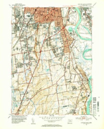
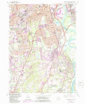
37 topographic sheets cover this place, the earliest surveyed in 1893 and the latest in 1994. It stands in Rocky Hill town. It lies in ZIP code area 06067. It stands on Rocky Hill. The Survey maps it on the Hartford South quadrangle.
On record in Rocky Hill
Buildings and businesses the archive holds for this place. Each opens its own page, with the source record it came from.
On the National Register 5 records
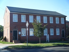 Academy Halllisted 1977
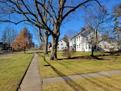 Elm Street Historic Districtlisted 1998
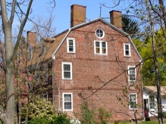 John Robbins Houselisted 1988
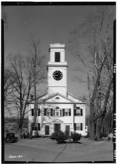 Rocky Hill Center Historic Districtlisted 2007
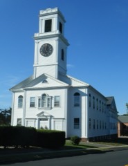 Rocky Hill Congregational Churchlisted 1982
Topographic sheets covering this place
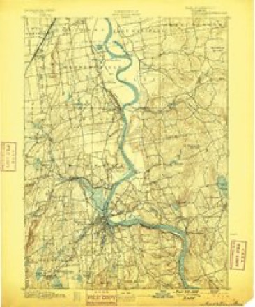
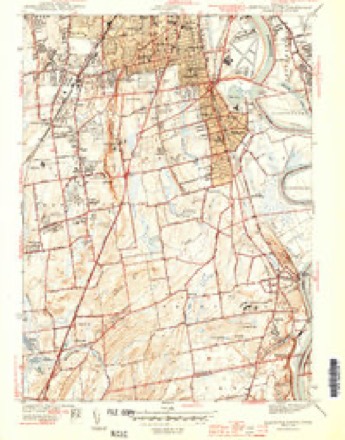
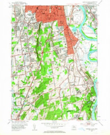
13 surveys from 37 printed sheetsMatched by testing this settlement's coordinate against the published boundary of every sheet in the United States Geological Survey's historical collection. Each opens the scanned sheet at the Survey.
- 1893 USGS Middletown quadrangle1:62500, 10 printings
- 1906 USGS Farmington quadrangle1:125000, 2 printings
- 1944 USGS Hartford South quadrangle1:31680, 3 printings
- 1947 USGS Hartford quadrangle1:250000, 2 printings
- 1948 USGS Hartford quadrangle1:250000, 2 printings
- 1952 USGS Hartford South quadrangle1:24000, 2 printings
- 1952 USGS Hartford South quadrangle1:31680, 2 printings
- 1961 USGS Hartford quadrangle1:250000
- 1962 USGS Hartford quadrangle1:250000, 3 printings
- 1964 USGS Hartford South quadrangle1:24000, 5 printings
- 1965 USGS Hartford quadrangle1:250000, 2 printings
- 1986 USGS Hartford quadrangle1:100000
- 1994 USGS Hartford quadrangle1:100000, 2 printings








In the county-history sources
2,060 words on this townshipThe Memorial History of Hartford County, Connecticut, 1633-1884;, published 1886 names this settlement in its chapter on Rocky Hill Town. These are the passages that mention it, exactly as the scans read.
Down to the date of the existence of Rocky Hill as a separate township it has been treated as a part of Wethersfield, excepting as to its ecclesiastical history. It remains, however, to narrate briefly the story of the rise and progress of the parish, out of which grew the township. In December, 1720, certain people at Rocky Hill, namely, Thomas Williams, Sr., Joseph Butler, Jonathan Smith, John Goodrich, Samuel Belden, John, Stephen, and Joseph Riley, William Nott, Stephen Williams, Joseph Cole, John Taylor, Richard Butler,
Passage source: The Memorial History of Hartford County, Connecticut, 1633-1884;, published 1886.
Stepney parish was enlarged in 1759 hy the extension of its east line to the river and its north line to the New Haven road. On the west it was made to include a part of Kensington parish. In 1794 Stepney contributed some of its territory to Worthiugton parish, which had been created in 1772. Minor changes were effected in 1823, 1829, and 1847, wliich we cannot detail here. In 1826 the legislature substituted the name Rocky Hill for Stepney.
Passage source: The Memorial History of Hartford County, Connecticut, 1633-1884;, published 1886.
In 1720 Thomas Williams, Sr., Jonathan Curtis, and others, " inhabitants of Rocky Hill," desiring ecclesiastical autonomy, asked the town for sixty acres of land for " church use." The town gave the land ; it being northerly from the " stone-pit " and south of Cold Spring. Eight acres, for a parsonage, was granted at the same time. These tracts were on the south side of the road leading from Griswoldville to Rocky Hill. The meeting-house was probably built, or begun, the same year. It was completed, excepting its pulj^it, prior to 1726. It was a two-story structure, of wood ; and it stood in the highway, in front of the present site of Wait Warner's barn. Pews were put in, from time to time, until 1730. In 1732 galleries were built. Its ceiling was plastered for the first time in 1769 or 1770. The meetings, for many years, were convoked by beat of drum. In 1808 the old building was sold at auction and demolished.
Passage source: The Memorial History of Hartford County, Connecticut, 1633-1884;, published 1886.
Machine-read from a century-old scan, so expect the errors a machine makes: misspelled names, dropped words, stray characters.
Read the whole chapter on Rocky Hill Town - it names this place 4 more 4 times.
Fires near this place
16 since 1993Regional context, not property-specific evidence. The federal wildfire occurrence database lists 16 fires within 5 miles of Rocky Hill between 1993 and 2020, burning about 191 acres in total. None started naturally. 3 were recorded as arson. Distance is straight-line from the map coordinates, so a fire counted here may appear on a neighbouring settlement's page as well.
| Reported cause | Fires |
|---|---|
| Missing data/not specified/undetermined | 6 |
| Arson/incendiarism | 3 |
| Debris and open burning | 3 |
| Smoking | 2 |
| Recreation and ceremony | 1 |
| Power generation/transmission/distribution | 1 |
The most recent of them, most recent first, with the day each was reported and the service that recorded it.
| Date | Cause | Size | Reported by | Name on the report |
|---|---|---|---|---|
| 15 September 2010 | Missing data/not specified/undetermined | 6.0 acres | Connecticut Division of Forestry | not named |
| 9 August 2020 | Power generation/transmission/distribution | under an acre | Connecticut Division of Forestry | NAUBUC AVENUE |
| 9 May 2007 | Smoking | under an acre | Connecticut Division of Forestry | not named |
| 4 May 1993 | Missing data/not specified/undetermined | 25 acres | Connecticut Division of Forestry | not named |
| 2 May 2003 | Arson/incendiarism | 5.0 acres | Connecticut Division of Forestry | not named |
| 1 May 1999 | Arson/incendiarism | 44 acres | Connecticut Division of Forestry | not named |
| 3 April 2011 | Missing data/not specified/undetermined | 2.0 acres | Connecticut Division of Forestry | NEWINGTON |
| 23 April 2016 | Smoking | under an acre | Connecticut Division of Forestry | 175 LOWREY PL, NEWINGTON, CT 06111 |
Settlements close enough to share some of these fires:
Mines and quarries near this place
10 of 69 shownRegional context, not property-specific evidence. The federal mineral resources record lists 69 workings within 5 miles of Rocky Hill: 58 past producers, 7 producers, 4 prospects. 7 still produce. What was taken out: Feldspar, Stone, Dimension, Sand and Gravel, Construction, Stone, Crushed/Broken. Distance is straight-line from the map coordinates, so a quarry counted here may appear on a neighbouring settlement's page as well.
| Where | Site | Commodity | Status | Recorded |
|---|---|---|---|---|
| Case Beryl Prospects | Feldspar, Beryllium, Mica, Silica, Niobium (Columbium), Tantalum | Past Producer | ||
| Gotta-Walden Mica-Beryl Prospect | Beryllium, Feldspar, Mica, Tantalum, Niobium (Columbium), Silica | Prospect | ||
| Hollister Mica & Beryl Quarry | Beryllium, Mica, Feldspar | Past Producer | ||
| Hollister Mica Beryl Prospect | Feldspar, Mica, Beryllium, Tantalum, Niobium (Columbium) | Producer | Pegmatite Dike | |
| Hollister Mica Beryl Prospect | Feldspar, Mica, Beryllium | Prospect | ||
| Pegmatite Quarries | Mica, Beryllium, Feldspar | Past Producer | ||
| Spinelli Feldspar-Samarskite Pegmatite Prospect Quarry | Tantalum, REE, Niobium (Columbium), Beryllium, Mica, Feldspar | Past Producer | 1940 | |
| Walden Gem Mine | Gemstone | Past Producer | ||
| Amphibolite Gneiss Rock Quarries No. Cj-014 | Stone | Past Producer | ||
| Bordonaro Beryl Prospect | Feldspar, Mica, Beryllium | Past Producer |
Storms near this place
5 since 2008Regional context, not property-specific evidence. The National Weather Service names Rocky Hill in 5 storm reports between 2008 and 2023: 2 lightning, 2 thunderstorm wind, 1 flash flood. No death or injury is recorded in these reports. Each account below is quoted exactly as the forecast office filed it, from the NOAA Storm Events Database, and each date opens the federal record of that event.
| When | Event | Place named | Harm | What the report says |
|---|---|---|---|---|
| June 2009 | Lightning | Rocky Hill | $30,000 | A house caught fire after being struck by lightning. |
| December 2011 | Thunderstorm Wind | Rocky Hill | $20,000 | A utility pole, wires, and tree limbs along Bailey Road and Parsonage Street were downed by thunderstorm winds. |
| June 2008 | Lightning | Rocky Hill | $5,000 | Lightning struck a house on Slade Circle setting it on fire. |
| July 2023 | Thunderstorm Wind | Rocky Hill | $1,000 | In Rocky Hill, a large tree was uprooted, per picture on social media. Time estimated by radar. |
| July 2023 | Flash Flood | Rocky Hill | - | In Rocky Hill, Main St was flooded from Dividend Rd to Elm St. |
Nearest settlements
The eight closest, with where each one stands in the county. Distances are straight-line, computed from the Geographic Names Information System coordinates.
| Map | Place | Distance | Sheets |
|---|---|---|---|
| South Wethersfield | 2.0 miles | 37 | |
| Cotton Hollow | 2.0 miles | 37 | |
| South Glastonbury | 2.3 miles | 37 | |
| Taylor Town | 2.3 miles | 37 | |
| Griswoldville | 2.6 miles | 37 | |
| Hopewell | 3.0 miles | 37 | |
| Glastonbury Center | 3.3 miles | 37 | |
| Wethersfield | 3.5 miles | 37 |
Provenance
This settlement is recorded in the Geographic Names Information System as feature 210273. The sheet list is computed by point-in-boundary test against the United States Geological Survey's historical topographic inventory. Both are works of the United States government and carry no copyright under 17 U.S.C. 105.
Wildfire. Short, Karen C. 2022. Spatial wildfire occurrence data for the United States, 1992-2020 [FPA_FOD_20221014]. 6th Edition. Fort Collins, CO: Forest Service Research Data Archive. https://doi.org/10.2737/RDS-2013-0009.6 Collected with United States Government funding and usable without additional permissions or fees.
Mines and quarries. USGS Mineral Resources Data System (MRDS) https://mrdata.usgs.gov/mrds/ A work of the United States government, no copyright under 17 U.S.C. 105.
Storms. NOAA National Centers for Environmental Information, Storm Events Database https://www.ncei.noaa.gov/stormevents/ A work of the United States government, no copyright under 17 U.S.C. 105. Narratives are quoted verbatim from the National Weather Service report and are not edited or summarised.