 Block
South Glastonbury, Connecticut
37 topographic sheets cover this place, the earliest surveyed in 1893 and the latest in 1994. It stands in Glastonbury town. It lies in ZIP code area 06073. It stands on Roaring Brook. The Survey maps it on the Glastonbury quadrangle. It stands 138 feet above sea level.
On record in South Glastonbury
Buildings and businesses the archive holds for this place. Each opens its own page, with the source record it came from.
On the National Register 1 record
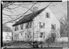 Welles-Shipman-Ward Houselisted 1977
Topographic sheets covering this place
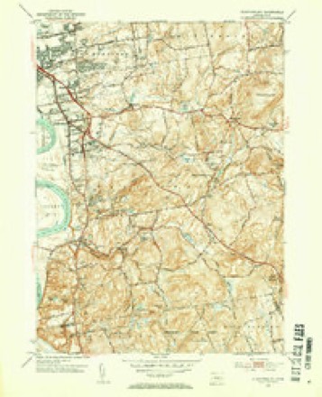
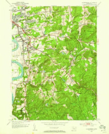
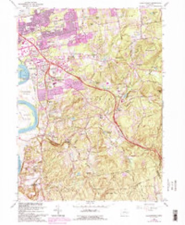
14 surveys from 37 printed sheetsMatched by testing this settlement's coordinate against the published boundary of every sheet in the United States Geological Survey's historical collection. Each opens the scanned sheet at the Survey.
- 1893 USGS Middletown quadrangle1:62500, 10 printings
- 1906 USGS Farmington quadrangle1:125000, 2 printings
- 1928 USGS Glastonbury quadrangle1:24000
- 1946 USGS Glastonbury quadrangle1:31680, 2 printings
- 1947 USGS Hartford quadrangle1:250000, 2 printings
- 1948 USGS Hartford quadrangle1:250000, 2 printings
- 1953 USGS Glastonbury quadrangle1:31680, 2 printings
- 1953 USGS Glastonbury quadrangle1:24000
- 1961 USGS Hartford quadrangle1:250000
- 1962 USGS Hartford quadrangle1:250000, 3 printings
- 1964 USGS Glastonbury quadrangle1:24000, 6 printings
- 1965 USGS Hartford quadrangle1:250000, 2 printings
- 1986 USGS Hartford quadrangle1:100000
- 1994 USGS Hartford quadrangle1:100000, 2 printings








In the county-history sources
10,239 words on this townshipThe Memorial History of Hartford County, Connecticut, 1633-1884;, published 1886 names this settlement in its chapter on Glastonbury Town. These are the passages that mention it, exactly as the scans read.
The old Hollister house at South Glastonbury is said to have been built in 1675, in which case it was probably erected by John Hollister, the second of that name, son of one of the early settlers of Wethersfield. He is said not to have lived constantlv on this side, although he owned and improved land here. He is distinguished as having been the de- feiidant and the vanquished party in a lawsuit before the General Court, with the redoubtable Gershom Bulkeley as his antagonist. This mansion is said to be the oldest wooden house now standing in this State, and is in excellent repair ; and bids fair, accidents not preventing, to stand as long again. Another famous dwelling was the old Talcott house, built about 1699, which occupied the site of the present residence of the venerable Jared G. Talcott, and was built by Samuel Talcott for his son Benjamin Talcott, grandson of the lirst settler, John Talcott, who came from England in 1632. This house was fortified in the earlier part of its history, and bore the sharp compliment of an Indian tomahawk upon one of its doors. The now standing near Welles Corner, formerly occupied by Jared Welles, was built by Samuel Welles for his son Thaddeus, a great-grandson of Governor Thomas Welles, and brother of Colonel Thomas Welles, who occupied the old mansion removed by David C. Brainard within a short time. Welles Corner, with its elegant and ancient elms, is the site of the domicile of the first ancestor of the Welles family resident in Glastonbury, though the present house has hardly completed the century. Besides the ancient houses built by John Goslce, Samuel Talcott, and Thomas Hollister, in the eastern part, there are a number of very respectable antiquity in different parts of the town.
Passage source: The Memorial History of Hartford County, Connecticut, 1633-1884;, published 1886.
The first meeting-house was erected on the Green, at or about the time of the Rev. Mr. Stevens's ordination, in October, 1693. It was enlarged in 1706, and stood until destroyed by fire on the night of Dec. 9, 1734. The second meeting-house, by compromise between the north and south, and by the decision of the General Court, was erected on the main street, about one fourth of a mile south of the Green, standing half in the street, just north of the old Moseley tavern,^ where David H. Carrier now lives. It was used as a church for more than a century, having been built in 1735. On the division of the society in 1836, by the establishment of the society at South Glastonbury, it was abandoned as a meeting-house, and during the year 1837 was demolished. The town, on the establishment of the East Farms as a society, had no further care of ecclesiastical matters, neither did it resume the charge of schools and cemeteries until a hundred and twenty years later. The meeting-house spoken of was forty-four feet wide and lifty-six long, and twenty-four feet in height between joints. It was clapboarded without and ceiled within, the walls being filled (a very proper thing in those stoveless days), and the whole " finished in a manner suitable for a Christian people to worship God in." It was furnished with a high pulpit, overshadowed by a sounding-board at the west end, pews for the dignitaries, and seats and galleries on three sides for those of lesser magnitude, and included a seat in the southeast corner, somewhat raised, for the colored servants.
Passage source: The Memorial History of Hartford County, Connecticut, 1633-1884;, published 1886.
The Episcopalians organized St. Luke's Parish about 1806, and built their church soon after, - a quaint and modest edifice in what, measuring on the main street from north to south, is the old historic centre of the town. It was occupied for church purposes until about 1838, when a brick church was erected in South Glastonbury village. The old edifice was used for various educational purposes until about 1860, when it was removed farther south on the main street, and is now known as Academy Hall. About 1858 the same denomination, at the northern part of the town, including a part of East Hartford, formed the St. James Parish, and erected a church a short distance above Welles Corner.
Passage source: The Memorial History of Hartford County, Connecticut, 1633-1884;, published 1886.
Machine-read from a century-old scan, so expect the errors a machine makes: misspelled names, dropped words, stray characters.
Read the whole chapter on Glastonbury Town - it names this place 9 more 9 times.
Fires near this place
14 since 1993Regional context, not property-specific evidence. The federal wildfire occurrence database lists 14 fires within 5 miles of South Glastonbury between 1993 and 2020, burning about 183 acres in total. None started naturally. 2 were recorded as arson. Distance is straight-line from the map coordinates, so a fire counted here may appear on a neighbouring settlement's page as well.
| Reported cause | Fires |
|---|---|
| Missing data/not specified/undetermined | 6 |
| Recreation and ceremony | 2 |
| Debris and open burning | 2 |
| Arson/incendiarism | 2 |
| Smoking | 1 |
| Power generation/transmission/distribution | 1 |
The most recent of them, most recent first, with the day each was reported and the service that recorded it.
| Date | Cause | Size | Reported by | Name on the report |
|---|---|---|---|---|
| 15 September 2010 | Missing data/not specified/undetermined | 6.0 acres | Connecticut Division of Forestry | not named |
| 9 August 2020 | Power generation/transmission/distribution | under an acre | Connecticut Division of Forestry | NAUBUC AVENUE |
| 28 August 2017 | Recreation and ceremony | under an acre | Connecticut Division of Forestry | NORTH MULFORD RD. |
| 9 May 2007 | Smoking | under an acre | Connecticut Division of Forestry | not named |
| 4 May 1993 | Missing data/not specified/undetermined | 25 acres | Connecticut Division of Forestry | not named |
| 1 May 1999 | Arson/incendiarism | 44 acres | Connecticut Division of Forestry | not named |
| 18 April 2006 | Missing data/not specified/undetermined | 17 acres | Connecticut Division of Forestry | not named |
| 17 April 2016 | Missing data/not specified/undetermined | 15 acres | Connecticut Division of Forestry | MULFORD ROAD/MESHOMASIC STATE FOREST |
Settlements close enough to share some of these fires:
Mines and quarries near this place
10 of 65 shownRegional context, not property-specific evidence. The federal mineral resources record lists 65 workings within 5 miles of South Glastonbury: 53 past producers, 7 producers, 5 prospects. 7 still produce. What was taken out: Feldspar, Stone, Dimension, Sand and Gravel, Construction, Granite. Distance is straight-line from the map coordinates, so a quarry counted here may appear on a neighbouring settlement's page as well.
| Where | Site | Commodity | Status | Recorded |
|---|---|---|---|---|
| Case Beryl Prospects | Feldspar, Beryllium, Mica, Silica, Niobium (Columbium), Tantalum | Past Producer | ||
| Gotta-Walden Mica-Beryl Prospect | Beryllium, Feldspar, Mica, Tantalum, Niobium (Columbium), Silica | Prospect | ||
| Hollister Mica & Beryl Quarry | Beryllium, Mica, Feldspar | Past Producer | ||
| Hollister Mica Beryl Prospect | Feldspar, Mica, Beryllium, Tantalum, Niobium (Columbium) | Producer | Pegmatite Dike | |
| Hollister Mica Beryl Prospect | Feldspar, Mica, Beryllium | Prospect | ||
| Pegmatite Quarries | Mica, Beryllium, Feldspar | Past Producer | ||
| Spinelli Feldspar-Samarskite Pegmatite Prospect Quarry | Tantalum, REE, Niobium (Columbium), Beryllium, Mica, Feldspar | Past Producer | 1940 | |
| Walden Gem Mine | Gemstone | Past Producer | ||
| Amphibolite Gneiss Rock Quarries No. Cj-014 | Stone | Past Producer | ||
| Bordonaro Beryl Prospect | Feldspar, Mica, Beryllium | Past Producer |
Nearest settlements
The eight closest, with where each one stands in the county. Distances are straight-line, computed from the Geographic Names Information System coordinates.
| Map | Place | Distance | Sheets |
|---|---|---|---|
| Cotton Hollow | 0.4 miles | 37 | |
| Hopewell | 0.7 miles | 37 | |
| Taylor Town | 1.7 miles | 37 | |
| Rocky Hill | 2.3 miles | 37 | |
| Glastonbury Center | 2.3 miles | 37 | |
| Glastonbury | 3.2 miles | 37 | |
| South Wethersfield | 3.5 miles | 37 | |
| Addison | 3.7 miles | 37 |
Elsewhere
Matched on this settlement's Geographic Names Information System number rather than its name, so it cannot be a different place of the same name in another state.
| Wikidata item Q123262302 | The structured record the population and elevation above come from. Public domain (CC0). |
Provenance
This settlement is recorded in the Geographic Names Information System as feature 210990. The sheet list is computed by point-in-boundary test against the United States Geological Survey's historical topographic inventory. Both are works of the United States government and carry no copyright under 17 U.S.C. 105.
Wildfire. Short, Karen C. 2022. Spatial wildfire occurrence data for the United States, 1992-2020 [FPA_FOD_20221014]. 6th Edition. Fort Collins, CO: Forest Service Research Data Archive. https://doi.org/10.2737/RDS-2013-0009.6 Collected with United States Government funding and usable without additional permissions or fees.
Mines and quarries. USGS Mineral Resources Data System (MRDS) https://mrdata.usgs.gov/mrds/ A work of the United States government, no copyright under 17 U.S.C. 105.