 Block
Southford, Connecticut
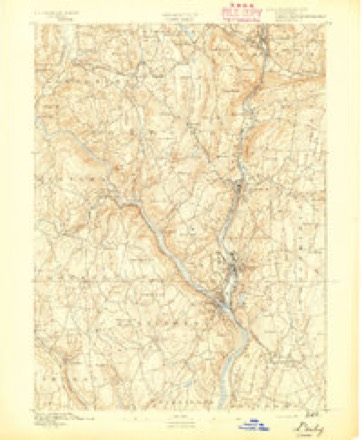
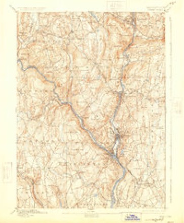
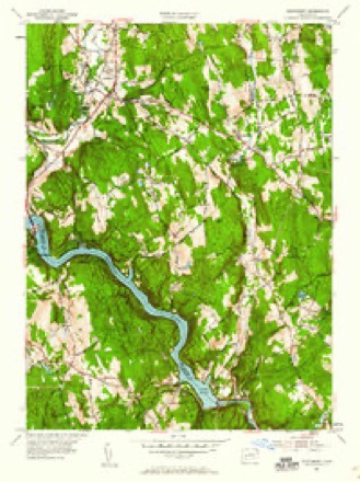
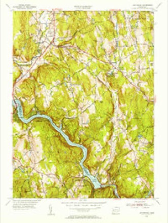
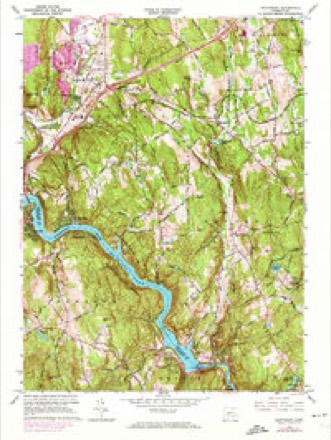
32 topographic sheets cover this place, the earliest surveyed in 1889 and the latest in 1986. It stands in Southbury town. It lies in ZIP code area 06488. It stands on Walnut Hill Brook. The Survey maps it on the Southbury quadrangle.
On record in Southford
Buildings and businesses the archive holds for this place. Each opens its own page, with the source record it came from.
On the National Register within a mile 4 records
The National Register names another town for these. They stand within one mile of this settlement's coordinate.
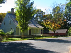 Adin Wheeler House and Theodore F. Wheeler Wheelwright Shoplisted 1993 · 0.3 miles away
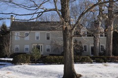 William Hurd Houselisted 1993 · 0.8 miles away
 Hurley Road Historic Districtlisted 1993 · 0.8 miles away
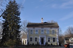 Reuben Curtiss Houselisted 1993 · 0.9 miles away
Topographic sheets covering this place
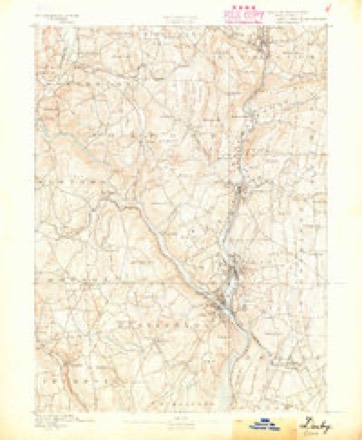
12 surveys from 32 printed sheetsMatched by testing this settlement's coordinate against the published boundary of every sheet in the United States Geological Survey's historical collection. Each opens the scanned sheet at the Survey.
- 1889 USGS Derby quadrangle1:62500
- 1891 USGS Derby quadrangle1:62500
- 1893 USGS Derby quadrangle1:62500, 9 printings
- 1947 USGS Hartford quadrangle1:250000, 2 printings
- 1948 USGS Hartford quadrangle1:250000, 2 printings
- 1953 USGS Southbury quadrangle1:24000, 2 printings
- 1953 USGS Southbury quadrangle1:31680
- 1961 USGS Hartford quadrangle1:250000
- 1962 USGS Hartford quadrangle1:250000, 3 printings
- 1964 USGS Southbury quadrangle1:24000, 5 printings
- 1965 USGS Hartford quadrangle1:250000, 2 printings
- 1986 USGS Bridgeport quadrangle1:100000, 3 printings






In the county-history sources
15,667 words on this townshipHistory of New Haven County, Connecticut, published 1892 names this settlement in its chapter on Southbury Town. These are the passages that mention it, exactly as the scans read.
The hills and streams have caused a number of localities, to which specific names have been applied. Along the Housatonic are Union Bridge, Bennett's Bridge and the Indian Pootatuck village. For many generations this has been the property of the Mitchell family, George W. Mitchell being the owner in 1890. Along the Eight Mile brook are Strongtown and Southford, and southwest of the latter is Kettle town. On the Pomperaug are White Oak, Southbury Center and South Britain. North of the latter are Pierce Hollow, Mulberry Corners and Transylvania. Southeast from this is a range of hill lands, called Poverty, whose derivation is not so clear as some of the foregoing.
Passage source: History of New Haven County, Connecticut, published 1892.
The Southford School District- comprises the third in Southbury and the ninth in Oxford, annexed, and lies to the east of Pomperaug Valley. The hill where the first school house was built is the highest elevation in New Haven county, on the road from New Haven to Litchfield. But this hill is encircled by an inner and outer circle of hills, some of which are of higher elevation. The principal ones are Osborn, Mitchel, Walnut tree, Buck and Horsehill, of the inner circle; of the outer, Bullet, Stiles, Pressen, Woodruff, Jack's, High and Hull's hill. The greater part of the territory lying within this outer circle comprises the Southford postal district, having a diameter on a line north and south of about five miles and on a line east and west of four miles.
Passage source: History of New Haven County, Connecticut, published 1892.
The Woodbury and Derby road, which was laid out by order of the general court, 1675, ran through this place on a line running northwest and southeast, crossing the Eight Mile brook where is now a private bridge near the paper mill, running along the southern slope of the hill and through Quaker Farms. Quassepaug was the third purchase made of the Indians by the inhabitants of ancient Woodbury and was obtained October 30th, 1687. It embraced all the territory lying north of the Woodbury and Derby road, east of the Pomperaug purchase to Waterbury line, then east along the line between ancient Woodbury and Waterbury to Towantic, then southward to where the Woodbury and Derby road crossed the Eight Mile brook. A part of the southern portion of the town of Middlebury is within this limit. That part of Southford which lies south of the line of the old Woodbury and Derby road was acquired under the Kettletown purchase.
Passage source: History of New Haven County, Connecticut, published 1892.
Machine-read from a century-old scan, so expect the errors a machine makes: misspelled names, dropped words, stray characters.
Read the whole chapter on Southbury Town - it names this place 18 more 18 times.
Fires near this place
231 since 1993Regional context, not property-specific evidence. The federal wildfire occurrence database lists 231 fires within 5 miles of Southford between 1993 and 2020, burning about 290 acres in total. None started naturally. 24 were recorded as arson. Distance is straight-line from the map coordinates, so a fire counted here may appear on a neighbouring settlement's page as well.
| Reported cause | Fires |
|---|---|
| Missing data/not specified/undetermined | 156 |
| Debris and open burning | 24 |
| Arson/incendiarism | 24 |
| Recreation and ceremony | 13 |
| Misuse of fire by a minor | 8 |
| Smoking | 5 |
| Fireworks | 1 |
The most recent of them, most recent first, with the day each was reported and the service that recorded it.
| Date | Cause | Size | Reported by | Name on the report |
|---|---|---|---|---|
| 7 September 1994 | Debris and open burning | under an acre | Connecticut Division of Forestry | not named |
| 7 September 1994 | Recreation and ceremony | under an acre | Connecticut Division of Forestry | not named |
| 6 September 1995 | Arson/incendiarism | under an acre | Connecticut Division of Forestry | not named |
| 4 September 2017 | Missing data/not specified/undetermined | under an acre | Connecticut Division of Forestry | CHRISTIAN ST |
| 3 September 2012 | Missing data/not specified/undetermined | under an acre | Connecticut Division of Forestry | MIDDLEBURY |
| 29 September 2015 | Missing data/not specified/undetermined | under an acre | Connecticut Division of Forestry | not named |
| 27 September 2008 | Debris and open burning | under an acre | Connecticut Division of Forestry | not named |
| 25 September 2016 | Recreation and ceremony | 2.3 acres | Connecticut Division of Forestry | CHESTNUT HILL ROAD NAUGATCK SF |
Settlements close enough to share some of these fires:
Mines and quarries near this place
10 of 13 shownRegional context, not property-specific evidence. The federal mineral resources record lists 13 workings within 5 miles of Southford: 9 past producers, 4 producers. 4 still produce. What was taken out: Sand and Gravel, Construction, Copper, Stone, Crushed/Broken, Quartz. Distance is straight-line from the map coordinates, so a quarry counted here may appear on a neighbouring settlement's page as well.
| Where | Site | Commodity | Status | Recorded |
|---|---|---|---|---|
| Basalt Rock Quarry No. Ej-011 | Stone, Dimension | Past Producer | ||
| Gneiss Rock Quarry No. Ej-010 | Stone | Producer | Gneiss | |
| Southford Pegmatite Quarry | Feldspar, Beryllium, Mica, Silica | Past Producer | ||
| Southford Quartz Pegmatite Quarry | Quartz, Feldspar, Mica | Producer | Muscovite, Plagioclase, Quartz | |
| Basalt Rock Quarry No. Ej-011 | Stone, Crushed/Broken | Past Producer | Basalt | |
| Basalt Rock Quarry No. Ej-012 | Stone, Crushed/Broken | Producer | Basalt | |
| Stevenson Bowers Hill Copper Mine | Copper | Past Producer | Metamorphosed Volcanic An | |
| Stevenson Mine | Copper | Past Producer | ||
| Kettletown Road Pit | Sand and Gravel, Construction | Past Producer | ||
| Quarry No. 2 Southbury | Sand and Gravel, Construction | Producer |
Storms near this place
2 since 2008Regional context, not property-specific evidence. The National Weather Service names Southford in 2 storm reports between 2008 and 2018: 1 thunderstorm wind, 1 tornado. No death or injury is recorded in these reports. Each account below is quoted exactly as the forecast office filed it, from the NOAA Storm Events Database, and each date opens the federal record of that event.
| When | Event | Place named | Harm | What the report says |
|---|---|---|---|---|
| May 2018 | Tornado (EF1) | Southford | $100,000 | A tornado touched down near the intersection of Route 67 and |Burma Road in Southbury and continued southeast into Oxford, |leaving a path of numerous uprooted and snapped pine trees and |some hardwood trees. The tornado lifted after damaging the roof of|the Great Oak School in Oxford. Based on this information, this |tornado is classified as an EF1 with maximum winds of 100 mph. |
| July 2008 | Thunderstorm Wind | Southford | $3,000 | Numerous trees were downed on Luther Drive, Fishrock Road and South Georges Hill. |
Nearest settlements
The eight closest, with where each one stands in the county. Distances are straight-line, computed from the Geographic Names Information System coordinates.
| Map | Place | Distance | Sheets |
|---|---|---|---|
| Kettletown | 1.8 miles | 32 | |
| Quaker Farms | 2.6 miles | 32 | |
| Southbury | 3.0 miles | 32 | |
| Oxford | 3.2 miles | 35 | |
| Cedar Land | 3.5 miles | 32 | |
| Lakeside | 4.0 miles | 32 | |
| Bowers Hill | 4.1 miles | 32 | |
| Heritage Village | 4.3 miles | 32 |
Provenance
This settlement is recorded in the Geographic Names Information System as feature 211028. The sheet list is computed by point-in-boundary test against the United States Geological Survey's historical topographic inventory. Both are works of the United States government and carry no copyright under 17 U.S.C. 105.
Wildfire. Short, Karen C. 2022. Spatial wildfire occurrence data for the United States, 1992-2020 [FPA_FOD_20221014]. 6th Edition. Fort Collins, CO: Forest Service Research Data Archive. https://doi.org/10.2737/RDS-2013-0009.6 Collected with United States Government funding and usable without additional permissions or fees.
Mines and quarries. USGS Mineral Resources Data System (MRDS) https://mrdata.usgs.gov/mrds/ A work of the United States government, no copyright under 17 U.S.C. 105.
Storms. NOAA National Centers for Environmental Information, Storm Events Database https://www.ncei.noaa.gov/stormevents/ A work of the United States government, no copyright under 17 U.S.C. 105. Narratives are quoted verbatim from the National Weather Service report and are not edited or summarised.