 Block
Pond Meadow, Connecticut
28 topographic sheets cover this place, the earliest surveyed in 1893 and the latest in 1983. It stands in Westbrook town. It lies in ZIP code area 06498. It lies near Mount Tom. The Survey maps it on the Essex quadrangle.
Topographic sheets covering this place
9 surveys from 28 printed sheetsMatched by testing this settlement's coordinate against the published boundary of every sheet in the United States Geological Survey's historical collection. Each opens the scanned sheet at the Survey.
- 1893 USGS Saybrook quadrangle1:62500, 8 printings
- 1944 USGS Essex quadrangle1:31680, 3 printings
- 1947 USGS Hartford quadrangle1:250000, 2 printings
- 1948 USGS Hartford quadrangle1:250000, 2 printings
- 1958 USGS Essex quadrangle1:24000, 5 printings
- 1961 USGS Hartford quadrangle1:250000
- 1962 USGS Hartford quadrangle1:250000, 3 printings
- 1965 USGS Hartford quadrangle1:250000, 2 printings
- 1983 USGS New Haven quadrangle1:100000, 2 printings
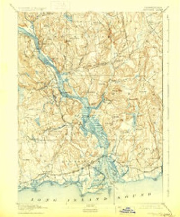
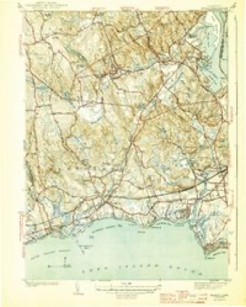


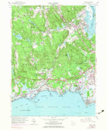




In the county-history sources
17,478 words on this townshipHistory of Middlesex County, Connecticut, with Biographical Sketches of Its Prominent Men, published 1884 names this settlement in its chapter on Westbrook Town. These are the passages that mention it, exactly as the scans read.
Until 1768, a period of 40 years from the time of the first school, Westbrook Parish constituted one school district and needed but one school house, but the increase of its population, especially in the north and west borders, made it desirable that school houses should be erected in those sections for their accommodation. Consequently, in 1768, the parish was divided into three school districts, and three school houses were built, the first house being sold and the site changed. -The third, that was to be on Pond Meadow, in anticipation of the division, had already partly built one.
Passage source: History of Middlesex County, Connecticut, with Biographical Sketches of Its Prominent Men, published 1884.
The school house in the First District was to be set somewhere between the meeting house and Mr. Hezekiah Post's dwelling. It was set on the ground occupied by the front of the present town hall. Its dimensions were 20 feet in length and 16 feet in width. That in the Second District, 16 feet long and 14 feet wide, was set " on Horse Hill, about 33 rods below the brook to the southward of Jeremiah Wright's house on the east side of the highway." The Third District was to go on and complete the house already begun. This was probably built on the site of the present Pond Meadow school house.
Passage source: History of Middlesex County, Connecticut, with Biographical Sketches of Its Prominent Men, published 1884.
Timothy Spencer, the father of these men, was a son of Caleb Spencer, and a direct descendant of Thomas Spencer, who settled in Pochaug, now Westbrook, in 1685, and soon after commenced working the iron mines of Pond Meadow, the first mining operations in what is now Middlesex county^ Timothy was a carpenter and shipbuilder, and as his business called him from home much of the time, he could give but little attention to his children. He married Polly Bushnell, a descendant of the Bushnells, who settled in Saybrook about 1644. By her he had seven children: Mariette, born in 1806; Emeline, born in 1807; Frederick Wilcox, born in 1810; Joseph Whittlesey, born in 1812; Alfred Goodrich, born in 1814; Eloise, born in i8i6; and Harriet, born in 1820.
Passage source: History of Middlesex County, Connecticut, with Biographical Sketches of Its Prominent Men, published 1884.
Machine-read from a century-old scan, so expect the errors a machine makes: misspelled names, dropped words, stray characters.
Read the whole chapter on Westbrook Town - it names this place 2 more 2 times.
Fires near this place
142 since 1992Regional context, not property-specific evidence. The federal wildfire occurrence database lists 142 fires within 5 miles of Pond Meadow between 1992 and 2020, burning about 135 acres in total. None started naturally. 1 was recorded as arson. Distance is straight-line from the map coordinates, so a fire counted here may appear on a neighbouring settlement's page as well.
| Reported cause | Fires |
|---|---|
| Missing data/not specified/undetermined | 72 |
| Debris and open burning | 26 |
| Recreation and ceremony | 19 |
| Misuse of fire by a minor | 7 |
| Power generation/transmission/distribution | 6 |
| Smoking | 5 |
| Railroad operations and maintenance | 5 |
| Equipment and vehicle use | 1 |
| Arson/incendiarism | 1 |
The most recent of them, most recent first, with the day each was reported and the service that recorded it.
| Date | Cause | Size | Reported by | Name on the report |
|---|---|---|---|---|
| 8 September 2020 | Missing data/not specified/undetermined | 1.5 acres | Connecticut Division of Forestry | 546 STEVENSTOWN ROAD |
| 25 September 2010 | Missing data/not specified/undetermined | 1.0 acres | Connecticut Division of Forestry | not named |
| 22 September 2020 | Missing data/not specified/undetermined | under an acre | Connecticut Division of Forestry | 1238 BOSTON POST ROAD |
| 18 September 2020 | Missing data/not specified/undetermined | under an acre | Connecticut Division of Forestry | 34 WOODLAND TRAIL |
| 16 September 2017 | Missing data/not specified/undetermined | under an acre | Connecticut Division of Forestry | 2 DENNISON RD |
| 15 September 2015 | Recreation and ceremony | 1.0 acres | Connecticut Division of Forestry | not named |
| 12 September 2016 | Debris and open burning | under an acre | Connecticut Division of Forestry | 76 LAUREL RIDGE TRAIL KILLINGWORTH |
| 9 August 2015 | Smoking | under an acre | Connecticut Division of Forestry | not named |
Settlements close enough to share some of these fires:
Mines and quarries near this place
4 within 5 milesRegional context, not property-specific evidence. The federal mineral resources record lists 4 workings within 5 miles of Pond Meadow: 2 past producers, 2 producers. 2 still produce. What was taken out: Sand and Gravel, Construction. Distance is straight-line from the map coordinates, so a quarry counted here may appear on a neighbouring settlement's page as well.
| Where | Site | Commodity | Status | Recorded |
|---|---|---|---|---|
| Deep River Sand and Gravel Pit | Sand and Gravel, Construction | Past Producer | ||
| Madison Mine and Plant | Sand and Gravel, Construction | Producer | ||
| Shore Line Concrete Sand Pit | Sand and Gravel, Construction | Past Producer | Sedimentary | |
| Shore Line Concrete Sand Pit | Sand and Gravel, Construction | Producer |
Nearest settlements
The eight closest, with where each one stands in the county. Distances are straight-line, computed from the Geographic Names Information System coordinates.
| Map | Place | Distance | Sheets |
|---|---|---|---|
| Ivoryton | 2.1 miles | 28 | |
| Winthrop | 2.6 miles | 28 | |
| Lake View | 3.0 miles | 27 | |
| Westbrook | 3.1 miles | 28 | |
| Centerbrook | 3.2 miles | 28 | |
| Grove Beach | 3.7 miles | 28 | |
| Hawks Nest | 4.0 miles | 28 | |
| Kelseytown | 4.0 miles | 27 |
Provenance
This settlement is recorded in the Geographic Names Information System as feature 209907. The sheet list is computed by point-in-boundary test against the United States Geological Survey's historical topographic inventory. Both are works of the United States government and carry no copyright under 17 U.S.C. 105.
Wildfire. Short, Karen C. 2022. Spatial wildfire occurrence data for the United States, 1992-2020 [FPA_FOD_20221014]. 6th Edition. Fort Collins, CO: Forest Service Research Data Archive. https://doi.org/10.2737/RDS-2013-0009.6 Collected with United States Government funding and usable without additional permissions or fees.
Mines and quarries. USGS Mineral Resources Data System (MRDS) https://mrdata.usgs.gov/mrds/ A work of the United States government, no copyright under 17 U.S.C. 105.