Listed on the National Register of Historic Places in 1982.
From the record
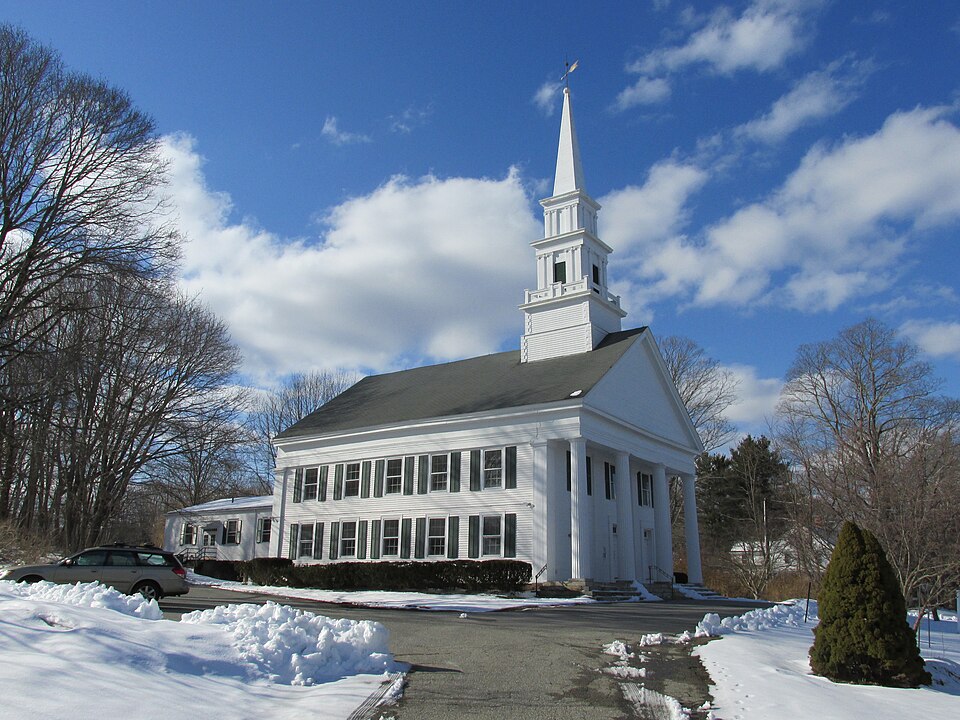
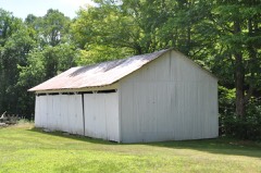
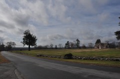
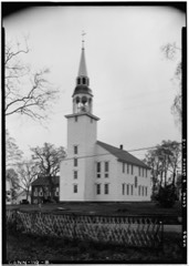
“The Hampton Hill Historic District encompasses the historic village center of Hampton, Connecticut, a small rural community in Windham County. It is a linear district, extending for about 1 mile (1.6 km) along Connecticut Route 97, the major north-south route through the town, and laid out as a tree-lined boulevard.”
Wikipedia article Hampton Hill Historic District, CC BY-SA 4.0.
One of 82 National Register listings published here for Windham County · listed in 1982 · category: District.
National Register reference number.82004408- the number the National Park Service assigned this property when it was listed, and the key its nomination file is catalogued under at the National Archives.
ONE of the beautiful towns of this beautiful rural countyis the town of Hampton. The territory covers about four miles in width from east to west and about seven miles in length from north to south. It lies in the southwest central part of the county, with Eastford and Pomfret on the north; Pomfret, Brooklyn and Canterbury on the east; Scotland on the south, and Chaplin on the west. The surface in most parts is hilly, in many places elevations rising in curious, majestic and commanding forms, giving ever changing scenes of quiet rural landscape to entrance the beholder who may for the first time be spell-bound upon their inviting summits. No village of any considerable magnitude exists in the town, but the central village on Hampton Hill makes up in the surpassing attractiveness of its scenery for any lack of busy life that it may show. The New York & New England railroad passes diagonally through the town, entering near the southwest corner and leaving near the northeast corner. Goshen, or Clark's Corners, and Hampton Station are the two depots on that line within this town. A line of high hills runs through nearly the central line of the town from north to south. Between and along the eastern foot of these hills Little river runs the length of the town, furnishing on its course water power for two or three mills, which are, however, mostly falling into disuse. Some farming is pursued in the town, but in a business point of view it maybe said that the town is declining. But it cannot be that a section of country possessing such loveliness of scenery and health inspiring properties can long remain in obscure decay. Already the tide has turned in the direction of the coming uses. Whilst the old methods of farming must decline, the new methods and the summer delights which are here offered to the overheated and weary citizen of the great centers of population and business, are laying the foundations of a new system of culture, improvement and profitable use.
The territory of this town was once included in the bounds of Windham. The good quality of its soil and the cheapness of land in this neighborhood induced settlement in the early years of the history of this county. By a land distribution in 1712, Hampton Hill was opened to purchasers. Nathaniel Hovey bought land in this vicinity in 1713, and soon settled upon it. A hundred acres were soon after sold to Timothy Pearl, by one Jennings. The locality was known by the Indian name of Appaquage hill. Another lot, with land on Little river were purchased by John Durkee of Gloucester, in 1715. Other settlers on or near this hill were Abiel and Robert Holt of Andover ; Nathaniel Kingsbury of Massachusetts; Thomas Fuller, John Button, George Allen and others. The settlement here was then known as Windham Village. A few sons of old Windham families like Ebenezer Abbe and Stephen Howard, joined in the settlement, but the greater part of the settlers were new-comers from Massachusetts.
Regional context, not property-specific
evidence. The
federal wildfire occurrence database
lists 66 fires within 5 miles of Hampton Hill Historic District
between 1999 and 2020, burning about 118 acres in total. None started naturally. 3 were recorded as arson.
Distance is straight-line from the map coordinates, so a fire counted
here may appear on a neighbouring settlement's page as well.
Reported cause
Fires
Missing data/not specified/undetermined
44
Debris and open burning
10
Recreation and ceremony
4
Arson/incendiarism
3
Smoking
2
Misuse of fire by a minor
1
Equipment and vehicle use
1
Power generation/transmission/distribution
1
The most recent of
them, most recent first, with the day each was reported and the service
that recorded it.
Regional context, not property-specific
evidence. The National Weather Service names
Hampton, the town this property stands in, in 7 storm reports between 2000 and 2024: 3 thunderstorm wind, 3 flash flood, 1 hail.
No death or injury is recorded in these reports. Each account below is quoted exactly as the forecast office
filed it, from the NOAA Storm Events Database, and each date
opens the federal record of that event.
No historic map-sheet match is published
for this property yet. That does not mean no map exists. This record needs
a coordinate-quality review before it can be joined to a sheet boundary.
Browse the county's mapped places while that work is
pending.
Listed places nearby
6 within 8 miles
Other National Register properties close
enough to walk or drive between, ordered by distance from this one. Both
positions come from the same geocoding pass that matched these properties
to their map sheets.
Listing record. National Park Service National Register of Historic Places, listed-properties dataset, current to 2026-05-22.
Map join. Address geocoded through the United States Census geocoder, then tested against the published boundary of every sheet in the USGS Historical Topographic Map Collection.
How this page is made. Listing fields come from federal records; map-sheet coverage is a labelled coordinate-to-boundary calculation, not a source-field claim.
Wildfire. Short, Karen C. 2022. Spatial wildfire occurrence data for the United States, 1992-2020 [FPA_FOD_20221014]. 6th Edition. Fort Collins, CO: Forest Service Research Data Archive. https://doi.org/10.2737/RDS-2013-0009.6 Collected with United States Government funding and usable without additional permissions or fees.
Storms. NOAA National Centers for Environmental Information, Storm Events Database https://www.ncei.noaa.gov/stormevents/ A work of the United States government, no copyright under 17 U.S.C. 105. Narratives are quoted verbatim from the National Weather Service report and are not edited or summarised.
 Block