 Block
From the record
12 National Register listings published here, 2 of them National Historic Landmarks.
Sources: the National Register database, National Park Service
93 topographic sheets cover 43 settlements here, and 12 properties are on the National Register of Historic Places.
12 National Register listings published here, 2 of them National Historic Landmarks.
Sources: the National Register database, National Park Service
Every property in this county listed on the National Register of Historic Places, with the year it was listed and the federal nomination document.
| Photograph | Property | Type | Listed | Reference |
|---|---|---|---|---|
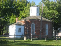 | Charter Oak Schoolhouse | building | 1978 | 78001181 |
 | Creole House | building | 1973 | 73000717 |
 | Fort de Chartres | site | 1966 | 66000329 |
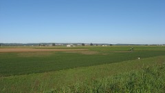 | French Colonial Historic District | district | 1974 | 74000772 |
 | Mary's River Covered Bridge | structure | 1974 | 74000771 |
 | Pierre Menard House | building | 1970 | 70000245 |
 | Old Fire Station | building | 2018 | 100002571 |
 | Red Bud Historic District | district | 1979 | 79000865 |
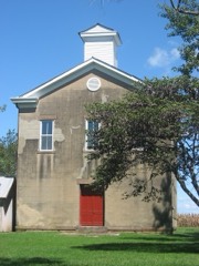 | Shiloh College | building | 2005 | 05001251 |
 | Sparta Historic District | district | 1982 | 82002595 |
 | Weinrich, Christian F. | building | 2018 | 100002572 |
 | Frederick Weister House | building | 2018 | 100002573 |
Randolph County has 1 covered bridge on the National Register. Each is a listed structure with a federal nomination on file.
| Mary's River Covered Bridge | Listed 1974 |
Every wildfire the federal occurrence database records inside this county: 27 of them, burning about 46 acres. None started naturally and 1 was recorded as arson. Each settlement page carries the fires within five miles of it.
| Reported cause | Fires |
|---|---|
| Debris and open burning | 18 |
| Missing data/not specified/undetermined | 4 |
| Equipment and vehicle use | 3 |
| Arson/incendiarism | 1 |
| Recreation and ceremony | 1 |
The five largest, by the area the report gives. None of them was recorded as arson.
| Date | Cause | Size | Reported by | Name on the report |
|---|---|---|---|---|
| 28 September 2013 | Debris and open burning | 5.0 acres | Illinois Division of Forestry Resources | 71-2013 |
| 16 February 2017 | Debris and open burning | 4.5 acres | Illinois Division of Forestry Resources | 190217 |
| 5 March 2017 | Debris and open burning | 4.0 acres | Illinois Division of Forestry Resources | 310317 |
| 8 April 2017 | Equipment and vehicle use | 3.0 acres | Illinois Division of Forestry Resources | 390417 |
| 17 February 2017 | Debris and open burning | 3.0 acres | Illinois Division of Forestry Resources | 200217 |
| 12 April 2014 | Debris and open burning | 3.0 acres | Illinois Division of Forestry Resources | 34-0414 |
| 17 February 2017 | Debris and open burning | 2.0 acres | Illinois Division of Forestry Resources | 210217 |
| 22 April 2014 | Debris and open burning | 2.0 acres | Illinois Division of Forestry Resources | 37-0414 |
Every settlement page carries the fires within five miles of it - see the settlement index below.
The NOAA Storm Events Database holds 426 reports for this county, causing 1 death, 14 injuries and about $10,422,800 in recorded property damage. Each settlement page carries the reports that name it.
| Kind of event | Reports |
|---|---|
| Thunderstorm Wind | 181 |
| Hail | 173 |
| Tornado | 45 |
| Flash Flood | 19 |
| Flood | 6 |
| Lightning | 1 |
| Heavy Rain | 1 |
The most serious of them, by death, then injury, then recorded damage. The accounts are quoted exactly as the forecast office filed them.
| When | Event | Place named | Harm | What the report says |
|---|---|---|---|---|
| April 1985 | Tornado (F2) | not stated | 1 killed, 3 hurt, $250,000 | no account filed |
| December 1967 | Tornado (F3) | not stated | 2 hurt, $250,000 | no account filed |
| July 2000 | Lightning | Coulterville | 2 hurt | Lightning struck a light pole resulting in minor injuries to 2 women standing nearby. Both women reported being stiff and sore for about 2 days and having a bad taste, "like a rusty pipe", in their mouths. |
| March 1959 | Tornado (F2) | not stated | 1 hurt, $25,000 | no account filed |
| June 2010 | Thunderstorm Wind | Eden | 1 hurt | Thunderstorm winds destroyed a produce stand just south of Eden. A couple who run the stand went to their pickup truck for cover as the storm approached. As the winds hit, destroying the produce stand, a 2x4 from the stand was propelled through the windshield of the truck. The board struck the female passenger on the side of the head. She was treated and released from the local hospital with minor injuries. Also, several tree limbs were blown down and the couple's house nearby sustained minor damage. |
| August 2010 | Thunderstorm Wind | Sparta Hunter Fld Ar | 1 hurt | Thunderstorm winds blew down numerous large trees, tree limbs and power lines around town. Just northwest of town at a recreational complex, a fifth wheel RV was blown over. A man was inside at the time sleeping. He sustained a broken arm and other minor injuries. In Sparta, one large tree limb damaged a carport and a nearby unoccupied car. |
| March 2009 | Tornado (EF1) | Griggs | 1 hurt | A tornado touched down one mile south of Grigg and travelled to the northeast. It destroyed 2 mobile homes and snapped numerous trees along its path. The tornado then caused major damage to the second floor of the two-story Kaskaskia River Hotel before lifting and dissipating one mile west of Baldwin. One of the mobile homes was occupied. The man sustained minor injuries from the tornado. |
| March 2009 | Hail | Red Bud | 1 hurt | One person sustained minor cuts when the large hail shattered a window in their home. |
| January 2008 | Hail | Evansville | 1 hurt | One man sustained a minor cut on his forehead caused by the 1 inch hail stones. |
| July 1984 | Thunderstorm Wind | not stated | 1 hurt | no account filed |
| October 2021 | Tornado (EF2) | Pujol | $3,040,000 | The tornado moved out of Missouri (Ste. Genevieve County) into Illinois (Randolph County) moving though flood plains and crossing the Mississippi River just north of the Menard Correctional Center. The tornado crossed Route 3 south of Lochhead Drive destroying a small barn, snapping or uprooting trees, and caused minor damage to several homes and a hardware store. Snapped or uprooted trees and downed power poles were found along the remainder of the tornado track through Chester with roof damage to several homes on Brenda Street. The worst damage in Chester occurred just northeast of the Palestine Road and Three Spring Roads intersection, where two farm outbuildings were completely destroyed. The larger of the two buildings was well-built with anchor bolts every 18-24 inches in the concrete foundation. This damage was rated EF-2. Further northeast, minor roof damage and the loss of the roof-mounted HVAC unit was found at the nursing home near Old Lodge Lane and Three Springs Road. The tornado continued to the northeast into Bremen paralleling and crossing Route 150, producing tree damage and minor roof damage to several homes. Minor roof damage to several homes, damage to several farm outbuildings, and snapped and uprooted trees were found along parts of Chester Road and Paradise Road. The worst of this damage was rated EF-1. The tornado dissipated around 1.6 miles northeast of Bremen, just west of Route 150. Overall the tornado was rated EF2 with a path length of 16.47 miles and a max path width of 400 yards. |
| April 1985 | Tornado (F1) | not stated | $2,500,000 | no account filed |
| March 1961 | Tornado (F2) | not stated | $2,500,000 | no account filed |
| April 1994 | Tornado (F0) | Ruma to | $500,000 | A tornado touched down north of Ruma and moved northeast before lifting near Baldwin. The damage path was intermittent but Illinois State Police troopers followed it and observed numerous trees blown down and a few farm buildings damaged. |
| December 1957 | Tornado (F3) | not stated | $250,000 | no account filed |
| March 1952 | Tornado (F2) | not stated | $250,000 | no account filed |
| May 2022 | Thunderstorm Wind | Menard | $200,000 | Widespread wind damage across Chester. Numerous trees, tree limbs, power poles and power lines were blown down around town. Also, a couple of houses sustained damage from fallen trees. Several businesses were damaged as well. |
| March 2025 | Tornado (EF1) | Rockwood | $50,000 | In Randolph County, most tornado damage occurred to trees. A few outbuildings did sustain significant damage to their roofs along the track. The tornado dissipated near Leanderville at approximately 11:55 PM. In Randolph County the tornado was rated EF-1 with a path length of 6.63 miles and a maximum path width of 175 yards. This is a continuation of a tornado that caused EF-1 damage in Bollinger County, MO and EF-2 damage in Perry County, MO. |
| April 1994 | Thunderstorm Wind | Baldwin | $50,000 | County officials reported a garage blown down along Highway 154 in Baldwin. A mobile home was heavily damaged in Sparta and several mobile home roofs were damaged in Coulterville. The county sheriff also reported trees and power lines down through out the county. |
| April 1994 | Thunderstorm Wind | Sparta | $50,000 | County officials reported a garage blown down along Highway 154 in Baldwin. A mobile home was heavily damaged in Sparta and several mobile home roofs were damaged in Coulterville. The county sheriff also reported trees and power lines down through out the county. |
| May 2025 | Tornado (EF1) | Prairie Du Rocher | $30,000 | A brief tornado touched down just south of Prairie du Rocher, destroying an outbuilding before heading north-northeast. From there the tornado caused tree damage and damaged another farm outbuilding before dissipating just southwest of Route 155. |
| April 2025 | Flash Flood | Houston | $30,000 | Heavy rain caused several feet of water over County Road 18, leading to a vehicle becoming submerged. The occupant was safe. Route 4 north of Sparta also had water over the roadway. During the event, up to 4.5 inches of rain fell in Randolph County. |
| April 2024 | Thunderstorm Wind | Menard | $25,000 | The Randolph County emergency manager reported snapped power poles and downed power lines east of Chester. |
| May 2022 | Thunderstorm Wind | Ruma | $25,000 | Thunderstorm winds blew down several trees onto Illinois Route 155 in Ruma. Numerous tree limbs were blown down in Baldwin. In the Sparta and Eden areas, numerous trees, tree limbs and power lines were blown down. Several buildings in Sparta sustained minor damage from fallen trees and tree limbs. |
| April 2002 | Hail | Central Portion | $25,000 | A severe thunderstorm produced a swath of golf ball size hail across the county. Golf-ball size hail began along the Randolph County line near Cutler and continued east across Pinckneyville. Quarter size hail fell at Tamaroa. There were at least several homes and vehicles damaged by the hail. |
| May 1960 | Tornado (F1) | not stated | $25,000 | no account filed |
| March 1960 | Tornado (F2) | not stated | $25,000 | no account filed |
| May 1960 | Tornado (F1) | not stated | $25,000 | no account filed |
| April 1958 | Tornado (F0) | not stated | $25,000 | no account filed |
| May 1958 | Tornado (F1) | not stated | $25,000 | no account filed |
| December 1957 | Tornado (F3) | not stated | $25,000 | no account filed |
| December 1957 | Tornado (F3) | not stated | $25,000 | no account filed |
| December 1950 | Tornado (F1) | not stated | $25,000 | no account filed |
| May 2024 | Thunderstorm Wind | Red Bud | $20,000 | Thunderstorm winds caused a power pole to fall across a roadway and a tree to fall on a house south of Red Bud. There was minor damage to the house. Several trees and power lines were knocked down in Sparta, and there was a tree down over a roadway near Eden. Cities in the path of the storm include Baldwin and Houston. |
| August 2001 | Thunderstorm Wind | Chester | $20,000 | Trees were downed on the north side of Chester. A truck was extensively damage by a downed tree. |
| July 1999 | Thunderstorm Wind | Prairie Du Rocher | $15,000 | no account filed |
| April 2025 | Tornado (EF1) | Preston | $10,000 | The tornado touched down on Baldwin Road at 8:25 PM, producing tree damage with winds estimated around 70 mph. The tornado then moved northeast and uprooted and snapped trees along Ridge Road. The snapped trees were the worst damage, with winds estimated as high as 93 mph. Moving northeastward, the tornado removed the roof of a grain silo along Pearidge Road before lifting at 8:26 PM just east of Pearidge Road. The tornado was rated EF-1 with a path length of 1.32 miles and a maximum path width of 75 yards. |
| June 2022 | Thunderstorm Wind | Evansville | $10,000 | Thunderstorm winds blew down numerous large tree limbs around town. Some of the fallen limbs also knocked down a couple of power lines. |
| June 2008 | Flood | Danley | $10,000 | The Mississippi River at Chester, IL crested at 39.46 feet on 7/01/2008. This is the tenth highest crest ever recorded. Damage was restricted to agricultural areas along the river. A few roads along the river had to be closed. Agricultural losses were estimated at $6.3 million. |
| February 1999 | Thunderstorm Wind | Sparta | $10,000 | no account filed |
| April 1996 | Tornado (F0) | Bremen | $9,000 | no account filed |
| May 2008 | Thunderstorm Wind | Percy | $8,000 | Thunderstorm winds ripped the siding off a wall of a house. A couple of trees and large limbs were also downed in the area. |
| May 2008 | Hail | Steeleville | $7,000 | Storm spotters reported hail up to 1 1/4 inch fell for about five minutes. A couple of vehicles were damaged. |
| June 1995 | Thunderstorm Wind | Chester | $5,400 | Golf ball-size hail was reported in Walsh with numerous trees and power lines down between Chester and Steeleville. The roof of a drug store in Chester was partially ripped away. About 1,900 households were also without power in Prairie Du Rocher, Ruma, and Red Bud. |
| July 2022 | Thunderstorm Wind | New Palestine | $5,000 | Thunderstorm winds blew down several large tree limbs and caused minor siding and shingle damage to a house. Also, a barn sustained minor roof damage. |
| April 1994 | Tornado (F0) | Steeleville | $5,000 | The county sheriff reported a brief tornado touchdown in Steeleville with damage mainly confined to large trees. |
| April 1993 | Thunderstorm Wind | Sparta | $5,000 | A radio station reported downed power lines with wind gusts to 60 mph. |
| April 1996 | Tornado (F0) | Baldwin | $5,000 | no account filed |
| April 1996 | Tornado (F0) | Tilden | $5,000 | no account filed |
| March 1996 | Thunderstorm Wind | Sparta | $5,000 | no account filed |
| June 1995 | Thunderstorm Wind | Prairie Du Rocher | $4,400 | Large trees and power lines were knocked down. Some of the trees damaged roofs and parked cars in Pr. Du Rocher. |
| April 1960 | Tornado (F1) | not stated | $2,500 | no account filed |
| August 2024 | Tornado (EF0) | Menard | $2,000 | A brief landspout tornado developed along the outflow boundary of a cluster of thunderstorms just north of Chester, IL. The landspout formed just east of Bodes Ln and tracked eastward, impacting several trees and two outbuildings before dissipating in an adjacent field. |
| July 2021 | Thunderstorm Wind | Coulterville | $2,000 | Thunderstorm winds blew down a few trees and numerous tree limbs. |
| March 1996 | Thunderstorm Wind | Ruma | $2,000 | no account filed |
| April 2025 | Thunderstorm Wind | Coulterville | $1,500 | Thunderstorm winds downed a utility pole in Coulterville. |
| June 2013 | Flood | Danley | $1,000 | The Mississippi River started June in flood and hit major flood levels cresting on the 5th. The river fell below flood stage on the 26. Damage was limited to some closed roads and flooded farmland. |
| May 1997 | Thunderstorm Wind | Steeleville | $1,000 | County sheriff reported power lines down and roof damage to a building at an baseball field. |
| April 1994 | Thunderstorm Wind | Coulterville | $500 | County officials reported a garage blown down along Highway 154 in Baldwin. A mobile home was heavily damaged in Sparta and several mobile home roofs were damaged in Coulterville. The county sheriff also reported trees and power lines down through out the county. |
| April 1994 | Thunderstorm Wind | Sparta | $500 | The county sheriff reported numerous trees down between Sparta and Tilden along Highway 4. |
The Survey's mineral resources record lists 24 workings inside this county. 2 still produce and 22 are closed or unrecorded. Each settlement page carries the workings within five miles of it.
| Commodity | Workings |
|---|---|
| Stone, Crushed/Broken | 18 |
| Clay | 4 |
| Sand and Gravel, Construction | 2 |
The least common of them first, because a county's hundredth gravel pit says nothing its first ten did not.
| Where | Site | Commodity | Status | Recorded |
|---|---|---|---|---|
| Hepp Sand Pit | Sand and Gravel, Construction | Past Producer | ||
| Southern Illinois Sand Dredge | Sand and Gravel, Construction | Producer | ||
| Birchler Shale Drill Hole | Clay | Prospect | ||
| Caseyville Shale Exposure | Clay | Prospect | ||
| Hornbastel Shale Exposure | Clay | Prospect | ||
| Wlatersburg Shale Exposure | Clay | Prospect | ||
| Chester Quarry | Stone, Crushed/Broken | Past Producer | ||
| Cohen Property | Stone, Crushed/Broken | Past Producer | ||
| Degonia Sandstone Exposure | Stone, Crushed/Broken | Prospect | ||
| Limestone Prospect | Stone, Crushed/Broken | Occurrence | ||
| Limestone Prospect | Stone, Crushed/Broken | Occurrence | ||
| Limestone Prospect | Stone, Crushed/Broken | Occurrence | ||
| Limestone Prospect | Stone, Crushed/Broken | Occurrence | ||
| Limestone Prospect | Stone, Crushed/Broken | Occurrence | ||
| Limestone Prospect | Stone, Crushed/Broken | Occurrence | ||
| Menard State Penitentiary Quarry | Stone, Crushed/Broken | Past Producer | ||
| Prairie Du Rocher Quarry | Stone, Crushed/Broken | Past Producer | ||
| Randolph County Highway Department | Stone, Crushed/Broken | Past Producer | ||
| Rockwood Sandstone Exposure | Stone, Crushed/Broken | Prospect | ||
| Solvay Mine | Stone, Crushed/Broken | Past Producer | ||
| Stotz Quarry Mine | Stone, Crushed/Broken | Producer | ||
| Unnamed Limestone Quarry | Stone, Crushed/Broken | Past Producer | ||
| Unnamed Limestone Quarry | Stone, Crushed/Broken | Past Producer | ||
| Unnamed Limestone Quarry | Stone, Crushed/Broken | Past Producer |
Named settlements recorded in the Geographic Names Information System, each with the topographic sheets covering it. Villages, hamlets and abandoned places alike. Each is shown with the nearest named watercourse or landform and the survey quadrangle it falls on.
Ellis Grove precinct · 62241 · On Ninemile Creek · Evansville quadrangle
12 sheets, 1912 to 1985
Evansville precinct · 62242 · On Horse Creek · Evansville quadrangle
12 sheets, 1912 to 1985
Ellis Grove precinct · 62241 · Near Beaver Island · Kaskaskia quadrangle
24 sheets, 1915 to 1993
Kaskaskia precinct · 63673 · On Kaskaskia Island · Kaskaskia quadrangle
24 sheets, 1915 to 1993
Brewerville precinct · 62261 · On The Discharge · Prairie du Rocher quadrangle
19 sheets, 1915 to 1993
Brewerville precinct · 62261 · Near Burns Hollow · Prairie du Rocher quadrangle
19 sheets, 1915 to 1993
Kaskaskia precinct · 63673 · Near Beaver Island · Kaskaskia quadrangle
24 sheets, 1915 to 1993
Prairie du Rocher precinct · 62277 · On Prairie Du Rocher · Prairie du Rocher quadrangle
19 sheets, 1915 to 1993
Ellis Grove precinct · 62241 · On Kaskaskia River · Kaskaskia quadrangle
24 sheets, 1915 to 1993
Steeleville precinct · 62288 · On North Fork Cox Creek · Steeleville quadrangle
12 sheets, 1914 to 1985