 Block
Alton, Illinois
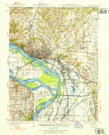
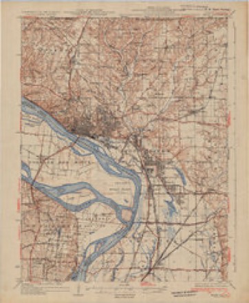
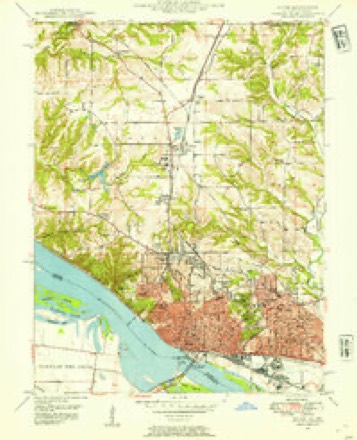
24 topographic sheets cover this place, the earliest surveyed in 1927 and the latest in 1994. It stands in Alton Township. It lies in ZIP code area 62002. It stands on Shields Branch. The Survey maps it on the Alton quadrangle. 25,676 people lived here at the 2020 count. It stands 492 feet above sea level.
Research this city
On record in Alton
Buildings and businesses the archive holds for this place. Each opens its own page, with the source record it came from.
On the National Register 12 of 15 shown
 Lyman Trumbull HouseNational Historic Landmark · listed 1975
 Alton Chapter Houselisted 1980
 Alton Gas & Electric Power Houselisted 2019
 Alton National Cemeterylisted 2011
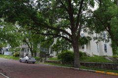 Christian Hill Historic Districtlisted 1978
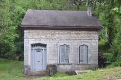 Guertler Houselisted 1974
 Haskell Playhouselisted 1974
 Hotel Stratfordlisted 2000
 Middletown Historic Districtlisted 2022
 Mount Lookoutlisted 1980
 Post Houselisted 1980
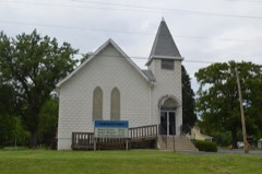 Salem Baptist Churchlisted 2013
Population over time
2 figuresAlton fell from 27,865 to 25,676 between 2010 and 2020. These are the recorded population figures Wikidata holds for this place, reached through the Geographic Names Information System number this page is keyed on rather than by name, so they belong to this place and not to another of the same name. Most are census counts, but not all are: an early figure may be a founding or settlement estimate, and an estimate published within five years of a census is left out. The change column is computed, and is left blank where more than 20 years separate a figure from the one before it, because a gap that long is not a change between two counts.
| Year | People | Change |
|---|---|---|
| 2010 | 27,865 | |
| 2020 | 25,676 | -2,189 (-8%) |
Topographic sheets covering this place
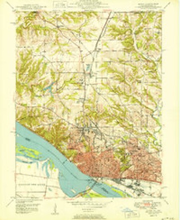
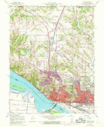
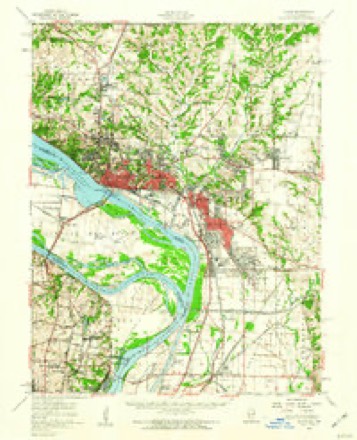
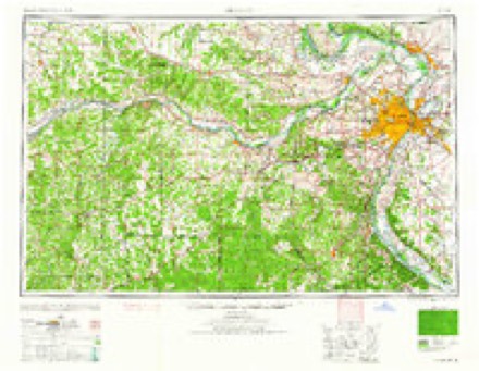
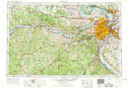
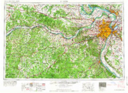
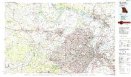
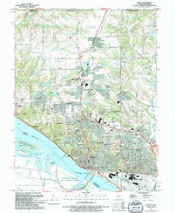
13 surveys from 24 printed sheetsMatched by testing this settlement's coordinate against the published boundary of every sheet in the United States Geological Survey's historical collection. Each opens the scanned sheet at the Survey.
- 1927 USGS Alton quadrangle1:62500
- 1934 USGS Alton quadrangle1:62500, 2 printings
- 1948 USGS Alton quadrangle1:24000
- 1949 USGS Saint Louis quadrangle1:250000
- 1949 USGS St. Louis quadrangle1:250000
- 1950 USGS Alton quadrangle1:24000, 2 printings
- 1954 USGS Alton quadrangle1:24000, 4 printings
- 1955 USGS Alton quadrangle1:62500, 2 printings
- 1962 USGS St. Louis quadrangle1:250000
- 1963 USGS St. Louis quadrangle1:250000, 4 printings
- 1966 USGS St. Louis quadrangle1:250000
- 1985 USGS St Louis quadrangle1:100000, 3 printings
- 1994 USGS Alton quadrangle1:24000
What happened here
An account from the chapter on Alton township. The inset identifies its exact source book and publication year.
City Court Of Alton
The Alton City Court was organized in 1859, and its first session was held on the 11th of April of that year. The name Was changed in 1874 from the Alton City Court to the City Court of Alton. It has jurisdiction of all chancery and common law causes, except murder. Henry W. Billings was the first judge.
In the county-history sources
44,031 words on this townshipHistory of Madison County, Illinois ... With Biographical Sketches .., published 1882 names this settlement in its chapter on Alton Township. These are the passages that mention it, exactly as the scans read.
The first to recognize the advantages of the site of Alton as the place for a flourishing town seems to have been Col. Rufus Easton, of the neighboring territory of Missouri. He was born at Litchfield, Connecticut, on the fourth of May, 1774 ; studied law in Connecticut, and after practicing \\\i profession a couple of years in Oneida county, New York, came to St. Louis in the year 1804. He enjoyed the friendship of Gideon Granger, Aaron Burr, and other influential men of that day, and through their influence was commissioned by President JeflTerson, Judge for the territory of Louisiana. In the year 1808 the first post office wa^ established in St. L)uis, and Rufus Easton was appointed postmaster. From ISH to I8l8 he was delegate in Congress from Missouri territory. On the organization of the state government of Missouri in 1821, he was appointed attorney general for the State, and held that office till 1826. He died at St. Charles, Jlissouri, on the fifth of July, 1834. He had fine executive and administrative ability. His son, Alton Rufus Easton, whose Christian name was given to Alton, commanded a regiment, known as the St. Louis Legion, in the Mexican war, and is still a resident of St. Louis.
Passage source: History of Madison County, Illinois ... With Biographical Sketches .., published 1882.
Col. Easton obtained possession of land in the vicinity, and early in the year 1817 laid out a town which, in ftonor of his son, Alton R. Easton, he called Alton. It is also said that Langdon, George and Alby streets were named after some of his children. The town was laid out on fractional sections eleven and fourteen, of township five north, range ten west.* The old town plat, or Easton's
Passage source: History of Madison County, Illinois ... With Biographical Sketches .., published 1882.
Alton, extended from Market street on the west to Henry street on the east, and iroin the river north to Ninth street- The firrft step which C.)l. Edston took towards building up the town was tlie establishment of a ferry. As early as the year 1806 a f<rrry was in existence on the Mississippi, just above the mouth of Wood river, conducted by Eli Langford, who carried passeng-TS to the opposite shores of both the Miseissippi and the ilissouri. A man by the name of Piper had a ferry across the Mississippi at the mouth of Hop Hollow, above the site of Alton. This ferry afterward came into the possession of Michael Squire and a man named Smeltzer, and at the time the town of Alton was founded was known as Smeltzer's ferry For much of the time the landing place on the Illinois side was several miles above Alton. Sjneltzer built a brick house on the Missouri side witli brick ma<le on the Illinois side of the river. This house gave the name to the " Brick House Bend," and was in existence till 1SG6, in August of which year it fell down. Smeltzer was a great miser. He was accustomed to ride with a tow-string bridle. Once when sick he told his brother-in law that he had a barrel of silver dollars buried, but died finally without telling where the money was hidden.
Passage source: History of Madison County, Illinois ... With Biographical Sketches .., published 1882.
Machine-read from a century-old scan, so expect the errors a machine makes: misspelled names, dropped words, stray characters.
Read the whole chapter on Alton Township - it names this place 159 more 159 times.
Fires near this place
2 since 2008Regional context, not property-specific evidence. The federal wildfire occurrence database lists 2 fires within 5 miles of Alton in 2008, burning about 2 acres in total. None started naturally. None was recorded as arson. Distance is straight-line from the map coordinates, so a fire counted here may appear on a neighbouring settlement's page as well.
| Reported cause | Fires |
|---|---|
| Missing data/not specified/undetermined | 2 |
The most recent of them, most recent first, with the day each was reported and the service that recorded it.
| Date | Cause | Size | Reported by | Name on the report |
|---|---|---|---|---|
| 21 May 2008 | Missing data/not specified/undetermined | 1.0 acres | Illinois Division of Forestry Resources | HATFIELD |
| 21 May 2008 | Missing data/not specified/undetermined | 1.0 acres | Illinois Division of Forestry Resources | ALLIANCE |
Settlements close enough to share some of these fires:
Mines and quarries near this place
10 within 5 milesRegional context, not property-specific evidence. The federal mineral resources record lists 10 workings within 5 miles of Alton: 6 past producers, 3 producers, 1 occurrence. 3 still produce. What was taken out: Stone, Crushed/Broken, Sand and Gravel, Construction, Clay. Distance is straight-line from the map coordinates, so a quarry counted here may appear on a neighbouring settlement's page as well.
| Where | Site | Commodity | Status | Recorded |
|---|---|---|---|---|
| Alton Brick Co.Clay Shale Pit | Clay | Past Producer | ||
| Alton Dredge | Sand and Gravel, Construction | Past Producer | ||
| St. Charles & Traveler Dredges | Sand and Gravel, Construction | Past Producer | ||
| Twin River Loading Dock | Sand and Gravel, Construction | Past Producer | ||
| Alton Mine | Stone, Crushed/Broken | Producer | ||
| Fort Bellefontaine Quarry | Stone, Crushed/Broken | Producer | ||
| Limestone Prospect | Stone, Crushed/Broken | Occurrence | ||
| Mississippi Lime and Material Quarr | Stone, Crushed/Broken | Past Producer | ||
| Reliance Quarry | Stone, Crushed/Broken | Past Producer | ||
| Reliance Quarry Inc. Alton Quarry | Stone, Crushed/Broken | Producer |
Storms near this place
60 of 78 shownRegional context, not property-specific evidence. The National Weather Service names Alton in 78 storm reports between 1994 and 2026: 38 thunderstorm wind, 34 hail, 3 flash flood, 1 flood. The reports record 1 injury. Each account below is quoted exactly as the forecast office filed it, from the NOAA Storm Events Database, and each date opens the federal record of that event.
| When | Event | Place named | Harm | What the report says |
|---|---|---|---|---|
| February 2014 | Thunderstorm Wind | Alton | 1 hurt | Thunderstorm winds blew a utility pole down in Alton. The pole fell onto an occupied car. One passenger sustained minor injuries. In Bethalto, several large tree limbs and a two foot diameter tree were blown down. |
| August 2005 | Thunderstorm Wind | Alton | $1,000,000 | no account filed |
| June 2022 | Thunderstorm Wind | Alton | $20,000 | Widespread wind damage between Alton and Edwardsville. In Alton, the soffit on a house was partially torn off. Numerous trees, tree limbs and power lines were blown down in Alton, Bethalto, Wood River, Glen Carbon and Edwardsville. |
| August 2022 | Thunderstorm Wind | Alton | $10,000 | Thunderstorm winds blew down several trees near the intersection of 4th Street and Henry Street. Also a large tree was blown over into the front yard, narrowly missing the house. Numerous tree limbs and power lines were blown down around town, including in Oakwood Cemetery. |
| May 2022 | Thunderstorm Wind | East Alton | $5,000 | Thunderstorm winds blew down several large tree limbs. |
| June 1994 | Thunderstorm Wind | East Alton | $5,000 | Ham radio spotters reported six to eight inch tree limbs snapped off and power lines down at East Alton along with gusts to 60 mph. The county sheriff also reported trees and power lines down from Worden to Holiday Shores between 1715 and 1725 CST. One lightning strike in East Alton caused a tree to catch fire. |
| May 1995 | Thunderstorm Wind | Alton | $1,400 | Ham radio spotters reported power lines and poles down in Alton. Tree limbs up to five inches in diameter were snapped off in East Alton several minutes later. |
| June 1994 | Thunderstorm Wind | East Alton | $500 | Ham radio spotters reported six to eight inch tree limbs snapped off and power lines down at East Alton along with gusts to 60 mph. The county sheriff also reported trees and power lines down from Worden to Holiday Shores between 1715 and 1725 CST. One lightning strike in East Alton caused a tree to catch fire. |
| June 1994 | Thunderstorm Wind | East Alton | $500 | Ham radio spotters reported six to eight inch tree limbs snapped off and power lines down at East Alton along with gusts to 60 mph. The county sheriff also reported trees and power lines down from Worden to Holiday Shores between 1715 and 1725 CST. One lightning strike in East Alton caused a tree to catch fire. |
| June 1994 | Thunderstorm Wind | East Alton | $500 | Ham radio spotters reported six to eight inch tree limbs snapped off and power lines down at East Alton along with gusts to 60 mph. The county sheriff also reported trees and power lines down from Worden to Holiday Shores between 1715 and 1725 CST. One lightning strike in East Alton caused a tree to catch fire. |
| November 1994 | Thunderstorm Wind | Alton | $300 | The county sheriff reported scattered large trees and power lines down between Alton and Holiday Shores, across the northern part of the county. |
| June 1995 | Thunderstorm Wind | Alton | $266 | Large tree limbs and power lines were knocked down at Godfrey. As the storm hit Alton, large trees fell demolishing a bandstand and heavily damaging at least three homes. |
| March 2026 | Hail | East Alton | - | Quarter sized hail was reported in Wood River by Madison County SKYWARN. |
| July 2023 | Thunderstorm Wind | East Alton | - | Thunderstorm winds blew down numerous large tree limbs around town as well as a few power lines. |
| August 2020 | Thunderstorm Wind | Alton | - | Thunderstorm gust front winds blew down numerous large tree limbs in the Alton and Wood River areas. |
| April 2017 | Thunderstorm Wind | Alton | - | Thunderstorm winds blew down numerous tree limbs around town. Also, a few trees were either uprooted or snapped off. |
| October 2017 | Thunderstorm Wind | East Alton | - | Thunderstorm winds blew down several large tree limbs. |
| April 2016 | Thunderstorm Wind | East Alton | - | Thunderstorm winds blew down several large tree limbs around town. |
| July 2016 | Thunderstorm Wind | Alton | - | As a line of severe storms moved through northern Madison County, numerous trees, tree limbs and power lines were blown down between Alton, Worden and Alhambra. |
| July 2014 | Thunderstorm Wind | North Alton | - | Thunderstorm winds blew down a large tree as well as large tree limbs in Godfrey. |
| April 2013 | Thunderstorm Wind | East Alton | - | Thunderstorm winds blew down numerous large tree limbs around Wood River and snapped a power pole. |
| June 2011 | Thunderstorm Wind | Alton | - | Thunderstorm winds blew down several power lines in town. |
| April 2011 | Hail | Alton | - | Large hail was reported in Alton, Wood River, and Roxana. |
| September 2011 | Thunderstorm Wind | East Alton | - | Thunderstorm winds blew down a large tree and snapped a telephone pole. |
| May 2010 | Flash Flood | Alton | - | Between 2 and 3 inches of rain fell in a short amount of time on already saturated soils causing flash flooding. Several roads were flooded including Harris Lane between Fosterburg Road and Seminary Street. |
| June 2010 | Thunderstorm Wind | East Alton | - | Thunderstorm winds blew down numerous large tree limbs around town. |
| July 2010 | Thunderstorm Wind | Alton | - | Thunderstorm winds blew down several large trees as well as numerous tree limbs in Alton. One tree fell onto a car causing major damage and landed on two homes causing moderate roof damage. A couple of tree limbs landed on power lines around town causing power outages. |
| May 2009 | Thunderstorm Wind | Alton | - | A downburst moved through portions of Alton, blowing down the third story of an old brick building on East Broadway. Some of the bricks and debris were thrown onto the roofs of adjacent buildings. Further down the block the winds blew in a wall of an abandoned lumber company's metal storage building. Numerous vehicles in the area sustained damage from the flying debris as well. Several large trees in the area were blown over as well. One tree fell onto the roof of a house causing minor damage. No one was injured due to this event. |
| September 2008 | Flash Flood | Alton | - | Flash flooding occurred when very heavy rainfall from the remnants of Hurricane Ike fell onto already saturated soils. Between 3 and 5 inches of rain fell in just under 6 hours. Numerous roads were flooded throughout the county. Some towns affected by the flooding were Alton, Fosterburg, Troy, Edwardsville and Granite City. East Lake Drive near Gerber Road was washed out in Edwardsville. In East Alton, a home was flooded on Tomilson Avenue. Near Hamel, 12 girl scouts and 4 adults leaders had to be rescued from a girl scout camp when flood waters washed out a bridge to the campground. Also, 2 people had to be rescued from their mobile home due to Wood River Creek flooding the surrounding area northeast of Alton. Numerous other water rescues occurred due to people driving into flooded roadways. |
| July 2007 | Hail | Alton | - | The public reported 3/4 inch hail. |
| June 2007 | Hail | Alton | - | Storm spotters reported nickel size hail. |
| August 2007 | Thunderstorm Wind | Alton | - | Co-op observer at the Alton Lock and Dam reported 60 mph winds. |
| July 2006 | Thunderstorm Wind | Alton | - | Numerous large trees were blown down in town. Some were up to two feet in diameter. |
| April 2005 | Hail | Alton | - | Storm spotters reported a brief period of 3/4 inch hail. |
| May 2004 | Thunderstorm Wind | Alton | - | Local law enforcement reported a large tree down in Cottage Hills. |
| August 2004 | Lightning | Alton | - | Lightning hit an electric substation knocking out power to about 12,000 Alton residents. |
| August 2004 | Tornado (F0) | Alton | - | A small tornado caused a 1 1/4 mile damage path in northeast Alton. Trees were downed at a golf course and a shoe store suffered roof damage. |
| March 2002 | Hail | Alton | - | A local television station reported 3/4 inch hail just east of Alton. |
| May 2001 | Thunderstorm Wind | Alton | - | A fast moving line of thunderstorms caused some wind damage in the Alton area. Some trees were down blocking a few roads. There was minor damage to a few decks and backyard pools caused by falling tree limbs. |
| August 2001 | Thunderstorm Wind | Alton | - | Amateur radio spotters reported trees uprooted at the intersection of Davenport and State Street. 5 to 6 inch limbs were also snapped off trees. |
| April 2000 | Hail | Alton | - | Storm spotters reported hail up to golfball size in the Alton area. |
| May 1995 | Thunderstorm Wind | East Alton | - | Ham radio spotters reported power lines and poles down in Alton. Tree limbs up to five inches in diameter were snapped off in East Alton several minutes later. |
| May 1995 | Hail | Alton | - | Several large trees were knocked down in Granite City. |
| April 2026 | Hail | Alton | - | no account filed |
| April 2026 | Hail | East Alton | - | no account filed |
| May 2018 | Hail | East Alton | - | no account filed |
| October 2016 | Hail | Alton | - | no account filed |
| April 2014 | Hail | East Alton | - | no account filed |
| April 2013 | Hail | East Alton | - | no account filed |
| May 2012 | Hail | Alton | - | no account filed |
| October 2012 | Hail | East Alton | - | no account filed |
| March 2012 | Hail | Alton | - | no account filed |
| March 2012 | Hail | East Alton | - | no account filed |
| June 2011 | Hail | Alton | - | no account filed |
| April 2011 | Hail | East Alton | - | no account filed |
| May 2011 | Hail | Alton | - | no account filed |
| July 2009 | Hail | Upper Alton | - | no account filed |
| May 2009 | Hail | Alton | - | no account filed |
| May 2009 | Hail | Alton | - | no account filed |
| May 2009 | Hail | Alton | - | no account filed |
Nearest settlements
The eight closest, with where each one stands in the county. Distances are straight-line, computed from the Geographic Names Information System coordinates.
| Map | Place | Distance | Sheets |
|---|---|---|---|
| Fairmont | 2.0 miles | 24 | |
| North Alton | 2.3 miles | 24 | |
| Upper Alton | 2.3 miles | 24 | |
| Milton | 2.3 miles | 24 | |
| Sloan | 2.6 miles | 24 | |
| Altamont | 2.6 miles | 24 | |
| Southmoor | 3.2 miles | 24 | |
| Belmont Village | 3.6 miles | 24 |
Elsewhere
Matched on this settlement's Geographic Names Information System number rather than its name, so it cannot be a different place of the same name in another state.
| Wikipedia article on Alton | An encyclopaedic summary. Its text is share-alike, so it is linked here rather than copied. |
| Wikidata item Q443852 | The structured record the population and elevation above come from. Public domain (CC0). |
Provenance
This settlement is recorded in the Geographic Names Information System as feature 403470. The sheet list is computed by point-in-boundary test against the United States Geological Survey's historical topographic inventory. Both are works of the United States government and carry no copyright under 17 U.S.C. 105.
Wildfire. Short, Karen C. 2022. Spatial wildfire occurrence data for the United States, 1992-2020 [FPA_FOD_20221014]. 6th Edition. Fort Collins, CO: Forest Service Research Data Archive. https://doi.org/10.2737/RDS-2013-0009.6 Collected with United States Government funding and usable without additional permissions or fees.
Mines and quarries. USGS Mineral Resources Data System (MRDS) https://mrdata.usgs.gov/mrds/ A work of the United States government, no copyright under 17 U.S.C. 105.
Storms. NOAA National Centers for Environmental Information, Storm Events Database https://www.ncei.noaa.gov/stormevents/ A work of the United States government, no copyright under 17 U.S.C. 105. Narratives are quoted verbatim from the National Weather Service report and are not edited or summarised.