 Block
Amboy, Illinois
10 topographic sheets cover this place, the earliest surveyed in 1951 and the latest in 1985. It stands in Amboy Township. It lies in ZIP code area 61310. The Survey maps it on the Amboy quadrangle. 2,278 people lived here at the 2020 count. It stands 755 feet above sea level.
On record in Amboy
Buildings and businesses the archive holds for this place. Each opens its own page, with the source record it came from.
On the National Register 1 record
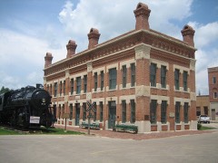 Amboy Illinois Central Depotlisted 1992
Population over time
2 figuresAmboy fell from 2,500 to 2,278 between 2010 and 2020. These are the recorded population figures Wikidata holds for this place, reached through the Geographic Names Information System number this page is keyed on rather than by name, so they belong to this place and not to another of the same name. Most are census counts, but not all are: an early figure may be a founding or settlement estimate, and an estimate published within five years of a census is left out. The change column is computed, and is left blank where more than 20 years separate a figure from the one before it, because a gap that long is not a change between two counts.
| Year | People | Change |
|---|---|---|
| 2010 | 2,500 | |
| 2020 | 2,278 | -222 (-9%) |
Topographic sheets covering this place
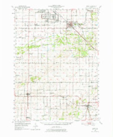
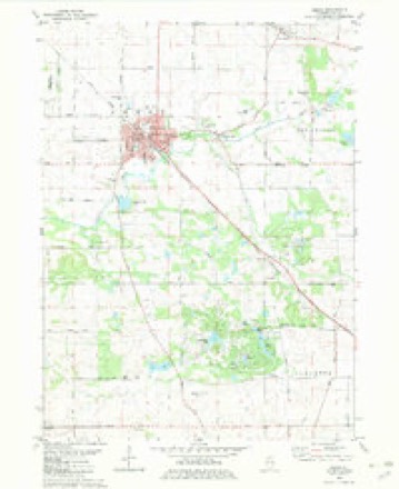
5 surveys from 10 printed sheetsMatched by testing this settlement's coordinate against the published boundary of every sheet in the United States Geological Survey's historical collection. Each opens the scanned sheet at the Survey.
- 1951 USGS Amboy quadrangle1:62500, 3 printings
- 1958 USGS Aurora quadrangle1:250000, 3 printings
- 1961 USGS Aurora quadrangle1:250000
- 1982 USGS Amboy quadrangle1:24000
- 1985 USGS Dixon quadrangle1:100000, 2 printings



In the county-history sources
51,232 words on this townshipHistory of Lee County, published 1881 names this settlement in its chapter on Amboy Township. These are the passages that mention it, exactly as the scans read.
This city is the oflspring of the Central railroad. In the early summer of 1851 the surveying parties under the chief engineer, Roswell B. Mason, took their several stations on the line and immediately began preliminary operations. T. B. Blackstone, whose name has been given to one of the streets in the original town, had charge of the squad emplo3'ed between Dixon and Bloomington. In December 1852 K. F. Booth, for several years afterward a resident of Amboy, came to this place at the head of a small party whose business was to direct the work on this part of the route. A company, distinct from the Illinois Central Railroad Company, but composed in part, if not wholly, of stockholders in the latter, purchased and owned the land for the village plats along the road. They bought the Lay farm for a depot and station two miles above here in the direction of Dixon, which was subsequently sold to a conductor named Cole. They gave out word that the company would erect machine shops at that point; a few loads of stone Were hauled there, and the place named Kepatau. If there was ever any real intention of making a station and building shops there it was of very brief duration. H. B. Judkins came down one day, and securing the company of a certain influential citizen, went to Farwell, and pretending to be a returned Californian, said he wanted to buy a stock-farm, and a bargain was forthwith made for the " Farwell slough farm," as old settlers had named it, for $13 per acre. John B. "Wyman, assistant superintendent of the road, hastened to buy out Cyrus Davis, and then Farwell was given to understand that if he had any wish to secure himself he should lose no time in doing it, and he accordingly purchased the farm from his son-in-law, Curtis Bridgman. The land company made a deed of trust to Messrs. Ketchum and Gray ; and Col. Mason, who was superintendent as well as chief engineer of road, acted as their attorney.
Passage source: History of Lee County, published 1881.
In June, 1853, Michael Egan was sent to this place to commence the mason work on the station buildings, and in the autumn of the same year D, S. Clark was put in charge of the carpenter work. Some time during the season Mr. Booth prepared the plans for the machine shops, and Mr. Egan laid the foundations and pushed the construction with his characteristic energy throughout the following winter. In the spring the walls of the passenger house were up and the building inclosed; in course of the summer both that and the freight house were completed, and before winter the machine shops were in a forward state of progress. Most of the other shops which the company now have were built in the following year, 1855.
Passage source: History of Lee County, published 1881.
The year 1854 was the natal year of Amboy. In January or February a Frenchman by tiie name of Meyer, under the directions of Col. Mason, came and laid out the town, completing his survey March 24. On July 26 the first bonds for deeds were executed, John L. Skinner was the first purchaser of lots. He paid $600 for the northeast corner lot on Main street and East avenue, now occupied by the Badger building. On this he began the erection of the Orient House in the fall of 1854; in September, 1855, it was completed, and opened to the public by the Lee brothers, who wei'e proprietors one year under lease. Charles W. Bell, who had been grading on the road nearly a year, in August, 1853, came here with his family and opened a boarding-house for railroad men in a mammoth, barn-like shanty belonging to the company, and which had been erected near the spot where tlie Baptist church stands. On January 21 this caught fire and burned down, but was immediately rebuilt by the company. When Mr. Bell settled in the place Cyrus Davis had moved away ; Appleton was on the homestead ; Farwell was about to move, or had just moved to his new purchase ; Alvan H. Thompson was living at his old home where Superintendent Jacobs resides; and a transient family occupied the Davis dwelling. These comprised the population of Amboy, which, by the way, was not yet surveyed and christened, except some railroad employes who could not at that time be regarded as settlers. Isaac Edwards, who graded seven miles of the railroad, settled temporarily south of the Inlet this year.
Passage source: History of Lee County, published 1881.
Machine-read from a century-old scan, so expect the errors a machine makes: misspelled names, dropped words, stray characters.
Read the whole chapter on Amboy Township - it names this place 133 more 133 times.
Fires near this place
21 since 2008Regional context, not property-specific evidence. The federal wildfire occurrence database lists 21 fires within 5 miles of Amboy between 2008 and 2018, burning about 187 acres in total. None started naturally. None was recorded as arson. Distance is straight-line from the map coordinates, so a fire counted here may appear on a neighbouring settlement's page as well.
| Reported cause | Fires |
|---|---|
| Missing data/not specified/undetermined | 14 |
| Debris and open burning | 5 |
| Power generation/transmission/distribution | 1 |
| Other causes | 1 |
The most recent of them, most recent first, with the day each was reported and the service that recorded it.
| Date | Cause | Size | Reported by | Name on the report |
|---|---|---|---|---|
| 25 September 2010 | Missing data/not specified/undetermined | 1.0 acres | Illinois Division of Forestry Resources | 10226 |
| 6 May 2008 | Missing data/not specified/undetermined | 1.0 acres | Illinois Division of Forestry Resources | HULL |
| 7 April 2013 | Debris and open burning | 1.0 acres | Illinois Division of Forestry Resources | 13-81 |
| 7 April 2008 | Missing data/not specified/undetermined | 2.0 acres | Illinois Division of Forestry Resources | AMBOY |
| 22 April 2014 | Missing data/not specified/undetermined | 52 acres | Illinois Division of Forestry Resources | 14-103 |
| 17 April 2016 | Debris and open burning | under an acre | Illinois Division of Forestry Resources | 2016-63561 |
| 16 April 2008 | Missing data/not specified/undetermined | 1.0 acres | Illinois Division of Forestry Resources | ROAD |
| 14 April 2016 | Debris and open burning | under an acre | Illinois Division of Forestry Resources | 2016-6349 |
Settlements close enough to share some of these fires:
Mines and quarries near this place
7 within 5 milesRegional context, not property-specific evidence. The federal mineral resources record lists 7 workings within 5 miles of Amboy: 4 past producers, 3 producers. 3 still produce. What was taken out: Stone, Crushed/Broken. Distance is straight-line from the map coordinates, so a quarry counted here may appear on a neighbouring settlement's page as well.
| Where | Site | Commodity | Status | Recorded |
|---|---|---|---|---|
| Delhotal Quarry & Portable Mill | Stone, Crushed/Broken | Producer | ||
| Robbin's Quarry | Stone, Crushed/Broken | Producer | ||
| Sheely's Quarry | Stone, Crushed/Broken | Producer | ||
| Unnamed Limestone Quarry | Stone, Crushed/Broken | Past Producer | ||
| Unnamed Limestone Quarry | Stone, Crushed/Broken | Past Producer | ||
| Unnamed Limestone Quarry | Stone, Crushed/Broken | Past Producer | ||
| Unnamed Limestone Quarry | Stone, Crushed/Broken | Past Producer |
Storms near this place
45 since 1996Regional context, not property-specific evidence. The National Weather Service names Amboy in 45 storm reports between 1996 and 2023: 28 thunderstorm wind, 12 hail, 4 flash flood, 1 flood. No death or injury is recorded in these reports. Each account below is quoted exactly as the forecast office filed it, from the NOAA Storm Events Database, and each date opens the federal record of that event.
| When | Event | Place named | Harm | What the report says |
|---|---|---|---|---|
| July 2004 | Thunderstorm Wind | Amboy | $20,000 | A roof was blown off the addition of a house and into a barn. Many rows of corn were knocked down. These events occurred at Bryer Knoll and Rocky Ford. |
| August 2006 | Thunderstorm Wind | Amboy | $5,000 | Wind gusts were estimated to 70 mph, which blew down trees, tree limbs and power lines. |
| June 2010 | Thunderstorm Wind | Amboy | $1,000 | Trees, tree limbs and power lines were blown down. |
| July 2023 | Thunderstorm Wind | Amboy | - | A large tree was down on the 700 block of Dry Gulch Road south of Amboy. The tree was blocking three quarters of the roadway. |
| March 2023 | Thunderstorm Wind | Amboy | - | A grain bin was damaged at Maplehurst Farms west of Amboy. Wind magnitude and time were estimated based on radar. |
| July 2023 | Thunderstorm Wind | Amboy | - | A picture shared via social media shows a tree down on a home in Amboy. Wind speed was estimated using radar. |
| May 2019 | Thunderstorm Wind | Amboy | - | Trees and tree limbs were blown down in Amboy. |
| February 2017 | Hail | Amboy | - | Nickel to quarter size hail completely covering the ground was reported. |
| May 2016 | Thunderstorm Wind | Amboy | - | Structural damage to a building in town. There are also a number of trees down. There are 2700 people without power in the county. Several trees and a powerpole down at the Lee County Fair Grounds. |
| June 2014 | Flash Flood | Amboy | - | A creek was out of its banks. A trained spotter measured 2.2 inches of rain between 16:30 CST and 20:15 CST. |
| June 2014 | Thunderstorm Wind | Amboy | - | Numerous large trees were blown down and uprooted across Amboy. Some of the trees were several feet in diameter. |
| May 2011 | Flash Flood | Amboy | - | The Green River was reported out of its banks in the Amboy area. Low areas including fields were flooded with 2 to 3 feet of standing water on the east and southeast side of Amboy. |
| June 2011 | Flood | Amboy | - | Multiple intersections were flooded in the town of Amboy. |
| July 2011 | Thunderstorm Wind | Amboy | - | Portions of a corn field were flattened near Amboy. |
| June 2010 | Thunderstorm Wind | Amboy | - | Wind gusts were estimated to 60 mph. |
| June 2010 | Thunderstorm Wind | Amboy | - | A tree was blown down. |
| May 2009 | Thunderstorm Wind | Amboy | - | Trees were blown down. |
| June 2009 | Thunderstorm Wind | Amboy | - | Trees were blown down. |
| July 2008 | Thunderstorm Wind | Amboy | - | Wind gusts were estimated to 60 mph, 7 miles west of Amboy. |
| May 2008 | Thunderstorm Wind | Amboy | - | Several trees were blown down including two Ash trees three feet in diameter. |
| July 2007 | Thunderstorm Wind | Amboy | - | A tree was blown down near Route 26 and Sterling Road. |
| July 2007 | Flash Flood | Amboy | - | Water coming up through storm drains in the roadways, 3.25 inches of rain was measured in Amboy. |
| August 2007 | Flash Flood | Amboy | - | Various roads closed across the county. |
| May 2006 | Thunderstorm Wind | Amboy | - | A large tree and numerous branches were blown down south of US 30, 2 miles east of the intersection of US 52 and US 30. |
| May 2006 | Thunderstorm Wind | Amboy | - | A one foot diameter tree was blown down on US 30, 2 to 3 miles west of US 52. |
| May 2006 | Thunderstorm Wind | Amboy | - | A tree was blown down on US 30. |
| September 2006 | Thunderstorm Wind | Amboy | - | A wind gust to 72 mph was measured. |
| May 2004 | Thunderstorm Wind | Amboy | - | Large tree limbs were blown down. |
| July 2004 | Thunderstorm Wind | Amboy | - | Wind gust was estimated by a trained spotter. |
| August 2000 | Thunderstorm Wind | Amboy | - | Downed transformers and tress reported. |
| May 1998 | Hail | Amboy | - | Some residents in the western part of the county sustained to their homes as winds and large hail brokewindows. A garage was blown off its foundation and shifted. The roof of another garage was blown off. |
| May 1997 | Hail | Amboy | - | Three quarter inch diameter hail fell at Amboy and golf ball size hail fell at Paw Paw. |
| April 2023 | Hail | Amboy | - | no account filed |
| March 2023 | Thunderstorm Wind | Amboy | - | no account filed |
| September 2021 | Hail | Amboy | - | no account filed |
| June 2014 | Hail | Amboy | - | no account filed |
| July 2008 | Hail | Amboy | - | no account filed |
| April 2006 | Hail | Amboy | - | no account filed |
| May 2006 | Hail | Amboy | - | no account filed |
| September 2006 | Hail | Amboy | - | no account filed |
| May 2004 | Thunderstorm Wind | Amboy | - | no account filed |
| July 2003 | Thunderstorm Wind | Amboy | - | no account filed |
| July 2003 | Hail | Amboy | - | no account filed |
| May 1999 | Thunderstorm Wind | Amboy | - | no account filed |
| April 1996 | Hail | Amboy | - | no account filed |
Nearest settlements
The eight closest, with where each one stands in the county. Distances are straight-line, computed from the Geographic Names Information System coordinates.
| Map | Place | Distance | Sheets |
|---|---|---|---|
| Binghampton | 1.3 miles | 10 | |
| Shelburn (historical) | 1.5 miles | 10 | |
| Lee Center | 3.5 miles | 10 | |
| Inlet | 4.9 miles | 10 | |
| Shaws | 5.0 miles | 10 | |
| Walton | 5.8 miles | 10 | |
| Eldena | 5.8 miles | 12 | |
| Maytown | 6.3 miles | 10 |
Elsewhere
Matched on this settlement's Geographic Names Information System number rather than its name, so it cannot be a different place of the same name in another state.
| Wikipedia article on Amboy | An encyclopaedic summary. Its text is share-alike, so it is linked here rather than copied. |
| Wikidata item Q458537 | The structured record the population and elevation above come from. Public domain (CC0). |
Provenance
This settlement is recorded in the Geographic Names Information System as feature 403478. The sheet list is computed by point-in-boundary test against the United States Geological Survey's historical topographic inventory. Both are works of the United States government and carry no copyright under 17 U.S.C. 105.
Wildfire. Short, Karen C. 2022. Spatial wildfire occurrence data for the United States, 1992-2020 [FPA_FOD_20221014]. 6th Edition. Fort Collins, CO: Forest Service Research Data Archive. https://doi.org/10.2737/RDS-2013-0009.6 Collected with United States Government funding and usable without additional permissions or fees.
Mines and quarries. USGS Mineral Resources Data System (MRDS) https://mrdata.usgs.gov/mrds/ A work of the United States government, no copyright under 17 U.S.C. 105.
Storms. NOAA National Centers for Environmental Information, Storm Events Database https://www.ncei.noaa.gov/stormevents/ A work of the United States government, no copyright under 17 U.S.C. 105. Narratives are quoted verbatim from the National Weather Service report and are not edited or summarised.