 Block
Eldena, Illinois
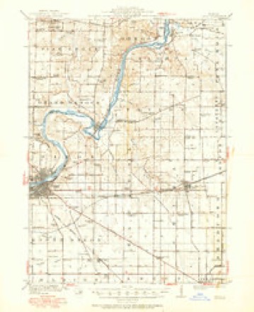
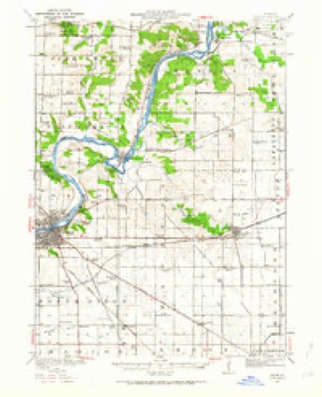
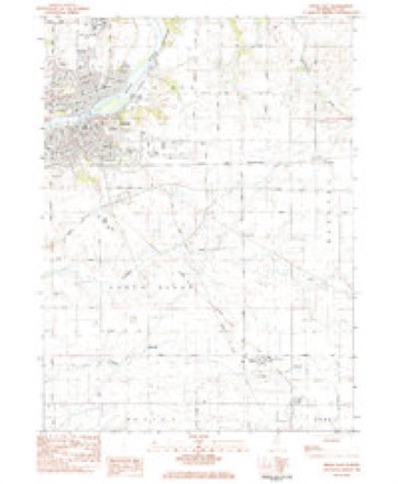
12 topographic sheets cover this place, the earliest surveyed in 1918 and the latest in 1985. It stands in South Dixon Township. It lies in ZIP code area 61021. The Survey maps it on the Dixon East quadrangle. It stands 801 feet above sea level.
Topographic sheets covering this place
6 surveys from 12 printed sheetsMatched by testing this settlement's coordinate against the published boundary of every sheet in the United States Geological Survey's historical collection. Each opens the scanned sheet at the Survey.
- 1918 USGS Dixon quadrangle1:62500, 3 printings
- 1950 USGS Dixon quadrangle1:62500, 2 printings
- 1958 USGS Aurora quadrangle1:250000, 3 printings
- 1961 USGS Aurora quadrangle1:250000
- 1983 USGS Dixon East quadrangle1:24000
- 1985 USGS Dixon quadrangle1:100000, 2 printings



In the county-history sources
12,108 words on this townshipHistory of Lee County, published 1881 names this settlement in its chapter on South Dixon Township. These are the passages that mention it, exactly as the scans read.
St. James' Evangelical Lutheran church is on the Chicago road and was erected in the year 1877, by the representatives of the various religious bodies in the vicinity, but is now exclusively used by members of the persuasion previously mentioned. It can accommodate about 280 members. It is a wooden structure, cost $3,200, and is now entirely out of debt. Wlien this church was built the Sabbath-school was removed thither from the old brick school-house ; it is well attended, has a staff of eight teachers, and for the past fifteen years Mr. Hiram Uhl has been superintendent. The first pastor was the Rev. J. P. Sanderson ; the present one is the Rev. A. J. B, Cast. The church belonging to the Methodist Episcopal body is situated in the village of Eldena. It was built in the year 1870. It is built of wood and can seat 150. It is also a union church, being used by the Evangelicals and United Brethren for church purposes. The first and present pastor is the Rev. M. A. Rice.
Passage source: History of Lee County, published 1881.
There are four schools in South Dixon. Particular allusion may be made to the old brick school-house in Dist. No. 3, T. 21, where the attendance at one time was one hundred and twenty ; the average attendance now is about twenty-seven. The present teacher is Lorenzo Wood ; the directors are Messrs. Abram Brown, HiramUhl and Isaac Seitz. Apropos of education here, the first school was held bj'Miss Edson, in a room in her brother's house. In the same room was organized the first union Sabbath-school in Lee county, outside of Dixon. Mr. E. B. Edson was appointed the first teacher of the new school. The gentlemen most active in its erection were Abram Brown, John and Charles Beal, Joseph Smith, Hiram Uhl, William J. and John Fritz. The Kellogg school is in Dist. No. 8, T. 21, R. 9. The present directors are A. E. Fellows, Frederick BoUman and William Missman. It can accommodate eighty children ; average attendance about twenty-five. It was erected in 1867. The first teacher was A. M. Jennes ; the present one Lydia Conderman. The Lievan school can accommodate seventy ; daily average about twenty-five. Eldena school, in the village of Eldena, can seat one hundred pupils : average attendance about fifty. The first teacher was A. F. Parker.
Passage source: History of Lee County, published 1881.
The Illinois Central railroad passes through the township from north to south. There is a passenger station at the village of Eldena. Mr. H. Hursey is the agent who fills the offices of the express agent and operator for the Western Union Telegraph Company. The
Passage source: History of Lee County, published 1881.
Machine-read from a century-old scan, so expect the errors a machine makes: misspelled names, dropped words, stray characters.
Read the whole chapter on South Dixon Township - it names this place 8 more 8 times.
Fires near this place
4 since 2008Regional context, not property-specific evidence. The federal wildfire occurrence database lists 4 fires within 5 miles of Eldena between 2008 and 2013, burning about 4 acres in total. None started naturally. None was recorded as arson. Distance is straight-line from the map coordinates, so a fire counted here may appear on a neighbouring settlement's page as well.
| Reported cause | Fires |
|---|---|
| Missing data/not specified/undetermined | 3 |
| Debris and open burning | 1 |
The most recent of them, most recent first, with the day each was reported and the service that recorded it.
| Date | Cause | Size | Reported by | Name on the report |
|---|---|---|---|---|
| 6 May 2008 | Missing data/not specified/undetermined | 1.0 acres | Illinois Division of Forestry Resources | HULL |
| 7 April 2013 | Debris and open burning | 1.0 acres | Illinois Division of Forestry Resources | 13-81 |
| 28 October 2008 | Missing data/not specified/undetermined | 1.0 acres | Illinois Division of Forestry Resources | SCAPES |
| 17 October 2010 | Missing data/not specified/undetermined | 1.0 acres | Illinois Division of Forestry Resources | 10242 |
Settlements close enough to share some of these fires:
Mines and quarries near this place
6 within 5 milesRegional context, not property-specific evidence. The federal mineral resources record lists 6 workings within 5 miles of Eldena: 4 past producers, 2 producers. 2 still produce. What was taken out: Stone, Crushed/Broken. Distance is straight-line from the map coordinates, so a quarry counted here may appear on a neighbouring settlement's page as well.
| Where | Site | Commodity | Status | Recorded |
|---|---|---|---|---|
| Hallquist Quarry | Stone, Crushed/Broken | Past Producer | ||
| Russell/Miller Portable #1 Quarry | Stone, Crushed/Broken | Producer | ||
| Sheely's Quarry | Stone, Crushed/Broken | Producer | ||
| Unnamed Limestone Quarry | Stone, Crushed/Broken | Past Producer | ||
| Unnamed Limestone Quarry | Stone, Crushed/Broken | Past Producer | ||
| Unnamed Limestone Quarry | Stone, Crushed/Broken | Past Producer |
Storms near this place
4 since 2008Regional context, not property-specific evidence. The National Weather Service names Eldena in 4 storm reports between 2008 and 2020: 2 flood, 2 thunderstorm wind. No death or injury is recorded in these reports. Each account below is quoted exactly as the forecast office filed it, from the NOAA Storm Events Database, and each date opens the federal record of that event.
| When | Event | Place named | Harm | What the report says |
|---|---|---|---|---|
| June 2010 | Thunderstorm Wind | Eldena | $20,000 | A roof was blown off a building near Route 52 and Robbins Road. Numerous trees were blown down along Route 30. |
| May 2020 | Flood | Eldena | - | Flooding was reported at Route 26 and Route 30 as well as on residential Streets in Amboy. |
| June 2010 | Thunderstorm Wind | Eldena | - | Tree damage was reported along Route 30 near Eldena. |
| July 2008 | Flood | Eldena | - | Minor street flooding was reported in Amboy and 5 to 6 inches of water was reported on Route 52, south of Amboy. Yards were flooded in Sublette. Water was reported in low lying areas along Route 30. Three miles west of Sublette, 4.75 inches of rainfall was measured. |
Nearest settlements
The eight closest, with where each one stands in the county. Distances are straight-line, computed from the Geographic Names Information System coordinates.
| Map | Place | Distance | Sheets |
|---|---|---|---|
| Walton | 4.2 miles | 10 | |
| Nachusa | 4.3 miles | 12 | |
| Amboy | 5.8 miles | 10 | |
| Dixon | 6.0 miles | 12 | |
| Shelburn (historical) | 6.1 miles | 10 | |
| Binghampton | 6.8 miles | 10 | |
| Lee Center | 7.2 miles | 10 | |
| Franklin Grove | 7.6 miles | 12 |
Elsewhere
Matched on this settlement's Geographic Names Information System number rather than its name, so it cannot be a different place of the same name in another state.
| Wikipedia article on Eldena | An encyclopaedic summary. Its text is share-alike, so it is linked here rather than copied. |
| Wikidata item Q161365 | The structured record the population and elevation above come from. Public domain (CC0). |
Provenance
This settlement is recorded in the Geographic Names Information System as feature 407840. The sheet list is computed by point-in-boundary test against the United States Geological Survey's historical topographic inventory. Both are works of the United States government and carry no copyright under 17 U.S.C. 105.
Wildfire. Short, Karen C. 2022. Spatial wildfire occurrence data for the United States, 1992-2020 [FPA_FOD_20221014]. 6th Edition. Fort Collins, CO: Forest Service Research Data Archive. https://doi.org/10.2737/RDS-2013-0009.6 Collected with United States Government funding and usable without additional permissions or fees.
Mines and quarries. USGS Mineral Resources Data System (MRDS) https://mrdata.usgs.gov/mrds/ A work of the United States government, no copyright under 17 U.S.C. 105.
Storms. NOAA National Centers for Environmental Information, Storm Events Database https://www.ncei.noaa.gov/stormevents/ A work of the United States government, no copyright under 17 U.S.C. 105. Narratives are quoted verbatim from the National Weather Service report and are not edited or summarised.