 Block
Ashmore, Illinois
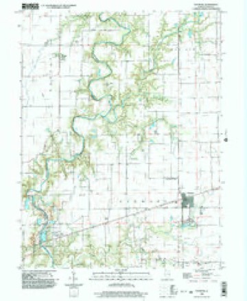
16 topographic sheets cover this place, the earliest surveyed in 1936 and the latest in 1998. It stands in Ashmore Township. It lies in ZIP code area 61912. The Survey maps it on the Ashmore quadrangle. 637 people lived here at the 2020 count. It stands 697 feet above sea level.
Population over time
2 figuresAshmore fell from 785 to 637 between 2010 and 2020. These are the recorded population figures Wikidata holds for this place, reached through the Geographic Names Information System number this page is keyed on rather than by name, so they belong to this place and not to another of the same name. Most are census counts, but not all are: an early figure may be a founding or settlement estimate, and an estimate published within five years of a census is left out. The change column is computed, and is left blank where more than 20 years separate a figure from the one before it, because a gap that long is not a change between two counts.
| Year | People | Change |
|---|---|---|
| 2010 | 785 | |
| 2020 | 637 | -148 (-19%) |
Topographic sheets covering this place
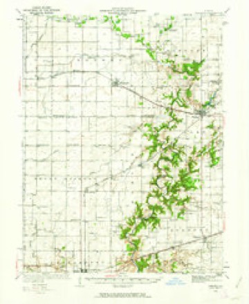
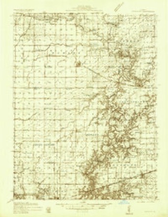
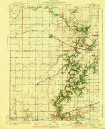
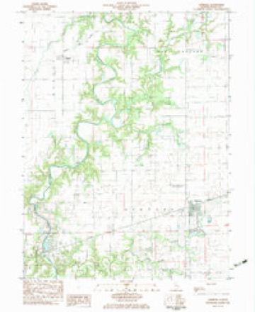
8 surveys from 16 printed sheetsMatched by testing this settlement's coordinate against the published boundary of every sheet in the United States Geological Survey's historical collection. Each opens the scanned sheet at the Survey.
- 1936 USGS Oakland quadrangle1:62500, 4 printings
- 1936 USGS Oakland quadrangle1:48000
- 1942 USGS Oakland quadrangle1:62500, 2 printings
- 1958 USGS Decatur quadrangle1:250000, 3 printings
- 1961 USGS Decatur quadrangle1:250000, 2 printings
- 1982 USGS Ashmore quadrangle1:24000
- 1985 USGS Decatur quadrangle1:100000, 2 printings
- 1998 USGS Ashmore quadrangle1:24000



In the county-history sources
2,495 words on this townshipThe History of Coles County, Illinois ... Map of Coles County; History of Illinois ... History of Northwest ... Constitution of the United States, Miscellaneous Matters, &c., &c, published 1879 names this settlement in its chapter on Ashmore Township. These are the passages that mention it, exactly as the scans read.
H. J. Ashmore and James D. Austin, and for the former of whom it was named. The entire villao;e stands on the oriorinal Austin farm ; Ashmore had bought out some of the Austin heirs, and hence owned a part of the land when the village was laid out. The first store was opened by John Hogue, on the laying out of the place. McAllister k Ashmore, who had a store on the road, half a mile southwest of the town " before it was," moved their store to the new village, and became the second house of the kind in Ashmore. Van Dyke & Hogue put up the first dwelling in the little village. The first blacksmith-shop was kept by William English. The Waters boys started a wagon-shop about the same time. The first mill in the village was built by J. A. Brown in 1856, and was burned some three or four years afterward. A brother of Brown's was the first railroad agent at Ashmore. The present mill was built by Clement k Fish, about 1866. It stands near the railroad track, just east of the station, is a frame building, with two runs of buhrs and does a good business. It is owned at present by Chris Miller, an efiicient man, who thoroughly understands the milling business. The first tavern was kept by H. J, Ashmore, is still standing and kept at present by A. B. McDavid. The village boasts of another hotel, the Franklin House, kept by John Franklin. The first post office was established on the laying out of the village, with Thomas O'Brien as Postmaster. Elias Monroe represents Uncle Sam in the post office department here at present. The first schoolhouse was built in 1857-58, and was a kind of partnership aiFair with the religious people. It was finally purchased for school purposes, and so used until the building of the present edifice. Washington Boyer and Charles P. Scott were the first teachers in the village, but which one has the honor of teaching the first school cannot be ascertained. Prof B. H. Chase is Principal of the school at present, and Miss Roma Carter, assistant teacher. The present fine brick schoolhouse was built in 1871, is two-stories high and cost about §3,000.
Passage source: The History of Coles County, Illinois ... Map of Coles County; History of Illinois ... History of Northwest ... Constitution of the United States, Miscellaneous Matters, &c., &c, published 1879.
The village of Ashmore boasts of three very stylish church edifices, viz., Methodist Episcopal, Cumberland Presbyterian and Old-School Presbyterian. The first religious society organized in the village, or now located in the village, was the Methodist. It was originally organized in the neighborhood in 1831, by Rev. Joseph Henry, a local preacher, with the following members : Dr. West and wife, C. Sousely and wife, Joseph Mclntire and wife, Robert Modrell and wife, J. H. Modrell and wife, Matthew McLain and wife, James Hubanks and wife, William Austin. Sr., and his daughters, Frances and Mahala, Samuel P. Burr, George Modrell, Margery Modrell, Sarah Hubanks, Ruth Clark, Jennie Clark and Elizabeth Clark, and perhaps some others. The name of the first preacher, or circuit-rider, was Rev. Mr. Rhimon. The first church was built in 1869, in the village, and cost about $2,500. About 1838, in conjunction with the Presbyterians, they built a log church some two miles west of the village, Avhich they used for a number of years. This log church, schoolhouses and settlers' cabins were their places of worship, until the building of their church in Ashmore, and the organization has been kept up ever since first established in 1831. The present membership is thirty-five, and J. A. Burke, Pastor. The first Sabbath school was organized in 1831, by Methodists and Presbyterians, William Austin and James Hite, Superintendents, and has been run as a union school ever since, until last summer, when the Methodists organized a separate school. It numbers about eighty or ninety scholars, with L. C. Fell, Superintendent.
Passage source: The History of Coles County, Illinois ... Map of Coles County; History of Illinois ... History of Northwest ... Constitution of the United States, Miscellaneous Matters, &c., &c, published 1879.
S. J. Bovell was called to the charge as stated supply, and has without any interruption continued to hold this relation up to the present time. Since its organization, 160 persons have been received into membership, about 60 now constituting the membership, the depletion being caused by death and removals. Only three of the original members are nojv living, viz., A. J. L. Brooks, James Moffett and Letitia Hogue. I. S. Wright, I. M. Moffett, T. J. Bull and A. J. L. Brooks are the Ruling Elders. The first church-building was located two miles west of the village of Ashmore, near the former residence of James Galbraith, and was a log structure, and built in connection with the Methodists. In 1867, a neat and commodious church-building was erected in the village, at a cost of $3,300, but the organization still retained the name of Hebron, and was known as Hebron Church, under the care of Mattoon Presbytery. The church was dedicated on the 20th of October, 1867. The history of the Sabbath school is similar to that of the Methodist Church above given, and was a union school with that church until the past summer, when the school was divided.
Passage source: The History of Coles County, Illinois ... Map of Coles County; History of Illinois ... History of Northwest ... Constitution of the United States, Miscellaneous Matters, &c., &c, published 1879.
Machine-read from a century-old scan, so expect the errors a machine makes: misspelled names, dropped words, stray characters.
Read the whole chapter on Ashmore Township - it names this place 7 more 7 times.
Mines and quarries near this place
4 within 5 milesRegional context, not property-specific evidence. The federal mineral resources record lists 4 workings within 5 miles of Ashmore: 3 producers, 1 past producer. 3 still produce. What was taken out: Stone, Crushed/Broken, Sand and Gravel, Construction, Stone. Distance is straight-line from the map coordinates, so a quarry counted here may appear on a neighbouring settlement's page as well.
| Where | Site | Commodity | Status | Recorded |
|---|---|---|---|---|
| Charleston Pit & Plant | Sand and Gravel, Construction | Producer | ||
| Hoskins Sand and Gravel | Stone | Producer | ||
| Charleston Quarry | Stone, Crushed/Broken | Producer | ||
| Lang Quarry | Stone, Crushed/Broken | Past Producer |
Storms near this place
20 since 1997Regional context, not property-specific evidence. The National Weather Service names Ashmore in 20 storm reports between 1997 and 2025: 12 hail, 7 thunderstorm wind, 1 tornado. No death or injury is recorded in these reports. Each account below is quoted exactly as the forecast office filed it, from the NOAA Storm Events Database, and each date opens the federal record of that event.
| When | Event | Place named | Harm | What the report says |
|---|---|---|---|---|
| January 2013 | Thunderstorm Wind | Ashmore | $250,000 | Strong thunderstorm winds snapped 64 power poles along Illinois Route 16 near Ashmore. 30 poles were snapped west of Ashmore and 34 east of town. The John Deere Implement Company suffered roof damage to three of its buildings on the southwest side of Ashmore. In addition, three empty grain bins and several outbuildings were damaged north of town. |
| May 2008 | Thunderstorm Wind | Ashmore | $70,000 | Seventeen power poles were blown down near the intersection of state highway 16 and 49. |
| August 2015 | Thunderstorm Wind | Ashmore | $10,000 | Several 5-inch diameter tree branches were blown down west of Ashmore. |
| May 2009 | Thunderstorm Wind | Ashmore | $10,000 | Three trees were blown down in Ashmore. One of the falling trees brought down a powerline. |
| May 2009 | Thunderstorm Wind | Ashmore | $8,000 | A large blue spruce tree was snapped off just above the ground. Numerous other tree branches were blown down around the area as well. |
| March 2025 | Thunderstorm Wind | Ashmore | - | Six power poles were blown down and trees were damaged. |
| July 2005 | Thunderstorm Wind | Ashmore | - | A few 8 inch diameter trees blown down. |
| May 1997 | Tornado (F0) | Ashmore | - | An Illinois Department of Conservation officer reported a brief touchdown of a tornado in a field 1 mile north of Ashmore. No injuries or damage were reported. |
| June 2023 | Hail | Ashmore | - | no account filed |
| May 2018 | Hail | Ashmore | - | no account filed |
| April 2015 | Hail | Ashmore | - | no account filed |
| September 2012 | Hail | Ashmore | - | no account filed |
| May 2009 | Hail | Ashmore | - | no account filed |
| May 2009 | Hail | Ashmore | - | no account filed |
| June 2008 | Hail | Ashmore | - | no account filed |
| June 2008 | Hail | Ashmore | - | no account filed |
| June 2008 | Hail | Ashmore | - | no account filed |
| May 2003 | Hail | Ashmore | - | no account filed |
| April 2002 | Hail | Ashmore | - | no account filed |
| April 2002 | Hail | Ashmore | - | no account filed |
Nearest settlements
The eight closest, with where each one stands in the county. Distances are straight-line, computed from the Geographic Names Information System coordinates.
| Map | Place | Distance | Sheets |
|---|---|---|---|
| Embarrass | 3.8 miles | 16 | |
| Rardin | 6.5 miles | 16 | |
| Bushton | 7.4 miles | 16 | |
| Oakland | 8.3 miles | 16 | |
| Fairgrange | 8.5 miles | 16 | |
| Charleston | 8.5 miles | 12 | |
| Hutton | 8.9 miles | 12 | |
| Kings | 10.3 miles | 15 |
Elsewhere
Matched on this settlement's Geographic Names Information System number rather than its name, so it cannot be a different place of the same name in another state.
| Wikipedia article on Ashmore | An encyclopaedic summary. Its text is share-alike, so it is linked here rather than copied. |
| Wikidata item Q2671582 | The structured record the population and elevation above come from. Public domain (CC0). |
Provenance
This settlement is recorded in the Geographic Names Information System as feature 403679. The sheet list is computed by point-in-boundary test against the United States Geological Survey's historical topographic inventory. Both are works of the United States government and carry no copyright under 17 U.S.C. 105.
Mines and quarries. USGS Mineral Resources Data System (MRDS) https://mrdata.usgs.gov/mrds/ A work of the United States government, no copyright under 17 U.S.C. 105.
Storms. NOAA National Centers for Environmental Information, Storm Events Database https://www.ncei.noaa.gov/stormevents/ A work of the United States government, no copyright under 17 U.S.C. 105. Narratives are quoted verbatim from the National Weather Service report and are not edited or summarised.