 Block
Charleston, Illinois
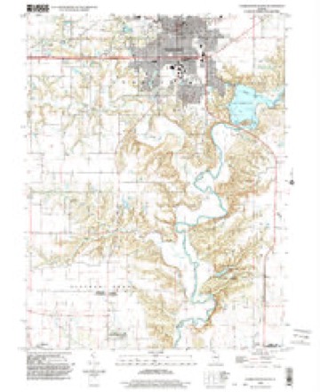
12 topographic sheets cover this place, the earliest surveyed in 1933 and the latest in 1998. It stands in Charleston Township. It lies in ZIP code area 61920. The Survey maps it on the Charleston South quadrangle. 17,286 people lived here at the 2020 count. It stands 696 feet above sea level.
Research this city
On record in Charleston
Buildings and businesses the archive holds for this place. Each opens its own page, with the source record it came from.
On the National Register 12 records
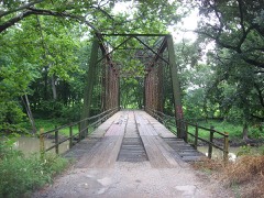 Airtight Bridgelisted 1981
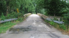 Blakeman Bridgelisted 1981
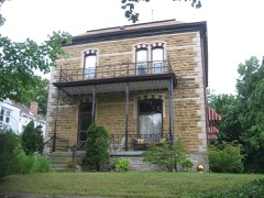 Alexander Briggs Houselisted 1980
 Coles County Courthouselisted 1978
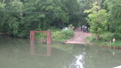 Harrison St. Bridgelisted 1981
 Health Education Buildinglisted 1995
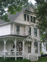 McFarland Houselisted 1991
 Old Mainlisted 1981
 Pemberton Hall and Gymnasiumlisted 1982
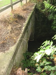 Sixth, Seventh, and Tenth Street Stone Arch Bridgeslisted 2001
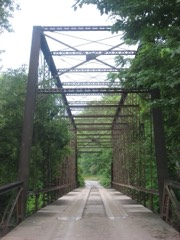 Stone Quarry Bridgelisted 1981
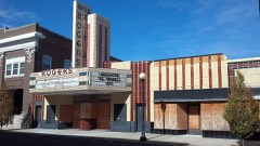 Will Rogers Theatre and Commercial Blocklisted 1984
Population over time
2 figuresCharleston fell from 21,838 to 17,286 between 2010 and 2020. These are the recorded population figures Wikidata holds for this place, reached through the Geographic Names Information System number this page is keyed on rather than by name, so they belong to this place and not to another of the same name. Most are census counts, but not all are: an early figure may be a founding or settlement estimate, and an estimate published within five years of a census is left out. The change column is computed, and is left blank where more than 20 years separate a figure from the one before it, because a gap that long is not a change between two counts.
| Year | People | Change |
|---|---|---|
| 2010 | 21,838 | |
| 2020 | 17,286 | -4,552 (-21%) |
Topographic sheets covering this place
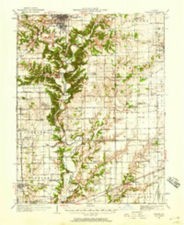
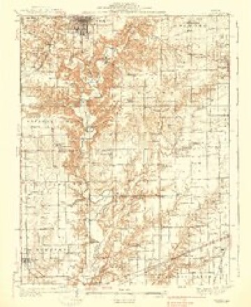
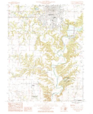
7 surveys from 12 printed sheetsMatched by testing this settlement's coordinate against the published boundary of every sheet in the United States Geological Survey's historical collection. Each opens the scanned sheet at the Survey.
- 1933 USGS Toledo quadrangle1:62500, 2 printings
- 1938 USGS Toledo quadrangle1:62500
- 1958 USGS Decatur quadrangle1:250000, 3 printings
- 1961 USGS Decatur quadrangle1:250000, 2 printings
- 1984 USGS Charleston South quadrangle1:24000
- 1986 USGS Effingham quadrangle1:100000, 2 printings
- 1998 USGS Charleston South quadrangle1:24000


In the county-history sources
6,035 words on this townshipThe History of Coles County, Illinois ... Map of Coles County; History of Illinois ... History of Northwest ... Constitution of the United States, Miscellaneous Matters, &c., &c, published 1879 names this settlement in its chapter on Charleston Township. These are the passages that mention it, exactly as the scans read.
Charleston is pleasantly situated on the Indianapolis & St. Louis Railroad, very nearly the center of the county, and 117 miles from Indianapolis, 14-) miles from St. Louis and about the same distance south of Chicago. It is a handsome little city of some four thousand inhabitants, and noted for its energetic business men, its mills and manufactories, and its excellent schooh, churches, and the genei'al intelligence of its inhabitants. While it claims i:o very extensive manufacturing establishments, yet there are several located within its limits, which will receive appropriate mention in the proper place. It is well supplied with water works, and the pure, clear water of the Embarrass River is thus utilized in providing its people with a bountiful supply of the health-giving element.
Passage source: The History of Coles County, Illinois ... Map of Coles County; History of Illinois ... History of Northwest ... Constitution of the United States, Miscellaneous Matters, &c., &c, published 1879.
Charleston was originally surveyed by Thomas Sconce, the first Surveyor of Coles County, and laid out by Commissioners (William Bowen, of Vermilioii County ; Jesse Essarey, of Clark, and Joshua Barber, of Crawford) appointed by the Legislature for the purpose of establishing the seat of justice of the county. The original town embraced, as shown by the plat on file in the Recorder's office, the west half of the southwest quarter of Section No. 11, in Township No. 12 north, of Range 9 east. It was resurveyed in June, 1839, bj Joseph Fowler, County Surveyor, and in this resurvey is noted the addition of Nathaniel Parker, of the east half of the southwest quarter of Section 10, etc. Since the first laying-out of Charleston, the records show some fifty additions and subdivisions to the original town by different individuals, giving it sufficient area, one would suppose, for a much larger city. It was named by the Commissioners who located the county seat, in honor of Charles Morton, one of the proprietors of the land on which it is situated, and who donated twenty acres of land for county purposes. In naming the place, they added the last syllable of Morton's last name to his first name, thus forming the word Charleston.
Passage source: The History of Coles County, Illinois ... Map of Coles County; History of Illinois ... History of Northwest ... Constitution of the United States, Miscellaneous Matters, &c., &c, published 1879.
The first house was built in Charleston by William Collom, who i's termed the first actual settler in its corporate limits. It was a small log house of one room, and in this spacious building he kept the first tavern in the future city of Charleston, then an incipient village. Such a diminutive hotel would scarcely supply the demand of the wayfaring men of Charleston now. The city is well furnished with excellent hotels. The Charleston House, with its genial landlord, Dan Van Sickle, is a model in its way, and is a cheerful home to the weary, wayworn traveler. Dan is an old commercial traveler, and, as such, has been the guest of half the hotels in Illinois and Indiana, and the experience thus obtained is used in the Charleston House to the advantage of his guests. The Maples Hotel, situated near the railroad, is less pretentious, but, withal, an excellent house. The first brick residence was built by Col. Norfolk, about 1835-36. James Wiley was the contractor, and superintended its erection. It is still standing, and being used as a residence by the widow of Col. Norfolk. Charles Morton was the first merchant in the village. As mentioned in the history of the township, he brought a stock of goods with him when he moved to the country, and opened them out in a cabin where he first settled. After the laying out of Charleston, he had reserved a choice "corner lot," in his donation to the county, and upon this he erected a storehouse. It was near the present post office. He also erected a number of " pole cabins " near his storehouse, in the rude style of architecture of that day. They stood all in a line, like the "nine little Injuns," and these he was in the habit of " letting "" to new-comers, three months free of rent, which time was sufficient to build a cabin of their own, if they were at all energetic. The second store in Charleston was kept by Baker & Norfolk, and was opened as soon after the town was laid out as the population of the place would justify.
Passage source: The History of Coles County, Illinois ... Map of Coles County; History of Illinois ... History of Northwest ... Constitution of the United States, Miscellaneous Matters, &c., &c, published 1879.
Machine-read from a century-old scan, so expect the errors a machine makes: misspelled names, dropped words, stray characters.
Read the whole chapter on Charleston Township - it names this place 38 more 38 times.
Mines and quarries near this place
8 within 5 milesRegional context, not property-specific evidence. The federal mineral resources record lists 8 workings within 5 miles of Charleston: 5 past producers, 3 producers. 3 still produce. What was taken out: Stone, Crushed/Broken, Sand and Gravel, Construction. Distance is straight-line from the map coordinates, so a quarry counted here may appear on a neighbouring settlement's page as well.
| Where | Site | Commodity | Status | Recorded |
|---|---|---|---|---|
| Charleston Pit & Plant | Sand and Gravel, Construction | Producer | ||
| Martinis Sand and Gravel Pit | Sand and Gravel, Construction | Past Producer | ||
| Pinnell Gravel Pit | Sand and Gravel, Construction | Producer | ||
| Charleston City Eng | Stone, Crushed/Broken | Past Producer | ||
| Charleston Quarry | Stone, Crushed/Broken | Producer | ||
| Coles Cty Hwy Dept | Stone, Crushed/Broken | Past Producer | ||
| Lang Quarry | Stone, Crushed/Broken | Past Producer | ||
| Unnamed Limestone Quarry | Stone, Crushed/Broken | Past Producer |
Storms near this place
60 of 61 shownRegional context, not property-specific evidence. The National Weather Service names Charleston in 61 storm reports between 1995 and 2025: 36 thunderstorm wind, 22 hail, 2 lightning, 1 flash flood. No death or injury is recorded in these reports. Each account below is quoted exactly as the forecast office filed it, from the NOAA Storm Events Database, and each date opens the federal record of that event.
| When | Event | Place named | Harm | What the report says |
|---|---|---|---|---|
| June 1995 | Thunderstorm Wind | Charleston | $200,000 | Thunderstorm winds damaged two barns and blew part of the roof off of a mall, causing damage to five buisnesses. Also, several downed trees damaged two homes and numerous power lines were blown down. Numerous trees were blown down and several windows were broken by flying debris at Eastern Illinois University. Damage was estimated around $200 thousand. |
| June 2018 | Lightning | Charleston | $100,000 | Lightning struck a business on the north side of Charleston, causing extensive fire and smoke damage. |
| July 2010 | Thunderstorm Wind | Charleston | $75,000 | Two homes on North 6th Street sustained significant structural damage due to a large 4-foot diameter tree falling on them. |
| June 2019 | Thunderstorm Wind | Charleston | $40,000 | Numerous trees and power lines were blown down. |
| June 2015 | Thunderstorm Wind | Charleston | $40,000 | Numerous power lines were blown down and a few trees were snapped in half. |
| August 2012 | Thunderstorm Wind | Charleston | $30,000 | Several tree limbs were blown down across Charleston. A power pole was knocked down as well. |
| June 2008 | Thunderstorm Wind | Charleston | $30,000 | Numerous trees and power lines were blown down. |
| July 2016 | Thunderstorm Wind | Charleston | $25,000 | Several trees were blown down. |
| October 2010 | Thunderstorm Wind | Charleston | $18,000 | Three untility poles were knocked down and numerous tree branches were blown into electrical lines near Charleston. |
| July 2011 | Thunderstorm Wind | Charleston | $15,000 | Several tree branches were blown down in Charleston. |
| October 2014 | Thunderstorm Wind | Charleston | $8,000 | A large tree branch was blown onto a car on the Eastern Illinois University campus. |
| June 2019 | Lightning | Charleston | $5,000 | Lightning struck a tree, causing it to fall onto a house in Charleston. |
| April 2011 | Thunderstorm Wind | Charleston | $5,000 | Shingles were blown off a roof and an 8-inch diameter tree was knocked down. |
| September 2012 | Thunderstorm Wind | Charleston | $4,000 | A tree was blown down across 14th Street in Charleston. Another tree fell onto Harrison Street. |
| August 2016 | Thunderstorm Wind | Charleston | $3,000 | A tree was blown onto power lines on Harrison Street in Charleston. |
| May 2015 | Thunderstorm Wind | Charleston | $2,000 | A tree was blown down. |
| July 2010 | Thunderstorm Wind | Charleston | $2,000 | A large TV/Radio antenna tower was torn from a house and blown over. |
| March 2025 | Thunderstorm Wind | Charleston | - | Several power poles were blown down. |
| July 2025 | Thunderstorm Wind | Charleston | - | A large tree was blown onto a home. |
| August 2023 | Thunderstorm Wind | Charleston | - | Several large tree branches were blown down. |
| June 2023 | Thunderstorm Wind | Charleston | - | A small tree was snapped on the Eastern Illinois University campus. |
| June 2023 | Thunderstorm Wind | Charleston | - | A few trees and numerous tree branches were blown down. Several streets were closed due to debris. |
| June 2023 | Thunderstorm Wind | Charleston | - | Numerous tree branches were blown down. |
| May 2021 | Thunderstorm Wind | Charleston | - | A tree was blown down. |
| June 2021 | Thunderstorm Wind | Charleston | - | A few tree branches and a power line were blown down. |
| June 2019 | Thunderstorm Wind | Charleston | - | A large tree was blown over along County Road 1800E. |
| August 2019 | Thunderstorm Wind | Charleston | - | Broken tree branches took down power lines in numerous locations across Charleston. |
| August 2019 | Thunderstorm Wind | Charleston | - | Power lines were blown down near 13th and Jefferson. |
| August 2017 | Thunderstorm Wind | Charleston | - | A flag pole was blown down on Lincoln Highway Road about 3 miles southwest of Charleston. |
| June 2007 | Flash Flood | Charleston | - | Several roads were closed for a few hours in Charleston due to flooding. |
| June 2005 | Thunderstorm Wind | Charleston | - | Tree blown down. |
| November 2005 | Thunderstorm Wind | Charleston | - | Large tree blown down. |
| May 2004 | Thunderstorm Wind | Charleston | - | A large tree was blown down. |
| May 2004 | Thunderstorm Wind | Charleston | - | Several large trees were uprooted in Charleston. |
| May 2003 | Hail | Charleston | - | Several rounds of hail fell between Charleston and Ashmore. The stones ranged in size from three quarters of an inch to 2 inches in diameter. |
| May 2003 | Thunderstorm Wind | Charleston | - | Numerous trees and power lines were blown down in the Charleston area. |
| April 2002 | Thunderstorm Wind | Charleston | - | The roof of a shed was blown off. |
| March 2024 | Hail | Charleston | - | no account filed |
| May 2020 | Hail | Charleston | - | no account filed |
| May 2020 | Hail | Charleston | - | no account filed |
| May 2020 | Hail | Charleston | - | no account filed |
| May 2018 | Hail | Charleston | - | no account filed |
| May 2018 | Hail | Charleston | - | no account filed |
| April 2015 | Hail | Charleston | - | no account filed |
| April 2015 | Hail | Charleston | - | no account filed |
| April 2015 | Hail | Charleston | - | no account filed |
| April 2015 | Hail | Charleston | - | no account filed |
| February 2011 | Hail | Charleston | - | no account filed |
| May 2011 | Hail | Charleston | - | no account filed |
| May 2011 | Hail | Charleston | - | no account filed |
| July 2010 | Hail | Charleston | - | no account filed |
| June 2006 | Hail | Charleston | - | no account filed |
| June 2006 | Hail | Charleston | - | no account filed |
| August 2005 | Thunderstorm Wind | Charleston | - | no account filed |
| September 2003 | Hail | Charleston | - | no account filed |
| April 2001 | Hail | Charleston | - | no account filed |
| May 2000 | Thunderstorm Wind | Charleston | - | no account filed |
| July 1997 | Hail | Charleston | - | no account filed |
| August 1997 | Hail | Charleston | - | no account filed |
| June 1997 | Hail | Charleston | - | no account filed |
Nearest settlements
The eight closest, with where each one stands in the county. Distances are straight-line, computed from the Geographic Names Information System coordinates.
| Map | Place | Distance | Sheets |
|---|---|---|---|
| Embarrass | 4.7 miles | 16 | |
| Loxa | 4.8 miles | 14 | |
| Fairgrange | 5.7 miles | 16 | |
| Bushton | 6.9 miles | 16 | |
| Campbell | 7.2 miles | 12 | |
| Hutton | 7.5 miles | 12 | |
| Lerna | 8.0 miles | 14 | |
| Country Club Estates | 8.3 miles | 14 |
Elsewhere
Matched on this settlement's Geographic Names Information System number rather than its name, so it cannot be a different place of the same name in another state.
| Wikipedia article on Charleston | An encyclopaedic summary. Its text is share-alike, so it is linked here rather than copied. |
| Wikidata item Q577909 | The structured record the population and elevation above come from. Public domain (CC0). |
Provenance
This settlement is recorded in the Geographic Names Information System as feature 405982. The sheet list is computed by point-in-boundary test against the United States Geological Survey's historical topographic inventory. Both are works of the United States government and carry no copyright under 17 U.S.C. 105.
Mines and quarries. USGS Mineral Resources Data System (MRDS) https://mrdata.usgs.gov/mrds/ A work of the United States government, no copyright under 17 U.S.C. 105.
Storms. NOAA National Centers for Environmental Information, Storm Events Database https://www.ncei.noaa.gov/stormevents/ A work of the United States government, no copyright under 17 U.S.C. 105. Narratives are quoted verbatim from the National Weather Service report and are not edited or summarised.