 Block
Coral, Illinois
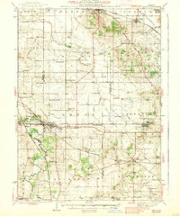
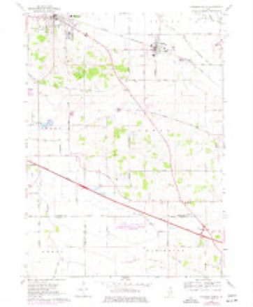
13 topographic sheets cover this place, the earliest surveyed in 1938 and the latest in 1981. It stands in Coral Township. It lies in ZIP code area 60152. The Survey maps it on the Marengo South quadrangle.
Topographic sheets covering this place
7 surveys from 13 printed sheetsMatched by testing this settlement's coordinate against the published boundary of every sheet in the United States Geological Survey's historical collection. Each opens the scanned sheet at the Survey.
- 1938 USGS Genoa quadrangle1:62500, 3 printings
- 1954 USGS Rockford quadrangle1:250000
- 1955 USGS Rockford quadrangle1:250000
- 1958 USGS Rockford quadrangle1:250000, 4 printings
- 1963 USGS Rockford quadrangle1:250000
- 1968 USGS Marengo South quadrangle1:24000, 2 printings
- 1981 USGS Elgin quadrangle1:100000





What happened here
An account from the chapter on Coral township. The inset identifies its exact source book and publication year.
History Of Mo Hknbt Oountv
Illinois (Second Board of Trade Regiment) Infantry, and was commissioned Lieutenant of Company I. At the battle of Kenesaw Mountain he was shot through the body, and left by the Surgeons on the field for dead, but through the care of his comrade, William Johnson, recovered. He was married Jan. 1, 1866, to Mary A.
In the county-history sources
42,214 words on this townshipHistory of McHenry County, Illinois : Together with Sketches of Its Cities, Villages and Towns : Educational, Religious, Civil, Military, and Political History : Portraits of Prominent Persons, and Biographies of Representative Citizens, Also a Condensed History of Illinois .., published 1885 names this settlement in its chapter on Coral Township. These are the passages that mention it, exactly as the scans read.
This township lies in the southern tier of townships in the county, joined on the south by Kane County,on the west by Riley Township, on the north by Seneca, and on the east by Grafton. It is township 43, range 6. It ranks well in quality of soil with other townships in the county. None, perhaps, are better adapted to the dairy business than this. The township is composed of fine farms, and dotted over with good substantial buildings. The township is traversed by the railroad, from one side to the other, entering on section 13, near the southeast corner, and passes through the northwest portion of section 5. Coral is watered by the Kishwaukee Creek principally.
Passage source: History of McHenry County, Illinois : Together with Sketches of Its Cities, Villages and Towns : Educational, Religious, Civil, Military, and Political History : Portraits of Prominent Persons, and Biographies of Representative Citizens, Also a Condensed History of Illinois .., published 1885.
This is one of the first settled towns in the county. The first settler was William ^Hamilton, who came from Ohio in November, 1835, and located near where the village of Coral now stands. "While assisting Calvin Spencer, of Marengo, to raise a log building, Mr. Hamilton received an injury from a falling timber, which caused his death the following spring. Benjamin Van Vleet and his father were the next to come into this township. They built their house near the old Indian camp-ground. Here they remained till the fall of 1836, when they sold to Wm. Jackson and moved to Pecatonica where they both died many years ago. O. P. Rogers came in 1836, arriving here on the 16th day of March. His was the first that was honored with the presence of a white woman. Mr. Kogers came from Middletown, Vt. At the time of his settlement there was not a single house between his residence and Dundee, and a house three miles west of Elgin marked the only spot of habitation between him and that city. Mr. Rogers resided in the township many years, when he moved to Marengo, where he still resides. Claims were made in 1835 for Frank Diggins and Enos A. Pease, who came in the spring of 1836. Mr. Diggins soon afterward moved to the township of Dunham, where he still resides. Mr. Pease remained in the township, and raised a large family. His son Marion was killed at the battle of Vicksburg. Some of the family are still residents of the county. L. Thompson came from Ohio in 1836 and resided in the township only a few years, when he moved to Abingdon, 111.
Passage source: History of McHenry County, Illinois : Together with Sketches of Its Cities, Villages and Towns : Educational, Religious, Civil, Military, and Political History : Portraits of Prominent Persons, and Biographies of Representative Citizens, Also a Condensed History of Illinois .., published 1885.
A. Thompson settled in Coral in 1837; he was the first that year. Same year came John Jab from England ; Robert Eddy, who died in 1844; A. F. Randall; Darius Carr, now a resident of Iowa Miss Mary Lackey, who afterward moved to Belvidere, where she died in 1870; Sebas Frisbie, John Denison, and Ira Nicholas, who afterward moved to Iowa, where he died some years afterward.
Passage source: History of McHenry County, Illinois : Together with Sketches of Its Cities, Villages and Towns : Educational, Religious, Civil, Military, and Political History : Portraits of Prominent Persons, and Biographies of Representative Citizens, Also a Condensed History of Illinois .., published 1885.
Machine-read from a century-old scan, so expect the errors a machine makes: misspelled names, dropped words, stray characters.
Read the whole chapter on Coral Township - it names this place 39 more 39 times.
Fires near this place
2 since 2003Regional context, not property-specific evidence. The federal wildfire occurrence database lists 2 fires within 5 miles of Coral between 2003 and 2010, burning under an acre in total. None started naturally. None was recorded as arson. Distance is straight-line from the map coordinates, so a fire counted here may appear on a neighbouring settlement's page as well.
| Reported cause | Fires |
|---|---|
| Smoking | 1 |
| Debris and open burning | 1 |
The most recent of them, most recent first, with the day each was reported and the service that recorded it.
| Date | Cause | Size | Reported by | Name on the report |
|---|---|---|---|---|
| 28 September 2010 | Debris and open burning | under an acre | Illinois Division of Forestry Resources | GOODMARK |
| 17 June 2003 | Smoking | under an acre | Illinois State Fire Marshal's Office | not named |
Settlements close enough to share some of these fires:
Mines and quarries near this place
4 within 5 milesRegional context, not property-specific evidence. The federal mineral resources record lists 4 workings within 5 miles of Coral: 2 producers, 2 past producers. 2 still produce. What was taken out: Sand and Gravel, Construction. Distance is straight-line from the map coordinates, so a quarry counted here may appear on a neighbouring settlement's page as well.
| Where | Site | Commodity | Status | Recorded |
|---|---|---|---|---|
| Griebel Trucking Co. Pit | Sand and Gravel, Construction | Producer | ||
| Metcalf Sand & Gravel Pit | Sand and Gravel, Construction | Past Producer | ||
| North Pit | Sand and Gravel, Construction | Producer | ||
| Union Pit | Sand and Gravel, Construction | Past Producer |
Storms near this place
5 since 2013Regional context, not property-specific evidence. The National Weather Service names Coral in 5 storm reports between 2013 and 2025: 3 thunderstorm wind, 1 lightning, 1 tornado. No death or injury is recorded in these reports. Each account below is quoted exactly as the forecast office filed it, from the NOAA Storm Events Database, and each date opens the federal record of that event.
| When | Event | Place named | Harm | What the report says |
|---|---|---|---|---|
| September 2018 | Lightning | Coral | $50,000 | A large barn in the 20000 block of Beck Road was burned to the ground after being struck by lightning. |
| March 2025 | Thunderstorm Wind | Coral | - | Large sections of siding were peeled off of an outbuilding near Union. |
| August 2020 | Tornado (EF1) | Coral | - | A tornado with peak winds of 95 mph touched down just south of Harmony Road, west of Payne Road where several large tree limbs were blown down. Tree damage occurred immediately northeast of Interstate 90. Farm sheds were heavily damaged near Anthony and Riley Roads. Tree limbs were blown down and corn was blown down in a convergent pattern in this area. Two utility poles were slightly leaning along Route 23, south of Grange Road. A single family home was heavily damaged near Maple Street. Mainly tree limbs were blown down along the remaining path. The tornado lifted near Coral and Dunham Roads. |
| July 2017 | Thunderstorm Wind | Coral | - | A large tree was blown down on Route 23 south of Marengo. |
| July 2013 | Thunderstorm Wind | Coral | - | Severe winds uprooted 42 trees at Marengo Ridge Golf Course, some of which were from 1963 when the golf course opened. |
Nearest settlements
The eight closest, with where each one stands in the county. Distances are straight-line, computed from the Geographic Names Information System coordinates.
| Map | Place | Distance | Sheets |
|---|---|---|---|
| Union | 1.6 miles | 13 | |
| Marengo | 3.2 miles | 13 | |
| Indian Trails | 3.8 miles | 13 | |
| Riley | 4.0 miles | 13 | |
| Harmony | 4.4 miles | 13 | |
| Franklinville | 5.0 miles | 15 | |
| Coyne | 6.4 miles | 18 | |
| Huntley | 8.0 miles | 18 |
Provenance
This settlement is recorded in the Geographic Names Information System as feature 406579. The sheet list is computed by point-in-boundary test against the United States Geological Survey's historical topographic inventory. Both are works of the United States government and carry no copyright under 17 U.S.C. 105.
Wildfire. Short, Karen C. 2022. Spatial wildfire occurrence data for the United States, 1992-2020 [FPA_FOD_20221014]. 6th Edition. Fort Collins, CO: Forest Service Research Data Archive. https://doi.org/10.2737/RDS-2013-0009.6 Collected with United States Government funding and usable without additional permissions or fees.
Mines and quarries. USGS Mineral Resources Data System (MRDS) https://mrdata.usgs.gov/mrds/ A work of the United States government, no copyright under 17 U.S.C. 105.
Storms. NOAA National Centers for Environmental Information, Storm Events Database https://www.ncei.noaa.gov/stormevents/ A work of the United States government, no copyright under 17 U.S.C. 105. Narratives are quoted verbatim from the National Weather Service report and are not edited or summarised.