 Block
Harmony, Illinois
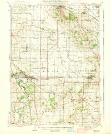
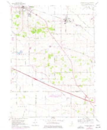
13 topographic sheets cover this place, the earliest surveyed in 1938 and the latest in 1981. It stands in Coral Township. It lies in ZIP code area 60142. The Survey maps it on the Marengo South quadrangle. 20 people lived here at the 2020 count. It stands 932 feet above sea level.
Topographic sheets covering this place
7 surveys from 13 printed sheetsMatched by testing this settlement's coordinate against the published boundary of every sheet in the United States Geological Survey's historical collection. Each opens the scanned sheet at the Survey.
- 1938 USGS Genoa quadrangle1:62500, 3 printings
- 1954 USGS Rockford quadrangle1:250000
- 1955 USGS Rockford quadrangle1:250000
- 1958 USGS Rockford quadrangle1:250000, 4 printings
- 1963 USGS Rockford quadrangle1:250000
- 1968 USGS Marengo South quadrangle1:24000, 2 printings
- 1981 USGS Elgin quadrangle1:100000





What happened here
An account from the chapter on Coral township. The inset identifies its exact source book and publication year.
History Of Mo Hknbt Oountv
Illinois (Second Board of Trade Regiment) Infantry, and was commissioned Lieutenant of Company I. At the battle of Kenesaw Mountain he was shot through the body, and left by the Surgeons on the field for dead, but through the care of his comrade, William Johnson, recovered. He was married Jan. 1, 1866, to Mary A.
In the county-history sources
42,214 words on this townshipHistory of McHenry County, Illinois : Together with Sketches of Its Cities, Villages and Towns : Educational, Religious, Civil, Military, and Political History : Portraits of Prominent Persons, and Biographies of Representative Citizens, Also a Condensed History of Illinois .., published 1885 names this settlement in its chapter on Coral Township. These are the passages that mention it, exactly as the scans read.
The first marriage in this township took place Aug. 25, 1839. The parties joined in wedlock were Samuel H. Bullard and Samantha Dunham; ceremony performed by Beman Crandall, Justice of the Peace. The first birth was that of Mary Eddy, daughter of Robert Eddy, in 1837. The first person who died in the township was John Hamilton in 1836. The first cemetery was laid out in 1838, on section 8. Not long after this was established, burying grounds were laid out at Harmony. After Union became a village a cemetery was also laid out there. In 1837, in a private house, the first school was taught by Caroline Cobb, since the wife of
Passage source: History of McHenry County, Illinois : Together with Sketches of Its Cities, Villages and Towns : Educational, Religious, Civil, Military, and Political History : Portraits of Prominent Persons, and Biographies of Representative Citizens, Also a Condensed History of Illinois .., published 1885.
David L. Davis, a prominent farmer of Coral Township, was born in South Wales, March 16, 1828, a son of David Davis. He was reared and educated in his native country, and in 1850 came to the United States and lived one year in Eaton, Madison Co., N. Y. Iu 1851 he came West and settled in Coral Township, McHenry Co., 111. He was a poor man when he came to this country, but has been industrious and economical, and now owns 290 acres of land on section 26. The first payment on the first thirty acres he bought was made by threshing oats all winter with a flail, he to receive every eighth bushel in payment for his labor. These he sold at from 10 to 15 cents a bushel. He was married in December, 1850, to Elizabeth Williams, sister of Deacon James Williams, of Huntley. Of their eleven children but seven are living - David, George, William, James, Thomas, Kate and Mary. Mr. and Mrs. Davis are members of the Methodist Episcopal church of Harmony. He has been Pathmaster and School Director of this township several years.
Passage source: History of McHenry County, Illinois : Together with Sketches of Its Cities, Villages and Towns : Educational, Religious, Civil, Military, and Political History : Portraits of Prominent Persons, and Biographies of Representative Citizens, Also a Condensed History of Illinois .., published 1885.
Machine-read from a century-old scan, so expect the errors a machine makes: misspelled names, dropped words, stray characters.
Read the whole chapter on Coral Township - it names this place 1 more 1 time.
Fires near this place
2 since 2003Regional context, not property-specific evidence. The federal wildfire occurrence database lists 2 fires within 5 miles of Harmony between 2003 and 2010, burning under an acre in total. None started naturally. None was recorded as arson. Distance is straight-line from the map coordinates, so a fire counted here may appear on a neighbouring settlement's page as well.
| Reported cause | Fires |
|---|---|
| Smoking | 1 |
| Debris and open burning | 1 |
The most recent of them, most recent first, with the day each was reported and the service that recorded it.
| Date | Cause | Size | Reported by | Name on the report |
|---|---|---|---|---|
| 28 September 2010 | Debris and open burning | under an acre | Illinois Division of Forestry Resources | GOODMARK |
| 17 June 2003 | Smoking | under an acre | Illinois State Fire Marshal's Office | not named |
Settlements close enough to share some of these fires:
Storms near this place
3 since 2008Regional context, not property-specific evidence. The National Weather Service names Harmony in 3 storm reports between 2008 and 2023: 1 hail, 1 thunderstorm wind, 1 tornado. No death or injury is recorded in these reports. Each account below is quoted exactly as the forecast office filed it, from the NOAA Storm Events Database, and each date opens the federal record of that event.
| When | Event | Place named | Harm | What the report says |
|---|---|---|---|---|
| April 2023 | Thunderstorm Wind | Harmony | - | Tree damage was reported along Harmony Road west of Route 20. |
| July 2023 | Tornado (EF1) | Harmony | - | This tornado started in a field off US-20 near Getty Road along the McHenry/Kane County line. The tornado tracked east-northeast along and just south of Harmony Road, west of Huntley, snapping tree limbs and uprooting trees. The tornado continued east, just south of Main Street, damaging a small outbuilding and downing additional tree limbs. The tornado then shifted northeast into downtown Huntley while increasing to EF-1 intensity. It then continued between Main Street and Douglas Avenue causing substantial roof damage to two homes and uprooting additional trees. The tornado shifted a final time to the east-southeast, passing the Huntley Police station and causing more tree damage before lifting near Leland Lane and Central Park Boulevard on the east side of Huntley. |
| July 2008 | Hail | Harmony | - | no account filed |
Nearest settlements
The eight closest, with where each one stands in the county. Distances are straight-line, computed from the Geographic Names Information System coordinates.
| Map | Place | Distance | Sheets |
|---|---|---|---|
| Coyne | 4.2 miles | 18 | |
| Coral | 4.4 miles | 13 | |
| Union | 5.0 miles | 13 | |
| Huntley | 5.2 miles | 18 | |
| Riley | 6.0 miles | 13 | |
| Marengo | 7.4 miles | 13 | |
| Indian Trails | 7.8 miles | 13 | |
| Franklinville | 8.0 miles | 15 |
Elsewhere
Matched on this settlement's Geographic Names Information System number rather than its name, so it cannot be a different place of the same name in another state.
| Wikipedia article on Harmony | An encyclopaedic summary. Its text is share-alike, so it is linked here rather than copied. |
| Wikidata item Q14687522 | The structured record the population and elevation above come from. Public domain (CC0). |
Provenance
This settlement is recorded in the Geographic Names Information System as feature 409799. The sheet list is computed by point-in-boundary test against the United States Geological Survey's historical topographic inventory. Both are works of the United States government and carry no copyright under 17 U.S.C. 105.
Wildfire. Short, Karen C. 2022. Spatial wildfire occurrence data for the United States, 1992-2020 [FPA_FOD_20221014]. 6th Edition. Fort Collins, CO: Forest Service Research Data Archive. https://doi.org/10.2737/RDS-2013-0009.6 Collected with United States Government funding and usable without additional permissions or fees.
Storms. NOAA National Centers for Environmental Information, Storm Events Database https://www.ncei.noaa.gov/stormevents/ A work of the United States government, no copyright under 17 U.S.C. 105. Narratives are quoted verbatim from the National Weather Service report and are not edited or summarised.