 Block
Riley, Illinois
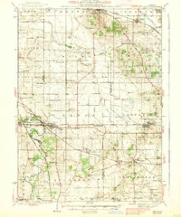
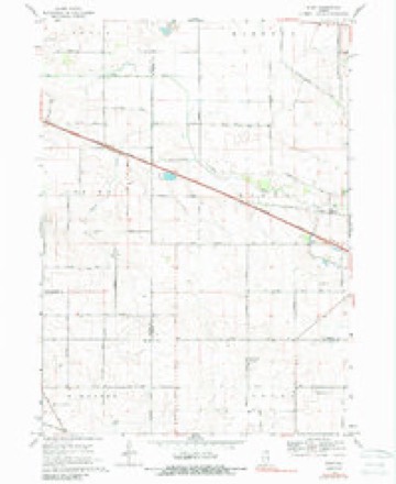
13 topographic sheets cover this place, the earliest surveyed in 1938 and the latest in 1981. It stands in Riley Township. It lies in ZIP code area 60152. The Survey maps it on the Riley quadrangle.
Topographic sheets covering this place
7 surveys from 13 printed sheetsMatched by testing this settlement's coordinate against the published boundary of every sheet in the United States Geological Survey's historical collection. Each opens the scanned sheet at the Survey.
- 1938 USGS Genoa quadrangle1:62500, 3 printings
- 1954 USGS Rockford quadrangle1:250000
- 1955 USGS Rockford quadrangle1:250000
- 1958 USGS Rockford quadrangle1:250000, 4 printings
- 1963 USGS Rockford quadrangle1:250000
- 1968 USGS Riley quadrangle1:24000, 2 printings
- 1981 USGS Elgin quadrangle1:100000





In the county-history sources
2,628 words on this townshipHistory of McHenry County, Illinois : Together with Sketches of Its Cities, Villages and Towns : Educational, Religious, Civil, Military, and Political History : Portraits of Prominent Persons, and Biographies of Representative Citizens, Also a Condensed History of Illinois .., published 1885 names this settlement in its chapter on Riley Township. These are the passages that mention it, exactly as the scans read.
The first settler of this township was Whitman Cobb, who came from New York and located here in 1836, where he remained till about the year 1874, when he moved to Warren and engaged in the grain business. At the expiration of three years he returned to Riley Township, where he died soon afterward. In 1837 Charles Knapp settled in Riley. He came from Pennsylvania, and after making his home in this township moved to Wisconsin where he died in 1882. An old gentleman by the name off Samuel Smith settled in this township in 1837. In 1838 Rassel Bailey came from New York and settled in Riley. About the same time came Roswell Bates, N. E. Barnes, Jenkins and Osborn Underwood.
Passage source: History of McHenry County, Illinois : Together with Sketches of Its Cities, Villages and Towns : Educational, Religious, Civil, Military, and Political History : Portraits of Prominent Persons, and Biographies of Representative Citizens, Also a Condensed History of Illinois .., published 1885.
The following statistics show that the educational interests of Riley have advanced with her other interests in a decree highly creditable to her citizens. The township contains eight school-houses, whose value is estimated at $4,300. One thousand six hundred and eighty-four dollars is annually paid her teachers, and there are in the township 225 children of a school age.
Passage source: History of McHenry County, Illinois : Together with Sketches of Its Cities, Villages and Towns : Educational, Religious, Civil, Military, and Political History : Portraits of Prominent Persons, and Biographies of Representative Citizens, Also a Condensed History of Illinois .., published 1885.
These industries, of late years, have attracted not only the attention ot the farmers in Riley, but their capital as well While many cattle are raised and fattened for the market, the dairy business is carried on quite extensively and successfully.
Passage source: History of McHenry County, Illinois : Together with Sketches of Its Cities, Villages and Towns : Educational, Religious, Civil, Military, and Political History : Portraits of Prominent Persons, and Biographies of Representative Citizens, Also a Condensed History of Illinois .., published 1885.
Machine-read from a century-old scan, so expect the errors a machine makes: misspelled names, dropped words, stray characters.
Read the whole chapter on Riley Township - it names this place 7 more 7 times.
Fires near this place
1 since 2010Regional context, not property-specific evidence. The federal wildfire occurrence database lists 1 fire within 5 miles of Riley in 2010, burning under an acre in total. None started naturally. None was recorded as arson. Distance is straight-line from the map coordinates, so a fire counted here may appear on a neighbouring settlement's page as well.
| Reported cause | Fires |
|---|---|
| Debris and open burning | 1 |
The most recent of them, most recent first, with the day each was reported and the service that recorded it.
| Date | Cause | Size | Reported by | Name on the report |
|---|---|---|---|---|
| 28 September 2010 | Debris and open burning | under an acre | Illinois Division of Forestry Resources | GOODMARK |
Settlements close enough to share some of these fires:
Mines and quarries near this place
3 within 5 milesRegional context, not property-specific evidence. The federal mineral resources record lists 3 workings within 5 miles of Riley: 2 producers, 1 past producer. 2 still produce. What was taken out: Sand and Gravel, Construction. Distance is straight-line from the map coordinates, so a quarry counted here may appear on a neighbouring settlement's page as well.
| Where | Site | Commodity | Status | Recorded |
|---|---|---|---|---|
| Griebel Trucking Co. Pit | Sand and Gravel, Construction | Producer | ||
| Metcalf Sand & Gravel Pit | Sand and Gravel, Construction | Past Producer | ||
| North Pit | Sand and Gravel, Construction | Producer |
Storms near this place
3 since 2025Regional context, not property-specific evidence. The National Weather Service names Riley in 3 storm reports between 2025 and 2026: 3 thunderstorm wind. No death or injury is recorded in these reports. Each account below is quoted exactly as the forecast office filed it, from the NOAA Storm Events Database, and each date opens the federal record of that event.
| When | Event | Place named | Harm | What the report says |
|---|---|---|---|---|
| June 2025 | Thunderstorm Wind | Riley | - | Power lines were damaged along Harmony Rd south of Marengo. |
| June 2025 | Thunderstorm Wind | Riley | - | An ILDOT station southwest of Marengo measured a 61 mph gust. |
| April 2026 | Thunderstorm Wind | Riley | - | no account filed |
Nearest settlements
The eight closest, with where each one stands in the county. Distances are straight-line, computed from the Geographic Names Information System coordinates.
| Map | Place | Distance | Sheets |
|---|---|---|---|
| Indian Trails | 3.8 miles | 13 | |
| Coral | 4.0 miles | 13 | |
| Marengo | 4.2 miles | 13 | |
| Union | 5.6 miles | 13 | |
| Harmony | 6.0 miles | 13 | |
| Franklinville | 8.7 miles | 15 | |
| Coyne | 9.6 miles | 18 | |
| Huntley | 11.0 miles | 18 |
Provenance
This settlement is recorded in the Geographic Names Information System as feature 423120. The sheet list is computed by point-in-boundary test against the United States Geological Survey's historical topographic inventory. Both are works of the United States government and carry no copyright under 17 U.S.C. 105.
Wildfire. Short, Karen C. 2022. Spatial wildfire occurrence data for the United States, 1992-2020 [FPA_FOD_20221014]. 6th Edition. Fort Collins, CO: Forest Service Research Data Archive. https://doi.org/10.2737/RDS-2013-0009.6 Collected with United States Government funding and usable without additional permissions or fees.
Mines and quarries. USGS Mineral Resources Data System (MRDS) https://mrdata.usgs.gov/mrds/ A work of the United States government, no copyright under 17 U.S.C. 105.
Storms. NOAA National Centers for Environmental Information, Storm Events Database https://www.ncei.noaa.gov/stormevents/ A work of the United States government, no copyright under 17 U.S.C. 105. Narratives are quoted verbatim from the National Weather Service report and are not edited or summarised.