 Block
Cortland, Illinois
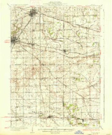
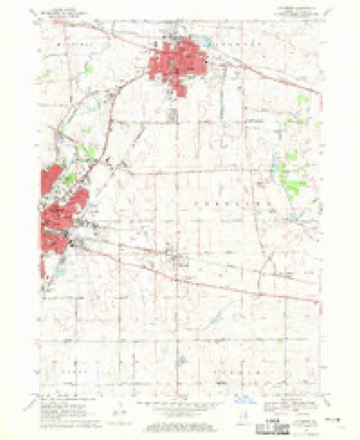
9 topographic sheets cover this place, the earliest surveyed in 1937 and the latest in 1985. It stands in Cortland Township. It lies in ZIP code area 60112. The Survey maps it on the Sycamore quadrangle. 4,398 people lived here at the 2020 count. It stands 869 feet above sea level.
Population over time
2 figuresCortland grew from 4,270 to 4,398 between 2010 and 2020. These are the recorded population figures Wikidata holds for this place, reached through the Geographic Names Information System number this page is keyed on rather than by name, so they belong to this place and not to another of the same name. Most are census counts, but not all are: an early figure may be a founding or settlement estimate, and an estimate published within five years of a census is left out. The change column is computed, and is left blank where more than 20 years separate a figure from the one before it, because a gap that long is not a change between two counts.
| Year | People | Change |
|---|---|---|
| 2010 | 4,270 | |
| 2020 | 4,398 | +128 (+3%) |
Topographic sheets covering this place
5 surveys from 9 printed sheetsMatched by testing this settlement's coordinate against the published boundary of every sheet in the United States Geological Survey's historical collection. Each opens the scanned sheet at the Survey.
- 1937 USGS Sycamore quadrangle1:62500, 2 printings
- 1958 USGS Aurora quadrangle1:250000, 3 printings
- 1961 USGS Aurora quadrangle1:250000
- 1968 USGS Sycamore quadrangle1:24000, 2 printings
- 1985 USGS Aurora quadrangle1:100000



In the county-history sources
6,079 words on this townshipPortrait and Biographical Album of DeKalb County, Illinois : Containing Full-page Portraits and Biographical Sketches of Prominent and Representative Citizens of the County : Together with Portraits and Biographies of All the Governors of Illinois, and of the Presidents of the United States : Also Containing a History of the County, from Its Earliest Settlement to the Present Time, published 1885 names this settlement in its chapter on Cortland Township. These are the passages that mention it, exactly as the scans read.
The first settlement was made in 1835 at what was subsequently termed Ohio Grove, from the fact that the greater number of the first settlers in that neighborhood were from the State of Ohio. Among the pioneers of the township were George W. and Isaac Gandy, John and Perry Ellet, David Wood, Henry Smith, Hale Perry, Alvin Dayton, Ralph Wyman, John Champlin, Peter Young, Elias Hartman, the Crossetts, Springs, Norcutts, Kites, Lowries and Osgoods. There may be others. All these it is believed settled in 1835 and 1836. They all settled as near as possible to the borders of Ohio Grove.
The first name given the township was Richland. This was soori after changed to Pampas, a name suggested by J. R. Crossett, from the resemblance of its prairies to the pampas or plains of South America. In 1864 the name was changed to Cortland, the name of its village.
The record of Cortland in the war for the Union is honorable in the extreme, 134 having enlisted from the township. Of that number 16 lost their lives in the service: Ruthven Russell, Alonzo Russell, Robert Close, W. Stark, Charles Flapper, Spafford Deford, John Young, Charles F. Bannister, Charles V. Peck, Oliver Wilson, Emory Marshall, George H. Gould, T. D. Packard, W. H. Rose and Morris R. Wilson. For war purposes the township raised $12,103.
Machine-read from a century-old scan, so expect the errors a machine makes: misspelled names, dropped words, stray characters.
Read the whole chapter on Cortland Township - it names this place 22 more 22 times.
Mines and quarries near this place
7 within 5 milesRegional context, not property-specific evidence. The federal mineral resources record lists 7 workings within 5 miles of Cortland: 3 producers, 3 past producers, 1 plant. 4 still produce. What was taken out: Vermiculite, Sand and Gravel, Construction, Perlite, Stone, Crushed/Broken. Distance is straight-line from the map coordinates, so a quarry counted here may appear on a neighbouring settlement's page as well.
| Where | Site | Commodity | Status | Recorded |
|---|---|---|---|---|
| Mica Pellets Inc. Plant | Perlite, Vermiculite | Producer | ||
| Sears Limestone Quarry & Plant | Stone, Crushed/Broken | Plant | ||
| Smith Chemical Plant | Iron | Producer | ||
| Sycamore City Pit | Stone | Past Producer | ||
| Mica Pellets Inc. Vermiculite Plant | Vermiculite | Producer | ||
| Tyrrell Pit | Sand and Gravel, Construction | Past Producer | ||
| West Lake Pit | Sand and Gravel, Construction | Past Producer |
Storms near this place
18 since 1996Regional context, not property-specific evidence. The National Weather Service names Cortland in 18 storm reports between 1996 and 2024: 12 thunderstorm wind, 3 hail, 1 funnel cloud, 1 heavy rain. No death or injury is recorded in these reports. Each account below is quoted exactly as the forecast office filed it, from the NOAA Storm Events Database, and each date opens the federal record of that event.
| When | Event | Place named | Harm | What the report says |
|---|---|---|---|---|
| July 2024 | Thunderstorm Wind | Cortland | - | Widespread wind damage was reported across southern portions of Cortland including trees, tree limbs and power lines blown down. Fascia was partly peeled off the police station and the flag pole was bent over. Fascia was also peeled off of two townhouses. Southwest facing doors on a small discount store were removed and blown onto Somonauk Road, the doors were locked. Two campers were rolled over. Multiple trees were blown down at a cemetery. Tree and fence damage was also reported along Chestnut Street. |
| August 2022 | Thunderstorm Wind | Cortland | - | Multiple sign poles were bent over near Somonauk Road and Route 38. |
| August 2022 | Thunderstorm Wind | Cortland | - | A photo shared on social media showed large tree limbs around 6 inches in diameter blown down. |
| May 2020 | Flash Flood | Cortland | - | Water and crop debris from fields was reported over the road at Perry and Somonauk Roads. |
| September 2012 | Thunderstorm Wind | Cortland | - | Winds were estimated between 50 to 60 mph for five minutes in a gust front just ahead of a line of thunderstorms. |
| August 2011 | Thunderstorm Wind | Cortland | - | Winds were estimated to 60 mph near Somonauk Road and Interstate 88. |
| August 2011 | Thunderstorm Wind | Cortland | - | Winds were estimated to 60 mph near Somonauk Road and Interstate 88. |
| June 2009 | Thunderstorm Wind | Cortland | - | A large tree was blown over along North Chase Road. |
| August 2009 | Heavy Rain | Cortland | - | Rainfall of 2.06 inches was reported in the past 24 hours. |
| May 2007 | Thunderstorm Wind | Cortland | - | Wind gusts estimated to 65 mph. |
| June 2007 | Thunderstorm Wind | Cortland | - | Wind gust estimated to 60 mph on the Kane DeKalb County line. |
| September 2006 | Thunderstorm Wind | Cortland | - | An eight inch diameter tree was blown down. |
| May 1998 | Thunderstorm Wind | Cortland | - | A semi-tractor trailer was blown over on interstate 88. |
| April 2013 | Hail | Cortland | - | no account filed |
| May 2003 | Hail | Cortland | - | no account filed |
| July 2000 | Funnel Cloud | Cortland | - | no account filed |
| May 1998 | Hail | Cortland | - | no account filed |
| June 1996 | Thunderstorm Wind | Cortland | - | no account filed |
Nearest settlements
The eight closest, with where each one stands in the county. Distances are straight-line, computed from the Geographic Names Information System coordinates.
| Map | Place | Distance | Sheets |
|---|---|---|---|
| DeKalb | 3.3 miles | 10 | |
| Sycamore | 4.8 miles | 9 | |
| Elva | 6.0 miles | 10 | |
| Five Points | 6.3 miles | 13 | |
| Afton Center | 6.6 miles | 10 | |
| Wilkinson | 7.8 miles | 13 | |
| Malta | 9.2 miles | 10 | |
| McGirr | 9.3 miles | 10 |
Elsewhere
Matched on this settlement's Geographic Names Information System number rather than its name, so it cannot be a different place of the same name in another state.
| Wikipedia article on Cortland | An encyclopaedic summary. Its text is share-alike, so it is linked here rather than copied. |
| Wikidata item Q576103 | The structured record the population and elevation above come from. Public domain (CC0). |
Provenance
This settlement is recorded in the Geographic Names Information System as feature 421759. The sheet list is computed by point-in-boundary test against the United States Geological Survey's historical topographic inventory. Both are works of the United States government and carry no copyright under 17 U.S.C. 105.
Mines and quarries. USGS Mineral Resources Data System (MRDS) https://mrdata.usgs.gov/mrds/ A work of the United States government, no copyright under 17 U.S.C. 105.
Storms. NOAA National Centers for Environmental Information, Storm Events Database https://www.ncei.noaa.gov/stormevents/ A work of the United States government, no copyright under 17 U.S.C. 105. Narratives are quoted verbatim from the National Weather Service report and are not edited or summarised.