 Block
Sycamore, Illinois
9 topographic sheets cover this place, the earliest surveyed in 1937 and the latest in 1985. It stands in Sycamore Township. It lies in ZIP code area 60178. The Survey maps it on the Sycamore quadrangle. 18,577 people lived here at the 2020 count. It stands 830 feet above sea level.
Research this city
On record in Sycamore
Buildings and businesses the archive holds for this place. Each opens its own page, with the source record it came from.
On the National Register 6 records
 Adolphus W. Brower Houselisted 1979
 Chicago and Northwestern Depotlisted 1978
 Elmwood Cemetery Gateslisted 1978
 William W. Marsh Houselisted 1978
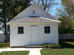 North Grove Schoollisted 2012
 Sycamore Historic Districtlisted 1978
Population over time
2 figuresSycamore grew from 17,519 to 18,577 between 2010 and 2020. These are the recorded population figures Wikidata holds for this place, reached through the Geographic Names Information System number this page is keyed on rather than by name, so they belong to this place and not to another of the same name. Most are census counts, but not all are: an early figure may be a founding or settlement estimate, and an estimate published within five years of a census is left out. The change column is computed, and is left blank where more than 20 years separate a figure from the one before it, because a gap that long is not a change between two counts.
| Year | People | Change |
|---|---|---|
| 2010 | 17,519 | |
| 2020 | 18,577 | +1,058 (+6%) |
Topographic sheets covering this place
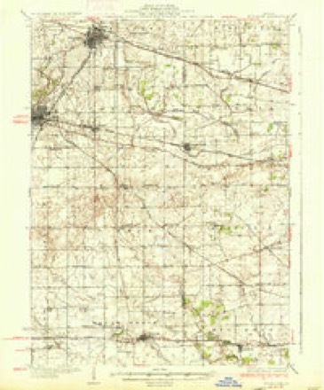
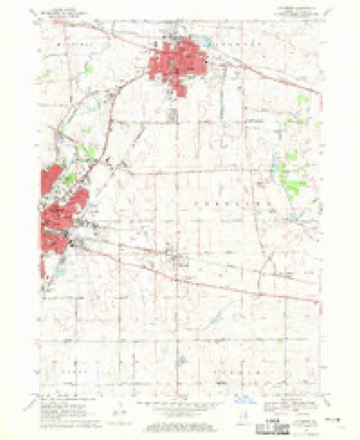
5 surveys from 9 printed sheetsMatched by testing this settlement's coordinate against the published boundary of every sheet in the United States Geological Survey's historical collection. Each opens the scanned sheet at the Survey.
- 1937 USGS Sycamore quadrangle1:62500, 2 printings
- 1958 USGS Aurora quadrangle1:250000, 3 printings
- 1961 USGS Aurora quadrangle1:250000
- 1968 USGS Sycamore quadrangle1:24000, 2 printings
- 1985 USGS Aurora quadrangle1:100000



In the county-history sources
35,267 words on this townshipPortrait and Biographical Album of DeKalb County, Illinois : Containing Full-page Portraits and Biographical Sketches of Prominent and Representative Citizens of the County : Together with Portraits and Biographies of All the Governors of Illinois, and of the Presidents of the United States : Also Containing a History of the County, from Its Earliest Settlement to the Present Time, published 1885 names this settlement in its chapter on Sycamore Township. These are the passages that mention it, exactly as the scans read.
HIS is an excellent township, being well supplied with timber 'and prairie, and watered by the Kishwaukee River. The Sycamore Branch of the Chicago & Northwestern is the only railroad within its borders. The country is quite flat - even along the river banks there are no steep bluffs. The soil is a rich black loam, and highly productive. Lands here are valued from $50 to $75 per acre, according to improvement.
The first settlers of the township were from the East, mostly from the Green Mountain State, and; like all New Englanders, the first thing to bethought of, after becoming settled, was to look after the educational interests of the coming generation. Therefore, early in 1837, the few neighbors then here met .A /-> together and erected a log school-house about four miles north of the present city of Sycamore, and in the summer of that year Mary Wood taught a term of school. She was followed by J. C. Kellogg, who taught the winter term. To Miss Wood belongs the honor of being the first teacher in the township of Sycamore.
Death came among the little band of pioneers, and on the 29th of May, 1837, Lorinda (Wood) French breathed her last. She was buried near the family residence, but her body has since been removed to the Sycamore Cemetery.
Machine-read from a century-old scan, so expect the errors a machine makes: misspelled names, dropped words, stray characters.
Read the whole chapter on Sycamore Township - it names this place 49 more 49 times.
Mines and quarries near this place
5 within 5 milesRegional context, not property-specific evidence. The federal mineral resources record lists 5 workings within 5 miles of Sycamore: 3 past producers, 1 plant, 1 producer. 2 still produce. What was taken out: Sand and Gravel, Construction, Stone, Crushed/Broken, Stone. Distance is straight-line from the map coordinates, so a quarry counted here may appear on a neighbouring settlement's page as well.
| Where | Site | Commodity | Status | Recorded |
|---|---|---|---|---|
| Sears Limestone Quarry & Plant | Stone, Crushed/Broken | Plant | ||
| Sycamore City Pit | Stone | Past Producer | ||
| Floit Sand & Gravel Co. | Sand and Gravel, Construction | Producer | ||
| Tyrrell Pit | Sand and Gravel, Construction | Past Producer | ||
| West Lake Pit | Sand and Gravel, Construction | Past Producer |
Storms near this place
48 since 1997Regional context, not property-specific evidence. The National Weather Service names Sycamore in 48 storm reports between 1997 and 2025: 32 thunderstorm wind, 12 hail, 2 flash flood, 1 lightning. The reports record 1 injury. Each account below is quoted exactly as the forecast office filed it, from the NOAA Storm Events Database, and each date opens the federal record of that event.
| When | Event | Place named | Harm | What the report says |
|---|---|---|---|---|
| April 1997 | Thunderstorm Wind | Sycamore | 1 hurt | no account filed |
| August 2008 | Thunderstorm Wind | Sycamore | $10,000 | Three utility poles were snapped off at their base. A large steel flagpole was bent over. Multiple trees and power lines were blown down. |
| March 2025 | Thunderstorm Wind | Sycamore | - | A tree branch was downed onto a power line near a grocery store in Sycamore. |
| March 2025 | Thunderstorm Wind | Sycamore | - | A large tree fell onto a building causing the roof to collapse. |
| March 2025 | Thunderstorm Wind | Sycamore | - | An evergreen tree was snapped at the trunk. |
| March 2025 | Thunderstorm Wind | Sycamore | - | A rotted pine tree was snapped 15 feet up. |
| March 2025 | Thunderstorm Wind | Sycamore | - | One tree was snapped and another uprooted northeast of Sycamore. |
| March 2025 | Thunderstorm Wind | Sycamore | - | Several live pine trees were snapped a few feet off the ground and facing northeast. |
| March 2025 | Thunderstorm Wind | Sycamore | - | Wind got underneath the garage doors of a farm outbuilding and blew the roof off. Debris was scattered several hundred yards toward the northeast. |
| March 2025 | Thunderstorm Wind | Sycamore | - | The top of a grain silo was blown off and carried to the northeast. |
| March 2025 | Thunderstorm Wind | Sycamore | - | Rotted tree trunks were snapped facing north to north-northeast. |
| March 2025 | Thunderstorm Wind | Sycamore | - | A structure at a ballfield in Sycamore was shifted slightly to the north. Bleachers were also tipped over and light towers were snapped. |
| July 2024 | Thunderstorm Wind | Sycamore | - | Tree damage was reported northeast of Sycamore. |
| July 2023 | Hail | Sycamore | - | A report of one inch hail was received via Spotter Network from south of Sycamore. Time was estimated using radar. |
| August 2022 | Thunderstorm Wind | Sycamore | - | Medium sized tree limbs were blown down. |
| August 2021 | Tornado (EF1) | Sycamore | - | A tornado with peak winds of 105 mph touched down west of Fenstermaker Road and south of Bethany Road. Shortly after touching down, just east of Fenstermaker Road, the tornado produced a concentrated corridor of damage where two farm buildings were nearly completely destroyed. Several trees in the area had trunks snapped near their bases. A single family home suffered some shingle loss along with two broken windows. Drone footage showed the tornado quickly widened to 150 yards as it moved east towards Airport Road, producing tree and crop damage. Farm outbuildings were damaged near Airport Road. Drone footage suggest the tornado lifted near the South Branch of the Kishwaukee River, north of Barber Green Road. |
| August 2021 | Thunderstorm Wind | Sycamore | - | Tree limbs 2 to 3 inches in diameter were blown down. |
| June 2020 | Thunderstorm Wind | Sycamore | - | Numerous large tree limbs were blown down near Freed and Peace Roads. |
| June 2020 | Thunderstorm Wind | Sycamore | - | Numerous trees were blown down between Genoa and Sycamore and a utility pole was on fire. |
| April 2020 | Hail | Sycamore | - | Golf ball size hail was reported at Peace Road and Route 23. |
| September 2018 | Thunderstorm Wind | Sycamore | - | Wind gusts were estimated to 60 mph with isolated tree damage. |
| September 2018 | Thunderstorm Wind | Sycamore | - | A large tree was blown down blocking County Line Road near Barber Greene Road. |
| March 2017 | Thunderstorm Wind | Sycamore | - | Three to four inch diameter tree limbs were blown down near Route 23 and Route 64. |
| June 2014 | Thunderstorm Wind | Sycamore | - | Power lines were blown down near Route 23 and Bethany Road. |
| May 2011 | Thunderstorm Wind | Sycamore | - | Half of a tree was blown down on North Fair Street. |
| April 2011 | Hail | Sycamore | - | Hail to the size of pennies was reported in Sycamore. |
| July 2011 | Thunderstorm Wind | Sycamore | - | Winds were estimated to 60 mph. |
| April 2010 | Thunderstorm Wind | Sycamore | - | Trees were blown down on Barber Greene Road east of Airport Road. |
| June 2010 | Thunderstorm Wind | Sycamore | - | Several eight inch diameter tree limbs were blown down. |
| April 2009 | Hail | Sycamore | - | Marble to penny size hail was reported near Route 23 and Bethany Road. |
| June 2008 | Thunderstorm Wind | Sycamore | - | Tree limbs five inches in diameter were blown down. |
| August 2008 | Thunderstorm Wind | Sycamore | - | A one foot diameter tree was blown down into a house. Multiple six to eight inch diameter tree limbs were blown down across Sycamore. |
| July 2007 | Flash Flood | Sycamore | - | Six inches of water reported on some roads, 1.99 inches of rain measured in 30 minutes south of Kishwaukee Hospital. |
| August 2007 | Flash Flood | Sycamore | - | Many streets closed due to flooding in Mayfield, South Grove, Sycamore. |
| March 2005 | Hail | Sycamore | - | Penny sized hail fell for about 90 seconds on Illinois Rt. 23. |
| July 2005 | Thunderstorm Wind | Sycamore | - | A gust to 70 mph was reported in Sycamore. |
| July 2005 | Lightning | Sycamore | - | A tree was destroyed by a bolt of lightning. |
| July 2024 | Thunderstorm Wind | Sycamore | - | no account filed |
| July 2024 | Thunderstorm Wind | Sycamore | - | no account filed |
| April 2023 | Thunderstorm Wind | Sycamore | - | no account filed |
| April 2020 | Hail | Sycamore | - | no account filed |
| March 2017 | Hail | Sycamore | - | no account filed |
| February 2017 | Hail | Sycamore | - | no account filed |
| March 2012 | Hail | Sycamore | - | no account filed |
| March 2007 | Hail | Sycamore | - | no account filed |
| May 2004 | Hail | Sycamore | - | no account filed |
| August 2001 | Thunderstorm Wind | Sycamore | - | no account filed |
| May 2000 | Hail | Sycamore | - | no account filed |
Nearest settlements
The eight closest, with where each one stands in the county. Distances are straight-line, computed from the Geographic Names Information System coordinates.
| Map | Place | Distance | Sheets |
|---|---|---|---|
| Five Points | 3.0 miles | 13 | |
| Cortland | 4.8 miles | 9 | |
| Wilkinson | 5.2 miles | 13 | |
| DeKalb | 5.3 miles | 10 | |
| Charter Grove | 6.1 miles | 13 | |
| Genoa | 7.5 miles | 13 | |
| Clare | 7.8 miles | 13 | |
| Kingston | 8.6 miles | 13 |
Elsewhere
Matched on this settlement's Geographic Names Information System number rather than its name, so it cannot be a different place of the same name in another state.
| Wikipedia article on Sycamore | An encyclopaedic summary. Its text is share-alike, so it is linked here rather than copied. |
| Wikidata item Q432099 | The structured record the population and elevation above come from. Public domain (CC0). |
Provenance
This settlement is recorded in the Geographic Names Information System as feature 422110. The sheet list is computed by point-in-boundary test against the United States Geological Survey's historical topographic inventory. Both are works of the United States government and carry no copyright under 17 U.S.C. 105.
Mines and quarries. USGS Mineral Resources Data System (MRDS) https://mrdata.usgs.gov/mrds/ A work of the United States government, no copyright under 17 U.S.C. 105.
Storms. NOAA National Centers for Environmental Information, Storm Events Database https://www.ncei.noaa.gov/stormevents/ A work of the United States government, no copyright under 17 U.S.C. 105. Narratives are quoted verbatim from the National Weather Service report and are not edited or summarised.