 Block
Davis Junction, Illinois
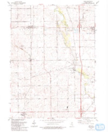
16 topographic sheets cover this place, the earliest surveyed in 1917 and the latest in 1993. It stands in Scott Township. It lies in ZIP code area 61020. The Survey maps it on the Kings quadrangle. 2,512 people lived here at the 2020 count. It stands 791 feet above sea level.
On record in Davis Junction
Buildings and businesses the archive holds for this place. Each opens its own page, with the source record it came from.
On the National Register 1 record
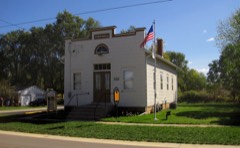 Village of Davis Junction Town Halllisted 2008
Population over time
2 figuresDavis Junction grew from 2,373 to 2,512 between 2010 and 2020. These are the recorded population figures Wikidata holds for this place, reached through the Geographic Names Information System number this page is keyed on rather than by name, so they belong to this place and not to another of the same name. Most are census counts, but not all are: an early figure may be a founding or settlement estimate, and an estimate published within five years of a census is left out. The change column is computed, and is left blank where more than 20 years separate a figure from the one before it, because a gap that long is not a change between two counts.
| Year | People | Change |
|---|---|---|
| 2010 | 2,373 | |
| 2020 | 2,512 | +139 (+6%) |
Topographic sheets covering this place
9 surveys from 16 printed sheetsMatched by testing this settlement's coordinate against the published boundary of every sheet in the United States Geological Survey's historical collection. Each opens the scanned sheet at the Survey.
- 1917 USGS Kings quadrangle1:62500
- 1918 USGS Kings quadrangle1:62500, 3 printings
- 1954 USGS Rockford quadrangle1:250000
- 1955 USGS Rockford quadrangle1:250000
- 1958 USGS Rockford quadrangle1:250000, 4 printings
- 1963 USGS Rockford quadrangle1:250000
- 1971 USGS Kings quadrangle1:24000, 2 printings
- 1981 USGS Rockford quadrangle1:100000, 2 printings
- 1993 USGS Kings quadrangle1:24000





In the county-history sources
6,769 words on this townshipThe History of Ogle County, Illinois, Containing a History of the County, Its Cities, Towns, Etc., a Biographical Directory of Its Citizens, War Record of Its Volunteers in the Late Rebellion, General and Local Statistics ... History of the Northwest, History of Illinois ... Etc, published 1878 names this settlement in its chapter on Scott Township. These are the passages that mention it, exactly as the scans read.
BI.ACKMAX JL. W. Farmer; Sec. 13 ; P. O. Davis Junction ; born in Genesee Co., N. Y., in 1846; married Olive Stevens in 1867; she was born in Chemung Co., N. Y., in 1844 ; have one child, Henry W., born Feb. 3, 1871 ; came to this Co. in 1858 and settled in Monroe Tp. with his father, Walter Blackman, an old settler; in 1861 he settled on his present estate, where he has since resided.
Passage source: The History of Ogle County, Illinois, Containing a History of the County, Its Cities, Towns, Etc., a Biographical Directory of Its Citizens, War Record of Its Volunteers in the Late Rebellion, General and Local Statistics ... History of the Northwest, History of Illinois ... Etc, published 1878.
BRACEi P. Hardware Merchant ; Davis Junction; born in Schuyler Co., N. Y., July 29, 1835 ; came to this state in 1860, and settled in Rochelle, where he was employed in the hardware business about two years, when he removed to Iowa and engaged in farming, returning to Rochelle after two years residence in that state ; in 1875 he came to this village and settled in business; has a fine stock of hardware, and is prominently known and identified with the interests of the town.
Passage source: The History of Ogle County, Illinois, Containing a History of the County, Its Cities, Towns, Etc., a Biographical Directory of Its Citizens, War Record of Its Volunteers in the Late Rebellion, General and Local Statistics ... History of the Northwest, History of Illinois ... Etc, published 1878.
BUBDICK EMEBY I. Carnage Maker and Blacksmith ; Davis Junction ; born in Genesee Co., N. Y., Nov. 31, 1847; married Levia C. Cole June 15, 1868 ; she was born in Milton, Rock Co., Dec. 18, 1849 ; have one child, adopted, eight years of age ; Mr, B. came to this country in 1862 and settled in Milton, Wis., where he resided one year, when he enlisted in the 33d W. V. I., Co. F, in 1863; participated in battles of Vicksburg, Jackson, Mobile, Black River, Pleasant Hill, Red River Campaign, Nashville; served under Sherman, Grant and Thomas, receiving an hoDorable discharge at the close of the war. In April, 1875, he settled in this village, forming co-partnership with James Wilson m the manufacture of carriages and blacksmithing ; have built two shops to accommodate their business, and have also erected a fine dwelling and otherwise added to the growth and prosperity of the place.
Passage source: The History of Ogle County, Illinois, Containing a History of the County, Its Cities, Towns, Etc., a Biographical Directory of Its Citizens, War Record of Its Volunteers in the Late Rebellion, General and Local Statistics ... History of the Northwest, History of Illinois ... Etc, published 1878.
Machine-read from a century-old scan, so expect the errors a machine makes: misspelled names, dropped words, stray characters.
Read the whole chapter on Scott Township - it names this place 19 more 19 times.
Mines and quarries near this place
6 within 5 milesRegional context, not property-specific evidence. The federal mineral resources record lists 6 workings within 5 miles of Davis Junction: 6 past producers. None of them still produces. What was taken out: Stone, Crushed/Broken. Distance is straight-line from the map coordinates, so a quarry counted here may appear on a neighbouring settlement's page as well.
| Where | Site | Commodity | Status | Recorded |
|---|---|---|---|---|
| Dummer Quarry | Stone, Crushed/Broken | Past Producer | ||
| Lumpkin Quarry | Stone, Crushed/Broken | Past Producer | ||
| Pagel Pit | Stone, Crushed/Broken | Past Producer | ||
| Unnamed Limestone Quarry | Stone, Crushed/Broken | Past Producer | ||
| Unnamed Limestone Quarry | Stone, Crushed/Broken | Past Producer | ||
| Winquist Qry.Rein, Schultz & Dahl | Stone, Crushed/Broken | Past Producer |
Storms near this place
8 since 2016Regional context, not property-specific evidence. The National Weather Service names Davis Junction in 8 storm reports between 2016 and 2025: 5 thunderstorm wind, 2 hail, 1 tornado. No death or injury is recorded in these reports. Each account below is quoted exactly as the forecast office filed it, from the NOAA Storm Events Database, and each date opens the federal record of that event.
| When | Event | Place named | Harm | What the report says |
|---|---|---|---|---|
| May 2025 | Thunderstorm Wind | Davis Junction | - | Trees were snapped causing damage to property. |
| June 2025 | Thunderstorm Wind | Davis Junction | - | A large tree was down and blocking IL-72 in Davis Junction. Another tree was reported down on power lines. |
| July 2024 | Tornado (EF0) | Davis Junction | - | A tornado with estimated peak winds of 80 mph touched down northwest of the intersection of Moulton Road and Route 72 and moved east through Davis Junction producing tree damage. The tornado ended east of Davis Junction and just north of Route 72. |
| August 2022 | Thunderstorm Wind | Davis Junction | - | Photos showed large live trees that were mostly uprooted. A few large tree limbs were also blown down. |
| August 2021 | Thunderstorm Wind | Davis Junction | - | A wind gust to 60 mph was measured. |
| June 2016 | Thunderstorm Wind | Davis Junction | - | Several four to six inch diameter tree limbs down near Friday Rd and Edson Rd. Time approximated from radar. |
| April 2023 | Hail | Davis Junction | - | no account filed |
| April 2022 | Hail | Davis Junction | - | no account filed |
Nearest settlements
The eight closest, with where each one stands in the county. Distances are straight-line, computed from the Geographic Names Information System coordinates.
| Map | Place | Distance | Sheets |
|---|---|---|---|
| Holcomb | 2.6 miles | 16 | |
| Stillman Valley | 4.6 miles | 15 | |
| Lindenwood | 4.7 miles | 16 | |
| Monroe Center | 4.9 miles | 16 | |
| White Rock | 5.0 miles | 15 | |
| White Rock Center | 5.7 miles | 16 | |
| Von Glen Acres | 6.7 miles | 15 | |
| Kings | 6.8 miles | 16 |
Elsewhere
Matched on this settlement's Geographic Names Information System number rather than its name, so it cannot be a different place of the same name in another state.
| Wikipedia article on Davis Junction | An encyclopaedic summary. Its text is share-alike, so it is linked here rather than copied. |
| Wikidata item Q2459360 | The structured record the population and elevation above come from. Public domain (CC0). |
Provenance
This settlement is recorded in the Geographic Names Information System as feature 406979. The sheet list is computed by point-in-boundary test against the United States Geological Survey's historical topographic inventory. Both are works of the United States government and carry no copyright under 17 U.S.C. 105.
Mines and quarries. USGS Mineral Resources Data System (MRDS) https://mrdata.usgs.gov/mrds/ A work of the United States government, no copyright under 17 U.S.C. 105.
Storms. NOAA National Centers for Environmental Information, Storm Events Database https://www.ncei.noaa.gov/stormevents/ A work of the United States government, no copyright under 17 U.S.C. 105. Narratives are quoted verbatim from the National Weather Service report and are not edited or summarised.