 Block
Deer Grove, Illinois
10 topographic sheets cover this place, the earliest surveyed in 1949 and the latest in 1985. It stands in Hahnaman Township. It lies in ZIP code area 61243. The Survey maps it on the New Bedford quadrangle. 38 people lived here at the 2020 count. It stands 646 feet above sea level.
Population over time
2 figuresDeer Grove fell from 48 to 38 between 2010 and 2020. These are the recorded population figures Wikidata holds for this place, reached through the Geographic Names Information System number this page is keyed on rather than by name, so they belong to this place and not to another of the same name. Most are census counts, but not all are: an early figure may be a founding or settlement estimate, and an estimate published within five years of a census is left out. The change column is computed, and is left blank where more than 20 years separate a figure from the one before it, because a gap that long is not a change between two counts.
| Year | People | Change |
|---|---|---|
| 2010 | 48 | |
| 2020 | 38 | -10 (-21%) |
Topographic sheets covering this place
5 surveys from 10 printed sheetsMatched by testing this settlement's coordinate against the published boundary of every sheet in the United States Geological Survey's historical collection. Each opens the scanned sheet at the Survey.
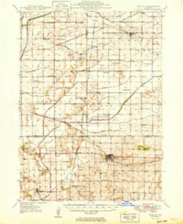
- 1949 USGS Walnut quadrangle1:62500, 3 printings
- 1958 USGS Aurora quadrangle1:250000, 3 printings
- 1961 USGS Aurora quadrangle1:250000
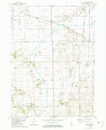
- 1982 USGS New Bedford quadrangle1:24000
- 1985 USGS Dixon quadrangle1:100000, 2 printings



What happened here
An account from the chapter on Hahnaman township. The inset identifies its exact source book and publication year.
Brave Record In The War
For a small, thinly inhabited town, the men of Hahnaman rallied nobly around the flag in 1861. Ten enlisted with the Yates Sharpshooters: Mc- Mckle, Hinman, Harvey, Reeves, William and Mahlon Humphrey, Crosby and H. D. Ryder, Henry May. The latter was killed at Atlanta in 1864. Mahlon Humphrey died at Cairo in 1862.
In the county-history sources
4,058 words on this townshipPortrait and Biographical Album of Whiteside County, Illinois : Containing Full-page Portraits and Biographies of All the Governors of Illinois, and of the Presidents of the United States, published 1885 names this settlement in its chapter on Hahnaman Township. These are the passages that mention it, exactly as the scans read.
The first settlement was made at Deer Grove, in 1841, by Wm. Renner and family, from Pennsylvania. Mr. Renner died in 1859, leaving a widow and eight children. Among the first settlers not mentioned in the biographical portion of the work are the following :
Passage source: Portrait and Biographical Album of Whiteside County, Illinois : Containing Full-page Portraits and Biographies of All the Governors of Illinois, and of the Presidents of the United States, published 1885.
In 1854, Mrs. Ryder, a widow lady, and her family arrived in the township. During the following three or four years a number of families came in. Among the arrivals were James Chambers, W. M. Halsted, Benj. Ackley, Martin Clark, Wm. Humphrey, Wm. Johnson, John J. Van Valkenburg, Wm. Brakey, Geo. Brakey, Wm. McNickel, Thomas Langan, Peter Ford, Amos Reeves and Dr. Reuben Davis.
Passage source: Portrait and Biographical Album of Whiteside County, Illinois : Containing Full-page Portraits and Biographies of All the Governors of Illinois, and of the Presidents of the United States, published 1885.
For the year ending June 30, 1884, the County Superintendent of Public Schools gave the following items pertaining to educational matters in the township. There were six school districts and frame school-houses, with 369 persons under 23 years of age, of which number 274 were of school age and 233 enrolled in the public schools. The highest wages paid teachers was $50 and the lowest $25 per month. The tax levy for school purposes was $2,232.
Passage source: Portrait and Biographical Album of Whiteside County, Illinois : Containing Full-page Portraits and Biographies of All the Governors of Illinois, and of the Presidents of the United States, published 1885.
Machine-read from a century-old scan, so expect the errors a machine makes: misspelled names, dropped words, stray characters.
Read the whole chapter on Hahnaman Township - it names this place 8 more 8 times.
Mines and quarries near this place
1 within 5 milesRegional context, not property-specific evidence. The federal mineral resources record lists 1 working within 5 miles of Deer Grove: 1 producer. All of them still produce. What was taken out: Sand and Gravel, Construction. Distance is straight-line from the map coordinates, so a quarry counted here may appear on a neighbouring settlement's page as well.
| Where | Site | Commodity | Status | Recorded |
|---|---|---|---|---|
| Quality Sand & Gravel Pit | Sand and Gravel, Construction | Producer |
Storms near this place
14 since 2009Regional context, not property-specific evidence. The National Weather Service names Deer Grove in 14 storm reports between 2009 and 2025: 8 thunderstorm wind, 3 hail, 3 tornado. No death or injury is recorded in these reports. Each account below is quoted exactly as the forecast office filed it, from the NOAA Storm Events Database, and each date opens the federal record of that event.
| When | Event | Place named | Harm | What the report says |
|---|---|---|---|---|
| May 2025 | Hail | Deer Grove | - | A trained spotter reported that several hailstones were quarter size, some were perhaps bigger. |
| May 2024 | Tornado (EFU) | Deer Grove | - | Public picture of a tornado near Deer Valley golf course, north of Deer Grove, IL in Whiteside County. There was no damage to assign a rating and the tornado is classified as an EF-Unknown. |
| June 2024 | Thunderstorm Wind | Deer Grove | - | Time estimated from radar. Power lines down on Hahnaman Rd. |
| March 2023 | Tornado (EF1) | Deer Grove | - | This tornado began just south of Illinois highway 92 in northwest Bureau County, then moved into far southeast Whiteside county, near the intersection of Osage Road and 1050 St E. The tornado tracked for 2 miles in Whiteside County, before moving into Lee County, about a half mile south of the Green River. This tornado would continue for 6 additional miles into southwest Lee County (see NWS Chicago StormData). The damage from this tornado included numerous heavily damaged outbuildings, several snapped power poles, and dozens of trees. The worst damage was to a large farmstead outbuilding on the Whiteside and Bureau County border area, with the roof and two of the four walls destroyed and debris slung well into a field. Peak winds with this tornado were estimated at 110 mph. The tornado was rated EF1 in Bureau and Whiteside Counties. |
| November 2022 | Thunderstorm Wind | Deer Grove | - | Law enforcement reported a tree blown near Hoover Road and Yates Road in Deer Grove. The time of the event was estimated using radar. |
| September 2018 | Thunderstorm Wind | Deer Grove | - | A NWS storm survey team found a large swath of corn blown down. |
| September 2018 | Thunderstorm Wind | Deer Grove | - | A NWS storm survey team found large tree branches down in the community of Deer Grove. |
| September 2018 | Thunderstorm Wind | Deer Grove | - | A NWS storm survey team found two large tree branches down. |
| March 2016 | Tornado (EF0) | Deer Grove | - | A tornado uprooted a tree, damaged shingles and siding on two homes, and overturned a short portion of an irrigation rig. The damage was rated EF0 with winds estimated at 80 MPH. The path was about 50 yards wide and roughly 1.5 miles long. |
| May 2013 | Thunderstorm Wind | Deer Grove | - | A trained spotter reported a large tree blown partially over. |
| June 2013 | Thunderstorm Wind | Deer Grove | - | The time of this event was estimated using radar. A trained spotter reported a downed fruit tree along with several limbs that were 3 to 5 inches in diameter. |
| November 2013 | Hail | Deer Grove | - | Pea to penny sized hail fell. |
| September 2010 | Thunderstorm Wind | Deer Grove | - | Wind gusts estimated to be 60 mph were observed in Deer Grove, IL around 430 pm CDT September 21. |
| May 2009 | Hail | Deer Grove | - | no account filed |
Nearest settlements
The eight closest, with where each one stands in the county. Distances are straight-line, computed from the Geographic Names Information System coordinates.
| Map | Place | Distance | Sheets |
|---|---|---|---|
| Hahnaman | 3.3 miles | 10 | |
| Tampico | 5.4 miles | 11 | |
| Yeoward Addition | 10.5 miles | 12 | |
| Como | 11.7 miles | 11 | |
| Rock Falls | 11.9 miles | 12 | |
| Leon Corners | 12.3 miles | 11 | |
| Sterling | 12.5 miles | 12 | |
| Douglas Park | 13.1 miles | 12 |
Elsewhere
Matched on this settlement's Geographic Names Information System number rather than its name, so it cannot be a different place of the same name in another state.
| Wikipedia article on Deer Grove | An encyclopaedic summary. Its text is share-alike, so it is linked here rather than copied. |
| Wikidata item Q1182471 | The structured record the population and elevation above come from. Public domain (CC0). |
Provenance
This settlement is recorded in the Geographic Names Information System as feature 407074. The sheet list is computed by point-in-boundary test against the United States Geological Survey's historical topographic inventory. Both are works of the United States government and carry no copyright under 17 U.S.C. 105.
Mines and quarries. USGS Mineral Resources Data System (MRDS) https://mrdata.usgs.gov/mrds/ A work of the United States government, no copyright under 17 U.S.C. 105.
Storms. NOAA National Centers for Environmental Information, Storm Events Database https://www.ncei.noaa.gov/stormevents/ A work of the United States government, no copyright under 17 U.S.C. 105. Narratives are quoted verbatim from the National Weather Service report and are not edited or summarised.