 Block
Tampico, Illinois
11 topographic sheets cover this place, the earliest surveyed in 1932 and the latest in 1985. It stands in Tampico Township. It lies in ZIP code area 61283. The Survey maps it on the Tampico quadrangle.
On record in Tampico
Buildings and businesses the archive holds for this place. Each opens its own page, with the source record it came from.
On the National Register 1 record
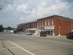 Main Street Historic Districtlisted 1982
Topographic sheets covering this place
6 surveys from 11 printed sheetsMatched by testing this settlement's coordinate against the published boundary of every sheet in the United States Geological Survey's historical collection. Each opens the scanned sheet at the Survey.
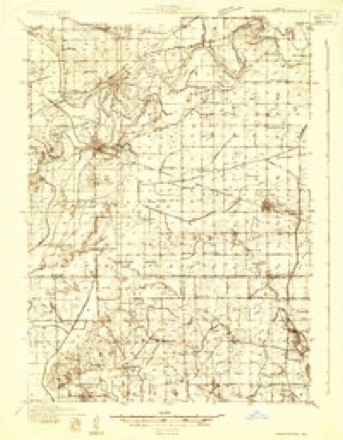
- 1932 USGS Prophetstown quadrangle1:48000
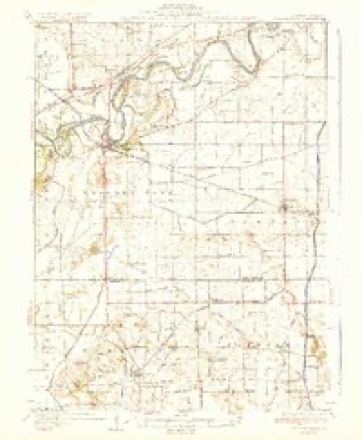
- 1936 USGS Prophetstown quadrangle1:62500, 3 printings
- 1958 USGS Aurora quadrangle1:250000, 3 printings
- 1961 USGS Aurora quadrangle1:250000
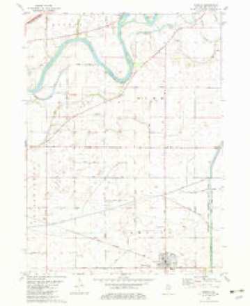
- 1982 USGS Tampico quadrangle1:24000
- 1985 USGS Dixon quadrangle1:100000, 2 printings



In the county-history sources
12,289 words on this townshipHistory of Whiteside County, Illinois, from Its First Settlement to the Present Time;, published 1877 names this settlement in its chapter on Tampico Township. These are the passages that mention it, exactly as the scans read.
The village was organized under the Act of the General Assembly to provide for the incorporation of cities and villages, in force July 1, 1872. The first election took place in February, 1875, and the following gentlemen were elected Trustees: D. McMillan, E. AV. High, Alfred Smith, J. W. Glassburn, J. H. Cain, and H. L. Denison.
Passage source: History of Whiteside County, Illinois, from Its First Settlement to the Present Time;, published 1877.
The Board of Trustees met at the office of D. McMillan, on the 26th of February, 1875, and organized by electing J. W. Grlassburn, President, and J. C. Mosshart, Clerk. Trustees, E. W. High, D. McMillan, and J. H. Cain were appointed a committee on ordinances, and at the meeting held on March 12th, reported seven ordinances, all of which were passed. The ordinances were in effect those usually passed for the government of cities and villages, with the exception of the dog ordinance which provides that every owner of a male dog shall pay an annual tax of one dollar for keeping the canine, and every owner of a female dog, two dollars. At this meeting C. H. Glassburn was appointed, Police Constable, and at a subsequent meeting Eli C. Cain was appointed Street Commissioner.
Passage source: History of Whiteside County, Illinois, from Its First Settlement to the Present Time;, published 1877.
The first Board of Trustees were only elected for the term between the organization of the village and the time provided by the statute for holding the annual election. This election too^ place on the third Tuesday of April, 1875, and resulted in the re-election of the first Board of Trustees. J. W. Glassburn was elected President, and B. F. Chase, Clerk. E. C. Cain was appointed Street Commissioner, and C. H. Glassburn, Police Constable. Trustees J. H. Cain, D. McMillan and A. Smith were appointed a Committee on Salaries. The first two Boards were in favor of licensing the sale of ardent spirits, and about $700 were realized from that source. The licenses were $240 each, per annum.
Passage source: History of Whiteside County, Illinois, from Its First Settlement to the Present Time;, published 1877.
Machine-read from a century-old scan, so expect the errors a machine makes: misspelled names, dropped words, stray characters.
Read the whole chapter on Tampico Township - it names this place 31 more 31 times.
Mines and quarries near this place
1 within 5 milesRegional context, not property-specific evidence. The federal mineral resources record lists 1 working within 5 miles of Tampico: 1 past producer. None of them still produces. What was taken out: Stone, Crushed/Broken. Distance is straight-line from the map coordinates, so a quarry counted here may appear on a neighbouring settlement's page as well.
| Where | Site | Commodity | Status | Recorded |
|---|---|---|---|---|
| Tampico Quarry | Stone, Crushed/Broken | Past Producer |
Storms near this place
17 since 1998Regional context, not property-specific evidence. The National Weather Service names Tampico in 17 storm reports between 1998 and 2025: 12 thunderstorm wind, 4 hail, 1 funnel cloud. No death or injury is recorded in these reports. Each account below is quoted exactly as the forecast office filed it, from the NOAA Storm Events Database, and each date opens the federal record of that event.
| When | Event | Place named | Harm | What the report says |
|---|---|---|---|---|
| June 2013 | Thunderstorm Wind | Tampico | $10,000 | Power lines and trees were downed in Tampico. |
| May 1999 | Thunderstorm Wind | Tampico | $5,000 | Severe thunderstorm winds caused plaster to fall inside a home and heavily damaged a garage. |
| August 2000 | Thunderstorm Wind | Tampico | $5,000 | no account filed |
| May 1998 | Thunderstorm Wind | Tampico | $10 | A gusty thunderstorm wind caused a tree to fall onto powerlines producing a brief power outage in Southeast Whiteside county. |
| March 2025 | Thunderstorm Wind | Tampico | - | Recorded gust with wind measuring equipment. Time estimated from radar information. |
| May 2024 | Thunderstorm Wind | Tampico | - | Several tree branches blown down in Tampico. The time was based on radar data. |
| June 2024 | Thunderstorm Wind | Tampico | - | Trees downed in Memorial Cemetery by the thunderstorm winds. |
| June 2024 | Thunderstorm Wind | Tampico | - | Small tree limbs down on powerlines, with powerlines downed as well. Time estimated by radar. |
| November 2022 | Thunderstorm Wind | Tampico | - | Law Enforcement reported a blow over tree took down power lines in Tampico. The time of the event was estimated using radar. |
| May 2020 | Thunderstorm Wind | Tampico | - | Trees were uprooted and large limbs snapped off. Nearby power poles snapped off near the base. |
| June 2013 | Thunderstorm Wind | Tampico | - | A trained spotter reported 2.5 inch diameter tree branches down. |
| June 2011 | Hail | Tampico | - | Half dollar sized hail fell in Tampico, IL at 554 am CDT June 9. |
| June 2011 | Hail | Tampico | - | Quarter sized hail fell about 1 mile north of Tampico, IL at 224 am CDT June 9. |
| May 2024 | Hail | Tampico | - | no account filed |
| November 2022 | Thunderstorm Wind | Tampico | - | no account filed |
| July 2004 | Funnel Cloud | Tampico | - | no account filed |
| May 2000 | Hail | Tampico | - | no account filed |
Nearest settlements
The eight closest, with where each one stands in the county. Distances are straight-line, computed from the Geographic Names Information System coordinates.
| Map | Place | Distance | Sheets |
|---|---|---|---|
| Deer Grove | 5.4 miles | 10 | |
| Leon Corners | 7.5 miles | 11 | |
| Hahnaman | 8.0 miles | 10 | |
| Prophetstown | 8.4 miles | 11 | |
| Sands | 9.3 miles | 11 | |
| Valley Vista Estates | 9.3 miles | 11 | |
| Como | 9.4 miles | 11 | |
| Lyndon | 9.5 miles | 11 |
Provenance
This settlement is recorded in the Geographic Names Information System as feature 419533. The sheet list is computed by point-in-boundary test against the United States Geological Survey's historical topographic inventory. Both are works of the United States government and carry no copyright under 17 U.S.C. 105.
Mines and quarries. USGS Mineral Resources Data System (MRDS) https://mrdata.usgs.gov/mrds/ A work of the United States government, no copyright under 17 U.S.C. 105.
Storms. NOAA National Centers for Environmental Information, Storm Events Database https://www.ncei.noaa.gov/stormevents/ A work of the United States government, no copyright under 17 U.S.C. 105. Narratives are quoted verbatim from the National Weather Service report and are not edited or summarised.