 Block
Erie, Illinois
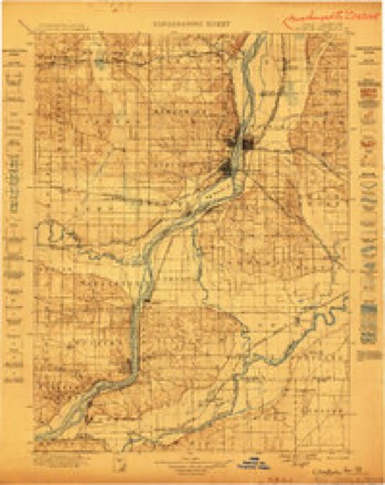
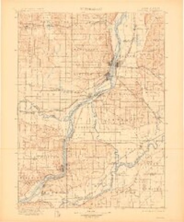
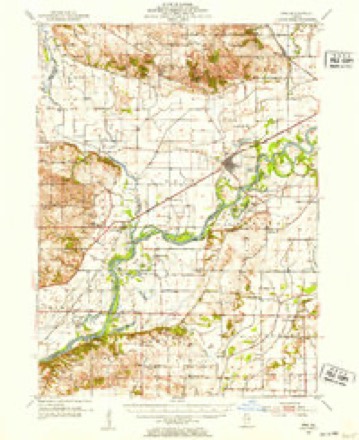
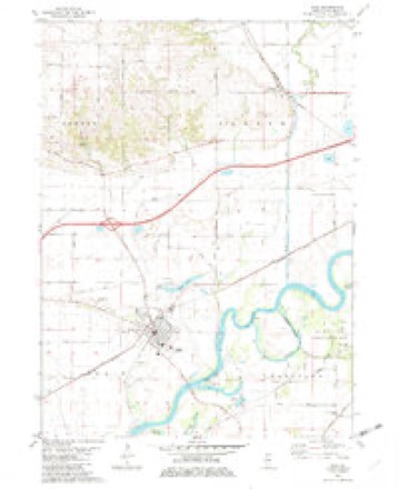
14 topographic sheets cover this place, the earliest surveyed in 1899 and the latest in 1984. It stands in Erie Township. It lies in ZIP code area 61250. It stands on Carson Slough. The Survey maps it on the Erie quadrangle. 1,518 people lived here at the 2020 count.
Population over time
2 figuresErie fell from 1,602 to 1,518 between 2010 and 2020. These are the recorded population figures Wikidata holds for this place, reached through the Geographic Names Information System number this page is keyed on rather than by name, so they belong to this place and not to another of the same name. Most are census counts, but not all are: an early figure may be a founding or settlement estimate, and an estimate published within five years of a census is left out. The change column is computed, and is left blank where more than 20 years separate a figure from the one before it, because a gap that long is not a change between two counts.
| Year | People | Change |
|---|---|---|
| 2010 | 1,602 | |
| 2020 | 1,518 | -84 (-5%) |
Topographic sheets covering this place
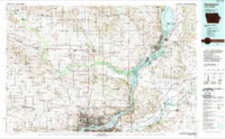
8 surveys from 14 printed sheetsMatched by testing this settlement's coordinate against the published boundary of every sheet in the United States Geological Survey's historical collection. Each opens the scanned sheet at the Survey.
- 1899 USGS Clinton quadrangle1:125000
- 1899 USGS Cordova quadrangle1:125000, 4 printings
- 1952 USGS Erie quadrangle1:62500, 2 printings
- 1958 USGS Davenport quadrangle1:250000, 2 printings
- 1961 USGS Davenport quadrangle1:250000
- 1962 USGS Davenport quadrangle1:250000
- 1982 USGS Erie quadrangle1:24000
- 1984 USGS Davenport quadrangle1:100000, 2 printings



In the county-history sources
7,006 words on this townshipPortrait and Biographical Album of Whiteside County, Illinois : Containing Full-page Portraits and Biographies of All the Governors of Illinois, and of the Presidents of the United States, published 1885 names this settlement in its chapter on Erie Township. These are the passages that mention it, exactly as the scans read.
This township was formed from Erie Precinct, which was established Dec. i, 1844, by order of the Commissioner's Court. It formerly composed a part of the territory of Albany and Lyndon Precincts. Its present territory embraces all that part of the Congressional township 19 north, of range 3 east, and so much of township 19 north, of range 4 east, as lies north of Rock River, which winds around the southeastern portion, containing in all 14,392 acres. On the north it is bordered by Newton and Fenton Townships.
Passage source: Portrait and Biographical Album of Whiteside County, Illinois : Containing Full-page Portraits and Biographies of All the Governors of Illinois, and of the Presidents of the United States, published 1885.
In some portions of this township, the land is rolling, with occasional ridges of sand. But the great body of it is is low and flat. When drained and brought under cultivation it is rich and very productive. The land is better adapted for dairying and stock-raising, and in this department are the farmers mostly engaged. It is very well watered, having the Rock River, which skirts its southeastern border, and several small streams. The township is
Passage source: Portrait and Biographical Album of Whiteside County, Illinois : Containing Full-page Portraits and Biographies of All the Governors of Illinois, and of the Presidents of the United States, published 1885.
Rock River runs along the eastern and southern line, and Rock Island County lies on the west. The people of this precinct voted against township organization in November, 1851. Of the 29 voters for the organization of the township in 1852, nine are still living, five of whom voted at the spring election, April 7, 1885 - W. W. Hubbart, N. K. Chapman, A. J. Osborne, Harvey Steele and L. F. Crandall. Thos. Freek still resides in Erie, and the other three in different parts of the country. [Since the above was written, Mr. Freek has deceased, dying July 4, 1885, at Erie.]
Passage source: Portrait and Biographical Album of Whiteside County, Illinois : Containing Full-page Portraits and Biographies of All the Governors of Illinois, and of the Presidents of the United States, published 1885.
Machine-read from a century-old scan, so expect the errors a machine makes: misspelled names, dropped words, stray characters.
Read the whole chapter on Erie Township - it names this place 27 more 27 times.
Fires near this place
2 since 2018Regional context, not property-specific evidence. The federal wildfire occurrence database lists 2 fires within 5 miles of Erie between 2018 and 2020, burning about 29 acres in total. None started naturally. None was recorded as arson. Distance is straight-line from the map coordinates, so a fire counted here may appear on a neighbouring settlement's page as well.
| Reported cause | Fires |
|---|---|
| Debris and open burning | 2 |
The most recent of them, most recent first, with the day each was reported and the service that recorded it.
| Date | Cause | Size | Reported by | Name on the report |
|---|---|---|---|---|
| 5 April 2020 | Debris and open burning | 19 acres | Illinois Division of Forestry Resources | 20-056 |
| 30 April 2018 | Debris and open burning | 10 acres | Illinois Division of Forestry Resources | 18-066 |
Settlements close enough to share some of these fires:
Mines and quarries near this place
2 within 5 milesRegional context, not property-specific evidence. The federal mineral resources record lists 2 workings within 5 miles of Erie: 2 past producers. None of them still produces. What was taken out: Stone, Crushed/Broken. Distance is straight-line from the map coordinates, so a quarry counted here may appear on a neighbouring settlement's page as well.
| Where | Site | Commodity | Status | Recorded |
|---|---|---|---|---|
| Erie Township Highway Department | Stone, Crushed/Broken | Past Producer | ||
| Slaymaker Quarry | Stone, Crushed/Broken | Past Producer |
Storms near this place
31 since 1993Regional context, not property-specific evidence. The National Weather Service names Erie in 31 storm reports between 1993 and 2024: 13 thunderstorm wind, 11 hail, 4 flood, 2 funnel cloud. No death or injury is recorded in these reports. Each account below is quoted exactly as the forecast office filed it, from the NOAA Storm Events Database, and each date opens the federal record of that event.
| When | Event | Place named | Harm | What the report says |
|---|---|---|---|---|
| July 2010 | Flood | Erie | $500,000 | no account filed |
| June 2009 | Flood | Erie | $250,000 | Heavy rains during the middle of the month resulted in the Rock River at Joslin going above the moderate flood stage level of 14 feet on June 22nd around 12 am. It crested around 14.73 feet around 830 pm on June 23. It fell below the moderate flood stage level around 5 pm June 24. |
| July 2010 | Flood | Erie | $250,000 | no account filed |
| June 2009 | Thunderstorm Wind | Erie | $25,000 | Wind gusts estimated to be 70 mph blew down several tree limbs and power lines in Erie, IL around 615 pm June 19. Some limbs were blocking a road. |
| June 2007 | Thunderstorm Wind | Erie | $10,000 | Some grain bins were blown off of their foundations into each other and a pole building was destroyed. In addition, some power poles and large tree limbs were blown down and a portion of a corn field was flattened. Time estimated. |
| May 1993 | Thunderstorm Wind | Erie | $5,000 | Thunderstorm winds flattened a barn, overturned a picnic table, moved a car 30 feet and blasted paint off the side of a house. |
| May 2006 | Hail | Erie | $2,000 | pea to quarter size hail with a heavy downpour |
| August 2000 | Thunderstorm Wind | Erie | $2,000 | Tree limbs knocked down. |
| June 2000 | Thunderstorm Wind | Erie | $2,000 | no account filed |
| March 2006 | Thunderstorm Wind | Erie | $1,000 | wires down |
| July 2024 | Thunderstorm Wind | Erie | - | The Emergency Manager reported a tree down across Moline Road. |
| March 2023 | Hail | Erie | - | Report from Mping. |
| March 2022 | Tornado (EF1) | Erie | - | An EF1 tornado tracked across rural Whiteside County. Max wind speeds were estimated at 90-95 MPH. Damage to trees and farm sheds were found along the 4 mile long path. The tornado was 50 yards at it widest. |
| May 2019 | Thunderstorm Wind | Erie | - | Media reported branches blown down on power lines causing widespread power outages in this area. |
| August 2017 | Hail | Erie | - | A trained spotter reported quarter size hail with wind gusts up to 45 MPH. |
| April 2013 | Hail | Erie | - | Penny sized hail fell for about 5 minutes around 902 pm CDT April 6. This was associated with the second storm of the day. |
| March 2011 | Hail | Erie | - | A trained spotter just north of Erie reported nickel size hail. |
| May 2011 | Thunderstorm Wind | Erie | - | Wind gusts estimated to be 60 mph were observed in Erie, IL at 1113 am CDT May 29. |
| June 2011 | Funnel Cloud | Erie | - | A funnel cloud was spotted and followed near and to the northwest of Erie, IL between 815 pm CDT and 825 pm CDT June 15. After a storm damage survey was conducted, it was determined that the funnel cloud never did touch down as a tornado. No evidence of damage was found. Previous reports of a tornado were incorrect. |
| April 2010 | Hail | Erie | - | Non-severe hail (<1.0) fell in Erie, IL around 545 am April 6. |
| June 2009 | Thunderstorm Wind | Erie | - | Wind gusts estimated to be 70 mph blew several 8 to 10 inch diameter branches down in Erie, IL around 609 pm June 19. |
| April 2000 | Hail | Erie | - | Penny-sized hail reported by storm spotter. |
| May 2020 | Hail | Erie | - | no account filed |
| April 2013 | Flood | Erie | - | no account filed |
| May 2011 | Hail | Erie | - | no account filed |
| May 2000 | Hail | Erie | - | no account filed |
| June 1999 | Funnel Cloud | Erie | - | no account filed |
| May 1999 | Hail | Erie | - | no account filed |
| June 1998 | Thunderstorm Wind | Erie | - | no account filed |
| October 1996 | Thunderstorm Wind | Erie | - | no account filed |
| October 1996 | Thunderstorm Wind | Erie | - | no account filed |
Nearest settlements
The eight closest, with where each one stands in the county. Distances are straight-line, computed from the Geographic Names Information System coordinates.
| Map | Place | Distance | Sheets |
|---|---|---|---|
| Spring Hill | 3.5 miles | 14 | |
| Mineral Springs (historical) | 4.1 miles | 14 | |
| Pratt (historical) | 5.0 miles | 11 | |
| Portland | 5.3 miles | 11 | |
| Fenton | 5.7 miles | 14 | |
| Newton Corners | 5.9 miles | 14 | |
| Denrock | 6.3 miles | 11 | |
| Jefferson Corners | 6.3 miles | 11 |
Elsewhere
Matched on this settlement's Geographic Names Information System number rather than its name, so it cannot be a different place of the same name in another state.
| Wikipedia article on Erie | An encyclopaedic summary. Its text is share-alike, so it is linked here rather than copied. |
| Wikidata item Q1353764 | The structured record the population and elevation above come from. Public domain (CC0). |
Provenance
This settlement is recorded in the Geographic Names Information System as feature 408054. The sheet list is computed by point-in-boundary test against the United States Geological Survey's historical topographic inventory. Both are works of the United States government and carry no copyright under 17 U.S.C. 105.
Wildfire. Short, Karen C. 2022. Spatial wildfire occurrence data for the United States, 1992-2020 [FPA_FOD_20221014]. 6th Edition. Fort Collins, CO: Forest Service Research Data Archive. https://doi.org/10.2737/RDS-2013-0009.6 Collected with United States Government funding and usable without additional permissions or fees.
Mines and quarries. USGS Mineral Resources Data System (MRDS) https://mrdata.usgs.gov/mrds/ A work of the United States government, no copyright under 17 U.S.C. 105.
Storms. NOAA National Centers for Environmental Information, Storm Events Database https://www.ncei.noaa.gov/stormevents/ A work of the United States government, no copyright under 17 U.S.C. 105. Narratives are quoted verbatim from the National Weather Service report and are not edited or summarised.