 Block
Etna, Illinois
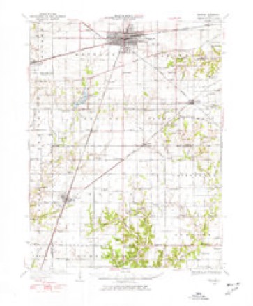
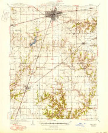
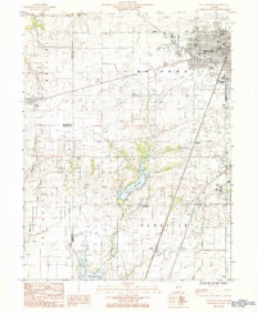
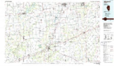
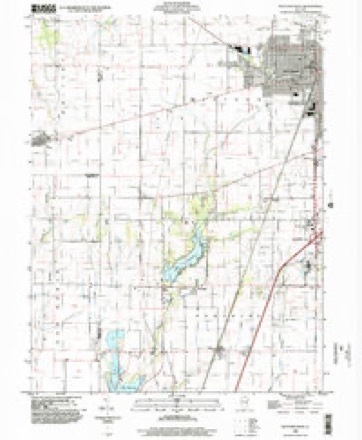
14 topographic sheets cover this place, the earliest surveyed in 1934 and the latest in 1998. It stands in Paradise Township. It lies in ZIP code area 61938. The Survey maps it on the Mattoon West quadrangle.
Topographic sheets covering this place
7 surveys from 14 printed sheetsMatched by testing this settlement's coordinate against the published boundary of every sheet in the United States Geological Survey's historical collection. Each opens the scanned sheet at the Survey.
- 1934 USGS Mattoon quadrangle1:62500, 2 printings
- 1937 USGS Mattoon quadrangle1:62500, 3 printings
- 1958 USGS Decatur quadrangle1:250000, 3 printings
- 1961 USGS Decatur quadrangle1:250000, 2 printings
- 1984 USGS Mattoon West quadrangle1:24000
- 1986 USGS Effingham quadrangle1:100000, 2 printings
- 1998 USGS Mattoon West quadrangle1:24000


In the county-history sources
11,660 words on this townshipThe History of Coles County, Illinois ... Map of Coles County; History of Illinois ... History of Northwest ... Constitution of the United States, Miscellaneous Matters, &c., &c, published 1879 names this settlement in its chapter on Paradise Township. These are the passages that mention it, exactly as the scans read.
This township is situated in the extreme southwest corner of the county, and is bounded on the north by Mattoon Township ; east, by Pleasant Grove Township ; south, by Cumberland County, and west, by Shelby County. In its primitive state, before the timber and underbrush were cleared away, for the earliest-made farms, three-fourths of iis surface were woodland to one-fourth prairie. Its surface is for the most part rolling, and easily admits of drainage. The Little Wabash, a stream rising a little south of the center of Mattoon Township, flows in a southern direction through the western half of the township, and, with its tributaries, effectually drains the central and western portions. Dry Grove Run, a small stream rising in the northeast corner of the township, and flowing south through a belt of timber of the same name, affords drainage for the eastern half. The extreme eastern and western portions are prairie, while the timber is found lining either side of the Little Wabash. There is, however, a small belt of timber in the eastern portion called Dry Grove, the average width of which does not exceed one-half mile, and its length not more than two miles and a half. How it acquired its name, Dry Grove, we have not been able to determine. The soil, for the most part, is of a deep-black cast, very rich, and prodvices well. The soil of the woodland, in the eastern portion, reduced to a state of cultivation, exceeds in richness and fertility even the adjacent prairie. Like the surrounding townships, it is well adapted to the growth of the various cereals, but corn is the staple product. The western portion produces fine wheat, and, for the past few years, quite an amount has been sown. Taking it one season with another, those possessing woodland farms are much surer of a good crop, than those upon the prairie, as the soil is generally more rolling, and of such a character as to withstand either a wet or dry season better. Much valuable timber has been removed from her groves, since the days of the early pioneers, and still there is much remaining. In different parts may be seen large tracts of woodland, from which the underbrush has been removed, well set in blue grass, which yields excellent pasturage. The Chicago Branch of the Illinois Central Railroad enters the township at the northeast corner of Section 3 and passing through in a general southwestern direction, leaves it at or near the center of the southern boundary of Section 21. The Grayville & Mattoon Railroad just touches the northeast corner of the township. Paradise contains no cities or towns, and but two small villages. Paradise and Etna, neither of which is incorporated. Of these, we will speak more specifically at the close of the township history. To offer, as a complete history of this section of the county, only what may be truthfully written of the township since reduced to her present limits, would be an act of great injustice to the descendants of her pioneers ; and yet, the early history and settlement are so intimately blended with that of the surrounding townships that to separate them with any degree of accuracy will be a task attended with no little labor and diflficulty. Soon after the formation of Coles County, the territory comprising it was divided into three voting precincts, Charleston, Woodbury and Paradise. Paradise, at that time, included in addition to its present limitsall the territory now embraced in Mattoon and Pleasant Grove Townships, a portion of North Okaw and a large scope of country in the present limits of Cumberland County. Thus we find that the name Paradise, as applied to a portion of the county, was almost cotemporary with the formation of the county itself. At a later date, we find it became necessary, in order to retain it, to submit it to a vote of the citizens. In the division of the county into townships. Paradise was made a full Congressional township ; but a few years later, when Cumberland County was erected, she was shorn of her two southern tiers of sections ; this gave her her present limits, four miles north and south by six east and west. When the question of naming the township came before the people, two parties appeared in the field. The one, led by H. B. Worley, proposed the name Wabash, while the other, headed by Aaron W. Hart, adhered to the ancient landmark, and voted for Paradise. Hart and his friends carried the day. It is said by some, that as the village of Etna was just then starting up, and Worley was largely interested in her welfare, he designed, if the name Wabash carried, to go before the Commissioners, and, through his personal influence, secure a change from Wabash to Etna. A decided majority in favor of Paradise put a quietus on all further proceedings in the matter of name.
Passage source: The History of Coles County, Illinois ... Map of Coles County; History of Illinois ... History of Northwest ... Constitution of the United States, Miscellaneous Matters, &c., &c, published 1879.
The spiritual and intellectual culture of themselves and their children was by no means neglected. Many of them were men of deep religious convictions, and not a few were acceptable proclaimers of the Gospel of Peace. Among the early preachers may be mentioned the names of Revs. James Graham, George M. Hanson, Daniel Bryant, Miles H. Hart, Hiram Tremble, Dr. John Apperson, Clemence Goar and others, who are worthy of being here recorded, but whose names have passed from memory. Meetings were held in an early day in the cabins of Miles Hart, Dr. Apperson, John Sawyer and others, and when they met, the men clad in their homespun and the mothers and daughters in their linsey-woolsey, it was not for the young sisters to discuss and criticise the latest fashions, or for the boys to ogle the o^irls, but to engage in solemn devotion to the Giver of all good. Simplicity of manners was characterized by simplicity of dress, which, though plain, was always neat. After a week of hard, laborious toil, it was esteemed a blessed privilege to be permitted to ride five or six miles, on horse-back, to engage in hymning songs of praise to God and to hear the sweet words of Gospel truth, as they were read and expounded by some revered brother. These were not the days of cushioned pews, in which the audience lazily dreamt the hour away, but, gathered beneath the roof of the humble cabin, seated on backless benches, of rude construction, men, women and children gave earnest attention to the preached Word. The impressions made by those early and earnest workmen in the vineyard of the Lord were lasting, and their influence for good has been felt through the ongoing years. Most of the early ministers in this section were members of the Methodist Episcopal Church, and the many flourishing societies of that denomination to-day throughout this section of country bear testimony to their early labors. The first church built in Paradise was in Dry Grove; the exact date of building cannot be ascertained. In 1860, the present church, a neat, substantial frame, was erected. Two others are in the township, one in Paradise village and the other in Etna.
Passage source: The History of Coles County, Illinois ... Map of Coles County; History of Illinois ... History of Northwest ... Constitution of the United States, Miscellaneous Matters, &c., &c, published 1879.
The schoolmaster put in his appearance in an early day, and, as schools were supported by individual subscriptions, the first schools were taught in the most populous neighborhoods. The first school in the township was kept by a Mr. Drake, and some of his pupils, still living, state that he was by no means a successful teacher. The second school was kept by a Mr. Kellar, near the residence of Miles H. Hart. To those already given may be added the names of William Moifett, David Campbell and Ebenezer Alexander. To-day, the township is provided with comfortable schoolhouses in each district, and the children enjoy the benefits accruing from our well-regulated school system.
Passage source: The History of Coles County, Illinois ... Map of Coles County; History of Illinois ... History of Northwest ... Constitution of the United States, Miscellaneous Matters, &c., &c, published 1879.
Machine-read from a century-old scan, so expect the errors a machine makes: misspelled names, dropped words, stray characters.
Read the whole chapter on Paradise Township - it names this place 18 more 18 times.
Fires near this place
8 since 2010Regional context, not property-specific evidence. The federal wildfire occurrence database lists 8 fires within 5 miles of Etna between 2010 and 2018, burning about 3 acres in total. None started naturally. None was recorded as arson. Distance is straight-line from the map coordinates, so a fire counted here may appear on a neighbouring settlement's page as well.
| Reported cause | Fires |
|---|---|
| Missing data/not specified/undetermined | 8 |
The most recent of them, most recent first, with the day each was reported and the service that recorded it.
| Date | Cause | Size | Reported by | Name on the report |
|---|---|---|---|---|
| 9 May 2010 | Missing data/not specified/undetermined | under an acre | Illinois Division of Forestry Resources | 1027 |
| 25 May 2010 | Missing data/not specified/undetermined | under an acre | Illinois Division of Forestry Resources | 10035 |
| 21 April 2010 | Missing data/not specified/undetermined | under an acre | Illinois Division of Forestry Resources | 1024 |
| 24 March 2011 | Missing data/not specified/undetermined | under an acre | Illinois Division of Forestry Resources | 1114 |
| 22 March 2011 | Missing data/not specified/undetermined | under an acre | Illinois Division of Forestry Resources | 1113 |
| 26 December 2018 | Missing data/not specified/undetermined | under an acre | Illinois Division of Forestry Resources | 2018-2931 |
| 21 October 2010 | Missing data/not specified/undetermined | 2.0 acres | Illinois Division of Forestry Resources | 1089 |
| 16 October 2010 | Missing data/not specified/undetermined | under an acre | Illinois Division of Forestry Resources | 1086 |
Settlements close enough to share some of these fires:
Mines and quarries near this place
2 within 5 milesRegional context, not property-specific evidence. The federal mineral resources record lists 2 workings within 5 miles of Etna: 1 past producer, 1 producer. 1 still produces. What was taken out: Sand and Gravel, Construction. Distance is straight-line from the map coordinates, so a quarry counted here may appear on a neighbouring settlement's page as well.
| Where | Site | Commodity | Status | Recorded |
|---|---|---|---|---|
| Diepholz Dredge | Sand and Gravel, Construction | Past Producer | ||
| Matton Sand & Gravel | Sand and Gravel, Construction | Producer |
Storms near this place
8 since 1999Regional context, not property-specific evidence. The National Weather Service names Etna in 8 storm reports between 1999 and 2023: 4 hail, 3 thunderstorm wind, 1 flash flood. No death or injury is recorded in these reports. Each account below is quoted exactly as the forecast office filed it, from the NOAA Storm Events Database, and each date opens the federal record of that event.
| When | Event | Place named | Harm | What the report says |
|---|---|---|---|---|
| May 2009 | Thunderstorm Wind | Etna | $45,000 | A mobile home was blown off its foundation on the west side of Lake Mattoon. Another mobile home was damaged on the east side of Lake Mattoon and several trees were blown down in the area. |
| August 2009 | Thunderstorm Wind | Etna | $10,000 | High winds tore 1/4 of the tin off the roof of a barn. |
| August 2023 | Thunderstorm Wind | Etna | - | A large tree was snapped. |
| June 2013 | Flash Flood | Etna | - | Slow moving thunderstorms produced 2 to 4 inches of rain in a two hour period during the late afternoon in extreme southwest Coles County. Most rural roads between U.S. Highway 45 and the Shelby County line were impassable. The flooding subsided by late evening. |
| March 2021 | Hail | Etna | - | no account filed |
| March 2012 | Hail | Etna | - | no account filed |
| April 2011 | Hail | Etna | - | no account filed |
| June 1999 | Hail | Etna | - | no account filed |
Nearest settlements
The eight closest, with where each one stands in the county. Distances are straight-line, computed from the Geographic Names Information System coordinates.
| Map | Place | Distance | Sheets |
|---|---|---|---|
| Paradise | 1.7 miles | 14 | |
| Magnet | 3.6 miles | 14 | |
| Wabash Point | 3.6 miles | 14 | |
| Trilla | 3.8 miles | 14 | |
| Jones | 6.2 miles | 14 | |
| Lane Acres | 6.4 miles | 14 | |
| Newby | 6.5 miles | 14 | |
| Rolling Green | 6.8 miles | 14 |
Elsewhere
Matched on this settlement's Geographic Names Information System number rather than its name, so it cannot be a different place of the same name in another state.
| Wikipedia article on Etna | An encyclopaedic summary. Its text is share-alike, so it is linked here rather than copied. |
| Wikidata item Q5404664 | The structured record the population and elevation above come from. Public domain (CC0). |
Provenance
This settlement is recorded in the Geographic Names Information System as feature 408070. The sheet list is computed by point-in-boundary test against the United States Geological Survey's historical topographic inventory. Both are works of the United States government and carry no copyright under 17 U.S.C. 105.
Wildfire. Short, Karen C. 2022. Spatial wildfire occurrence data for the United States, 1992-2020 [FPA_FOD_20221014]. 6th Edition. Fort Collins, CO: Forest Service Research Data Archive. https://doi.org/10.2737/RDS-2013-0009.6 Collected with United States Government funding and usable without additional permissions or fees.
Mines and quarries. USGS Mineral Resources Data System (MRDS) https://mrdata.usgs.gov/mrds/ A work of the United States government, no copyright under 17 U.S.C. 105.
Storms. NOAA National Centers for Environmental Information, Storm Events Database https://www.ncei.noaa.gov/stormevents/ A work of the United States government, no copyright under 17 U.S.C. 105. Narratives are quoted verbatim from the National Weather Service report and are not edited or summarised.