 Block
Hamilton, Illinois
16 topographic sheets cover this place, the earliest surveyed in 1936 and the latest in 1990. It stands in Montebello Township. It lies in ZIP code area 62341. It stands on Railroad Creek. The Survey maps it on the Hamilton quadrangle. 2,753 people lived here at the 2020 count. It stands 645 feet above sea level.
On record in Hamilton
Buildings and businesses the archive holds for this place. Each opens its own page, with the source record it came from.
On the National Register 1 record
 Cyrus Felt Houselisted 1980
Population over time
2 figuresHamilton fell from 2,951 to 2,753 between 2010 and 2020. These are the recorded population figures Wikidata holds for this place, reached through the Geographic Names Information System number this page is keyed on rather than by name, so they belong to this place and not to another of the same name. Most are census counts, but not all are: an early figure may be a founding or settlement estimate, and an estimate published within five years of a census is left out. The change column is computed, and is left blank where more than 20 years separate a figure from the one before it, because a gap that long is not a change between two counts.
| Year | People | Change |
|---|---|---|
| 2010 | 2,951 | |
| 2020 | 2,753 | -198 (-7%) |
Topographic sheets covering this place
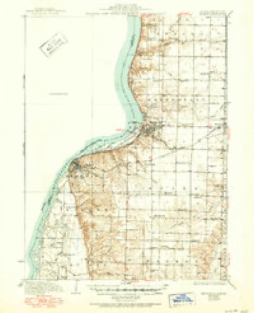
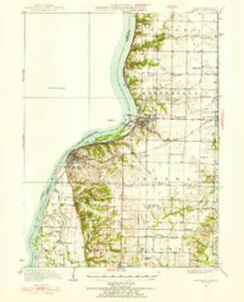
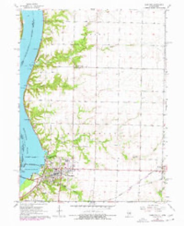
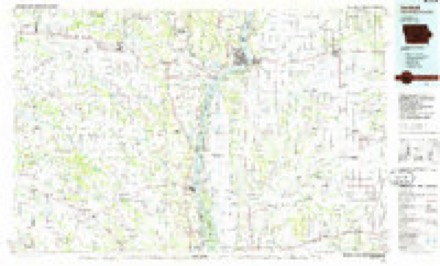
8 surveys from 16 printed sheetsMatched by testing this settlement's coordinate against the published boundary of every sheet in the United States Geological Survey's historical collection. Each opens the scanned sheet at the Survey.
- 1936 USGS Keokuk quadrangle1:62500, 3 printings
- 1950 USGS Keokuk quadrangle1:62500
- 1958 USGS Burlington quadrangle1:250000, 4 printings
- 1961 USGS Burlington quadrangle1:250000
- 1963 USGS Burlington quadrangle1:250000
- 1964 USGS Hamilton quadrangle1:24000, 2 printings
- 1986 USGS Keokuk quadrangle1:100000, 2 printings
- 1990 USGS Burlington quadrangle1:250000, 2 printings




In the county-history sources
1,494 words on this townshipHistory of Hancock County, Illinois, Together with an Outline History of the State, and a Digest of State Laws, published 1880 names this settlement in its chapter on Montebello Township. These are the passages that mention it, exactly as the scans read.
This township, numbered 5 - 8, was probably named for Monte Belle, in France (now the practice to write it Montebello). Who had the honor of naming it, we do not know. There were Frenchmen about the fort and along the river when the village on the rapids received this cognomen, but none of its proprietors were French. It was laid out in 1832 by Luther Whitney and William Vance, on the southwest of sec. 18, the place now owned by C. F. Darnell, two miles above the present site of Hamilton.
Passage source: History of Hancock County, Illinois, Together with an Outline History of the State, and a Digest of State Laws, published 1880.
Hamilton is now the only town in the township, including Oakwood, a separate survey, but united by act of incorporation. It lies at the foot of the rapids, opposite Keokuk, Iowa, between which, across the Mississippi river, lies the great iron railroad and wagon bridge. It was laid out in 1852, by Bryant Bartlett, Wm. R. Hamilton, Powers Ritchej', Henry R. Dickinson, Sanford Faught, Henry Davis and George Edmunds, Jr. The late Artois Hamilton, of Carthage, was an active proprietor, but we find the record uses, the name of his s^A William R., who was then a young man. Samuel Gordon, resfding at the place, was also interested, having furnished a portidn of the land, but his name does not appear of record. In tlie Kumihon DoUar Monthly of June, 1873, is a notice of the origin of this town, which we reproduce in part in this place:
Passage source: History of Hancock County, Illinois, Together with an Outline History of the State, and a Digest of State Laws, published 1880.
Besides originating the city of Hamilton, Messrs. Bartlett and Dickinson, b}' their untiring zeal and energy, in conjunction with Henry W. Sample, Esq., of Keokuk, and others, succeeded in establishing a steam ferry between the two points. At that time the
Passage source: History of Hancock County, Illinois, Together with an Outline History of the State, and a Digest of State Laws, published 1880.
Machine-read from a century-old scan, so expect the errors a machine makes: misspelled names, dropped words, stray characters.
Read the whole chapter on Montebello Township - it names this place 4 more 4 times.
Mines and quarries near this place
2 within 5 milesRegional context, not property-specific evidence. The federal mineral resources record lists 2 workings within 5 miles of Hamilton: 1 producer, 1 past producer. 1 still produces. What was taken out: Stone, Crushed/Broken. Distance is straight-line from the map coordinates, so a quarry counted here may appear on a neighbouring settlement's page as well.
| Where | Site | Commodity | Status | Recorded |
|---|---|---|---|---|
| Gray Quarry | Stone, Crushed/Broken | Producer | ||
| Mc Manus and Tucker Quarry | Stone, Crushed/Broken | Past Producer |
Storms near this place
53 since 1993Regional context, not property-specific evidence. The National Weather Service names Hamilton in 53 storm reports between 1993 and 2026: 27 thunderstorm wind, 13 hail, 7 flash flood, 5 flood. The reports record 1 injury. Each account below is quoted exactly as the forecast office filed it, from the NOAA Storm Events Database, and each date opens the federal record of that event.
| When | Event | Place named | Harm | What the report says |
|---|---|---|---|---|
| July 2003 | Thunderstorm Wind | Hamilton | 1 hurt, $60,000 | Numerous trees down |
| June 2011 | Thunderstorm Wind | Hamilton | $250,000 | Wind gusts estimated to be 60 to 80 mph downed several trees and large limbs across much of Hamilton, IL around 130 am CDT June 27. A home on North 19th Street sustained roof damage and a power pole was blown down in the front yard. |
| July 2003 | Flash Flood | Hamilton | $100,000 | Water over IL 96 between Hamilton & Nauvoo |
| July 2003 | Thunderstorm Wind | Hamilton | $50,000 | Power lines down |
| June 2011 | Flash Flood | Hamilton | $25,000 | Heavy rains during the predawn hours of June 5 resulted in a portion of Windy Hills Rd just southwest of Hamilton, IL washing out. |
| August 2010 | Thunderstorm Wind | Hamilton | $10,000 | Wind gusts estimated to be 65 mph blew down some large tree limbs and power lines in Hamilton, IL around 540 pm CDT August 20. |
| May 2004 | Thunderstorm Wind | Hamilton | $10,000 | Continuous path of straight line winds from the Mississippi River north of Hamilton to between Ferris and Adrian were 30 power poles were snapped off near the ground. |
| November 2005 | Hail | Hamilton | $1,500 | no account filed |
| May 2000 | Thunderstorm Wind | Hamilton | $1,000 | no account filed |
| August 1993 | Thunderstorm Wind | Hamilton | $500 | Large tree limbs were blown down 2 miles northeast of town. |
| March 2025 | Thunderstorm Wind | Hamilton | - | A tree was blown down. |
| June 2023 | Thunderstorm Wind | Hamilton | - | Very poor visibility. |
| June 2023 | Thunderstorm Wind | Hamilton | - | Tree snapped off, with several large branches blown down. |
| June 2019 | Flash Flood | Hamilton | - | Very heavy rain created significant street flooding, so high that spotter has never seen this before. Water from the street flowed through the spotter's garage. |
| June 2019 | Thunderstorm Wind | Hamilton | - | A report of a tree blown down onto a house near between 17th street and 18th street in Hamilton was reported through social media. |
| June 2019 | Thunderstorm Wind | Hamilton | - | A spotter reported 1 to 2 inch diameter tree limbs blown down in addition to the flash flooding. |
| June 2019 | Hail | Hamilton | - | The public reported a few quarter sized hailstones. |
| June 2019 | Thunderstorm Wind | Hamilton | - | This reported was relayed by the NWS in Lincoln (ILX) Illinois. A public report of pine trees snapped off a few tree limbs of unknown size were also down. The time of the event was estimated using radar. |
| June 2019 | Thunderstorm Wind | Hamilton | - | A trained spotter estimated thunderstorms wind gusts around 60 MPH. |
| June 2019 | Thunderstorm Wind | Hamilton | - | A public report estimated thunderstorm wind gusts around 60 MPH. |
| July 2019 | Thunderstorm Wind | Hamilton | - | A trained spotter reported several two inch tree limbs down. |
| May 2019 | Flood | Hamilton | - | The Mississippi River at Keokuk Lock and Dam 19 began the month above its major flood stage of 19 feet. The river stage at the beginning of the month was 21.4 feet. The river would rise to a crest of 23.5 feet on May 2nd and another higher crest later in the month, in a later storm data entry. The river fell below major flood stage the morning of May 11th. |
| May 2019 | Flash Flood | Hamilton | - | Water was covering roadways and ditches throughout the southern part of Hancock County, in addition, water was covering a portion of the 136 bridge due to poor drainage from sandbagging efforts near the Mississippi River. |
| April 2019 | Flood | Hamilton | - | The Mississippi River at Keokuk Lock and Dam 19 rose back above its major flood stage of 19 feet during the morning hours of April 30th and continued to rise through the end of the month. |
| July 2017 | Flash Flood | Hamilton | - | Local law enforcement reported 6 inches of water blocking the northbound lane of traffic on Highway 96. Traffic was being diverted into the southbound lane. |
| April 2016 | Hail | Hamilton | - | Law Enforcement reported hail that started out as pea sized around 920 PM and increase in size to quarters. |
| March 2016 | Hail | Hamilton | - | This report was received via twitter. |
| July 2014 | Flood | Hamilton | - | Heavy rainfall that fell across the Upper Midwest during the last two weeks of June brought the Mississippi River at Keokuk above the major flood stage of 19 feet around 200 AM on July 3 and fell below major flood stage around 600 AM on July 14. The river crested at 23.4 feet around 1100 PM on July 7. |
| June 2014 | Thunderstorm Wind | Hamilton | - | Law enforcement reported trees and power lines down. |
| June 2013 | Flood | Hamilton | - | Heavy rain across the region late in the month of May led to the Mississippi River being above the major flood stage of 18 feet to begin the month. The river fell below major flood stage by mid morning on the 1st and then rose back above it shortly after midnight on the 4th. The river remained above major flood stage until late in the day on the 9th. |
| June 2012 | Thunderstorm Wind | Hamilton | - | Wind gusts estimated to be 75 mph blew down several trees and six power poles were broken with power lines down in the Montebello Township area northeast of Hamilton, IL at 1007 am CDT June 24. |
| June 2012 | Thunderstorm Wind | Hamilton | - | Wind gusts estimated to be 75 mph blew down a large tree about 3 miles northeast of Hamilton, IL at 1008 am CDT June 24. |
| April 2010 | Hail | Hamilton | - | Quarter sized hail fell near Hamilton, IL at 608 pm April 4. The hail covered the ground. |
| April 2010 | Thunderstorm Wind | Hamilton | - | Wind gusts estimated to be 60 mph knocked down some branches near Hamilton, IL at 608 pm April 4. |
| July 2010 | Thunderstorm Wind | Hamilton | - | Wind gusts estimated to be 65 mph blew a tree down across Highway 96 about 2 miles north of Hamilton, IL around 700 am CDT July 18. |
| August 2010 | Flash Flood | Hamilton | - | Heavy rains resulted in some flash flooding in the Hamilton, IL area during the late afternoon and evening of August 13. |
| October 2010 | Hail | Hamilton | - | Trained spotter reported pea to nickel size hail just east of Hamilton. |
| June 2010 | Thunderstorm Wind | Hamilton | - | Wind gusts estimated to be 65 mph blew a tree down onto the highway in Hamilton, IL around 630 pm June 23. |
| July 2010 | Thunderstorm Wind | Hamilton | - | Wind gusts estimated to be 65 mph blew down a couple of trees in Hamilton, IL at 134 pm CDT July 24. |
| August 2009 | Thunderstorm Wind | Hamilton | - | Wind gusts estimated to be 60 mph were observed about 2 miles north northeast of Hamilton, IL around 700 am August 4. |
| April 2008 | Flash Flood | Hamilton | - | A trained spotter reported creeks and rivers bankfull with some smaller streams out of their banks. Some farm fields were also flooded. |
| June 2008 | Thunderstorm Wind | Hamilton | - | Wind gusts estimated to be 65 to 70 mph were observed just north of Hamilton, IL around 1:35 pm June 15. |
| June 2008 | Hail | Hamilton | - | Nickel to quarter-sized hail fell just north of Hamilton, IL at 1:35 pm June 15. |
| April 2006 | Funnel Cloud | Hamilton | - | Funnel cloud north of Hamilton |
| July 2001 | Thunderstorm Wind | Hamilton | - | Power lines down. Reported by law enforcement. |
| April 2026 | Thunderstorm Wind | Hamilton | - | no account filed |
| June 2019 | Hail | Hamilton | - | no account filed |
| September 2019 | Hail | Hamilton | - | no account filed |
| May 2013 | Hail | Hamilton | - | no account filed |
| April 1999 | Flood | Hamilton | - | no account filed |
| June 1998 | Hail | Hamilton | - | no account filed |
| April 1996 | Hail | Hamilton | - | no account filed |
| April 1995 | Hail | Hamilton | - | no account filed |
Nearest settlements
The eight closest, with where each one stands in the county. Distances are straight-line, computed from the Geographic Names Information System coordinates.
| Map | Place | Distance | Sheets |
|---|---|---|---|
| Elvaston | 4.7 miles | 14 | |
| Elderville | 5.1 miles | 16 | |
| Warsaw | 5.7 miles | 17 | |
| Sonora (historical) | 6.8 miles | 16 | |
| Sutter | 8.1 miles | 16 | |
| McCall | 8.5 miles | 14 | |
| Basco | 8.8 miles | 14 | |
| Ferris | 10.2 miles | 14 |
Elsewhere
Matched on this settlement's Geographic Names Information System number rather than its name, so it cannot be a different place of the same name in another state.
| Wikipedia article on Hamilton | An encyclopaedic summary. Its text is share-alike, so it is linked here rather than copied. |
| Wikidata item Q544705 | The structured record the population and elevation above come from. Public domain (CC0). |
Provenance
This settlement is recorded in the Geographic Names Information System as feature 409689. The sheet list is computed by point-in-boundary test against the United States Geological Survey's historical topographic inventory. Both are works of the United States government and carry no copyright under 17 U.S.C. 105.
Mines and quarries. USGS Mineral Resources Data System (MRDS) https://mrdata.usgs.gov/mrds/ A work of the United States government, no copyright under 17 U.S.C. 105.
Storms. NOAA National Centers for Environmental Information, Storm Events Database https://www.ncei.noaa.gov/stormevents/ A work of the United States government, no copyright under 17 U.S.C. 105. Narratives are quoted verbatim from the National Weather Service report and are not edited or summarised.