 Block
Warsaw, Illinois
17 topographic sheets cover this place, the earliest surveyed in 1936 and the latest in 1990. It stands in Warsaw Township. It lies in ZIP code area 62379. It lies near Mud Island. The Survey maps it on the Warsaw quadrangle. 1,510 people lived here at the 2020 count. It stands 659 feet above sea level.
On record in Warsaw
Buildings and businesses the archive holds for this place. Each opens its own page, with the source record it came from.
On the National Register 1 record
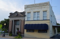 Warsaw Historic Districtlisted 1977
Population over time
2 figuresWarsaw fell from 1,607 to 1,510 between 2010 and 2020. These are the recorded population figures Wikidata holds for this place, reached through the Geographic Names Information System number this page is keyed on rather than by name, so they belong to this place and not to another of the same name. Most are census counts, but not all are: an early figure may be a founding or settlement estimate, and an estimate published within five years of a census is left out. The change column is computed, and is left blank where more than 20 years separate a figure from the one before it, because a gap that long is not a change between two counts.
| Year | People | Change |
|---|---|---|
| 2010 | 1,607 | |
| 2020 | 1,510 | -97 (-6%) |
Topographic sheets covering this place
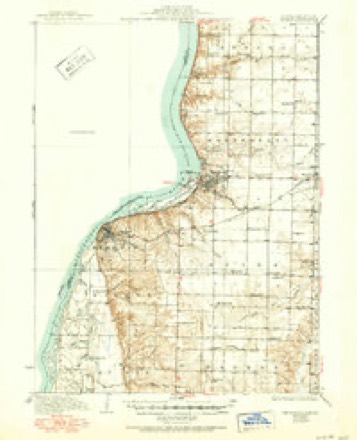
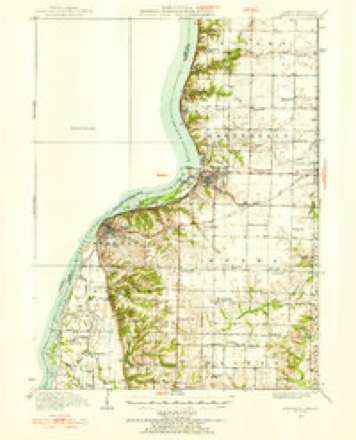
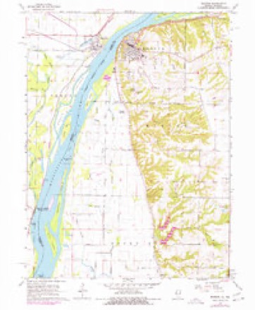
8 surveys from 17 printed sheetsMatched by testing this settlement's coordinate against the published boundary of every sheet in the United States Geological Survey's historical collection. Each opens the scanned sheet at the Survey.
- 1936 USGS Keokuk quadrangle1:62500, 3 printings
- 1950 USGS Keokuk quadrangle1:62500
- 1958 USGS Burlington quadrangle1:250000, 4 printings
- 1961 USGS Burlington quadrangle1:250000
- 1963 USGS Burlington quadrangle1:250000
- 1964 USGS Warsaw quadrangle1:24000, 3 printings
- 1986 USGS Keokuk quadrangle1:100000, 2 printings
- 1990 USGS Burlington quadrangle1:250000, 2 printings




In the county-history sources
8,861 words on this townshipHistory of Hancock County, Illinois, Together with an Outline History of the State, and a Digest of State Laws, published 1880 names this settlement in its chapter on Warsaw Township. These are the passages that mention it, exactly as the scans read.
Cyrus B. Adams, proprietor of the Adams House of Warsaw, is a native of Rochester, New York; was born May 25. 1S22, and is a son of J. D. Adams, who was a native of Vermont. He was reared and educated in JSTew York; came to Warsaw in 1858, and brought tlie first locomotive on the T., P. &. W. R. R. to Warsaw. He was master meciianic and assistant superintendent of the raih'oad until 1862, when he entered the navy; was 1st Asst. Engineer of the Mississippi squadron, being 3 years in the service, which closed in 1865. Soon afterward he opened the Adams House, and is still proprietor, and keeps a first-class hotel. He was married Dec. 12, 1843, to Catharine Lanard, of Canada. On his father's side he is of Scotch ancestry. His father was in the war of 1812, and participated in the battle of Lake Champlain. He was Ensign in the navy. His grandfather was a soldier in the Revolutionary war, participating in the first battle of the Revolution. On his mother's side he is of French ancestry. Her uncle was a soldier in the Revolutionary war; also was in the frigate Boston; was ranked as Captain in the army. The Master was taken prisoner and confined in Dartmere prison in London, about 8 months.
Passage source: History of Hancock County, Illinois, Together with an Outline History of the State, and a Digest of State Laws, published 1880.
C. Alhers is a native of Hanover, German^', and was born in 1817. He emigrated to America in 1836, and to Warsaw in 1847. He here became a prominent merchant, and in 1856 erected a large flouring mill at a cost of $30,000. This mill is known far and near as the " Grace Mills," and stands on the foundation of the Water street mill that was erected in 1854, and was burned in 1855, during the great conflagration that occurred in Warsaw at that time. C. Albers & Co. manufacture the best of flour, and have entirely a merchant trade. They use Thropp's patent middlings purifier, and Becker's brusher. There are 6 stands of burrs, which are driven by an 80 horse-power engine. The present capacity of the mill is 250 barrels in 24 hours.
Passage source: History of Hancock County, Illinois, Together with an Outline History of the State, and a Digest of State Laws, published 1880.
Mr. Albers was married in Cincinnati, Ohio, March 5, 1839, to Miss Rebecca Knoop, by whom he had 10 children; of these, 7 are living; viz., Henry, a partner of his father; Sophia (now Mrs. Vanmarter. of Florence, Italy); Anna (now Mrs. Kev. J. G. Kessler, of Warrington, Mo.); Rebecca (now Mrs. William Zuppann, of Warsaw, 111.); Charles, Wm. Edward and Homer.
Passage source: History of Hancock County, Illinois, Together with an Outline History of the State, and a Digest of State Laws, published 1880.
Machine-read from a century-old scan, so expect the errors a machine makes: misspelled names, dropped words, stray characters.
Read the whole chapter on Warsaw Township - it names this place 42 more 42 times.
Fires near this place
4 since 1996Regional context, not property-specific evidence. The federal wildfire occurrence database lists 4 fires within 5 miles of Warsaw between 1996 and 2014, burning about 77 acres in total. None started naturally. None was recorded as arson. Distance is straight-line from the map coordinates, so a fire counted here may appear on a neighbouring settlement's page as well.
| Reported cause | Fires |
|---|---|
| Debris and open burning | 3 |
| Missing data/not specified/undetermined | 1 |
The most recent of them, most recent first, with the day each was reported and the service that recorded it.
| Date | Cause | Size | Reported by | Name on the report |
|---|---|---|---|---|
| 2 June 1997 | Debris and open burning | 1.0 acres | Missouri Department of Conservation | not named |
| 8 April 2014 | Debris and open burning | 50 acres | Iowa Department of Natural Resources | not named |
| 17 April 1997 | Debris and open burning | 1.0 acres | Missouri Department of Conservation | not named |
| 11 April 1996 | Missing data/not specified/undetermined | 25 acres | Great Rivers National Wildlife Refuge | GREG LANDI |
Settlements close enough to share some of these fires:
Mines and quarries near this place
3 within 5 milesRegional context, not property-specific evidence. The federal mineral resources record lists 3 workings within 5 miles of Warsaw: 2 past producers, 1 producer. 1 still produces. What was taken out: Stone, Crushed/Broken, Sand and Gravel, Construction. Distance is straight-line from the map coordinates, so a quarry counted here may appear on a neighbouring settlement's page as well.
| Where | Site | Commodity | Status | Recorded |
|---|---|---|---|---|
| Unknown | Sand and Gravel, Construction | Past Producer | ||
| Gray Quarry | Stone, Crushed/Broken | Producer | ||
| Mc Manus and Tucker Quarry | Stone, Crushed/Broken | Past Producer |
Storms near this place
30 since 1996Regional context, not property-specific evidence. The National Weather Service names Warsaw in 30 storm reports between 1996 and 2020: 12 thunderstorm wind, 7 hail, 5 tornado, 3 flash flood. No death or injury is recorded in these reports. Each account below is quoted exactly as the forecast office filed it, from the NOAA Storm Events Database, and each date opens the federal record of that event.
| When | Event | Place named | Harm | What the report says |
|---|---|---|---|---|
| April 1999 | Tornado (F3) | Warsaw | $15,000,000 | no account filed |
| April 1997 | Tornado (F0) | Warsaw | $400,000 | no account filed |
| April 1997 | Tornado (F1) | Warsaw | $400,000 | no account filed |
| April 1997 | Tornado (F0) | Warsaw | $400,000 | no account filed |
| June 2011 | Flash Flood | Warsaw | $250,000 | Heavy rains resulted in some flash flooding in parts of Hancock County IL during the morning of June 14. New Warsaw Rd in Warsaw, IL to Route 400 E was closed due to the flood waters. Several mud slides occurred in the area. |
| July 2003 | Thunderstorm Wind | Warsaw | $50,000 | Trees & power lines down |
| August 2010 | Thunderstorm Wind | Warsaw | $10,000 | Wind gusts estimated to be 65 mph blew down some large tree limbs and power lines in Warsaw, IL around 520 pm CDT August 20. |
| June 2011 | Thunderstorm Wind | Warsaw | $5,000 | Wind gusts estimated to be 65 mph blew down some tree limbs and power lines in Warsaw, IL at 138 am CDT June 27. |
| June 2007 | Tornado (EF0) | Warsaw | $5,000 | A tornado touched down briefly around 8:45 pm at the farm residence located at 875 N County Road 300E just southwest of Warsaw, IL. The roof of a cattle barn, a corn storage silo, irrigation equipment, some trees, and the roof, siding and a window of the residence were all damaged. |
| July 2003 | Heavy Rain | Warsaw | $5,000 | Water on roads |
| November 2020 | Thunderstorm Wind | Warsaw | - | Reports of tree limbs and power lines down throughout the county. Time estimated using radar. |
| June 2019 | Flood | Warsaw | - | The Mississippi River at Gregory Landing and Keokuk began June above their major flood stages of 25.0 and 19.0 feet respectively. The river at Gregory Landing fell below major flood stage around 5 AM on June 1st and around 5 AM on June 13th at Keokuk. The river crested at 26.97 feet on June 2 at Gregory Landing which is preliminarily the 3rd highest crest on record. The Mississippi River at Keokuk crested on May 30th and was falling through the month of June but its highest level during the month was 25.3 feet early on June 1st. |
| July 2018 | Hail | Warsaw | - | Time of the event was estimated using radar. |
| July 2018 | Thunderstorm Wind | Warsaw | - | Broadcast media relayed a report of numerous trees down in town. |
| October 2017 | Thunderstorm Wind | Warsaw | - | Trees were reported blown down, and damage was reported destroyed by thunderstorms wind. |
| May 2014 | Thunderstorm Wind | Warsaw | - | Wind gusts estimated to be 65 mph blew down some 8 to 9 inch diameter tree limbs in Warsaw, IL around 615 pm CDT May 12. |
| May 2013 | Hail | Warsaw | - | The time of this report was estimated based off of radar data. |
| June 2011 | Hail | Warsaw | - | Quarter sized hail fell in Warsaw, IL at 138 am CDT June 27. |
| June 2009 | Flash Flood | Warsaw | - | Heavy rains resulted in some flash flooding during the evening of June 1 across parts of Hancock County Illinois. A bridge on Conable Road about 5 miles north of Hamilton, IL was under flood waters. In addition, the Bentley Blacktop was flooded and impassible just east of Bentley, IL. |
| July 2008 | Thunderstorm Wind | Warsaw | - | Wind gusts estimated to be 70 mph were observed on County Road 12 four miles west of Sutter, IL at 730 pm July 27. |
| August 2001 | Thunderstorm Wind | Warsaw | - | Fire dept reported 60 mph thunderstorm wind gust |
| August 2001 | Thunderstorm Wind | Warsaw | - | Law enforcement reported power lines down |
| August 2001 | Thunderstorm Wind | Warsaw | - | Law enforcement reported additional power lines down |
| February 2000 | Thunderstorm Wind | Warsaw | - | Semi truck overturned by strong wind. |
| July 2000 | Flash Flood | Warsaw | - | Thunderstorms produced heavy rains, which resulted in a mud slide across a county road. |
| March 2016 | Hail | Warsaw | - | no account filed |
| May 2013 | Hail | Warsaw | - | no account filed |
| April 2008 | Flood | Warsaw | - | no account filed |
| April 1996 | Hail | Warsaw | - | no account filed |
| April 1996 | Hail | Warsaw | - | no account filed |
Nearest settlements
The eight closest, with where each one stands in the county. Distances are straight-line, computed from the Geographic Names Information System coordinates.
| Map | Place | Distance | Sheets |
|---|---|---|---|
| Hamilton | 5.7 miles | 16 | |
| Sutter | 7.3 miles | 16 | |
| Mallard | 7.5 miles | 17 | |
| Elderville | 7.7 miles | 16 | |
| Elvaston | 10.1 miles | 14 | |
| Sonora (historical) | 10.2 miles | 16 | |
| Breckenridge | 11.2 miles | 14 | |
| Tioga | 11.2 miles | 14 |
Elsewhere
Matched on this settlement's Geographic Names Information System number rather than its name, so it cannot be a different place of the same name in another state.
| Wikipedia article on Warsaw | An encyclopaedic summary. Its text is share-alike, so it is linked here rather than copied. |
| Wikidata item Q576165 | The structured record the population and elevation above come from. Public domain (CC0). |
Provenance
This settlement is recorded in the Geographic Names Information System as feature 420542. The sheet list is computed by point-in-boundary test against the United States Geological Survey's historical topographic inventory. Both are works of the United States government and carry no copyright under 17 U.S.C. 105.
Wildfire. Short, Karen C. 2022. Spatial wildfire occurrence data for the United States, 1992-2020 [FPA_FOD_20221014]. 6th Edition. Fort Collins, CO: Forest Service Research Data Archive. https://doi.org/10.2737/RDS-2013-0009.6 Collected with United States Government funding and usable without additional permissions or fees.
Mines and quarries. USGS Mineral Resources Data System (MRDS) https://mrdata.usgs.gov/mrds/ A work of the United States government, no copyright under 17 U.S.C. 105.
Storms. NOAA National Centers for Environmental Information, Storm Events Database https://www.ncei.noaa.gov/stormevents/ A work of the United States government, no copyright under 17 U.S.C. 105. Narratives are quoted verbatim from the National Weather Service report and are not edited or summarised.