 Block
Hammond, Illinois
12 topographic sheets cover this place, the earliest surveyed in 1955 and the latest in 1998. It stands in Unity Township. It lies in ZIP code area 61929. The Survey maps it on the Hammond quadrangle. 508 people lived here at the 2020 count. It stands 671 feet above sea level.
Population over time
3 figuresHammond fell from 518 to 508 between 2000 and 2020. These are the recorded population figures Wikidata holds for this place, reached through the Geographic Names Information System number this page is keyed on rather than by name, so they belong to this place and not to another of the same name. Most are census counts, but not all are: an early figure may be a founding or settlement estimate, and an estimate published within five years of a census is left out. The change column is computed, and is left blank where more than 20 years separate a figure from the one before it, because a gap that long is not a change between two counts.
| Year | People | Change |
|---|---|---|
| 2000 | 518 | |
| 2010 | 509 | -9 (-2%) |
| 2020 | 508 | -1 (-0%) |
Topographic sheets covering this place
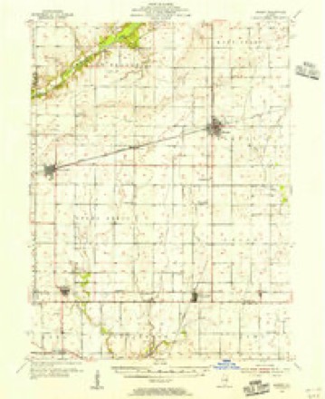
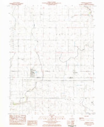
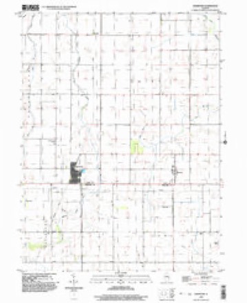
7 surveys from 12 printed sheetsMatched by testing this settlement's coordinate against the published boundary of every sheet in the United States Geological Survey's historical collection. Each opens the scanned sheet at the Survey.
- 1955 USGS Bement quadrangle1:62500, 2 printings
- 1958 USGS Decatur quadrangle1:250000, 3 printings
- 1961 USGS Decatur quadrangle1:250000, 2 printings
- 1975 USGS Bement SE quadrangle1:24000
- 1983 USGS Hammond quadrangle1:24000
- 1985 USGS Decatur quadrangle1:100000, 2 printings
- 1998 USGS Hammond quadrangle1:24000




In the county-history sources
4,025 words on this townshipHistory of Piatt County; Together with a Brief History of Illinois from the Discovery of the Upper Mississippi to the Present Time, published 1883 names this settlement in its chapter on Unity Township. These are the passages that mention it, exactly as the scans read.
Relics ofla former race are found in this township. On the banks of Lake Fork and on Mr. Livengood's place there are some mounds at least three feet in height and two rods in circumference. Trees eight inches in diameter grow on these mounds, human bones have been found in them, and stone axes and arrow-points have been found in their vicinity.
Passage source: History of Piatt County; Together with a Brief History of Illinois from the Discovery of the Upper Mississippi to the Present Time, published 1883.
Two railroads cross Unity township. What was originally known as the Chicago & Paducah road strikes the northern boundary line about two miles from the northwestern corner of the township, runs south nearly five miles, and then bends a little to the southwest, leaving the township about one mile east of the southwest corner of the township. This road has two stations, Voorhies and Hammond, which is at the intersection of this road witli the Indianapolis, Decatur & Springfield railroad. The Indianapolis, Dacatur & Springfield road, which has lately become a part of the Indianapolis, Bloomington & Wabash system of roads, crosses the southern part of the township from east to west, and just half a mile from the southern township line. There are three stations on this road, Hammond, Pierson and Atwood, the latter lying only partly within the limits of Piatt county.
Passage source: History of Piatt County; Together with a Brief History of Illinois from the Discovery of the Upper Mississippi to the Present Time, published 1883.
Earhj settlements. - The Monroes, Shonkwilers, Harshbargers, Moores, and Mr. James Utterback, were the first settlers in Unity township. These people settled on the Lake Fork during the years 1836 and 183T, and part of them still live there. Other old settlers were the Quicks, Grains and Gregorys. Most of these people, or their descendants, have successfully built up homes in this township, and in every way are well-to-do people. From our transient contact with the people in this section of the township we think that they probably retain more of the good old ways of pioneer life than any other people in the county. We found here several of the old substantial two-story hewn log-houses, with their great fireplaces. We also found the second brick house of the county. We observed a great deal of the good old-time neighborly feeling, and we fpund characteristic pioneer hospitality. There was not a great deal of ceremony about this hospitality, but with it all you could not fail to see that you were welcome in every sense of the word. We also found here one of the oldest church organizations of the county.
Passage source: History of Piatt County; Together with a Brief History of Illinois from the Discovery of the Upper Mississippi to the Present Time, published 1883.
Machine-read from a century-old scan, so expect the errors a machine makes: misspelled names, dropped words, stray characters.
Read the whole chapter on Unity Township - it names this place 10 more 10 times.
Storms near this place
9 since 2003Regional context, not property-specific evidence. The National Weather Service names Hammond in 9 storm reports between 2003 and 2025: 6 thunderstorm wind, 2 hail, 1 tornado. No death or injury is recorded in these reports. Each account below is quoted exactly as the forecast office filed it, from the NOAA Storm Events Database, and each date opens the federal record of that event.
| When | Event | Place named | Harm | What the report says |
|---|---|---|---|---|
| April 2020 | Thunderstorm Wind | Hammond | $30,000 | Thunderstorm winds blew a wall out of a pole barn. |
| September 2015 | Thunderstorm Wind | Hammond | $25,000 | Numerous 4-inch diameter tree branches were blown down along US-36 about a half mile west of Hammond. |
| August 2009 | Thunderstorm Wind | Hammond | $17,000 | A large tree was blown down onto an apartment building in Hammond. |
| March 2025 | Thunderstorm Wind | Hammond | - | A barn roof was blown off. This damage occurred about a mile and a half east of the Hammond tornado track. |
| March 2025 | Tornado (EF2) | Hammond | - | This tornado began in far northern Moultrie County, where it produced EF-1 damage to trees, roofs, and a few outbuildings along a three mile path before continuing into Piatt County. It entered into Piatt County at the southwest corner of Hammond and then continued along a curved path for over nine additional miles. Numerous trees were damaged in Hammond, some of which caused damage to buildings as they fell. The peak intensity of EF-2 occurred near the intersection of Don Ryan St. and country road 100, where a farm outbuilding was completely destroyed with debris strewn to the northeast. The tornado continued to produce damage to trees and farm outbuildings as it continued east, and eventually east-northeast, for several more miles. The tornado dissipated northeast of the intersection of county roads North 1400 East Road and State Highway 105, about one mile west of the Champaign-Piatt County line. From its start in Moultrie County through its dissipation in Piatt County, this tornado lasted a total of 13 minutes. |
| April 2006 | Thunderstorm Wind | Hammond | - | Power lines blown down. |
| May 2003 | Thunderstorm Wind | Hammond | - | Thunderstorm winds blew down numerous trees and power lines. |
| April 2006 | Hail | Hammond | - | no account filed |
| May 2005 | Hail | Hammond | - | no account filed |
Nearest settlements
The eight closest, with where each one stands in the county. Distances are straight-line, computed from the Geographic Names Information System coordinates.
Elsewhere
Matched on this settlement's Geographic Names Information System number rather than its name, so it cannot be a different place of the same name in another state.
| Wikipedia article on Hammond | An encyclopaedic summary. Its text is share-alike, so it is linked here rather than copied. |
| Wikidata item Q2671788 | The structured record the population and elevation above come from. Public domain (CC0). |
Provenance
This settlement is recorded in the Geographic Names Information System as feature 409714. The sheet list is computed by point-in-boundary test against the United States Geological Survey's historical topographic inventory. Both are works of the United States government and carry no copyright under 17 U.S.C. 105.
Storms. NOAA National Centers for Environmental Information, Storm Events Database https://www.ncei.noaa.gov/stormevents/ A work of the United States government, no copyright under 17 U.S.C. 105. Narratives are quoted verbatim from the National Weather Service report and are not edited or summarised.