 Block
Harmon, Illinois
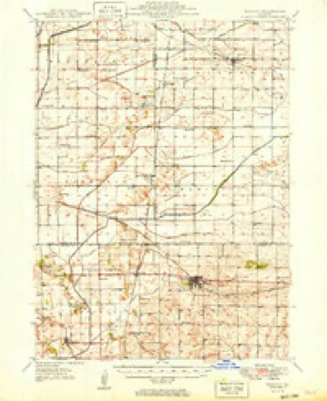
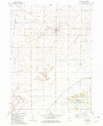
12 topographic sheets cover this place, the earliest surveyed in 1949 and the latest in 1985. It stands in Harmon Township. It lies in ZIP code area 61042. The Survey maps it on the Harmon quadrangle. 111 people lived here at the 2020 count. It stands 676 feet above sea level.
Population over time
2 figuresHarmon fell from 120 to 111 between 2010 and 2020. These are the recorded population figures Wikidata holds for this place, reached through the Geographic Names Information System number this page is keyed on rather than by name, so they belong to this place and not to another of the same name. Most are census counts, but not all are: an early figure may be a founding or settlement estimate, and an estimate published within five years of a census is left out. The change column is computed, and is left blank where more than 20 years separate a figure from the one before it, because a gap that long is not a change between two counts.
| Year | People | Change |
|---|---|---|
| 2010 | 120 | |
| 2020 | 111 | -9 (-8%) |
Topographic sheets covering this place
5 surveys from 12 printed sheetsMatched by testing this settlement's coordinate against the published boundary of every sheet in the United States Geological Survey's historical collection. Each opens the scanned sheet at the Survey.
- 1949 USGS Walnut quadrangle1:62500, 3 printings
- 1958 USGS Aurora quadrangle1:250000, 3 printings
- 1961 USGS Aurora quadrangle1:250000
- 1982 USGS Harmon quadrangle1:24000, 3 printings
- 1985 USGS Dixon quadrangle1:100000, 2 printings



In the county-history sources
8,638 words on this townshipHistory of Lee County, Together with Biographical Matter, Statistics, Etc. .., published 1881 names this settlement in its chapter on Harmon Township. These are the passages that mention it, exactly as the scans read.
In early times, owing to the numerous swamps and ponds, ducks and geese were very plentiful, and hunting was a favorite pastime among the early settlers. The first settler was John D. Rosebrook, who purchased a large tract of land in the eastern part of the township. Among the settlers who came soon after Mr. Rosebrook were Louis Hullinger, Thomas Sntton, John L. Porter and James Porter, jr. The first school-house in the township was built on Sec. 23 in 1856. The first school was held at the residence of Mrs. Tuttle and conducted by her daughter, Vienna Tuttle.
Passage source: History of Lee County, Together with Biographical Matter, Statistics, Etc. .., published 1881.
The village of Harmon, situated on the Chicago, Burlington & Quincy railroad, was laid out in 1871, on land owned by A. Kenyon. The present population of the village is about three hundred. Surrounded by a wide scope of country, which, owing to the industry of its enterprising citizens, is rapidly improving, Harmon promises to become one of the thriving inland villages of Lee county. It has two extensive elevators, wliich receive large quantities of grain, three drygoods and grocery stores, one jewelry store, three blacksmith shops, one livery stable and one hotel, one creamery and three churches, the Methodist Episcopal, Weslej'an Methodist and Catholic.
Passage source: History of Lee County, Together with Biographical Matter, Statistics, Etc. .., published 1881.
The Methodist Episcopal society was organized in 1871. The first pastor was the Rev. Rice, whose initials the writer was unable to ascertain. The first class-leader was James Backus ; the present pastor is the Rev. Edward Breen, who took charge in October 1879. In March, 1881, the following-named persons were elected as trustees for the purpose of building a church : A. B. Smith, W. E. Mechem, J. U. Fry, W. H. Kline, Daniel Swartz.
Passage source: History of Lee County, Together with Biographical Matter, Statistics, Etc. .., published 1881.
Machine-read from a century-old scan, so expect the errors a machine makes: misspelled names, dropped words, stray characters.
Read the whole chapter on Harmon Township - it names this place 14 more 14 times.
Fires near this place
2 since 2013Regional context, not property-specific evidence. The federal wildfire occurrence database lists 2 fires within 5 miles of Harmon in 2013, burning about 6 acres in total. None started naturally. None was recorded as arson. Distance is straight-line from the map coordinates, so a fire counted here may appear on a neighbouring settlement's page as well.
| Reported cause | Fires |
|---|---|
| Equipment and vehicle use | 1 |
| Power generation/transmission/distribution | 1 |
The most recent of them, most recent first, with the day each was reported and the service that recorded it.
| Date | Cause | Size | Reported by | Name on the report |
|---|---|---|---|---|
| 17 December 2013 | Equipment and vehicle use | 1.0 acres | Illinois Division of Forestry Resources | 13-203 |
| 19 October 2013 | Power generation/transmission/distribution | 5.0 acres | Illinois Division of Forestry Resources | 13-223 |
Settlements close enough to share some of these fires:
Mines and quarries near this place
1 within 5 milesRegional context, not property-specific evidence. The federal mineral resources record lists 1 working within 5 miles of Harmon: 1 past producer. None of them still produces. What was taken out: Stone, Crushed/Broken. Distance is straight-line from the map coordinates, so a quarry counted here may appear on a neighbouring settlement's page as well.
| Where | Site | Commodity | Status | Recorded |
|---|---|---|---|---|
| Unnamed Limestone Quarry | Stone, Crushed/Broken | Past Producer |
Storms near this place
18 since 1995Regional context, not property-specific evidence. The National Weather Service names Harmon in 18 storm reports between 1995 and 2023: 7 hail, 5 thunderstorm wind, 4 tornado, 2 flash flood. No death or injury is recorded in these reports. Each account below is quoted exactly as the forecast office filed it, from the NOAA Storm Events Database, and each date opens the federal record of that event.
| When | Event | Place named | Harm | What the report says |
|---|---|---|---|---|
| June 2013 | Thunderstorm Wind | Harmon | $100,000 | Winds were estimated in excess of 80 mph and upwards of 100 mph for a 13 mile swath. A large outbuilding bolted to its foundation was destroyed. One part of the barn wall was lifted taking a portion of the foundation with it. Numerous large trees were snapped or uprooted, including one that fell onto the front portion of a house. In Walton, four large grain storage bins were destroyed. Also in Walton, a metal outbuilding was destroyed with debris thrown over 200 yards. Shingle damage was also noted on a few homes. |
| June 2013 | Tornado (EF0) | Harmon | $10,000 | The tornado mainly traveled over farm fields but did take down numerous utility poles, including a few that were bent sharply to the south, opposite of the storm motion which was to the northeast. A weakly constructed barn was destroyed near the end of the path. |
| August 2016 | Flash Flood | Harmon | $2,000 | A foot of water moving across Pump Factory Rd between Amboy Rd and McCoy Rd approximately 10 miles south of Dixon. |
| April 2023 | Thunderstorm Wind | Harmon | - | A semi truck was blown over on Route 30 north of Harmon. |
| March 2023 | Tornado (EF1) | Harmon | - | This tornado began just south of Illinois Highway 92 in northwest Bureau County. It then tracked through far southeast Whiteside County within 3 miles of the town of Deer Grove. This tornado would continue for 6 additional miles into southwest Lee County, where it dissipated near Maytown Road and Atkinson Road. The damage from this tornado included numerous heavily damaged outbuildings, several snapped power poles, and dozens of trees. The worst damage was to a large farmstead outbuilding along the Whiteside-Bureau county line with the roof and two of the four walls destroyed and debris slung well into a field. |
| June 2020 | Flash Flood | Harmon | - | Route 30 was flooded west of Hoyle Road. |
| August 2020 | Thunderstorm Wind | Harmon | - | Several tree limbs were blown down. Exterior siding of a house was peeled away. |
| June 2015 | Tornado (EF1) | Harmon | - | The tornado touched down near Howland Road where hardwood trees were snapped. The tornado moved southeast just north of Harmon where additional trees were snapped. The tornado snapped trees as it cross Hoyle Road. The tornado lifted before reaching IL-26. Peak winds were estimated to be 105 mph. (Tornado 2 of 10). |
| June 2008 | Thunderstorm Wind | Harmon | - | Trees were blown down. |
| May 1995 | Tornado (F0) | Harmon | - | State Police reported a tornado on the ground southwest of Harmon. No damage was reported. Golf ball-size hail fell near Dixon. |
| May 2019 | Hail | Harmon | - | no account filed |
| May 2014 | Hail | Harmon | - | no account filed |
| June 2014 | Hail | Harmon | - | no account filed |
| May 2005 | Hail | Harmon | - | no account filed |
| May 2005 | Thunderstorm Wind | Harmon | - | no account filed |
| May 2003 | Hail | Harmon | - | no account filed |
| July 2003 | Hail | Harmon | - | no account filed |
| April 2000 | Hail | Harmon | - | no account filed |
Nearest settlements
The eight closest, with where each one stands in the county. Distances are straight-line, computed from the Geographic Names Information System coordinates.
| Map | Place | Distance | Sheets |
|---|---|---|---|
| Van Petten | 3.8 miles | 12 | |
| Nelson | 5.7 miles | 11 | |
| Walton | 6.1 miles | 10 | |
| Woodland Shores | 6.4 miles | 11 | |
| Eldena | 8.3 miles | 12 | |
| Prairieville | 8.7 miles | 11 | |
| Dixon | 8.9 miles | 12 | |
| Palmyra | 9.0 miles | 11 |
Elsewhere
Matched on this settlement's Geographic Names Information System number rather than its name, so it cannot be a different place of the same name in another state.
| Wikipedia article on Harmon | An encyclopaedic summary. Its text is share-alike, so it is linked here rather than copied. |
| Wikidata item Q2672107 | The structured record the population and elevation above come from. Public domain (CC0). |
Provenance
This settlement is recorded in the Geographic Names Information System as feature 409794. The sheet list is computed by point-in-boundary test against the United States Geological Survey's historical topographic inventory. Both are works of the United States government and carry no copyright under 17 U.S.C. 105.
Wildfire. Short, Karen C. 2022. Spatial wildfire occurrence data for the United States, 1992-2020 [FPA_FOD_20221014]. 6th Edition. Fort Collins, CO: Forest Service Research Data Archive. https://doi.org/10.2737/RDS-2013-0009.6 Collected with United States Government funding and usable without additional permissions or fees.
Mines and quarries. USGS Mineral Resources Data System (MRDS) https://mrdata.usgs.gov/mrds/ A work of the United States government, no copyright under 17 U.S.C. 105.
Storms. NOAA National Centers for Environmental Information, Storm Events Database https://www.ncei.noaa.gov/stormevents/ A work of the United States government, no copyright under 17 U.S.C. 105. Narratives are quoted verbatim from the National Weather Service report and are not edited or summarised.