 Block
Nelson, Illinois
11 topographic sheets cover this place, the earliest surveyed in 1930 and the latest in 1985. It stands in Nelson Township. It lies in ZIP code area 61021. The Survey maps it on the Dixon West quadrangle. 127 people lived here at the 2020 count.
Population over time
2 figuresNelson fell from 170 to 127 between 2010 and 2020. These are the recorded population figures Wikidata holds for this place, reached through the Geographic Names Information System number this page is keyed on rather than by name, so they belong to this place and not to another of the same name. Most are census counts, but not all are: an early figure may be a founding or settlement estimate, and an estimate published within five years of a census is left out. The change column is computed, and is left blank where more than 20 years separate a figure from the one before it, because a gap that long is not a change between two counts.
| Year | People | Change |
|---|---|---|
| 2010 | 170 | |
| 2020 | 127 | -43 (-25%) |
Topographic sheets covering this place
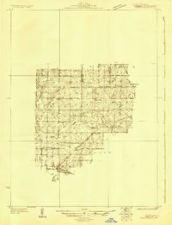
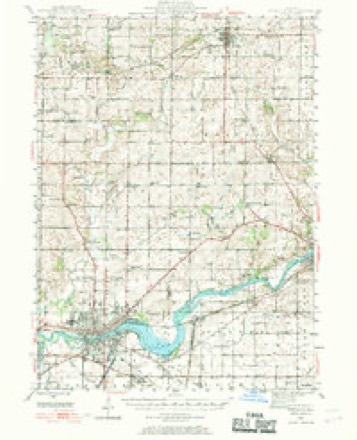
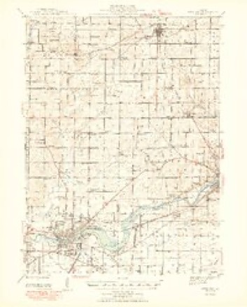
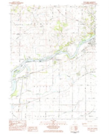
7 surveys from 11 printed sheetsMatched by testing this settlement's coordinate against the published boundary of every sheet in the United States Geological Survey's historical collection. Each opens the scanned sheet at the Survey.
- 1930 USGS Woodsung quadrangle1:48000
- 1946 USGS Sterling quadrangle1:62500
- 1948 USGS Sterling quadrangle1:62500, 2 printings
- 1958 USGS Aurora quadrangle1:250000, 3 printings
- 1961 USGS Aurora quadrangle1:250000
- 1983 USGS Dixon West quadrangle1:24000
- 1985 USGS Dixon quadrangle1:100000, 2 printings



In the county-history sources
10,735 words on this townshipHistory of Lee County, published 1881 names this settlement in its chapter on Nelson Township. These are the passages that mention it, exactly as the scans read.
This township is bounded on the east by South Dixon, on the south by Harmon, on the north and west by Rock river and Whitesides county. The soil is sandy and not so productive as in some other .portions of the county, and consequently was not settled as earl3^ The principal products are corn, wheat, oats, barley and rye. The land is nearly all tillable and devoted to grain raising. The farmers of Nelson do not devote as much of their attention to grazing and stock raising as do the people in some portions of the county. Her people are a quiet, wellto-do class of farmers, and intelligent, enterprising and patriotic. Politically the township is republican, yet as a rule her citizens are rather independent, and do not so far forget the welfare of the common country as to allow party prejudice to cause them to overlook errors and corruption simply because they exist in their own party. They do not believe in permitting a scoundrel to evade justice simply because he bears a party trade-mark. Neither do they believe that patriotism is confined to party lines. They are broad-minded enough to see that a man whose lot is cast in America, who has a home on her soil, whose father and mother lie side by side under the sod made free by patriotic blood, whose children are taught to lisp the names of Washington and Lincoln, regardless of his political opinion, is as deeply interested in the common welfare of the nation as themselves.
Passage source: History of Lee County, published 1881.
The earliest settler in Nelson township was Luther Stone, who came in 1836 from Erie county. New York, and located on Sec. 29. Burrel and Samuel Stone, who are still residents of the township, are sons of Luther, and shared with their father the dangers and hardships of pioneer life. In the winter of 1837 Burrel, his brother Samuel, and their father, were getting home a supply of wood from
Passage source: History of Lee County, published 1881.
Scott's GrovG, eight miles south of BniTel's present residence. During the father's absence with a load of wood a snowstorm of unusual severity came on. Alone in the timber, without shelter or food, the boys became alarmed and saw that something must be done or they would perish in the storm. The snow came down in such quantities as to darken the air, Tlie wind roared through the leafless branches of the forest and night was coming on. With this gloomy prospect, together with that of passing the night in the forest, filled their hearts with dismay, and they set out in a westerly direction, hoping to find a deserted cabin that stood about two miles distant. Fortunately, after a long search, the}' came in view of the shanty, which, although in a very dilapidated condition, afforded them a shelter from the merciless storm. With the aid of some tow they succeeded in making a fire with their guns, and for three days were cooped up in that gloomy prison, subsisting during their imprisonment on a coon they had shot in the forest. At the end of that time tlie storm subsided, so that they were enabled to make their way home. At another time, in the winter of 1842, Burrel was driving home from Dixon. A few scattering flakes of snow were falling when he started, which soon developed into a howling blizzard. Owing to the density of the falling snow darkness came on earlier than usual, and Burrel lost his way in the blinding storm. Knowing that if he did not keep himself and horses in motion death would be certain, he kept the horses going around in a circle until daybreak, when he found to his surprise that he was within a short distance of home.
Passage source: History of Lee County, published 1881.
Machine-read from a century-old scan, so expect the errors a machine makes: misspelled names, dropped words, stray characters.
Read the whole chapter on Nelson Township - it names this place 9 more 9 times.
Fires near this place
2 since 2013Regional context, not property-specific evidence. The federal wildfire occurrence database lists 2 fires within 5 miles of Nelson between 2013 and 2018, burning about 6 acres in total. None started naturally. None was recorded as arson. Distance is straight-line from the map coordinates, so a fire counted here may appear on a neighbouring settlement's page as well.
| Reported cause | Fires |
|---|---|
| Power generation/transmission/distribution | 1 |
| Missing data/not specified/undetermined | 1 |
The most recent of them, most recent first, with the day each was reported and the service that recorded it.
| Date | Cause | Size | Reported by | Name on the report |
|---|---|---|---|---|
| 18 May 2018 | Missing data/not specified/undetermined | under an acre | Illinois Division of Forestry Resources | 18-414 |
| 19 October 2013 | Power generation/transmission/distribution | 5.0 acres | Illinois Division of Forestry Resources | 13-223 |
Settlements close enough to share some of these fires:
Mines and quarries near this place
10 of 15 shownRegional context, not property-specific evidence. The federal mineral resources record lists 15 workings within 5 miles of Nelson: 11 past producers, 2 producers, 2 occurrences. 2 still produce. What was taken out: Stone, Crushed/Broken, Sand and Gravel, Construction. Distance is straight-line from the map coordinates, so a quarry counted here may appear on a neighbouring settlement's page as well.
| Where | Site | Commodity | Status | Recorded |
|---|---|---|---|---|
| Nelson Sand and Gravel Pit | Sand and Gravel, Construction | Past Producer | ||
| Propheter Pit & Mill | Sand and Gravel, Construction | Past Producer | ||
| Rock River Pit | Sand and Gravel, Construction | Past Producer | ||
| Dixon Quarry | Stone, Crushed/Broken | Past Producer | ||
| Law Quarry | Stone, Crushed/Broken | Past Producer | ||
| Limestone Prospect | Stone, Crushed/Broken | Occurrence | ||
| Limestone Prospect | Stone, Crushed/Broken | Occurrence | ||
| Nelson Quarry - Portable Unit #1 | Stone, Crushed/Broken | Producer | ||
| Palmyra Quarry | Stone, Crushed/Broken | Producer | ||
| Unnamed Limestone Quarry | Stone, Crushed/Broken | Past Producer |
Storms near this place
8 since 1998Regional context, not property-specific evidence. The National Weather Service names Nelson in 8 storm reports between 1998 and 2025: 4 hail, 2 thunderstorm wind, 1 tornado, 1 flood. No death or injury is recorded in these reports. Each account below is quoted exactly as the forecast office filed it, from the NOAA Storm Events Database, and each date opens the federal record of that event.
| When | Event | Place named | Harm | What the report says |
|---|---|---|---|---|
| June 2020 | Flood | Nelson | - | One foot of standing water was reported at the intersection of Rock Island and Harmon Roads. |
| July 2020 | Thunderstorm Wind | Nelson | - | Damage to power lines was reported in Nelson. |
| July 2011 | Thunderstorm Wind | Nelson | - | Portions of a corn field were flattened near Harmon Road and Rock Island Road. |
| April 2006 | Hail | Nelson | - | Penny size hail fell on Highway 2, about two miles northwest of Nelson. |
| July 2025 | Hail | Nelson | - | no account filed |
| September 2021 | Hail | Nelson | - | no account filed |
| July 2003 | Hail | Nelson | - | no account filed |
| June 1998 | Tornado (F0) | Nelson | - | no account filed |
Nearest settlements
The eight closest, with where each one stands in the county. Distances are straight-line, computed from the Geographic Names Information System coordinates.
| Map | Place | Distance | Sheets |
|---|---|---|---|
| Woodland Shores | 2.5 miles | 11 | |
| Prairieville | 3.2 miles | 11 | |
| Palmyra | 4.0 miles | 11 | |
| Harmon | 5.7 miles | 12 | |
| Lincoln Heights | 6.0 miles | 11 | |
| Van Petten | 6.5 miles | 12 | |
| Dixon | 7.1 miles | 12 | |
| Eldena | 10.3 miles | 12 |
Elsewhere
Matched on this settlement's Geographic Names Information System number rather than its name, so it cannot be a different place of the same name in another state.
| Wikipedia article on Nelson | An encyclopaedic summary. Its text is share-alike, so it is linked here rather than copied. |
| Wikidata item Q2672028 | The structured record the population and elevation above come from. Public domain (CC0). |
Provenance
This settlement is recorded in the Geographic Names Information System as feature 414346. The sheet list is computed by point-in-boundary test against the United States Geological Survey's historical topographic inventory. Both are works of the United States government and carry no copyright under 17 U.S.C. 105.
Wildfire. Short, Karen C. 2022. Spatial wildfire occurrence data for the United States, 1992-2020 [FPA_FOD_20221014]. 6th Edition. Fort Collins, CO: Forest Service Research Data Archive. https://doi.org/10.2737/RDS-2013-0009.6 Collected with United States Government funding and usable without additional permissions or fees.
Mines and quarries. USGS Mineral Resources Data System (MRDS) https://mrdata.usgs.gov/mrds/ A work of the United States government, no copyright under 17 U.S.C. 105.
Storms. NOAA National Centers for Environmental Information, Storm Events Database https://www.ncei.noaa.gov/stormevents/ A work of the United States government, no copyright under 17 U.S.C. 105. Narratives are quoted verbatim from the National Weather Service report and are not edited or summarised.