 Block
Hinckley, Illinois
8 topographic sheets cover this place, the earliest surveyed in 1937 and the latest in 1985. It stands in Squaw Grove Township. It lies in ZIP code area 60520. It stands on Battle Creek. The Survey maps it on the Hinckley quadrangle. 2,006 people lived here at the 2020 count. It stands 745 feet above sea level.
Population over time
2 figuresHinckley fell from 2,070 to 2,006 between 2010 and 2020. These are the recorded population figures Wikidata holds for this place, reached through the Geographic Names Information System number this page is keyed on rather than by name, so they belong to this place and not to another of the same name. Most are census counts, but not all are: an early figure may be a founding or settlement estimate, and an estimate published within five years of a census is left out. The change column is computed, and is left blank where more than 20 years separate a figure from the one before it, because a gap that long is not a change between two counts.
| Year | People | Change |
|---|---|---|
| 2010 | 2,070 | |
| 2020 | 2,006 | -64 (-3%) |
Topographic sheets covering this place
5 surveys from 8 printed sheetsMatched by testing this settlement's coordinate against the published boundary of every sheet in the United States Geological Survey's historical collection. Each opens the scanned sheet at the Survey.
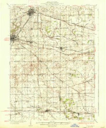
- 1937 USGS Sycamore quadrangle1:62500, 2 printings
- 1958 USGS Aurora quadrangle1:250000, 3 printings
- 1961 USGS Aurora quadrangle1:250000
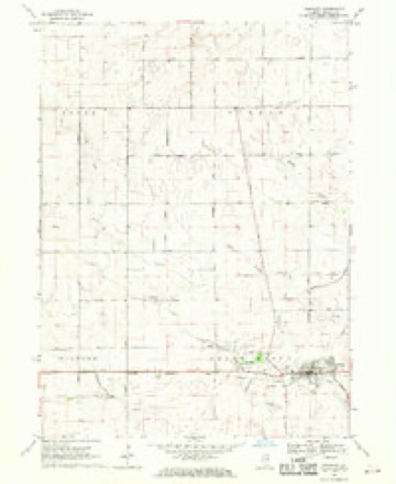
- 1968 USGS Hinckley quadrangle1:24000
- 1985 USGS Aurora quadrangle1:100000



In the county-history sources
5,058 words on this townshipPortrait and Biographical Album of DeKalb County, Illinois : Containing Full-page Portraits and Biographical Sketches of Prominent and Representative Citizens of the County : Together with Portraits and Biographies of All the Governors of Illinois, and of the Presidents of the United States : Also Containing a History of the County, from Its Earliest Settlement to the Present Time, published 1885 names this settlement in its chapter on Squaw Grove Township. These are the passages that mention it, exactly as the scans read.
A man named Robson lived this fall in a log cabin at the crossing of Somonauk Creek, a few miles south, but abandoned the place at the approach of winter, leaving Sebree and his family the only white inhabitants in this section of country.
John Eastabrooks was a native of Pennsylvania. He located on the north side of Squaw Grove, where he remained till his death in 1850. He was accompanied here by his son Decatur and his daughter Mary. His wife and the remainder of his family came the following year. Decatur Eastabrooks moved to Carroll County many years ago, where he yet resides. When Mr. Eastabrooks came to the county he brought with him two large, powerful dogs. When the men were away from the house, the dogs would allow no one, especially an Indian, to come near, unless called off by Miss Eastabrooks.
But few of the settlers of 1835 are now living. Among the number are Mrs. Rachel Lee, George \V. Lee, Mrs. Sarah J. Sebree, W. M. Sebree, C. B. Lee, Mrs. Mary E. Millard and Decatur Eastabrooks. Of the number Mrs. Lee, George W. and C. B. Lee, Mrs. Sebree and W. M. Sebree yet reside in the township. There may be others, but these are the only ones remembered by George W. Lee.
Machine-read from a century-old scan, so expect the errors a machine makes: misspelled names, dropped words, stray characters.
Read the whole chapter on Squaw Grove Township - it names this place 11 more 11 times.
Mines and quarries near this place
1 within 5 milesRegional context, not property-specific evidence. The federal mineral resources record lists 1 working within 5 miles of Hinckley: 1 past producer. None of them still produces. What was taken out: Sand and Gravel, Construction. Distance is straight-line from the map coordinates, so a quarry counted here may appear on a neighbouring settlement's page as well.
| Where | Site | Commodity | Status | Recorded |
|---|---|---|---|---|
| Long Pit | Sand and Gravel, Construction | Past Producer |
Storms near this place
11 since 2000Regional context, not property-specific evidence. The National Weather Service names Hinckley in 11 storm reports between 2000 and 2025: 10 thunderstorm wind, 1 tornado. No death or injury is recorded in these reports. Each account below is quoted exactly as the forecast office filed it, from the NOAA Storm Events Database, and each date opens the federal record of that event.
| When | Event | Place named | Harm | What the report says |
|---|---|---|---|---|
| June 2017 | Thunderstorm Wind | Hinckley | $5,000 | Several utility poles and power lines were blown down along East Chicago Road. |
| February 2024 | Tornado (EF0) | Hinckley | - | Storm chasers documented a tornado touching down in a field south of Hinckley near Somonauk Road and Bastian Road. High resolution satellite imagery showed that this tornado first moved to the northeast mostly in open fields, but likely caused tree damage to properties just north of Bastian Road as it crossed into Kane County. The tornado then turned to the east and caused damage to multiple farm outbuildings, peeled shingles off of roofs, and caused tree damage before lifting as it tracked into Big Rock. |
| February 2024 | Thunderstorm Wind | Hinckley | - | An NWS storm survey found a portion of metal roofing had been peeled back from a farm outbuilding south of Hinckley. Time was estimated using radar. |
| June 2021 | Thunderstorm Wind | Hinckley | - | A tree was blown down onto power lines. |
| June 2021 | Thunderstorm Wind | Hinckley | - | Tree damage was reported along Somonauk Road near Hinckley. |
| May 2020 | Thunderstorm Wind | Hinckley | - | Large tree limbs were blown down. |
| May 2020 | Thunderstorm Wind | Hinckley | - | Tree damage was reported north of Hinckley. |
| May 2017 | Thunderstorm Wind | Hinckley | - | Straight line winds caused isolated tree damage and destroyed a farm outbuilding. |
| June 2010 | Thunderstorm Wind | Hinckley | - | Four inch diameter tree limbs were blown down. |
| March 2025 | Thunderstorm Wind | Hinckley | - | no account filed |
| August 2000 | Thunderstorm Wind | Hinckley | - | no account filed |
Nearest settlements
The eight closest, with where each one stands in the county. Distances are straight-line, computed from the Geographic Names Information System coordinates.
Elsewhere
Matched on this settlement's Geographic Names Information System number rather than its name, so it cannot be a different place of the same name in another state.
| Wikipedia article on Hinckley | An encyclopaedic summary. Its text is share-alike, so it is linked here rather than copied. |
| Wikidata item Q585656 | The structured record the population and elevation above come from. Public domain (CC0). |
Provenance
This settlement is recorded in the Geographic Names Information System as feature 421851. The sheet list is computed by point-in-boundary test against the United States Geological Survey's historical topographic inventory. Both are works of the United States government and carry no copyright under 17 U.S.C. 105.
Mines and quarries. USGS Mineral Resources Data System (MRDS) https://mrdata.usgs.gov/mrds/ A work of the United States government, no copyright under 17 U.S.C. 105.
Storms. NOAA National Centers for Environmental Information, Storm Events Database https://www.ncei.noaa.gov/stormevents/ A work of the United States government, no copyright under 17 U.S.C. 105. Narratives are quoted verbatim from the National Weather Service report and are not edited or summarised.