 Block
Campbell, Illinois
12 topographic sheets cover this place, the earliest surveyed in 1933 and the latest in 1998. It stands in Pleasant Grove Township. It lies in ZIP code area 62440. It stands on South Fork Indian Creek. The Survey maps it on the Charleston South quadrangle. It stands 702 feet above sea level.
On record in Campbell
Buildings and businesses the archive holds for this place. Each opens its own page, with the source record it came from.
On the National Register within a mile 1 record
The National Register names another town for these. They stand within one mile of this settlement's coordinate.
 Civilian Conservation Corps Camp Shiloh Encampment Sitelisted 2014 · 0.9 miles away
Topographic sheets covering this place
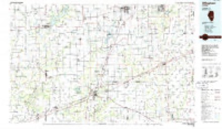
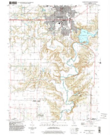
7 surveys from 12 printed sheetsMatched by testing this settlement's coordinate against the published boundary of every sheet in the United States Geological Survey's historical collection. Each opens the scanned sheet at the Survey.
- 1933 USGS Toledo quadrangle1:62500, 2 printings
- 1938 USGS Toledo quadrangle1:62500
- 1958 USGS Decatur quadrangle1:250000, 3 printings
- 1961 USGS Decatur quadrangle1:250000, 2 printings
- 1984 USGS Charleston South quadrangle1:24000
- 1986 USGS Effingham quadrangle1:100000, 2 printings
- 1998 USGS Charleston South quadrangle1:24000


In the county-history sources
25,778 words on this townshipThe History of Coles County, Illinois ... Map of Coles County; History of Illinois ... History of Northwest ... Constitution of the United States, Miscellaneous Matters, &c., &c, published 1879 names this settlement in its chapter on Pleasant Grove Township. These are the passages that mention it, exactly as the scans read.
Beyond the coal-beds underlying the surface, the county, as we have said, is not very rich in geology. There are, we believe, some stone-beds along the Embarrass River, but the quality of the stone is poor and of but little value for building purposes. With this brief glance at the geological features, we will leave the subject, referring the reader to the Geological Survey of the State for further information on this interesting point of history.
Passage source: The History of Coles County, Illinois ... Map of Coles County; History of Illinois ... History of Northwest ... Constitution of the United States, Miscellaneous Matters, &c., &c, published 1879.
It is likely that these persons are all that settled in this township that year. If they brought their families as Mr. Gordon did, there were four settlers and four pioneer homes in the township that fall.
Passage source: The History of Coles County, Illinois ... Map of Coles County; History of Illinois ... History of Northwest ... Constitution of the United States, Miscellaneous Matters, &c., &c, published 1879.
The first settlement on Indian Creek was made this same year. At the head of this creek, was an old Indian camping-ground, evidencing use in many generations past. It was a convenient spot for pasturage and water, and, as such, was regarded favorably by the pioneers. It is in the north and northeast part of the township, and may be considered the third settlement in the township. Its pioneers were Zeno Campbell, Gershom, William and Thomas Balch, who, as stated, located in 1829.
Passage source: The History of Coles County, Illinois ... Map of Coles County; History of Illinois ... History of Northwest ... Constitution of the United States, Miscellaneous Matters, &c., &c, published 1879.
Machine-read from a century-old scan, so expect the errors a machine makes: misspelled names, dropped words, stray characters.
Read the whole chapter on Pleasant Grove Township - it names this place 30 more 30 times.
Fires near this place
2 since 2015Regional context, not property-specific evidence. The federal wildfire occurrence database lists 2 fires within 5 miles of Campbell between 2015 and 2019, burning about 1 acre in total. None started naturally. None was recorded as arson. Distance is straight-line from the map coordinates, so a fire counted here may appear on a neighbouring settlement's page as well.
| Reported cause | Fires |
|---|---|
| Debris and open burning | 2 |
The most recent of them, most recent first, with the day each was reported and the service that recorded it.
| Date | Cause | Size | Reported by | Name on the report |
|---|---|---|---|---|
| 27 March 2019 | Debris and open burning | under an acre | Illinois Division of Forestry Resources | 2019-63 |
| 24 March 2015 | Debris and open burning | under an acre | Illinois Division of Forestry Resources | 1303241 |
Settlements close enough to share some of these fires:
Mines and quarries near this place
3 within 5 milesRegional context, not property-specific evidence. The federal mineral resources record lists 3 workings within 5 miles of Campbell: 2 past producers, 1 producer. 1 still produces. What was taken out: Sand and Gravel, Construction. Distance is straight-line from the map coordinates, so a quarry counted here may appear on a neighbouring settlement's page as well.
| Where | Site | Commodity | Status | Recorded |
|---|---|---|---|---|
| East Pit | Sand and Gravel, Construction | Past Producer | ||
| Greenup Sand & Gravel | Sand and Gravel, Construction | Producer | ||
| Martinis Sand and Gravel Pit | Sand and Gravel, Construction | Past Producer |
Storms near this place
6 since 1999Regional context, not property-specific evidence. The National Weather Service names Campbell in 6 storm reports between 1999 and 2025: 2 tornado, 2 hail, 2 thunderstorm wind. No death or injury is recorded in these reports. Each account below is quoted exactly as the forecast office filed it, from the NOAA Storm Events Database, and each date opens the federal record of that event.
| When | Event | Place named | Harm | What the report says |
|---|---|---|---|---|
| April 1999 | Tornado (F0) | Campbell | $50,000 | A tornado touched down on the southwest side of Janesville (Cumberland County side of town). It hopped and skipped along a northeast path through town causing scattered damage. Three homes sustained moderate damage and an above ground pool was destroyed. A front porch on one of the homes was destroyed. Several trees were blown down as well. The tornado lifted on the northeast side of town (in Coles County). No injuries were reported and damage was estimated around $100,000. |
| April 2025 | Tornado (EFU) | Campbell | - | Video evidence showed a tornado touched down just west of North County Road 1270 East and south of East County Road 210 North about 2 miles north of Janesville at 9:03 PM CDT. The tornado tracked northeastward and quickly dissipated at 9:04 PM CDT. No damage was observed. |
| March 2024 | Hail | Campbell | - | Golf ball-sized hail at Bent Tree Golf Course. |
| June 2024 | Thunderstorm Wind | Campbell | - | A tree was blown into powerlines. |
| June 2023 | Thunderstorm Wind | Campbell | - | Several 2-foot diameter trees were blown over or snapped near Bent Tree Golf Course along Lincoln Highway Road. |
| May 2011 | Hail | Campbell | - | no account filed |
Nearest settlements
The eight closest, with where each one stands in the county. Distances are straight-line, computed from the Geographic Names Information System coordinates.
Elsewhere
Matched on this settlement's Geographic Names Information System number rather than its name, so it cannot be a different place of the same name in another state.
| Wikipedia article on Campbell | An encyclopaedic summary. Its text is share-alike, so it is linked here rather than copied. |
| Wikidata item Q5027971 | The structured record the population and elevation above come from. Public domain (CC0). |
Provenance
This settlement is recorded in the Geographic Names Information System as feature 408289. The sheet list is computed by point-in-boundary test against the United States Geological Survey's historical topographic inventory. Both are works of the United States government and carry no copyright under 17 U.S.C. 105.
Wildfire. Short, Karen C. 2022. Spatial wildfire occurrence data for the United States, 1992-2020 [FPA_FOD_20221014]. 6th Edition. Fort Collins, CO: Forest Service Research Data Archive. https://doi.org/10.2737/RDS-2013-0009.6 Collected with United States Government funding and usable without additional permissions or fees.
Mines and quarries. USGS Mineral Resources Data System (MRDS) https://mrdata.usgs.gov/mrds/ A work of the United States government, no copyright under 17 U.S.C. 105.
Storms. NOAA National Centers for Environmental Information, Storm Events Database https://www.ncei.noaa.gov/stormevents/ A work of the United States government, no copyright under 17 U.S.C. 105. Narratives are quoted verbatim from the National Weather Service report and are not edited or summarised.