 Block
Lafayette, Illinois
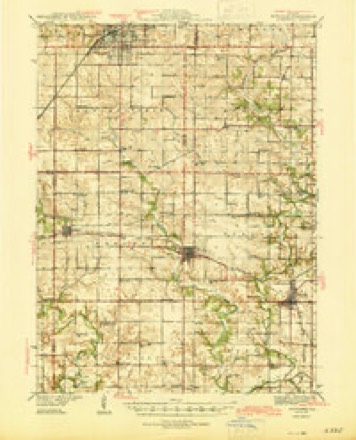
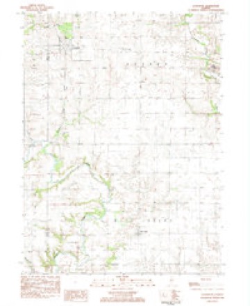
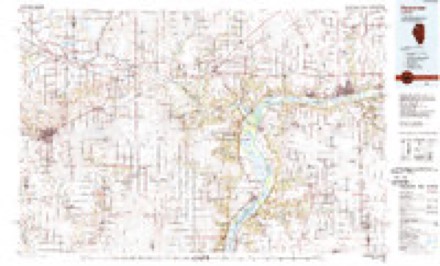
10 topographic sheets cover this place, the earliest surveyed in 1944 and the latest in 1985. It stands in Goshen Township. It lies in ZIP code area 61449. The Survey maps it on the Lafayette quadrangle. 160 people lived here at the 2020 count. It stands 797 feet above sea level.
Population over time
2 figuresLafayette fell from 223 to 160 between 2010 and 2020. These are the recorded population figures Wikidata holds for this place, reached through the Geographic Names Information System number this page is keyed on rather than by name, so they belong to this place and not to another of the same name. Most are census counts, but not all are: an early figure may be a founding or settlement estimate, and an estimate published within five years of a census is left out. The change column is computed, and is left blank where more than 20 years separate a figure from the one before it, because a gap that long is not a change between two counts.
| Year | People | Change |
|---|---|---|
| 2010 | 223 | |
| 2020 | 160 | -63 (-28%) |
Topographic sheets covering this place
5 surveys from 10 printed sheetsMatched by testing this settlement's coordinate against the published boundary of every sheet in the United States Geological Survey's historical collection. Each opens the scanned sheet at the Survey.
- 1944 USGS Kewanee quadrangle1:62500, 3 printings
- 1958 USGS Aurora quadrangle1:250000, 3 printings
- 1961 USGS Aurora quadrangle1:250000
- 1983 USGS La Fayette quadrangle1:24000
- 1985 USGS Kewanee quadrangle1:100000, 2 printings


In the county-history sources
20,251 words on this townshipDocuments and Biography Pertaining to the Settlement and Progress of Stark County, Illinois : Containing an Authentic Summary of Records, Documents, Historical Works and Newspapers Relating to Indian History, Original Settlement, Organization and Politics ..., published 1887 names this settlement in its chapter on Goshen Township. These are the passages that mention it, exactly as the scans read.
Isaac L. Hart was trustee in 1858. and in '59, J. W. Eodgere, James Inglis, W.AV. Wright and Hiram Xance served up to Jnlv. 18t3(i, when Daniel J. Hurd was appointed treasurer. In 1862. John Emery was elected trustee: in '64, Elijah Eltzworth and John A. White; in ^Q(\ William Ogle and William Xowlan ; in '68, William Xowlan : in B. L. Hilliard. Looman Himes; in '71, Eqbert Moore and John A. White: in '74, George Bradley; in '76, R. Bruce Jamieson, now of Abingdon, Knox county ; in '77, Robert Moore ; in '79, J. W. Dexter : in '8<^ George W. Potter and J. H. Quinn : in '81, John A. White to fill vacancy. In April, 1881, Daniel J. Hurd, after serWng as treasurer twenty-one years, gave place to C. M. Beecher. In '82, X. C. Brown took his piace as trustee ; Frank A. Jones, in '83, vice George W. Potter, John A. White, in '84; F. A. Jones and W. F. Price, in '86. In April. "84. the property deeded by David Smith to the school trustees, now known as the addition to the old Lafayette burial ground, was deeded by them to the village trustees. In 1886 there were 271 males, and 26(> females under twentA^-one years, one graded school and eight ungi'aded schools, attended ])y 23n pupils, and pi'esided over b}" five male and thirteen female teachers ; the former earning S865.35, and the latter si. 795.45. Tax levy, §2,695: total receipts, 85,610.63; total ex))enditures, 83,321.34. C. M. Beecher was serving as treasurer.
Passage source: Documents and Biography Pertaining to the Settlement and Progress of Stark County, Illinois : Containing an Authentic Summary of Records, Documents, Historical Works and Newspapers Relating to Indian History, Original Settlement, Organization and Politics ..., published 1887.
Pioneer Neighhors. - As stated in the general history the Frakers, Owens and Fitch families were the first settlers in the northeastern part of Knox county, and consequently the first in the neighborhood of West Jersev and Goshen townships. Fraker had purchased a few quarter sections prior to his coming here, on one of which was an Indian village. When he arrived the Indians strongly objected to his settlement, but in the face of the L'nited States patents they concluded to leave, and moved their town to Indian creek of Spoon river, seven miles east of Fraker's grove, to which they often paid visits, and every spring would go there to raise squaw corn and vegetables and make sugar, their trail i-unning just two miles south of Lafayette village, through what was kniAvn as Cedar townshij), of Knox county. During the Black Hawk war the northeast part of Knox and what are now the western towns of Stark, were thrown into great excitement, and settlers rushed to and fro bet\veen Henderson Fort and Essex Foi't. but troubles settling down, all returned to their homes except Amelia Fraker (afterwards Mrs. James Jackson, of Lafa3^ette) who remained with friends at the fort.
Passage source: Documents and Biography Pertaining to the Settlement and Progress of Stark County, Illinois : Containing an Authentic Summary of Records, Documents, Historical Works and Newspapers Relating to Indian History, Original Settlement, Organization and Politics ..., published 1887.
The original town of Lafayette, blocks 1 to 10, of eight lots each, extending from Fi'anklin north to Monroe, and from Timber east to Hoggins, was surveyed July 7. 1836, by George A. Charles, for William Dunbar. Main street formed the center of the town, with Franklin. Jackson, Wasiiington, Lafayette, Jefferson, and Monroe running east and west. The ])lat was acknowledged by Justice Josiah Witcher, of Knox county. Among the first purchasers of lots at Lafayette were P>. M. Jackson, 1846; Dan. J. Hurd, "49; Theo. F. Hurd, '50; Sabina Miner, '54; Emeline Headley, '53; George Farr, '47; Jacob Ross, '58; Washington Dunbar, '47; Sarah Messenger, '53; Henry Dunbar, '43; George W. Dunl)ar, '43; James E. White, '4H; G. W. Jackson, '40; Peter F. Miner, '37; W. F. Reed, L. B. Leonard, '43; James B. Lewis, '46; Andrew Church, Eliza Sellon, '51; Thomas C, Moore, Driscoll & Gooding, '53; William D. Runyan, '47; Nathan Barlow, '50; Jacob Ross, '53; E. Gunsaul, '48; David W. Brown, James Brink, and James Dunn, '39 ; Asael Holmes, '41 ; Harry Hayes,
Passage source: Documents and Biography Pertaining to the Settlement and Progress of Stark County, Illinois : Containing an Authentic Summary of Records, Documents, Historical Works and Newspapers Relating to Indian History, Original Settlement, Organization and Politics ..., published 1887.
Machine-read from a century-old scan, so expect the errors a machine makes: misspelled names, dropped words, stray characters.
Read the whole chapter on Goshen Township - it names this place 57 more 57 times.
Mines and quarries near this place
1 within 5 milesRegional context, not property-specific evidence. The federal mineral resources record lists 1 working within 5 miles of Lafayette: 1 past producer. None of them still produces. What was taken out: Stone, Crushed/Broken. Distance is straight-line from the map coordinates, so a quarry counted here may appear on a neighbouring settlement's page as well.
| Where | Site | Commodity | Status | Recorded |
|---|---|---|---|---|
| Stark County Highway Department | Stone, Crushed/Broken | Past Producer |
Nearest settlements
The eight closest, with where each one stands in the county. Distances are straight-line, computed from the Geographic Names Information System coordinates.
| Map | Place | Distance | Sheets |
|---|---|---|---|
| Toulon | 5.7 miles | 10 | |
| West Jersey | 6.6 miles | 10 | |
| Elmira | 8.9 miles | 10 | |
| Wyoming | 11.0 miles | 10 | |
| Modena | 11.2 miles | 10 | |
| Slackwater (historical) | 11.8 miles | 14 | |
| Waldron (historical) | 11.8 miles | 10 | |
| Osceola | 12.5 miles | 10 |
Elsewhere
Matched on this settlement's Geographic Names Information System number rather than its name, so it cannot be a different place of the same name in another state.
| Wikipedia article on Lafayette | An encyclopaedic summary. Its text is share-alike, so it is linked here rather than copied. |
| Wikidata item Q2526286 | The structured record the population and elevation above come from. Public domain (CC0). |
Provenance
This settlement is recorded in the Geographic Names Information System as feature 411684. The sheet list is computed by point-in-boundary test against the United States Geological Survey's historical topographic inventory. Both are works of the United States government and carry no copyright under 17 U.S.C. 105.
Mines and quarries. USGS Mineral Resources Data System (MRDS) https://mrdata.usgs.gov/mrds/ A work of the United States government, no copyright under 17 U.S.C. 105.