 Block
West Jersey, Illinois
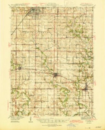
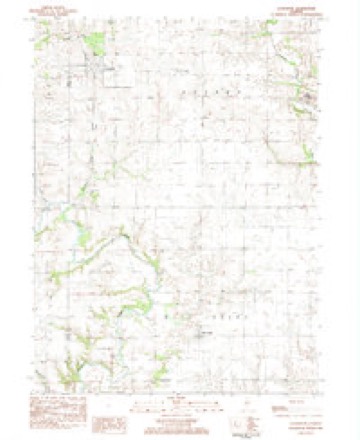
10 topographic sheets cover this place, the earliest surveyed in 1944 and the latest in 1985. It stands in West Jersey Township. It lies in ZIP code area 61483. The Survey maps it on the Lafayette quadrangle.
Topographic sheets covering this place
5 surveys from 10 printed sheetsMatched by testing this settlement's coordinate against the published boundary of every sheet in the United States Geological Survey's historical collection. Each opens the scanned sheet at the Survey.
- 1944 USGS Kewanee quadrangle1:62500, 3 printings
- 1958 USGS Aurora quadrangle1:250000, 3 printings
- 1961 USGS Aurora quadrangle1:250000
- 1983 USGS La Fayette quadrangle1:24000
- 1985 USGS Kewanee quadrangle1:100000, 2 printings


In the county-history sources
15,449 words on this townshipDocuments and Biography Pertaining to the Settlement and Progress of Stark County, Illinois : Containing an Authentic Summary of Records, Documents, Historical Works and Newspapers Relating to Indian History, Original Settlement, Organization and Politics ..., published 1887 names this settlement in its chapter on West Jersey Township. These are the passages that mention it, exactly as the scans read.
Pioneer NeigJibors. - Before proceeding to notice the pioneers of the township, let us examine who were their neighbors on the south and west. Millbrook Township adjoining, was first settled in "33 by "William Metcalf and his family. In '36. John Smith, jr.. platted the village of Rochester, Clark Stanton being the onh^ other settler there then. About this time one Hurd opened a store there, but was soon succeeded by Stacy & Holmes. In '37, a mill was erected here ; in '46, Therrygood Smith was chosen first postmaster. Dr. John Fitield practiced there from "38 to '45. In '44 the Christian church was organized there by Milton King ; the Congregational in '41, by S. G. Wright, at the house of EliasWycoff, which was known as Spoon River Congregational church until -iSQ. In '36, Rev. William Cummings organized tlie Methodist church, and George G. Sill, the Old School Presbyterian church. In '36-7, Caleb North taught the first school for .slO per month.
Passage source: Documents and Biography Pertaining to the Settlement and Progress of Stark County, Illinois : Containing an Authentic Summary of Records, Documents, Historical Works and Newspapers Relating to Indian History, Original Settlement, Organization and Politics ..., published 1887.
Victoria Township, of Knox county, adjoins West Jersey on the west. In '35 the Fraziers, John Essex and Edward Brown made the first settlement, and following them came Moses Moody and Archibald Robinson ; William Overlander, John and Conrad Smith, Charles Bostic, John Arnold, P. Aldridge and H. Shurtliff. Sarah Robinson was the first Avhite child born there (Xovember It). "36). and Mrs. Frazier, who died in '37, the first death. In "36 Peter Sornberger and Phoebe Wilbur, were the parties to the first marriage ; G. F. Reynolds built the first house near the village in "37 ; P. Aldridge was the first justice in "37, and Charles Bostic, a local Methodist preacher, held the first religious services in '36. Salem schoolhouse, built in '37, was the first school ; J. L. Jarnag-han was the first supervisor in '53 ; Rev. S. G. Wright organized the first church in '51 ; the Swede Methodist church was built in '54; the Methodist Episcopal, Free Methodist church, Mormon church, and Second Adventists all followed.
Passage source: Documents and Biography Pertaining to the Settlement and Progress of Stark County, Illinois : Containing an Authentic Summary of Records, Documents, Historical Works and Newspapers Relating to Indian History, Original Settlement, Organization and Politics ..., published 1887.
At this time the women would become entangled in tlie weed known as the devil's darning-needle, whenever they ventured out, or if escaping this, had to fly from the snakes, which were found everywhere. The men had their milling done at Ellisville, Bernadotte or Peoria for some time, and there, also, was their marketing done. Twenty-five cents a bushel was the ])rice of the best wheat, while calico sold for thirty-eight cents per yard. To escape the trials of going to mill, the old corn-mortar was brought into use. In 1836 Daniel Prince erected a log mill, 11x16 feet, at Shickwater, with a capacity of five bushels cracked corn per diem. Later, a distillery was connected with this concern. Some Spoon river men, enraged at the poor qualit}^ of the whisky produced, attacked the distillery part of the building one night, and put an end to the enterprise of Prince in this direction. The Barnett, Jones and Trickle mill, on Walnut creek, begun in 1838, was completed in 1839. Harvey Barnett hewed the timbers ; his brother Ephraim, Michael Jones and Stephen Trickle helped to erect it. Stephen Trickle l)ecame owner of this concern, whicli in later years was known as '^ Pound's Mill.'' In 1838-9 Stanton's mill, at Rochester, was erected and entered into fair competition with " Trickle's mill," doing away forever with the prospect of long journeys, delays, etc., attending the old-time "going to mill." The first j:eg.ular ball in West Jersey was at Joseph Palmer's, on Wain lit creelT, July 4, 1838. Palmer contracted to give dinner to twenty-one couples for forty-two dollars, provided that number presented themselves. Forty-six persons were present. Caleb North delivered the oration. Wm. Mason, then residing near Toulon, was the orchestra, for wiiich he was paid
Passage source: Documents and Biography Pertaining to the Settlement and Progress of Stark County, Illinois : Containing an Authentic Summary of Records, Documents, Historical Works and Newspapers Relating to Indian History, Original Settlement, Organization and Politics ..., published 1887.
Machine-read from a century-old scan, so expect the errors a machine makes: misspelled names, dropped words, stray characters.
Read the whole chapter on West Jersey Township - it names this place 34 more 34 times.
Fires near this place
1 since 2018Regional context, not property-specific evidence. The federal wildfire occurrence database lists 1 fire within 5 miles of West Jersey in 2018, burning about 25 acres in total. None started naturally. None was recorded as arson. Distance is straight-line from the map coordinates, so a fire counted here may appear on a neighbouring settlement's page as well.
| Reported cause | Fires |
|---|---|
| Debris and open burning | 1 |
The most recent of them, most recent first, with the day each was reported and the service that recorded it.
| Date | Cause | Size | Reported by | Name on the report |
|---|---|---|---|---|
| 29 April 2018 | Debris and open burning | 25 acres | Illinois Division of Forestry Resources | 2018220 |
Settlements close enough to share some of these fires:
Storms near this place
18 since 2000Regional context, not property-specific evidence. The National Weather Service names West Jersey in 18 storm reports between 2000 and 2026: 9 thunderstorm wind, 4 flash flood, 2 hail, 2 tornado. No death or injury is recorded in these reports. Each account below is quoted exactly as the forecast office filed it, from the NOAA Storm Events Database, and each date opens the federal record of that event.
| When | Event | Place named | Harm | What the report says |
|---|---|---|---|---|
| April 2013 | Flash Flood | West Jersey | $5,000,000 | Torrential rainfall of 5.00 to 8.00 inches resulted in damage to nearly one thousand houses and businesses in the county. Every creek and stream in the county was flooded. Every road in the county was impassable, and several water rescues were made. |
| July 2020 | Thunderstorm Wind | West Jersey | $50,000 | Trees, power lines, and crops were damaged near West Jersey. |
| August 2007 | Thunderstorm Wind | West Jersey | $35,000 | A swath of thunderstorm wind damage cut across Stark county. The winds blew down numerous trees, power lines, and corn fields. A church in Toulon also had some windows blown out.| |
| June 2015 | Thunderstorm Wind | West Jersey | $2,000 | A power line was blown down. |
| June 2008 | Thunderstorm Wind | West Jersey | $2,000 | A tree was blown down. |
| March 2026 | Tornado (EF1) | West Jersey | - | This tornado crossed from far northeastern Knox County into Stark County southwest of Walnut Creek at 7:23 PM CDT. The tornado tracked eastward, damaging a few homes and outbuildings and snapping trees near the intersection of 100 East Road and 450 North Road. It then crossed IL-78 where it caused extensive siding damage, broke windows, and damaged the roof of a home before dissipating north of the intersection of 400 East Road and 400 North Road at 7:29 PM CDT. |
| March 2025 | Thunderstorm Wind | West Jersey | - | Pieces of metal were blown off of farm outbuildings and a small area of drip edge was removed from a home. |
| August 2024 | Thunderstorm Wind | West Jersey | - | Several large tree branches were blown down. |
| August 2024 | Tornado (EF1) | West Jersey | - | A tornado touched down along Walnut Creek near the Knox County-Stark County line about 3 miles northwest of West Jersey at 11:06pm CDT. It moved east-northeastward through farm fields before crossing over Walnut Creek again and snapping trees as it progressed across 250 East Road. The tornado then crossed State Route 78 and dissipated in a field at 11:12pm CDT. |
| June 2018 | Thunderstorm Wind | West Jersey | - | A road sign was bent and a corn field was flattened. |
| June 2015 | Flash Flood | West Jersey | - | Thunderstorms with rainfall rates of 1.00 to 1.50 per hour persisted for nearly three hours in much of Stark County. Observers reported 3.00 to 4.00 of rain on ground already saturated during the previous week. Many rural roads from West Jersey to Toulon to Wyoming were impassable. |
| April 2013 | Flood | West Jersey | - | Torrential rainfall of 5.00 to 8.00 inches resulted in damage to nearly one thousand houses and businesses in the county. Every creek and stream in the county was flooded. Every road in the county was impassable, and several water rescues were made. The flash flooding was so significant that creeks stayed in flood and most roads remained closed until the afternoon of April 22nd. |
| May 2010 | Flash Flood | West Jersey | - | A slow moving single cell thunderstorm, which also spawned a brief landspout tornado northwest of Princeville, produced nearly 3.00 inches of rain in one hour across a small part of southern Stark County. Most rural roads were inundated from the heavy rain. Illinois Route 91 west of the town of Stark was closed due to the flooding. |
| June 2005 | Thunderstorm Wind | West Jersey | - | A few trees blown down. |
| May 2002 | Flash Flood | West Jersey | - | Water flooded several roads between West Jersey and Wyoming. |
| August 2000 | Thunderstorm Wind | West Jersey | - | Several large trees were blown down. |
| June 2019 | Hail | West Jersey | - | no account filed |
| August 2014 | Hail | West Jersey | - | no account filed |
Nearest settlements
The eight closest, with where each one stands in the county. Distances are straight-line, computed from the Geographic Names Information System coordinates.
Elsewhere
Matched on this settlement's Geographic Names Information System number rather than its name, so it cannot be a different place of the same name in another state.
| Wikidata item Q122569299 | The structured record the population and elevation above come from. Public domain (CC0). |
Provenance
This settlement is recorded in the Geographic Names Information System as feature 420857. The sheet list is computed by point-in-boundary test against the United States Geological Survey's historical topographic inventory. Both are works of the United States government and carry no copyright under 17 U.S.C. 105.
Wildfire. Short, Karen C. 2022. Spatial wildfire occurrence data for the United States, 1992-2020 [FPA_FOD_20221014]. 6th Edition. Fort Collins, CO: Forest Service Research Data Archive. https://doi.org/10.2737/RDS-2013-0009.6 Collected with United States Government funding and usable without additional permissions or fees.
Storms. NOAA National Centers for Environmental Information, Storm Events Database https://www.ncei.noaa.gov/stormevents/ A work of the United States government, no copyright under 17 U.S.C. 105. Narratives are quoted verbatim from the National Weather Service report and are not edited or summarised.