 Block
Lewistown, Illinois
19 topographic sheets cover this place, the earliest surveyed in 1925 and the latest in 1990. It stands in Lewistown Township. It lies in ZIP code area 61542. The Survey maps it on the Lewistown quadrangle. 2,041 people lived here at the 2020 count. It stands 3,950 feet above sea level.
On record in Lewistown
Buildings and businesses the archive holds for this place. Each opens its own page, with the source record it came from.
On the National Register 5 records
 Dickson Moundslisted 1972
 East Waterford Schoollisted 2009
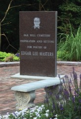 Oak Hill Cemeterylisted 1995
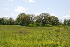 Ogden-Fettie Sitelisted 1972
- Duncan Mills Bridgelisted 1980
Population over time
2 figuresLewistown fell from 2,384 to 2,041 between 2010 and 2020. These are the recorded population figures Wikidata holds for this place, reached through the Geographic Names Information System number this page is keyed on rather than by name, so they belong to this place and not to another of the same name. Most are census counts, but not all are: an early figure may be a founding or settlement estimate, and an estimate published within five years of a census is left out. The change column is computed, and is left blank where more than 20 years separate a figure from the one before it, because a gap that long is not a change between two counts.
| Year | People | Change |
|---|---|---|
| 2010 | 2,384 | |
| 2020 | 2,041 | -343 (-14%) |
Topographic sheets covering this place
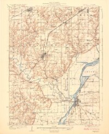
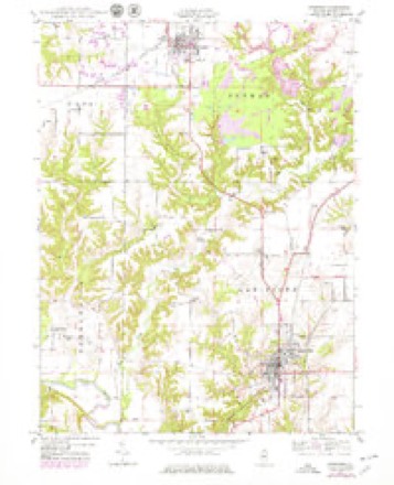
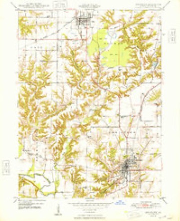
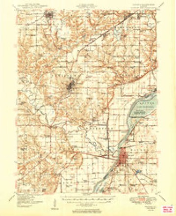
10 surveys from 19 printed sheetsMatched by testing this settlement's coordinate against the published boundary of every sheet in the United States Geological Survey's historical collection. Each opens the scanned sheet at the Survey.
- 1925 USGS Havana quadrangle1:62500, 3 printings
- 1947 USGS Lewistown quadrangle1:24000
- 1948 USGS Lewistown quadrangle1:24000, 2 printings
- 1949 USGS Havana quadrangle1:62500, 3 printings
- 1958 USGS Burlington quadrangle1:250000, 4 printings
- 1961 USGS Burlington quadrangle1:250000
- 1963 USGS Burlington quadrangle1:250000
- 1985 USGS Macomb quadrangle1:100000
- 1989 USGS Macomb quadrangle1:100000
- 1990 USGS Burlington quadrangle1:250000, 2 printings




In the county-history sources
20,657 words on this townshipHistory of Fulton County, Illinois;, published 1879 names this settlement in its chapter on Lewistown Township. These are the passages that mention it, exactly as the scans read.
This township is bounded upon the north by Putman township, upon the east by Liverpool, the south by Waterford, and upon the west by Bcrnadotte. Formerly most of its surface was covered with timber, but muc^h of tliis has been cleared away and the land is in a high state of cultivation. There are in the townshij) 13,471 acres of improved land, with an average value of $24 per acre. Of unimproved land there are 8,796 acres, with an average value of $9.40 per acre. There arc' in the township 851 horses, with an average value of S7'2 per head. Of cattle tiicre are 1,857, having a total value of $22,138. Indeed, as an agricultural township, Lewistown ranks among the first in this fine agricultural county.
Passage source: History of Fulton County, Illinois;, published 1879.
It will naturally be expected that in our historical sketch of Lewistown we will give more than a passing notice of those early and prominent citizens whose fortunes were cast with the early history of the place. For a period of eight years, from 1S21 to 1820, Ossian M. Ross took a conspicnous ])art in jiromoting the enter-, prises of the infant village, so far separated iVoiu civilization. He was a man of great force of character, aud the utuiost coutidence was reposed in him by the few inhabitants of the place, lie moved to Havana, Mason county, in 1829, became its tirst merchant, and there passed the remainder of his days. Stej)hen Dewey, the surveyor and first settler of the town; is described as a social and intelligent gentleman, and occupied various offices of trust and responsibilitv. He erected several of the first buildings of the town. David W. Barnes located here when he first came to the county, which was in 1822, but he .soon removed to his farui near (^anton.
Passage source: History of Fulton County, Illinois;, published 1879.
Stephen Phcljis, of New York, came from the Sangamo country, as Sangamon county was then known, and settled at Lewistown. He is described by Col. Ross as a man of unusual business tact and ability. He rented a portion of a building which stood in the southern i)art of the town, and opened a small stock of goods which he liad purchased at St. Louis. The Indians were then 'numerous, and in tradinti' with them lie secured cdnsiderahle means. He soon was able to erect a store-huihlinjii: of his own, which lie did just north of the brick bu;^iness buihliug owned and occupied by Ileurv Phelps. Here he engaged in an extensive business. The style of the firm name was 8te})hen Phelj)s & Son. He died about 1840, after a life of unusual activity. After his demise the firm was changed to iSIyron Pheljis c\: Son. Myron was an older son of Stej)hen, and about 1841 admitted to partnership his son, HenrA' Phelps, the present head of the Hi-ni. Mr. Myron Phelps died some two years ago. His religious convictions were strong, and toward the Church and business enterprises he was unusually liberal. During his life he laid by a certain portion of his income toward the interests of religion.
Passage source: History of Fulton County, Illinois;, published 1879.
Machine-read from a century-old scan, so expect the errors a machine makes: misspelled names, dropped words, stray characters.
Read the whole chapter on Lewistown Township - it names this place 89 more 89 times.
Fires near this place
3 since 1999Regional context, not property-specific evidence. The federal wildfire occurrence database lists 3 fires within 5 miles of Lewistown between 1999 and 2019, burning about 288 acres in total. None started naturally. None was recorded as arson. Distance is straight-line from the map coordinates, so a fire counted here may appear on a neighbouring settlement's page as well.
| Reported cause | Fires |
|---|---|
| Debris and open burning | 2 |
| Missing data/not specified/undetermined | 1 |
The most recent of them, most recent first, with the day each was reported and the service that recorded it.
| Date | Cause | Size | Reported by | Name on the report |
|---|---|---|---|---|
| 4 April 2004 | Missing data/not specified/undetermined | 28 acres | Illinois River National Wildlife Refuge | KNOTT FIRE 4-5-04 |
| 23 March 2019 | Debris and open burning | 10 acres | Illinois Division of Forestry Resources | 19-020 |
| 14 October 1999 | Debris and open burning | 250 acres | Illinois River National Wildlife Refuge | CANTERBERR |
Settlements close enough to share some of these fires:
Storms near this place
60 since 1995Regional context, not property-specific evidence. The National Weather Service names Lewistown in 60 storm reports between 1995 and 2025: 31 thunderstorm wind, 27 hail, 1 flash flood, 1 flood. No death or injury is recorded in these reports. Each account below is quoted exactly as the forecast office filed it, from the NOAA Storm Events Database, and each date opens the federal record of that event.
| When | Event | Place named | Harm | What the report says |
|---|---|---|---|---|
| June 2016 | Thunderstorm Wind | Lewistown | $35,000 | Several trees and large tree branches blown down in Lewistown. |
| April 2010 | Thunderstorm Wind | Lewistown | $30,000 | Wind damage reported along Highway 24 from 3 miles east of Lewistown to Little America. Numerous tree branches were blown down and several picnic tables were overturned along this path. |
| September 2019 | Thunderstorm Wind | Lewistown | $25,000 | Numerous trees were blown down along IL-97 just north of Lewistown. |
| June 2009 | Thunderstorm Wind | Lewistown | $25,000 | Several small trees were blown down in Lewistown. Power lines were also brought down, causing scattered power outages. |
| April 2014 | Thunderstorm Wind | Lewistown | $20,000 | A garage was destroyed at Hedgecomb Road in Lewistown. |
| June 2009 | Thunderstorm Wind | Lewistown | $20,000 | A 14-inch diameter tree was blown down onto power lines and a parked vehicle. |
| May 2020 | Thunderstorm Wind | Lewistown | $12,000 | A garage was damaged and a power pole was blown down. |
| June 2010 | Thunderstorm Wind | Lewistown | $10,000 | Large tree limbs were snapped. |
| July 2008 | Thunderstorm Wind | Lewistown | $10,000 | A tree was blown down onto the roof of the fire department. Several power lines were blown down across town. |
| June 2010 | Thunderstorm Wind | Lewistown | $1,000 | A carport was severely damaged. |
| March 2025 | Thunderstorm Wind | Lewistown | - | A portion of a barn roof was blown off, as were shingles from a home. A portion of a large tree was also blown down. The report was relayed by the county Emergency Manager. |
| March 2025 | Thunderstorm Wind | Lewistown | - | A farm outbuilding lost a small subset of its metal roofing panels. |
| April 2025 | Thunderstorm Wind | Lewistown | - | A trained spotter reported 60-65 mph wind gusts. |
| June 2024 | Thunderstorm Wind | Lewistown | - | A trained spotter estimated a wind gust of 55-60 mph. |
| July 2024 | Thunderstorm Wind | Lewistown | - | Emergency manager estimated 60 mph wind gusts. |
| April 2023 | Thunderstorm Wind | Lewistown | - | A tree was blown over along West Milton Avenue. |
| April 2023 | Thunderstorm Wind | Lewistown | - | Two metal farm outbuildings experienced roof damage and two power poles were blown down northeast of Lewistown. |
| April 2023 | Thunderstorm Wind | Lewistown | - | A grain bin was crumpled. |
| July 2023 | Thunderstorm Wind | Lewistown | - | Extensive tree damage occurred in Lewistown with tree limbs down on houses. |
| August 2023 | Thunderstorm Wind | Lewistown | - | An 8 to 12-inch diameter tree branch was blown down. |
| June 2023 | Thunderstorm Wind | Lewistown | - | Numerous tree branches were blown down. |
| March 2022 | Thunderstorm Wind | Lewistown | - | A pine tree was snapped. |
| June 2010 | Thunderstorm Wind | Lewistown | - | Debris from yards was blown blocks away. |
| August 2009 | Flood | Lewistown | - | Heavy rainfall in a short amount of time caused areas of minor flooding in and near Lewistown. Water flowed across the road at Rt 100 and Taylor Road and numerous streets were flooded in Lewistown. |
| May 2006 | Thunderstorm Wind | Lewistown | - | Numerous trees, tree limbs and power lines were blown down. |
| May 2006 | Hail | Lewistown | - | Widespread large hail, with maximum sizes ranging from 1 to 3 inches, was reported along a line from Lewistown, to St. David, to Canton. The largest hail was reported in the vicinity of St David. |
| June 2006 | Thunderstorm Wind | Lewistown | - | A few tree limbs were blown down. |
| September 2006 | Flash Flood | Lewistown | - | Flooding reported in town, resulting in numerous flooded basements. |
| June 2005 | Hail | Lewistown | - | Golf ball sized hail broke windows on several vehicles. |
| June 2004 | Thunderstorm Wind | Lewistown | - | A tree and several large tree limbs were blown down. |
| April 2001 | Thunderstorm Wind | Lewistown | - | Windows were blown out of a house as well as power poles knocked down. |
| June 2001 | Thunderstorm Wind | Lewistown | - | Thunderstorm winds blew siding off of a house causing minor damage. |
| July 1997 | Thunderstorm Wind | Lewistown | - | Thunderstorm winds blew down numerous trees, tree limbs, and power lines in Lewistown and in Sepo. No injuries were reported and no damage estimate was available. |
| April 1997 | Thunderstorm Wind | Lewistown | - | As the storms moved through Fulton County, numerous large tree limbs and power lines were blown down 1 mile north of Lewistown, in Canton, and in Banner. |
| July 2024 | Thunderstorm Wind | Lewistown | - | no account filed |
| June 2024 | Hail | Lewistown | - | no account filed |
| April 2023 | Hail | Lewistown | - | no account filed |
| May 2023 | Hail | Lewistown | - | no account filed |
| May 2023 | Hail | Lewistown | - | no account filed |
| May 2023 | Hail | Lewistown | - | no account filed |
| April 2020 | Hail | Lewistown | - | no account filed |
| September 2019 | Hail | Lewistown | - | no account filed |
| September 2019 | Hail | Lewistown | - | no account filed |
| May 2019 | Hail | Lewistown | - | no account filed |
| December 2018 | Hail | Lewistown | - | no account filed |
| April 2013 | Hail | Lewistown | - | no account filed |
| June 2010 | Hail | Lewistown | - | no account filed |
| June 2010 | Hail | Lewistown | - | no account filed |
| June 2010 | Hail | Lewistown | - | no account filed |
| June 2010 | Hail | Lewistown | - | no account filed |
| March 2006 | Hail | Lewistown | - | no account filed |
| May 2006 | Hail | Lewistown | - | no account filed |
| March 2005 | Hail | Lewistown | - | no account filed |
| August 2003 | Hail | Lewistown | - | no account filed |
| May 2003 | Hail | Lewistown | - | no account filed |
| May 2002 | Hail | Lewistown | - | no account filed |
| May 2000 | Hail | Lewistown | - | no account filed |
| July 1997 | Hail | Lewistown | - | no account filed |
| February 1996 | Hail | Lewistown | - | no account filed |
| May 1995 | Hail | Lewistown | - | no account filed |
Nearest settlements
The eight closest, with where each one stands in the county. Distances are straight-line, computed from the Geographic Names Information System coordinates.
| Map | Place | Distance | Sheets |
|---|---|---|---|
| Depler Springs | 3.2 miles | 19 | |
| Sepo | 3.9 miles | 19 | |
| Waterford (historical) | 4.0 miles | 19 | |
| Duncan Mills | 4.1 miles | 19 | |
| Keeler (historical) | 4.8 miles | 19 | |
| Bryant | 6.0 miles | 19 | |
| Little America | 6.4 miles | 19 | |
| Maples Mill | 7.0 miles | 19 |
Elsewhere
Matched on this settlement's Geographic Names Information System number rather than its name, so it cannot be a different place of the same name in another state.
| Wikipedia article on Lewistown | An encyclopaedic summary. Its text is share-alike, so it is linked here rather than copied. |
| Wikidata item Q576115 | The structured record the population and elevation above come from. Public domain (CC0). |
Provenance
This settlement is recorded in the Geographic Names Information System as feature 424186. The sheet list is computed by point-in-boundary test against the United States Geological Survey's historical topographic inventory. Both are works of the United States government and carry no copyright under 17 U.S.C. 105.
Wildfire. Short, Karen C. 2022. Spatial wildfire occurrence data for the United States, 1992-2020 [FPA_FOD_20221014]. 6th Edition. Fort Collins, CO: Forest Service Research Data Archive. https://doi.org/10.2737/RDS-2013-0009.6 Collected with United States Government funding and usable without additional permissions or fees.
Storms. NOAA National Centers for Environmental Information, Storm Events Database https://www.ncei.noaa.gov/stormevents/ A work of the United States government, no copyright under 17 U.S.C. 105. Narratives are quoted verbatim from the National Weather Service report and are not edited or summarised.