 Block
Morrison, Illinois
11 topographic sheets cover this place, the earliest surveyed in 1934 and the latest in 1985. It stands in Mount Pleasant Township. It lies in ZIP code area 61270. It stands on French Creek. The Survey maps it on the Morrison quadrangle. 4,085 people lived here at the 2020 count. It stands 656 feet above sea level.
On record in Morrison
Buildings and businesses the archive holds for this place. Each opens its own page, with the source record it came from.
On the National Register 3 records
 Malvern Roller Milllisted 1995
 Morrison Main Street Historic Districtlisted 2014
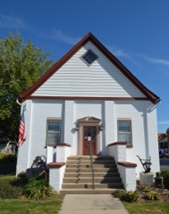 Odell Buildinglisted 1996
Population over time
2 figuresMorrison fell from 4,188 to 4,085 between 2010 and 2020. These are the recorded population figures Wikidata holds for this place, reached through the Geographic Names Information System number this page is keyed on rather than by name, so they belong to this place and not to another of the same name. Most are census counts, but not all are: an early figure may be a founding or settlement estimate, and an estimate published within five years of a census is left out. The change column is computed, and is left blank where more than 20 years separate a figure from the one before it, because a gap that long is not a change between two counts.
| Year | People | Change |
|---|---|---|
| 2010 | 4,188 | |
| 2020 | 4,085 | -103 (-2%) |
Topographic sheets covering this place
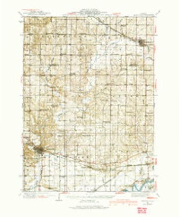
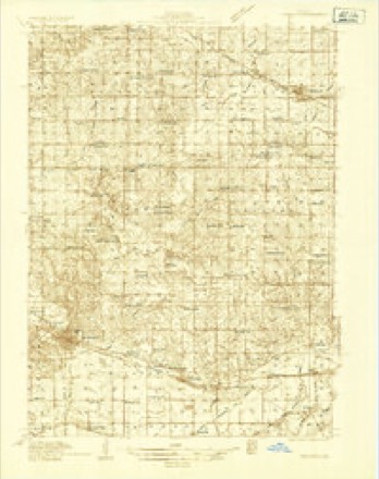
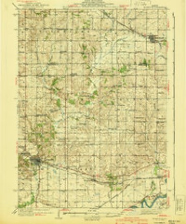
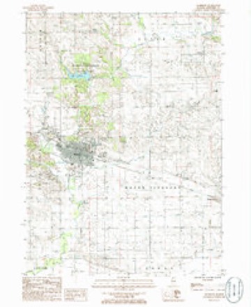
7 surveys from 11 printed sheetsMatched by testing this settlement's coordinate against the published boundary of every sheet in the United States Geological Survey's historical collection. Each opens the scanned sheet at the Survey.
- 1934 USGS Morrison quadrangle1:62500
- 1934 USGS Morrison quadrangle1:48000
- 1940 USGS Morrison quadrangle1:62500, 2 printings
- 1958 USGS Aurora quadrangle1:250000, 3 printings
- 1961 USGS Aurora quadrangle1:250000
- 1985 USGS Dixon quadrangle1:100000, 2 printings
- 1985 USGS Morrison quadrangle1:24000



In the county-history sources
16,049 words on this townshipPortrait and Biographical Album of Whiteside County, Illinois : Containing Full-page Portraits and Biographies of All the Governors of Illinois, and of the Presidents of the United States, published 1885 names this settlement in its chapter on Mount Pleasant Township. These are the passages that mention it, exactly as the scans read.
The credit of the first settlement is given to Felix French, James J. Thomas, J. D. Pashcal, Wm. H. Pashcal and George O. James, who came in the spring of 1835. Felix French located on section 19; W. H. Pashcal on section 17 ; J. D. Pashcal on section 16; James J. Thomas on section 16, and George O. James on section 7. George W. Thomas came in a little later, and made a claim on section 9, and one for his brother, W. C., on section 8. John W. Stakes, with Joshua T. Atkinson, made the first claims in Union Grove Precinct, on both sides of Rock Creek, in 1835. They made a division of their property in 1836, Mr. Atkinson taking the west side of the creek and Stakes the east side, which is now embraced by Mt. Pleasant Township. He should be regarded as a settler in this township. During the summer of 1836 he broke up the ground and planted a crop where Morrison now stands.
Passage source: Portrait and Biographical Album of Whiteside County, Illinois : Containing Full-page Portraits and Biographies of All the Governors of Illinois, and of the Presidents of the United States, published 1885.
Jonathan Haines put up a saw-mill on Rock Creek, about a mile and a half above Unionville. He had only cut a few feet of lumber when a freshet came and took his mill down stream. It was hauled back and set up again, but not in time to cut any lumber that season. In the spring of 1837 it was again started, and with better success. During this season two stones were put in for grinding corn and wheat. This mill site was in what was afterward called
Passage source: Portrait and Biographical Album of Whiteside County, Illinois : Containing Full-page Portraits and Biographies of All the Governors of Illinois, and of the Presidents of the United States, published 1885.
Jacqbstown. Mr. Haines became quite a prominent and useful citizen, doing much toward advancing the township. He afterward moved to Pekin, 111, where he died, Feb. 22, 1868. William H. Fashcal accumulated considerable property, and was a much respected citizen. He died on his farm home, March 12, 1875. He was a son-in-law of Anthony M. Thomas. J. D. Pashcal died during the winter of 1885. J. B. Dodge died at his farm in January, 1843.
Passage source: Portrait and Biographical Album of Whiteside County, Illinois : Containing Full-page Portraits and Biographies of All the Governors of Illinois, and of the Presidents of the United States, published 1885.
Machine-read from a century-old scan, so expect the errors a machine makes: misspelled names, dropped words, stray characters.
Read the whole chapter on Mount Pleasant Township - it names this place 42 more 42 times.
Mines and quarries near this place
3 within 5 milesRegional context, not property-specific evidence. The federal mineral resources record lists 3 workings within 5 miles of Morrison: 3 past producers. None of them still produces. What was taken out: Stone, Crushed/Broken. Distance is straight-line from the map coordinates, so a quarry counted here may appear on a neighbouring settlement's page as well.
| Where | Site | Commodity | Status | Recorded |
|---|---|---|---|---|
| Morrison Quarry | Stone, Crushed/Broken | Past Producer | ||
| Unnamed Limestone Quarry | Stone, Crushed/Broken | Past Producer | ||
| Whiteside County Highway Department | Stone, Crushed/Broken | Past Producer |
Storms near this place
57 since 1993Regional context, not property-specific evidence. The National Weather Service names Morrison in 57 storm reports between 1993 and 2024: 22 hail, 22 thunderstorm wind, 3 funnel cloud, 3 flash flood. The reports record 1 injury. Each account below is quoted exactly as the forecast office filed it, from the NOAA Storm Events Database, and each date opens the federal record of that event.
| When | Event | Place named | Harm | What the report says |
|---|---|---|---|---|
| August 2010 | Lightning | Morrison | 1 hurt | A 12 year old boy was struck by lightning at Southside Elementary School in Morrison, IL just before 2 pm CDT August 20. |
| August 2014 | Thunderstorm Wind | Morrison | $250,000 | Wind gusts estimated to be 75 mph blew down numerous trees across all of Morrison, IL around 220 pm CDT August 25. There was widespread tree damage across town with some trees on power lines and residences. |
| June 2009 | Thunderstorm Wind | Morrison | $25,000 | Wind gusts estimated to be 70 mph blew some trees and power lines down in Morrison, IL around 610 pm June 19. |
| March 2006 | Thunderstorm Wind | Morrison | $25,000 | 15 power poles snapped at ground level on Frog Pond Road between Garden Plain and Hazel Roads. |
| July 2003 | Hail | Morrison | $20,000 | no account filed |
| August 2014 | Thunderstorm Wind | Morrison | $15,000 | Wind gusts estimated to be 75 mph blew down several trees on the spotter's block in Morrison, IL around 220 pm CDT August 25. A two foot diameter tree fell on a garage and another nearby tree was snapped off. |
| June 2008 | Thunderstorm Wind | Morrison | $10,000 | Wind gusts estimated to be 60 mph blew down some tree branches throughout the town of Morrison, IL around 4:45 am June 6. The branches fell onto some power lines breaking them causing a power outage. |
| July 2006 | Thunderstorm Wind | Morrison | $5,000 | Also from co-op observer. Trees and power lines down. Many of the limbs were 6 inches in diameter with some greater than 10 inches in diameter. |
| August 1993 | Hail | Morrison | $5,000 | Rapid developing thunderstorms produced golf-ball size hail, twice, at Morrison, Illinois. Both severe thunderstorms were about half an hour apart and moved northeast at 35 mph. The second storm arrived with a stronger punch of wind with measured wind gusts recorded at 68 mph. Numerous tree limbs were blown down. No dollar amounts were reported, but crop damage had to be significant considering the time of year. |
| August 2000 | Thunderstorm Wind | Morrison | $5,000 | no account filed |
| March 2006 | Hail | Morrison | $3,000 | no account filed |
| September 2000 | Thunderstorm Wind | Morrison | $2,000 | Trees down. |
| August 1995 | Thunderstorm Wind | Morrison | $2,000 | no account filed |
| June 2024 | Thunderstorm Wind | Morrison | - | Powerlines downed by thunderstorm winds. |
| April 2023 | Tornado (EF1) | Morrison | - | An isolated tornado began just east of Morrison IL around 2:56 PM CST. The tornado damaged a power pole and a tree at this location. The tornado then caused sporadic damage until it approached Fulfs Road. It strengthened at this location and caused damage to trees, farm outbuildings, and a power pole. The tornado ended shortly after this location. Wind speeds are estimated in the 105-110 MPH range, with a rating of EF1. At it's widest, the tornado was 300 yards and was likely a multi-vortex tornado. The tornado path length was nearly 6 miles. |
| August 2021 | Thunderstorm Wind | Morrison | - | A large tree branch blown down, approximately 15 to 18 inches in diameter. |
| November 2020 | Thunderstorm Wind | Morrison | - | Tree branch blown down on a roof, with possible funnel cloud spotted. |
| November 2020 | Thunderstorm Wind | Morrison | - | Multiple power poles down on the east side of town. |
| November 2020 | Thunderstorm Wind | Morrison | - | Ten to twelve power poles snapped on Hazel Road, west of Lyndon Road. This is a general location and the time is estimated from radar. |
| May 2020 | Thunderstorm Wind | Morrison | - | A large tree was topped off by high winds. |
| November 2020 | Thunderstorm Wind | Morrison | - | Barn destroyed and blown into a field. The damage occurred on Lyndon Road, north of Hazel Road. This is the general location, with time estimated by radar. |
| May 2018 | Hail | Morrison | - | A trained spotter reported hail up to the size of 1 inch in diameter. |
| May 2018 | Hail | Morrison | - | A trained spotter reported hail up to the size of golf balls. |
| May 2018 | Hail | Morrison | - | A public report was received of hail up to the size of quarters. |
| June 2015 | Thunderstorm Wind | Morrison | - | Lots of trees damaged between Morrison and Sterling in thunderstorm winds. |
| June 2014 | Thunderstorm Wind | Morrison | - | A trained spotter estimated wind gusts to 60 mph. |
| August 2011 | Heavy Rain | Morrison | - | Rain fell over a 10 to 15 minute period. |
| August 2011 | Heavy Rain | Morrison | - | Storm total precipitation as of 15:27 CDT. |
| April 2010 | Hail | Morrison | - | Non-severe hail (<1.0) fell in Morrison, IL around 628 pm April 4. |
| April 2010 | Hail | Morrison | - | Golf ball sized hail fell in Morrison, IL around 630 pm April 4. |
| June 2008 | Thunderstorm Wind | Morrison | - | Wind gusts estimated to be 60 mph blew down a tree limb onto a house in Morrison, IL at 2:49 pm June 7. |
| June 2008 | Thunderstorm Wind | Morrison | - | Winds estimated to be 60 mph blew down a tree across N Orange Street in Morrison, IL around 6:00 am June 15. Other branches were also blown down. |
| May 2006 | Thunderstorm Wind | Morrison | - | Estimated 60 mph winds |
| May 2006 | Hail | Morrison | - | nickel size hail with strong winds |
| June 2006 | Hail | Morrison | - | penny size hail on south side of town |
| June 2002 | Flash Flood | Morrison | - | Heavy rain resulted in a mudslide which closed portions of Highway 30 east of Morrison. |
| June 2002 | Flash Flood | Morrison | - | Spring Valley Road closed south of Morrison. |
| June 2002 | Flash Flood | Morrison | - | Train bridge at Lyndon Road buckled due to high water. |
| June 2002 | Flood | Morrison | - | Several streets with water up to the curb. |
| May 1999 | Tornado (F0) | Morrison | - | Law enforcement officials reported a brief tornado south of Morrison. No damage was reported. |
| June 1999 | Thunderstorm Wind | Morrison | - | Several large trees, roughly 4 to 6 feet in diameter, were blown down. Power lines were also downed. |
| June 1994 | Hail | Morrison | - | Early in the afternoon a large crowd at the Davenport, Iowa Airport were able to witness a funnel cloud near the Mississippi River between Princeton, Iowa, and Port Byron, Illinois. The large crowd was due to the Quad City Air Show in progress at the time of the event. Later in the afternoon thunderstorms strengthened in Whiteside County, Illinois. Numerous reports of hail was received. Walnut-size hail was the largest reported in Lyndon, Illinois, shortly before 1500 CST. One tree was also blown down just north of Lyndon shortly after 1500 CST. Chicago Doppler Radar estimated three and one-half to four inches of rain between Morrison and Sterling between 1300 CST and 1600 CST. |
| July 1994 | Hail | Morrison | - | Dime-size hail and 50 to 60 mph winds were reported in Fulton. Nickel-size hail was reported on Route 78 in northern Whiteside County. Some street flooding was reported in Morrison after a reported 1.7 inches of rain fell in about one hours time. |
| June 1994 | Hail | Morrison | - | Early in the afternoon a large crowd at the Davenport, Iowa Airport were able to witness a funnel cloud near the Mississippi River between Princeton, Iowa, and Port Byron, Illinois. The large crowd was due to the Quad City Air Show in progress at the time of the event. Later in the afternoon thunderstorms strengthened in Whiteside County, Illinois. Numerous reports of hail was received. Walnut-size hail was the largest reported in Lyndon, Illinois, shortly before 1500 CST. One tree was also blown down just north of Lyndon shortly after 1500 CST. Chicago Doppler Radar estimated three and one-half to four inches of rain between Morrison and Sterling between 1300 CST and 1600 CST. |
| June 1994 | Hail | Morrison | - | Early in the afternoon a large crowd at the Davenport, Iowa Airport were able to witness a funnel cloud near the Mississippi River between Princeton, Iowa, and Port Byron, Illinois. The large crowd was due to the Quad City Air Show in progress at the time of the event. Later in the afternoon thunderstorms strengthened in Whiteside County, Illinois. Numerous reports of hail was received. Walnut-size hail was the largest reported in Lyndon, Illinois, shortly before 1500 CST. One tree was also blown down just north of Lyndon shortly after 1500 CST. Chicago Doppler Radar estimated three and one-half to four inches of rain between Morrison and Sterling between 1300 CST and 1600 CST. |
| August 1993 | Hail | Morrison | - | Rapid developing thunderstorms produced golf-ball size hail, twice, at Morrison, Illinois. Both severe thunderstorms were about half an hour apart and moved northeast at 35 mph. The second storm arrived with a stronger punch of wind with measured wind gusts recorded at 68 mph. Numerous tree limbs were blown down. No dollar amounts were reported, but crop damage had to be significant considering the time of year. |
| April 2023 | Hail | Morrison | - | no account filed |
| May 2019 | Hail | Morrison | - | no account filed |
| May 2019 | Hail | Morrison | - | no account filed |
| May 2006 | Hail | Morrison | - | no account filed |
| May 2000 | Hail | Morrison | - | no account filed |
| May 2000 | Hail | Morrison | - | no account filed |
| May 2000 | Hail | Morrison | - | no account filed |
| May 2000 | Flood | Morrison | - | no account filed |
| May 1999 | Funnel Cloud | Morrison | - | no account filed |
| May 1999 | Funnel Cloud | Morrison | - | no account filed |
| May 1999 | Funnel Cloud | Morrison | - | no account filed |
Nearest settlements
The eight closest, with where each one stands in the county. Distances are straight-line, computed from the Geographic Names Information System coordinates.
| Map | Place | Distance | Sheets |
|---|---|---|---|
| Unionville | 1.1 miles | 11 | |
| Union Grove | 3.7 miles | 18 | |
| Malvern | 5.2 miles | 11 | |
| Round Grove | 5.2 miles | 11 | |
| Ustick | 5.3 miles | 11 | |
| Oliver | 5.5 miles | 18 | |
| Fenton | 6.5 miles | 14 | |
| Valley Vista Estates | 6.6 miles | 11 |
Elsewhere
Matched on this settlement's Geographic Names Information System number rather than its name, so it cannot be a different place of the same name in another state.
| Wikipedia article on Morrison | An encyclopaedic summary. Its text is share-alike, so it is linked here rather than copied. |
| Wikidata item Q374745 | The structured record the population and elevation above come from. Public domain (CC0). |
Provenance
This settlement is recorded in the Geographic Names Information System as feature 413843. The sheet list is computed by point-in-boundary test against the United States Geological Survey's historical topographic inventory. Both are works of the United States government and carry no copyright under 17 U.S.C. 105.
Mines and quarries. USGS Mineral Resources Data System (MRDS) https://mrdata.usgs.gov/mrds/ A work of the United States government, no copyright under 17 U.S.C. 105.
Storms. NOAA National Centers for Environmental Information, Storm Events Database https://www.ncei.noaa.gov/stormevents/ A work of the United States government, no copyright under 17 U.S.C. 105. Narratives are quoted verbatim from the National Weather Service report and are not edited or summarised.