 Block
Middletown, Illinois
13 topographic sheets cover this place, the earliest surveyed in 1948 and the latest in 1990. It stands in Corwin Township. It lies in ZIP code area 62666. The Survey maps it on the Middletown quadrangle. 329 people lived here at the 2020 count. It stands 581 feet above sea level.
Population over time
2 figuresMiddletown grew from 324 to 329 between 2010 and 2020. These are the recorded population figures Wikidata holds for this place, reached through the Geographic Names Information System number this page is keyed on rather than by name, so they belong to this place and not to another of the same name. Most are census counts, but not all are: an early figure may be a founding or settlement estimate, and an estimate published within five years of a census is left out. The change column is computed, and is left blank where more than 20 years separate a figure from the one before it, because a gap that long is not a change between two counts.
| Year | People | Change |
|---|---|---|
| 2010 | 324 | |
| 2020 | 329 | +5 (+2%) |
Topographic sheets covering this place
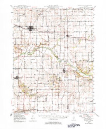
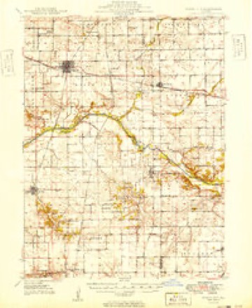
8 surveys from 13 printed sheetsMatched by testing this settlement's coordinate against the published boundary of every sheet in the United States Geological Survey's historical collection. Each opens the scanned sheet at the Survey.
- 1948 USGS Mason City quadrangle1:62500, 2 printings
- 1949 USGS Mason City quadrangle1:62500, 2 printings
- 1958 USGS Peoria quadrangle1:250000, 4 printings
- 1961 USGS Peoria quadrangle1:250000
- 1963 USGS Peoria quadrangle1:250000
- 1985 USGS Lincoln quadrangle1:100000
- 1989 USGS Lincoln quadrangle1:100000
- 1990 USGS Peoria quadrangle1:250000




What happened here
An account from the chapter on Corwin township. The inset identifies its exact source book and publication year.
Hi8Tobt Of Logan County
Lucinda, who married David Stone, both she and her husband being now deceased, and Elizabeth Jane, widow of Henry Post, who accidently shot himself at Middletown in 1862. The three sons are all living - Robert A., at Middletown; Nathan B., of Martinsburg, Iowa, and James L., in Menard County. Robert A.
In the county-history sources
13,266 words on this townshipHistory of Logan County, Illinois : Its Past and Present .., published 1878 names this settlement in its chapter on Corwin Township. These are the passages that mention it, exactly as the scans read.
BEAVER JAMES, farmer and stockraiser, Sec. 12; P.O. Lincoln; rep; liberal; born in Ross Co. Ohio, Jan. 9, 1820; married Aug. 18, 1843, to Nancy Chasteen, bom in Ross Co. Ohio, March 17, 1823; have five children: Azariah W. born Sept. 9, 1844, married to Eliza Preston; Edward, Sept. 9, 1846, married to Matilda Linson; Seymour, May 14, 1849, married Elizabeth Linson; Thomas, June 29, 1857, married Jennie Anson; Sherman, June 12, 1865; lived in Ohio until spring of 1846, then moved to Fulton Co. Ill; came to this county in 1S52; owns 1,640 acres, value about $50,000; owns 400 acres in Nebraska
Passage source: History of Logan County, Illinois : Its Past and Present .., published 1878.
LEONARD JOHN A* farmer. Sec 17; P.O. Middletown; rep; Chris; bom in Knox Co. Indiana, Sept. 6, 1832; married Dec 22. 1855. to Matilda Robins, bom in LickenCo. Ohio, March 18, 1841; came to this county September, 1864; owns 40 acres in Menard Co. and 5 acres in this township; enlisted Feb. 28, 1861, in Co. K, 28th I. V. I. under Gen. Hulbert, 4th Army Corps; engaged in battles of Corinth and Bolivar; discharged Nov. 22, 1862, on ac^ count of a burn on the legs; has five children Lucinda J. married to William Clevenger; Martha A. bom March 14, i860; Alvin T. Sept. 5. 1863; Marr G. Aug. 7, 1869; Eliza A., May 17, 1876; lost three: William A., James S. M. and Theophilus
Passage source: History of Logan County, Illinois : Its Past and Present .., published 1878.
SIMMONS ALBERT, farmer and justice of the peace. Sec. 14; P.O. Lincoln; rep; Meth; born in Rensaeller . Co. N. Y. March 3, 18^3; married April 19, 1854, to Susan J. Denton, born in Rock Island. Ills. May 20, 1837^ has one child, Frank, bom March 3, 1862; came to this county in 1870; has held the office of justice of the peace since April, 1874; rents 120 acres from Mr. Mark with. His son Frank, at the age of 14 years tended his father's farm, helping to plant, plow, and gather 52 acres of com; his father during this time was able to do but very little work on account of ill health; first plowed at the age of 10 years, doing effective work- Smith David J. farmer. Sec. 15; P.O. Lincoln rep; Meth; from Kentucky
Passage source: History of Logan County, Illinois : Its Past and Present .., published 1878.
Machine-read from a century-old scan, so expect the errors a machine makes: misspelled names, dropped words, stray characters.
Read the whole chapter on Corwin Township - it names this place 18 more 18 times.
Mines and quarries near this place
1 within 5 milesRegional context, not property-specific evidence. The federal mineral resources record lists 1 working within 5 miles of Middletown: 1 past producer. None of them still produces. What was taken out: Sand and Gravel, Construction. Distance is straight-line from the map coordinates, so a quarry counted here may appear on a neighbouring settlement's page as well.
| Where | Site | Commodity | Status | Recorded |
|---|---|---|---|---|
| Heinzel Pit | Sand and Gravel, Construction | Past Producer |
Storms near this place
21 since 1994Regional context, not property-specific evidence. The National Weather Service names Middletown in 21 storm reports between 1994 and 2025: 16 thunderstorm wind, 3 hail, 2 flash flood. No death or injury is recorded in these reports. Each account below is quoted exactly as the forecast office filed it, from the NOAA Storm Events Database, and each date opens the federal record of that event.
| When | Event | Place named | Harm | What the report says |
|---|---|---|---|---|
| April 2017 | Thunderstorm Wind | Middletown | $2,000,000 | A downburst with estimated 80mph winds impacted locations from Middeltown to 1.5 miles north of Burton View between 4:56 PM CDT and 5:15 PM CDT. 43 homes were damaged by falling trees and 29 power poles were snapped. Several large outbuildings and two grain bins were severely damaged. In addition, tree limbs were blown onto a car in Middletown. |
| August 1999 | Thunderstorm Wind | Middletown | $50,000 | Numerous trees, tree limbs, and power lines were blown down countywide. Also, thousands of acres of corn were flattened. In Mt. Pulaski, a tree was blown down onto a house causing minor damage. New Holland Fire Department estimated 85 mph winds for about 2 minutes. Damage to the crops was estimated around $8.3 million. |
| November 1998 | Thunderstorm Wind | Middletown | $35,000 | In Middletown, an empty grain bin was blown over and some windows were blown out of the grade school. Also, numerous trees were either blown over or snapped off and numerous power lines were blown down. Damage was estimated around $35,000. |
| June 2013 | Thunderstorm Wind | Middletown | $15,000 | A large tree was blown onto a house and a power line was knocked down. |
| May 2018 | Thunderstorm Wind | Middletown | $10,000 | Shingles were damaged on a home and several tree branches were blown down. |
| June 2010 | Thunderstorm Wind | Middletown | $4,000 | Three trees were blown down along 1400th Street just outside of Middletown. |
| June 2011 | Thunderstorm Wind | Middletown | $2,000 | A large tree was blown down onto power lines. |
| April 2011 | Thunderstorm Wind | Middletown | $1,000 | A tree was blown down onto the Greenview Blacktop just southwest of Middletown. |
| April 2025 | Thunderstorm Wind | Middletown | - | A power pole was snapped near the intersection of 1400th Street and County Road 350 East. |
| July 2025 | Thunderstorm Wind | Middletown | - | Tree branches were blown down. |
| March 2024 | Thunderstorm Wind | Middletown | - | A tree was blown down. |
| May 2023 | Thunderstorm Wind | Middletown | - | Powerlines were blown down and a power pole caught fire. |
| May 2019 | Thunderstorm Wind | Middletown | - | Seventeen power poles were blown down. |
| August 2014 | Flash Flood | Middletown | - | A slow moving thunderstorm produced 2.50 to 4.00 inches of rain in less than two hours across southwest Logan County and western parts of the city of Lincoln. Most rural roads were impassable between New Holland, Lincoln and Middletown. State Route 10 west of Lincoln was closed for a short period of time, and streets in the western half of Lincoln were inundated. The flooding quickly subsided in less than three hours. |
| May 2010 | Flash Flood | Middletown | - | Slow moving, training thunderstorm cells produced an area of flash flooding in western Logan County. Rainfall rates of 1.50 inches per hour were reported for about three hours. Many rural roads were inundated by the flooding, particularly near Middletown. |
| April 2006 | Hail | Middletown | - | Nickel size hail covered the ground. |
| July 2002 | Thunderstorm Wind | Middletown | - | Three large trees were blown down, one caused minor roof damage. |
| April 1994 | Thunderstorm Wind | Middletown | - | Thunderstorm winds damaged two barns, a grain bin, and a chimney on one house. Four trees were uprooted and numerous tree limbs were blown down. |
| July 1994 | Thunderstorm Wind | Middletown | - | Thunderstorm winds blew down numerous power lines in Middletown. |
| March 2024 | Hail | Middletown | - | no account filed |
| May 2011 | Hail | Middletown | - | no account filed |
Nearest settlements
The eight closest, with where each one stands in the county. Distances are straight-line, computed from the Geographic Names Information System coordinates.
| Map | Place | Distance | Sheets |
|---|---|---|---|
| New Holland | 5.9 miles | 14 | |
| Burton View | 7.4 miles | 15 | |
| Elkhart | 7.9 miles | 14 | |
| Broadwell | 8.1 miles | 14 | |
| Mount Fulcher | 8.6 miles | 17 | |
| Fogarty | 9.1 miles | 14 | |
| Harness | 10.2 miles | 14 | |
| Lincoln | 12.4 miles | 14 |
Elsewhere
Matched on this settlement's Geographic Names Information System number rather than its name, so it cannot be a different place of the same name in another state.
| Wikipedia article on Middletown | An encyclopaedic summary. Its text is share-alike, so it is linked here rather than copied. |
| Wikidata item Q2671702 | The structured record the population and elevation above come from. Public domain (CC0). |
Provenance
This settlement is recorded in the Geographic Names Information System as feature 413514. The sheet list is computed by point-in-boundary test against the United States Geological Survey's historical topographic inventory. Both are works of the United States government and carry no copyright under 17 U.S.C. 105.
Mines and quarries. USGS Mineral Resources Data System (MRDS) https://mrdata.usgs.gov/mrds/ A work of the United States government, no copyright under 17 U.S.C. 105.
Storms. NOAA National Centers for Environmental Information, Storm Events Database https://www.ncei.noaa.gov/stormevents/ A work of the United States government, no copyright under 17 U.S.C. 105. Narratives are quoted verbatim from the National Weather Service report and are not edited or summarised.