 Block
Oblong, Illinois
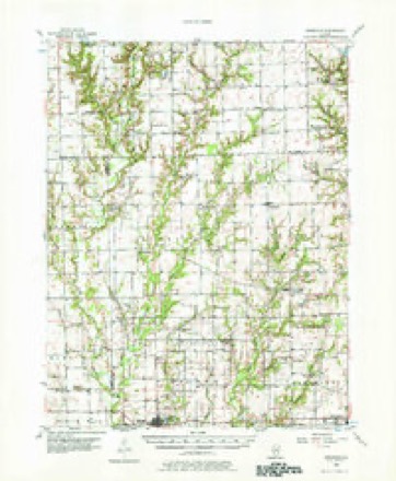
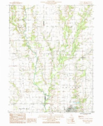
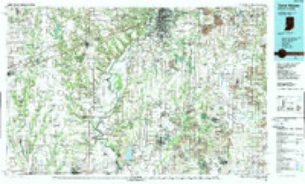
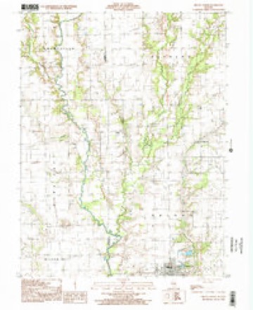
14 topographic sheets cover this place, the earliest surveyed in 1953 and the latest in 1998. It stands in Oblong Township. It lies in ZIP code area 62449. The Survey maps it on the Oblong North quadrangle. 1,371 people lived here at the 2020 count. It stands 512 feet above sea level.
Population over time
2 figuresOblong fell from 1,466 to 1,371 between 2010 and 2020. These are the recorded population figures Wikidata holds for this place, reached through the Geographic Names Information System number this page is keyed on rather than by name, so they belong to this place and not to another of the same name. Most are census counts, but not all are: an early figure may be a founding or settlement estimate, and an estimate published within five years of a census is left out. The change column is computed, and is left blank where more than 20 years separate a figure from the one before it, because a gap that long is not a change between two counts.
| Year | People | Change |
|---|---|---|
| 2010 | 1,466 | |
| 2020 | 1,371 | -95 (-6%) |
Topographic sheets covering this place
8 surveys from 14 printed sheetsMatched by testing this settlement's coordinate against the published boundary of every sheet in the United States Geological Survey's historical collection. Each opens the scanned sheet at the Survey.
- 1953 USGS Indianapolis quadrangle1:250000, 4 printings
- 1956 USGS Annapolis quadrangle1:62500, 2 printings
- 1956 USGS Indianapolis quadrangle1:250000
- 1957 USGS Indianapolis quadrangle1:250000, 2 printings
- 1962 USGS Indianapolis quadrangle1:250000
- 1985 USGS Oblong North quadrangle1:24000
- 1986 USGS Terre Haute quadrangle1:100000, 2 printings
- 1998 USGS Oblong North quadrangle1:24000




In the county-history sources
1,216 words on this townshipILLINOIS HISTORICAL CRAWFORD COUNTY, published 1909 names this settlement in its chapter on Oblong Township. These are the passages that mention it, exactly as the scans read.
In the western part of Crawford County stretches a prairie, which was called Oblong by the first settlers in that region, and this name was subsequently given to the township division within whose borders it was included. This township has an area of 56 square miles, lying in the middle of the western portion of the county, extending seven miles east and west and eight miles north and south. It is bounded on the north by Licking Township, on the east by Robinson, south by Martin and west by Jasper County. Muddy Creek, Big Creek, Willow and Dogwood Creeks, and North Fork are the water courses running through the township. In its wild state nearly half of the township was wooded, heavy timber bordering the creek, and now the land, which is very productive, is divided into farms. moderate sized. Lot Watts, who came from Tennessee to Illinois early in the '20s, first buying a tract of eighty acres in the vieinity of Robinson, made the first entry of land in the township, locating on Section 6 in 1830. He was the first Justice of the Peace in the township, and subsequently served as one of the County Judges. His death took place in 1854, and that of his brother, Robert Watts, who settled in the township in 1831, occurred in 1871. James Watts, Robert's son, was a venturesome hunter and trapper, and became known a daring backwoods fighter. He married a daughter of William Wilson and lived in a small cabin, devoting the latter part of his life to trapping, whereby he profited much. Together with Robert Watts, arrived Jeremiah and Jesse York, cousins, and later, in 1831, Jesse Eaton. In the humble dwelling of Jesse York, a very worthy and influential man and a devout Methodist, were held the first religious services in the township. Jesse Eaton lived a while on North Fork, moving then to the northeastern part of the township, which was his home until 1863. He was an Old School Baptist minister, and preached throughout the township. Ezekiel and Areh York developed good farms in the southern part of the township, clearing the ground in 1834. In the same year George Miller, a successful hunter and trapper, but a bully and frontier marauder, "squatted" on North Fork, where he died in 1863.
Passage source: ILLINOIS HISTORICAL CRAWFORD COUNTY, published 1909.
In 1836 the community received additions through the arrival of John Smith, Elijah Smith, Greenberry Eaton and John Salisbury, with their families. Mr. Eaton entered up land in Section 36, near the present village of Oblong, and being a cooper by trade, supplied his neighbors with buckets, tubs and barrels, of which they had much need. Mr. Salisbury came from Indiana, locating in Section 19, where he became the owner of considerable land. 'The Smiths, who came from Kentucky, were men of unsettled habits and rambling tendencies, having no definite abiding place. and earning their living by hunting. Their brother, James, whose advent was somewhat later, was a man of different mold. He located a little east of the site of Oblong village and acquired forty acres of land. He was one of the first constables of the precinct out of which Oblong Township was created. Conspieuous in the early history and progress of Oblong was Joseph Wood, who became a resident of the township in 1839. He was a native of Virginia, whence he journeyed to Indiana on horseback in 1809. After living a short time in Vincennes, he came to Illinois, locating near Palestine, and serving as a "ranger" during the Indian trouble. After these were ended he changed his location to the vicinity of the present village of Robinson, and next made his home in Oblong Township, entering land in Section 3, a little way from Big Creek. He continued taking up more land until he acquired over 2,000 acres, and was the most prominent and prosperous farmer in the township. His death occurred in 1866. Other early settlers were Richard Lecky, Wood's son-in-law, who made his home in Section 2, near the eastern township line; D. F. Hale (of New York) and Abraham Walters, who located north of Lecky ; John Hollingsworth, who settled in Section 32, and Reiley York, whose home was in Section 18 to the south. Still later came George Jeffers, settling in Section 27; James Boatright, of Tennessee, in Section 23; Ira King, a New Yorker, in Section 27; William Wilson, in Section 31; and John Mc- Crillis, from Ohio, in Section 32. The last named developed a fine farm east of the site of Oblong and was also engaged in tanning. All these arrivals preceded 1850, the larger portion being from Indiana and Ohio, and by the end of the first half of the century the public lands were all taken up. But a few years have elapsed since the passing away of the last of the pioneers, who were accustomed to recount to their children (some of whom are still residents of the township) tales of the savages and wild animals, of the lack of provisions (excepting game) and most of the comforts of life, of the crude log shelters with puncheon floors and stick chimneys, and of spinning wheels and looms in the humble abodes.
Passage source: ILLINOIS HISTORICAL CRAWFORD COUNTY, published 1909.
Near its northern line, in 1832, was built the first mill in Oblong Township, the owner being George Miller. It was run by horse-power, its utmost capacity being 15 bushels of corn per day. In 1833 Richard Eaton put up on North Fork, a frame water-mill of two stones, 20 by 30 feet in dimensions. It had a saw attachment, and besides its flour and meal output, turned out a large amount of lumber. In the eastern part of the township, in 1840, Joseph Wood built a combination mill two stories high and 20 by 32 feet in size, the capacity of which was about 100 bushels of grain per day. Big Creek supplied | the water-power of this mill, which was conducted for sixteen years. The Oblong steam flouring-mil was erected by John Miller. It covered 30 by 40 feet of ground and was two and a half stories high. In 1881 it was entirely remodeled and equipped with new machinery,
Passage source: ILLINOIS HISTORICAL CRAWFORD COUNTY, published 1909.
Machine-read from a century-old scan, so expect the errors a machine makes: misspelled names, dropped words, stray characters.
Read the whole chapter on Oblong Township - it names this place 2 more 2 times.
Storms near this place
41 since 1994Regional context, not property-specific evidence. The National Weather Service names Oblong in 41 storm reports between 1994 and 2022: 24 thunderstorm wind, 13 hail, 3 flash flood, 1 tornado. No death or injury is recorded in these reports. Each account below is quoted exactly as the forecast office filed it, from the NOAA Storm Events Database, and each date opens the federal record of that event.
| When | Event | Place named | Harm | What the report says |
|---|---|---|---|---|
| April 2006 | Thunderstorm Wind | Oblong | $120,000 | Two mile wide swath of damage between Oblong and Robinson. An airport hanger and four airplanes inside were destroyed at the Robinson Municipal Airport. Many trees, power poles and power lines blown down. A 24 foot trailer was blown over. No injuries were reported. |
| April 2020 | Thunderstorm Wind | Oblong | $100,000 | Numerous trees and power poles were blown down. |
| September 2014 | Thunderstorm Wind | Oblong | $100,000 | Several trees and tree branches were blown down, including some that fell onto houses and garages. A carport was blown over as well. |
| July 2016 | Thunderstorm Wind | Oblong | $45,000 | Several trees and power lines were blown down west of Oblong. |
| May 2011 | Thunderstorm Wind | Oblong | $25,000 | A large tree and several powerlines were blown down north of Oblong. In addition, a large storage shed was damaged. |
| February 2008 | Thunderstorm Wind | Oblong | $20,000 | Numerous trees and power lines were blown down between Oblong and Robinson. |
| April 2017 | Thunderstorm Wind | Oblong | $15,000 | The roof of a business was damaged in Oblong. |
| July 2016 | Thunderstorm Wind | Oblong | $15,000 | Trees were blown down in Oblong. |
| June 2010 | Thunderstorm Wind | Oblong | $15,000 | Several power poles were blown down along North 25th Street just north of Oblong. |
| June 2011 | Thunderstorm Wind | Oblong | $12,000 | Trees were blown down in Oblong. |
| April 2017 | Thunderstorm Wind | Oblong | $10,000 | Numerous trees were blown down on a property on the northeast side of Oblong. |
| May 2016 | Thunderstorm Wind | Oblong | $8,000 | A few power lines were blown down just west of Oblong. |
| April 1994 | Thunderstorm Wind | Oblong | $500 | Numerous trees were blown down shortly before a small tornado touched down. The tornado overturned a travel trailer and uprooted eight to ten trees. Some of the trees fell onto homes. |
| August 2022 | Flash Flood | Oblong | - | Water was flowing across the road west-northwest of Hardinville. |
| July 2022 | Flash Flood | Oblong | - | Some flooding of secondary roads from 9 to 930 PM from thunderstorms with heavy rains on south and southeast side of Oblong. |
| July 2022 | Thunderstorm Wind | Oblong | - | Trees and powerlines blown down over parts of Oblong. 24 to 26 inch tree uprooted at 601 E Kentucky St. 12 to 14 inch tree limbs down at 501 E Kentucky St. Tree blown on powerline and on fire at 300 block of north Ranger St. |
| July 2019 | Thunderstorm Wind | Oblong | - | Several tree limbs were blown down in Oblong. |
| July 2017 | Thunderstorm Wind | Oblong | - | A large tree and numerous tree branches were blown down in Olney. Power was knocked out across town. |
| July 2013 | Flash Flood | Oblong | - | Thunderstorms with very heavy rain produced 2.00 to 3.00 inches of rainfall in less than two hours during the late afternoon. Flash flooding rapidly developed on rural roads and on streets in the city of Oblong. The rain was relatively short lived, so the flash flooding quickly dissipated by early evening. |
| August 2006 | Thunderstorm Wind | Oblong | - | Several large tree limbs and power lines were blown down. |
| April 2002 | Thunderstorm Wind | Oblong | - | The aluminum facade of a business in Oblong was loosened by the thunderstorm winds. |
| July 2002 | Thunderstorm Wind | Oblong | - | Several power lines were blown down around town. |
| April 2001 | Thunderstorm Wind | Oblong | - | A roof was blown off of a pole bar 1/2 mile north of Oblong. A house lost its porch and part of the roof, with a barn losing part of its roof as well. Wind gusts of 82 and 86 mph were recorded with 2 different pieces of equipment. |
| August 2001 | Hail | Oblong | - | Dime size hail was reported in Oblong, Robinson and Palestine. |
| May 1999 | Thunderstorm Wind | Oblong | - | Thunderstorm winds blew down several trees and power lines. One large tree limb fell causing minor damage to a car in Oblong. No damage estimate was available. |
| July 1999 | Thunderstorm Wind | Oblong | - | Thunderstorm winds blew a utility shed on top of a car in Oblong. |
| May 1998 | Thunderstorm Wind | Oblong | - | Thunderstorm winds blew down two trees in Oblong. No injuries or structural damage were reported. |
| June 1997 | Thunderstorm Wind | Oblong | - | Thunderstorm winds blew down numerous large tree limbs in Oblong. No injuries were reported and no damage estimate was available. |
| April 2017 | Hail | Oblong | - | no account filed |
| April 2012 | Hail | Oblong | - | no account filed |
| April 2011 | Hail | Oblong | - | no account filed |
| February 2009 | Hail | Oblong | - | no account filed |
| April 2006 | Hail | Oblong | - | no account filed |
| April 2006 | Hail | Oblong | - | no account filed |
| April 2006 | Hail | Oblong | - | no account filed |
| June 2006 | Hail | Oblong | - | no account filed |
| May 2003 | Hail | Oblong | - | no account filed |
| June 1999 | Hail | Oblong | - | no account filed |
| April 1999 | Hail | Oblong | - | no account filed |
| May 1999 | Hail | Oblong | - | no account filed |
| May 1996 | Tornado (F0) | Oblong | - | no account filed |
Nearest settlements
The eight closest, with where each one stands in the county. Distances are straight-line, computed from the Geographic Names Information System coordinates.
| Map | Place | Distance | Sheets |
|---|---|---|---|
| Stoy | 4.0 miles | 13 | |
| Dogwood | 4.4 miles | 14 | |
| Oil Center | 4.7 miles | 13 | |
| Kibbie | 4.9 miles | 14 | |
| Pierceburg | 4.9 miles | 13 | |
| Green Brier | 6.4 miles | 13 | |
| Hardinville | 7.0 miles | 13 | |
| Porterville | 8.3 miles | 14 |
Elsewhere
Matched on this settlement's Geographic Names Information System number rather than its name, so it cannot be a different place of the same name in another state.
| Wikipedia article on Oblong | An encyclopaedic summary. Its text is share-alike, so it is linked here rather than copied. |
| Wikidata item Q2180935 | The structured record the population and elevation above come from. Public domain (CC0). |
Provenance
This settlement is recorded in the Geographic Names Information System as feature 414948. The sheet list is computed by point-in-boundary test against the United States Geological Survey's historical topographic inventory. Both are works of the United States government and carry no copyright under 17 U.S.C. 105.
Storms. NOAA National Centers for Environmental Information, Storm Events Database https://www.ncei.noaa.gov/stormevents/ A work of the United States government, no copyright under 17 U.S.C. 105. Narratives are quoted verbatim from the National Weather Service report and are not edited or summarised.