 Block
Orangeville, Illinois
13 topographic sheets cover this place, the earliest surveyed in 1939 and the latest in 1981. It stands in Oneco Township. It lies in ZIP code area 61060. It stands on Brush Creek. The Survey maps it on the Orangeville quadrangle. 766 people lived here at the 2020 count. It stands 820 feet above sea level.
On record in Orangeville
Buildings and businesses the archive holds for this place. Each opens its own page, with the source record it came from.
On the National Register 6 records
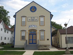 AF and AM Lodge 687, Orangevillelisted 2003
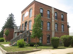 Central Houselisted 1999
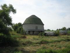 Charles Fehr Round Barnlisted 1984
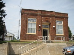 People's State Banklisted 2004
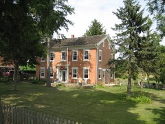 William Ritzman Houselisted 2000
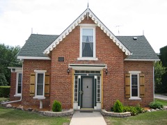 Union Houselisted 2000
Population over time
3 figuresOrangeville grew from 751 to 766 between 2000 and 2020. These are the recorded population figures Wikidata holds for this place, reached through the Geographic Names Information System number this page is keyed on rather than by name, so they belong to this place and not to another of the same name. Most are census counts, but not all are: an early figure may be a founding or settlement estimate, and an estimate published within five years of a census is left out. The change column is computed, and is left blank where more than 20 years separate a figure from the one before it, because a gap that long is not a change between two counts.
| Year | People | Change |
|---|---|---|
| 2000 | 751 | |
| 2010 | 793 | +42 (+6%) |
| 2020 | 766 | -27 (-3%) |
Topographic sheets covering this place
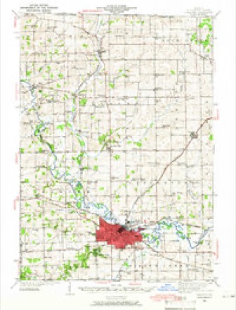
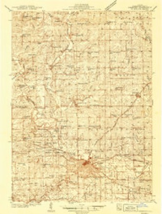
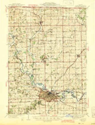
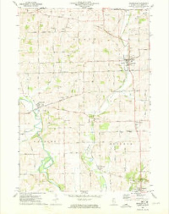
9 surveys from 13 printed sheetsMatched by testing this settlement's coordinate against the published boundary of every sheet in the United States Geological Survey's historical collection. Each opens the scanned sheet at the Survey.
- 1939 USGS Freeport quadrangle1:62500
- 1939 USGS Freeport quadrangle1:48000
- 1944 USGS Freeport quadrangle1:62500
- 1954 USGS Rockford quadrangle1:250000
- 1955 USGS Rockford quadrangle1:250000
- 1958 USGS Rockford quadrangle1:250000, 4 printings
- 1963 USGS Rockford quadrangle1:250000
- 1971 USGS Orangeville quadrangle1:24000
- 1981 USGS Rockford quadrangle1:100000, 2 printings





In the county-history sources
14,005 words on this townshipThe History of Stephenson County, Illinois : Containing ... Biographical Sketches ... War Record ... Statistics ... Portraits of Early Settlers ... History of the Northwest, History of Illinois, &c. .., published 1880 names this settlement in its chapter on Oneco Township. These are the passages that mention it, exactly as the scans read.
School was taught in sight of the village as early as 1843. In 1851, a brick building was erected on Denio's Addition, east of the post office, which was occupied until the completion of the present structure, on the Orangeville road. This was accomplished in 1876, at a cost of $2,000 ; at present, one teacher is employed, who furnishes education and the attendant concomitants to an average daily attendance of sixty-five pupils. The annual expenses incident to maintaining the school are stated at $500.
Passage source: The History of Stephenson County, Illinois : Containing ... Biographical Sketches ... War Record ... Statistics ... Portraits of Early Settlers ... History of the Northwest, History of Illinois, &c. .., published 1880.
JOHN W. BArHOARDNER, with Deal & Swartz, Orangeville ; born in Stephenson Co., 111., Nov. 27 ; he went to Western College, at Western, Lynn Co., Iowa, took a classical course, and graduated in 1878; then he went into business there, but closed out and came to Orangeville, and went in with Deal & Co., general merchandise, and has been here since. In 1876, Aug. 17, he married Miss Frances Owen, of Pennsylvania, who was born in April, 1854 ; their child is named Katie C. Mr. Baumgardner is now studying for the United Brethren ministry ; his father died in 1855 ; his mother, Catharine, while a widow living at Buckeye Center, married Martin Bender, who died in 1876, in the fall ; she is now living with^er sister on the old estate.
Passage source: The History of Stephenson County, Illinois : Containing ... Biographical Sketches ... War Record ... Statistics ... Portraits of Early Settlers ... History of the Northwest, History of Illinois, &c. .., published 1880.
B. P. BEIiKNAP, farmer, Sec. 31 ; P. 0. Orangeville ; born in Vermont, Dec. 24, 1811. In 1836, he was married to Miss Deborah Beebe, of Vermont ; moved to Albany, N. Y., and went into the coal business; in 1839, he started West, and walked from Milwaukee to Monroe, Wis., and then to Gratiot; his wife came in 1841 ; they stopped with the Brewster family on Sec. 25, then moved on the farm where they now reside, consisting of 140 acres, and, with the exception of six years in Monroe, Wis., have been here since. Mr. Belknap taught the first school in Oneco Township, at Aaron Denio's house, in 1840. The children are Mary (now Mrs. Everett), Lattig (deceased), Hannah (now Mrs. Mulks), Corwin (who has served in the 46th I. V. I. Co. A), F. C, Edwin C, Lillie M., Edwin (deceased) and Laura (deceased). Mr. Belknap has been Constable, Coroner and Commissioner of Highways.
Passage source: The History of Stephenson County, Illinois : Containing ... Biographical Sketches ... War Record ... Statistics ... Portraits of Early Settlers ... History of the Northwest, History of Illinois, &c. .., published 1880.
Machine-read from a century-old scan, so expect the errors a machine makes: misspelled names, dropped words, stray characters.
Read the whole chapter on Oneco Township - it names this place 58 more 58 times.
Fires near this place
1 since 2018Regional context, not property-specific evidence. The federal wildfire occurrence database lists 1 fire within 5 miles of Orangeville in 2018, burning about 3 acres in total. None started naturally. None was recorded as arson. Distance is straight-line from the map coordinates, so a fire counted here may appear on a neighbouring settlement's page as well.
| Reported cause | Fires |
|---|---|
| Debris and open burning | 1 |
The most recent of them, most recent first, with the day each was reported and the service that recorded it.
| Date | Cause | Size | Reported by | Name on the report |
|---|---|---|---|---|
| 11 April 2018 | Debris and open burning | 3.0 acres | Wisconsin Department of Natural Resources | 61 |
Settlements close enough to share some of these fires:
Mines and quarries near this place
9 within 5 milesRegional context, not property-specific evidence. The federal mineral resources record lists 9 workings within 5 miles of Orangeville: 6 past producers, 2 producers, 1 occurrence. 2 still produce. What was taken out: Stone, Crushed/Broken. Distance is straight-line from the map coordinates, so a quarry counted here may appear on a neighbouring settlement's page as well.
| Where | Site | Commodity | Status | Recorded |
|---|---|---|---|---|
| Clark Quarry | Stone, Crushed/Broken | Producer | ||
| J. Wagner Quarry | Stone, Crushed/Broken | Past Producer | ||
| Limestone Prospect | Stone, Crushed/Broken | Occurrence | ||
| Monte Quarry | Stone, Crushed/Broken | Producer | ||
| Unnamed Limestone Quarry | Stone, Crushed/Broken | Past Producer | ||
| Unnamed Limestone Quarry | Stone, Crushed/Broken | Past Producer | ||
| Unnamed Limestone Quarry | Stone, Crushed/Broken | Past Producer | ||
| Unnamed Limestone Quarry | Stone, Crushed/Broken | Past Producer | ||
| Unnamed Limestone Quarry | Stone, Crushed/Broken | Past Producer |
Storms near this place
17 since 1999Regional context, not property-specific evidence. The National Weather Service names Orangeville in 17 storm reports between 1999 and 2023: 9 thunderstorm wind, 6 hail, 1 lightning, 1 funnel cloud. The reports record 1 injury. Each account below is quoted exactly as the forecast office filed it, from the NOAA Storm Events Database, and each date opens the federal record of that event.
| When | Event | Place named | Harm | What the report says |
|---|---|---|---|---|
| May 1999 | Thunderstorm Wind | Orangeville | 1 hurt, $40,000 | Severe thunderstorm winds rolled a mobile home trailer over and destroyed it. The occupant of the trailer suffered 2 dislocated shoulders, cuts, and abrasions. |
| June 2005 | Thunderstorm Wind | Orangeville | $5,000 | Trees down |
| August 2005 | Thunderstorm Wind | Orangeville | $5,000 | Power lines down |
| June 2023 | Thunderstorm Wind | Orangeville | - | County dispatch reported a few trees blown down north of Freeport through Orangeville. |
| August 2022 | Thunderstorm Wind | Orangeville | - | Law enforcement reported a tree down on Rock Grove Road. The time of the event was estimated using radar. |
| July 2022 | Thunderstorm Wind | Orangeville | - | A trained spotter reported 8 to 12 inch diameter based on a photo shared on social media. The time of the event was estimated using radar. |
| May 2020 | Thunderstorm Wind | Orangeville | - | Power poles blown down near Orangeville. |
| August 2018 | Funnel Cloud | Orangeville | - | A public report of a funnel cloud. A photo of the funnel cloud was relayed by local broadcast media. |
| July 2017 | Thunderstorm Wind | Orangeville | - | An amateur radio operator reported winds estimated up to 70 mph with tree branches blowing across the road. |
| June 2011 | Hail | Orangeville | - | Quarter sized hail fell in Orangeville, IL at 932 pm CDT June 8. |
| June 2008 | Hail | Orangeville | - | Nickel-sized hail fell near Orangeville, IL at 2:30 pm June 20. |
| June 2008 | Hail | Orangeville | - | Golf ball-sized hail fell in Orangeville, IL around 2:30 pm June 20. This report was relayed by WREX-TV in Rockford. |
| September 2001 | Thunderstorm Wind | Orangeville | - | 60 mph thunderstorm wind gust estimated by trained spotter. |
| July 1999 | Lightning | Orangeville | - | A NWS spotter reported trees downed by lightning in Orangeville. |
| April 2020 | Hail | Orangeville | - | no account filed |
| April 2013 | Hail | Orangeville | - | no account filed |
| May 2000 | Hail | Orangeville | - | no account filed |
Nearest settlements
The eight closest, with where each one stands in the county. Distances are straight-line, computed from the Geographic Names Information System coordinates.
| Map | Place | Distance | Sheets |
|---|---|---|---|
| Oneco | 1.7 miles | 13 | |
| Buckhorn Corners | 3.0 miles | 13 | |
| Buena Vista | 3.5 miles | 13 | |
| Afolkey | 4.4 miles | 13 | |
| McConnell | 5.2 miles | 13 | |
| Red Oak | 5.5 miles | 13 | |
| Cedarville | 6.4 miles | 13 | |
| Rock Grove | 7.0 miles | 13 |
Elsewhere
Matched on this settlement's Geographic Names Information System number rather than its name, so it cannot be a different place of the same name in another state.
| Wikipedia article on Orangeville | An encyclopaedic summary. Its text is share-alike, so it is linked here rather than copied. |
| Wikidata item Q2671866 | The structured record the population and elevation above come from. Public domain (CC0). |
Provenance
This settlement is recorded in the Geographic Names Information System as feature 415157. The sheet list is computed by point-in-boundary test against the United States Geological Survey's historical topographic inventory. Both are works of the United States government and carry no copyright under 17 U.S.C. 105.
Wildfire. Short, Karen C. 2022. Spatial wildfire occurrence data for the United States, 1992-2020 [FPA_FOD_20221014]. 6th Edition. Fort Collins, CO: Forest Service Research Data Archive. https://doi.org/10.2737/RDS-2013-0009.6 Collected with United States Government funding and usable without additional permissions or fees.
Mines and quarries. USGS Mineral Resources Data System (MRDS) https://mrdata.usgs.gov/mrds/ A work of the United States government, no copyright under 17 U.S.C. 105.
Storms. NOAA National Centers for Environmental Information, Storm Events Database https://www.ncei.noaa.gov/stormevents/ A work of the United States government, no copyright under 17 U.S.C. 105. Narratives are quoted verbatim from the National Weather Service report and are not edited or summarised.