 Block
Prophetstown, Illinois
11 topographic sheets cover this place, the earliest surveyed in 1932 and the latest in 1985. It stands in Prophetstown Township. It lies in ZIP code area 61277. It stands on Coon Creek. The Survey maps it on the Prophetstown quadrangle. 1,946 people lived here at the 2020 count. It stands 630 feet above sea level.
Population over time
2 figuresProphetstown fell from 2,080 to 1,946 between 2010 and 2020. These are the recorded population figures Wikidata holds for this place, reached through the Geographic Names Information System number this page is keyed on rather than by name, so they belong to this place and not to another of the same name. Most are census counts, but not all are: an early figure may be a founding or settlement estimate, and an estimate published within five years of a census is left out. The change column is computed, and is left blank where more than 20 years separate a figure from the one before it, because a gap that long is not a change between two counts.
| Year | People | Change |
|---|---|---|
| 2010 | 2,080 | |
| 2020 | 1,946 | -134 (-6%) |
Topographic sheets covering this place
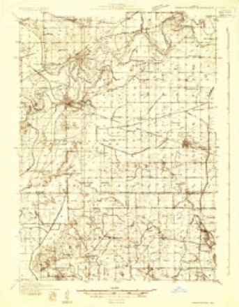
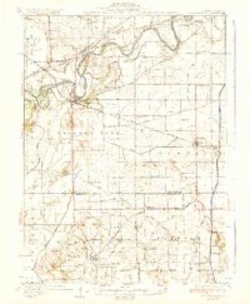
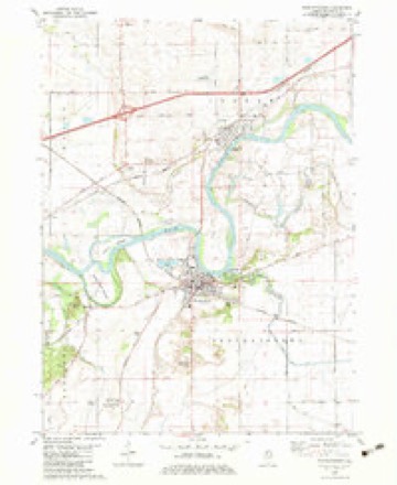
6 surveys from 11 printed sheetsMatched by testing this settlement's coordinate against the published boundary of every sheet in the United States Geological Survey's historical collection. Each opens the scanned sheet at the Survey.
- 1932 USGS Prophetstown quadrangle1:48000
- 1936 USGS Prophetstown quadrangle1:62500, 3 printings
- 1958 USGS Aurora quadrangle1:250000, 3 printings
- 1961 USGS Aurora quadrangle1:250000
- 1982 USGS Prophetstown quadrangle1:24000
- 1985 USGS Dixon quadrangle1:100000, 2 printings



In the county-history sources
20,495 words on this townshipHistory of Whiteside County, Illinois, from Its First Settlement to the Present Time;, published 1877 names this settlement in its chapter on Prophetstown Township. These are the passages that mention it, exactly as the scans read.
Prophetstown township contains 28,486 acres of improved land, and 1,705 acres of unimproved land. The Assessor's books for 1877 show that the num ber of horses in the township in that year, wa's 924; number of cattle, 2.423 mules and asses, 11; sheep, 2,019; hogs, 3,094; carriages and wagons, 337 watches and clocks, 265; sewing and knitting machines, 160; pianofortes, 23: melodeons and organs, 33. Total assessed value of lands, lots, and personal property $654,574. Value of railroad property, $25,022. Total assessed value of all property in 1877, $679,596.
Passage source: History of Whiteside County, Illinois, from Its First Settlement to the Present Time;, published 1877.
The population of the township of Prophetstown in 1870, outside of the village, as shown by the Federal census of that year, was 998, of which 890 were of native birth, and 108 of foreign birth. The population of the township in 1860, including the village, was 1,144. The estimated population of the township in 1877, excluding the village, is 1,100.
Passage source: History of Whiteside County, Illinois, from Its First Settlement to the Present Time;, published 1877.
The town of Prophetstown was laid out and platted in 1838, the proprietors being George W. Campbell, Dixon B. Morehouse, James Craig, Daniel Webster, Asa Crook, Erastus Nichols, and Jabez Warner. The original plat only included that part of the present village lying north of Main street. Campbell, Morehouse, and Craig lived at Galena. The interest of Daniel Webster was probably given to him for the influence of his great name; but, be that as it may, Prophetstown can exultingly exclaim that the godlike Daniel was one of its first proprietors. Mr. Webster's interest was sold in Philadelphia some time afterwards. In 1855 the town was re-surveyed, as the first survey was found to be incorrect. The village is beautifully located on the south bank of Rock river, and is the market town of a rich agricultural country. The first frame building in the village was erected in 1838, by Alanson Stowell, the lumber being brought from Spring Creek, in Henry county. It stood upon the river bank until 1875, when it was torn down. The streets are broad, and most of them, outside the business part, finely shaded. Many handsome residences grace the village, showing the opulence of its citizens. The business portion of the town is mainly on Washington and Second streets, and these present a lively appearance during business hours. During the past few years several fine stores and other buildings have been erected, notably among them being the mercantile building of Baldwin Bro's, the First National Bank building, and the Seely House.
Passage source: History of Whiteside County, Illinois, from Its First Settlement to the Present Time;, published 1877.
Machine-read from a century-old scan, so expect the errors a machine makes: misspelled names, dropped words, stray characters.
Read the whole chapter on Prophetstown Township - it names this place 64 more 64 times.
Mines and quarries near this place
2 within 5 milesRegional context, not property-specific evidence. The federal mineral resources record lists 2 workings within 5 miles of Prophetstown: 1 producer, 1 past producer. 1 still produces. What was taken out: Sand and Gravel, Construction. Distance is straight-line from the map coordinates, so a quarry counted here may appear on a neighbouring settlement's page as well.
| Where | Site | Commodity | Status | Recorded |
|---|---|---|---|---|
| Collinson Pit and Mill | Sand and Gravel, Construction | Producer | ||
| Lynden Pit | Sand and Gravel, Construction | Past Producer |
Storms near this place
29 since 1996Regional context, not property-specific evidence. The National Weather Service names Prophetstown in 29 storm reports between 1996 and 2026: 12 thunderstorm wind, 11 hail, 2 tornado, 2 funnel cloud. No death or injury is recorded in these reports. Each account below is quoted exactly as the forecast office filed it, from the NOAA Storm Events Database, and each date opens the federal record of that event.
| When | Event | Place named | Harm | What the report says |
|---|---|---|---|---|
| July 2003 | Thunderstorm Wind | Prophetstown | $25,000 | Trees down |
| July 2004 | Tornado (F1) | Prophetstown | $7,500 | Also from newspaper and insurance reports |
| May 2006 | Hail | Prophetstown | $4,000 | Cooperative observer reported penny to quarter size hail. |
| May 2006 | Thunderstorm Wind | Prophetstown | $500 | tree down with numerous leaves and small branches down as well. |
| May 2024 | Thunderstorm Wind | Prophetstown | - | A 3 inch diameter birch tree branch snapped off. The time is based on radar data. |
| March 2020 | Flash Flood | Prophetstown | - | A trained spotter reported that several city streets were flooded with water that was curb deep, and that sewage was backing into basements. They also reported that ditches along Illinois Highway 78 were full of water with the water ins some ditches spreading out to near the edge of the road and that several yards in the city were full of water. |
| April 2019 | Hail | Prophetstown | - | The emergency manager reported that there was a considerable amount of penny sized hail. The time of the event was estimated using radar. |
| May 2017 | Thunderstorm Wind | Prophetstown | - | A NWS storm survey team observed tree damage in Prophetstown. |
| March 2011 | Hail | Prophetstown | - | Law enforcement reported penny size hail at Prophetstown that lasted for 20 minutes. |
| June 2008 | Thunderstorm Wind | Prophetstown | - | Wind gusts estimated to be 60 mph blew down a tree limb across a road in Prophetstown, IL at 2:55 pm June 7. |
| May 2008 | Hail | Prophetstown | - | The emergency manager reported quarter size hail in Prophetstown. |
| May 2008 | Hail | Prophetstown | - | A trained spotter measured nickel to quarter size hail. |
| August 2007 | Thunderstorm Wind | Prophetstown | - | Winds estimated to be 60 mph blew down some tree limbs in Prophetstown, IL. Time estimated. |
| August 2007 | Thunderstorm Wind | Prophetstown | - | Winds estimated to be 70 mph blew down two trees in Prophetstown, IL. Time estimated. |
| March 2006 | Heavy Rain | Prophetstown | - | minor flooding of lower streets |
| May 2006 | Hail | Prophetstown | - | penny size hail |
| July 2002 | Thunderstorm Wind | Prophetstown | - | Trees blown down on Highway 78. |
| April 2000 | Hail | Prophetstown | - | Pea-sized hail reported by trained spotter. |
| June 1999 | Tornado (F0) | Prophetstown | - | A tornado touched down briefly causing no injuries or damage. |
| June 1999 | Thunderstorm Wind | Prophetstown | - | Thunderstorm winds gusted to 60 mph for 5 minutes. A few small trees were downed. |
| April 2026 | Thunderstorm Wind | Prophetstown | - | no account filed |
| May 2000 | Hail | Prophetstown | - | no account filed |
| May 2000 | Hail | Prophetstown | - | no account filed |
| May 2000 | Hail | Prophetstown | - | no account filed |
| June 1999 | Funnel Cloud | Prophetstown | - | no account filed |
| May 1999 | Funnel Cloud | Prophetstown | - | no account filed |
| April 1997 | Thunderstorm Wind | Prophetstown | - | no account filed |
| April 1997 | Thunderstorm Wind | Prophetstown | - | no account filed |
| February 1996 | Hail | Prophetstown | - | no account filed |
Nearest settlements
The eight closest, with where each one stands in the county. Distances are straight-line, computed from the Geographic Names Information System coordinates.
| Map | Place | Distance | Sheets |
|---|---|---|---|
| Portland | 2.4 miles | 11 | |
| Denrock | 2.9 miles | 11 | |
| Hamilton Corners | 3.0 miles | 11 | |
| Lyndon | 3.2 miles | 11 | |
| Pratt (historical) | 3.5 miles | 11 | |
| Valley Vista Estates | 3.8 miles | 11 | |
| Jefferson Corners | 5.1 miles | 11 | |
| Leon Corners | 5.4 miles | 11 |
Elsewhere
Matched on this settlement's Geographic Names Information System number rather than its name, so it cannot be a different place of the same name in another state.
| Wikipedia article on Prophetstown | An encyclopaedic summary. Its text is share-alike, so it is linked here rather than copied. |
| Wikidata item Q574925 | The structured record the population and elevation above come from. Public domain (CC0). |
Provenance
This settlement is recorded in the Geographic Names Information System as feature 416235. The sheet list is computed by point-in-boundary test against the United States Geological Survey's historical topographic inventory. Both are works of the United States government and carry no copyright under 17 U.S.C. 105.
Mines and quarries. USGS Mineral Resources Data System (MRDS) https://mrdata.usgs.gov/mrds/ A work of the United States government, no copyright under 17 U.S.C. 105.
Storms. NOAA National Centers for Environmental Information, Storm Events Database https://www.ncei.noaa.gov/stormevents/ A work of the United States government, no copyright under 17 U.S.C. 105. Narratives are quoted verbatim from the National Weather Service report and are not edited or summarised.