 Block
Lyndon, Illinois
11 topographic sheets cover this place, the earliest surveyed in 1932 and the latest in 1985. It stands in Lyndon Township. It lies in ZIP code area 61261. It stands on Ellsworth Creek. The Survey maps it on the Prophetstown quadrangle. 537 people lived here at the 2020 count.
On record in Lyndon
Buildings and businesses the archive holds for this place. Each opens its own page, with the source record it came from.
On the National Register 1 record
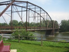 Lyndon Bridgelisted 2003
Population over time
2 figuresLyndon fell from 648 to 537 between 2010 and 2020. These are the recorded population figures Wikidata holds for this place, reached through the Geographic Names Information System number this page is keyed on rather than by name, so they belong to this place and not to another of the same name. Most are census counts, but not all are: an early figure may be a founding or settlement estimate, and an estimate published within five years of a census is left out. The change column is computed, and is left blank where more than 20 years separate a figure from the one before it, because a gap that long is not a change between two counts.
| Year | People | Change |
|---|---|---|
| 2010 | 648 | |
| 2020 | 537 | -111 (-17%) |
Topographic sheets covering this place
6 surveys from 11 printed sheetsMatched by testing this settlement's coordinate against the published boundary of every sheet in the United States Geological Survey's historical collection. Each opens the scanned sheet at the Survey.
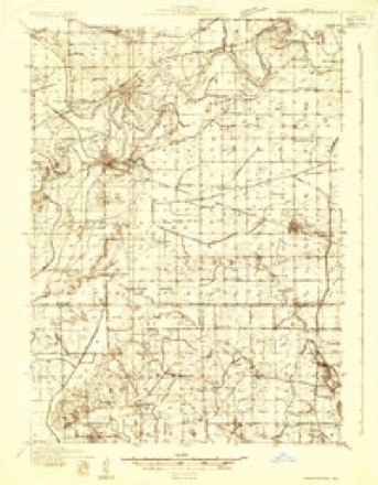
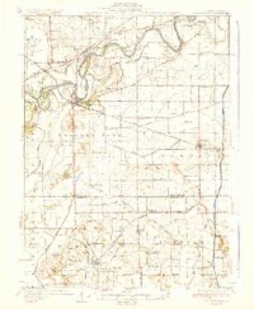
- 1932 USGS Prophetstown quadrangle1:48000
- 1936 USGS Prophetstown quadrangle1:62500, 3 printings
- 1958 USGS Aurora quadrangle1:250000, 3 printings
- 1961 USGS Aurora quadrangle1:250000
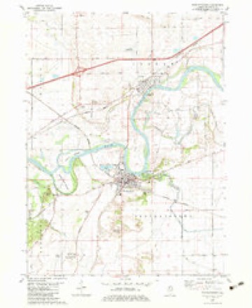
- 1982 USGS Prophetstown quadrangle1:24000
- 1985 USGS Dixon quadrangle1:100000, 2 printings



In the county-history sources
44,484 words on this townshipHistory of Whiteside County, Illinois, from Its First Settlement to the Present Time;, published 1877 names this settlement in its chapter on Lyndon Township. These are the passages that mention it, exactly as the scans read.
Wesley Anderson came to Lyndon in 1837. He divided his time between teaching school and clerking in a store. At one time he was in business for himself. He was elected County Judge in 1860, and served in that capacity for one year. He married Miss Martha E. Harris, October 20, 1847; one child, Charles F. Mr. Anderson died at Lyndon May 26, 1871. Mrs. Anderson still resides at that place.
Passage source: History of Whiteside County, Illinois, from Its First Settlement to the Present Time;, published 1877.
Jared D. Conyne came from Lewis county. New York, and settled in Lyndon township in 1839. He worked on the mill race then being extended by Ray, Harmon, Spencer and Dix. He formerly lived on a farm owned by him one and a half miles north of Lyndon, but has of late years resided in the village, where he owns a fine residence. He married Miss Orrell M. Warner; one child has been born to them, a daughter, named Orrell, who married Truman Gr. Wilder.
Passage source: History of Whiteside County, Illinois, from Its First Settlement to the Present Time;, published 1877.
GrEORGE Dennis Came from Trenton, New Jersey, and settled in Lyndon township prior to 1840. It required moral courage and back-bone for a young man to leave all the social advantages of an old settled country and come to the far West, where he would be almost entirely deprived of the society of young people. Mr. Dennis, though fond of fun, was manly, and very much respected by all who knew him. He married Miss Dodge, a sister of Job Dodge - now of Peru, Illinois - and is now living at Princeton, Iowa.
Passage source: History of Whiteside County, Illinois, from Its First Settlement to the Present Time;, published 1877.
Machine-read from a century-old scan, so expect the errors a machine makes: misspelled names, dropped words, stray characters.
Read the whole chapter on Lyndon Township - it names this place 42 more 42 times.
Mines and quarries near this place
2 within 5 milesRegional context, not property-specific evidence. The federal mineral resources record lists 2 workings within 5 miles of Lyndon: 1 producer, 1 past producer. 1 still produces. What was taken out: Sand and Gravel, Construction. Distance is straight-line from the map coordinates, so a quarry counted here may appear on a neighbouring settlement's page as well.
| Where | Site | Commodity | Status | Recorded |
|---|---|---|---|---|
| Collinson Pit and Mill | Sand and Gravel, Construction | Producer | ||
| Lynden Pit | Sand and Gravel, Construction | Past Producer |
Storms near this place
11 since 1994Regional context, not property-specific evidence. The National Weather Service names Lyndon in 11 storm reports between 1994 and 2022: 5 thunderstorm wind, 2 hail, 1 tornado, 1 funnel cloud. No death or injury is recorded in these reports. Each account below is quoted exactly as the forecast office filed it, from the NOAA Storm Events Database, and each date opens the federal record of that event.
| When | Event | Place named | Harm | What the report says |
|---|---|---|---|---|
| May 2006 | Thunderstorm Wind | Lyndon | $3,000 | tranformers blown up south of I-88 and intersection of IL 78 |
| May 2006 | Hail | Lyndon | $2,000 | penny size hail increased to quarter size hail |
| June 2000 | Thunderstorm Wind | Lyndon | $1,000 | no account filed |
| June 1994 | Thunderstorm Wind | Lyndon | $500 | Early in the afternoon a large crowd at the Davenport, Iowa Airport were able to witness a funnel cloud near the Mississippi River between Princeton, Iowa, and Port Byron, Illinois. The large crowd was due to the Quad City Air Show in progress at the time of the event. Later in the afternoon thunderstorms strengthened in Whiteside County, Illinois. Numerous reports of hail was received. Walnut-size hail was the largest reported in Lyndon, Illinois, shortly before 1500 CST. One tree was also blown down just north of Lyndon shortly after 1500 CST. Chicago Doppler Radar estimated three and one-half to four inches of rain between Morrison and Sterling between 1300 CST and 1600 CST. |
| March 2022 | Thunderstorm Wind | Lyndon | - | An NWS Storm Survey found that a microburst with wind speeds of 80 to 85 MPH caused 1 to 3 inch broken tree branches. The tree damage was located 2 miles east northeast of Lyndon at the Rivers Edge Resort Most of the damage was blown to the east-northeast. |
| October 2018 | Flood | Lyndon | - | Major flooding on the Rock River at the Joslin, IL gage began at 12 PM, October 8th, when it exceeded 16.5 feet. It crested at 17.2 feet, 2 AM, October 10th, before falling below 16.5 feet, which is major flood stage, at 3 PM, October 12th. |
| August 2016 | Flash Flood | Lyndon | - | Law enforcement was reported over a County Road. The Fire Department was called out to close the road but conditions were improving quickly and the road would be reopening a short time later. |
| May 1998 | Thunderstorm Wind | Lyndon | - | Thunderstorm winds downed tree limbs producing light damage in the city of Lyndon. |
| May 1995 | Tornado (F0) | Lyndon | - | A tornado touched down briefly on Interstate 88 near mile marker 27. No damage was reported. |
| June 1994 | Hail | Lyndon | - | Early in the afternoon a large crowd at the Davenport, Iowa Airport were able to witness a funnel cloud near the Mississippi River between Princeton, Iowa, and Port Byron, Illinois. The large crowd was due to the Quad City Air Show in progress at the time of the event. Later in the afternoon thunderstorms strengthened in Whiteside County, Illinois. Numerous reports of hail was received. Walnut-size hail was the largest reported in Lyndon, Illinois, shortly before 1500 CST. One tree was also blown down just north of Lyndon shortly after 1500 CST. Chicago Doppler Radar estimated three and one-half to four inches of rain between Morrison and Sterling between 1300 CST and 1600 CST. |
| August 2000 | Funnel Cloud | Lyndon | - | no account filed |
Nearest settlements
The eight closest, with where each one stands in the county. Distances are straight-line, computed from the Geographic Names Information System coordinates.
| Map | Place | Distance | Sheets |
|---|---|---|---|
| Valley Vista Estates | 0.9 miles | 11 | |
| Hamilton Corners | 2.2 miles | 11 | |
| Denrock | 2.9 miles | 11 | |
| Prophetstown | 3.2 miles | 11 | |
| Sands | 4.1 miles | 11 | |
| Pratt (historical) | 4.2 miles | 11 | |
| Portland | 4.8 miles | 11 | |
| Round Grove | 5.5 miles | 11 |
Elsewhere
Matched on this settlement's Geographic Names Information System number rather than its name, so it cannot be a different place of the same name in another state.
| Wikipedia article on Lyndon | An encyclopaedic summary. Its text is share-alike, so it is linked here rather than copied. |
| Wikidata item Q1878835 | The structured record the population and elevation above come from. Public domain (CC0). |
Provenance
This settlement is recorded in the Geographic Names Information System as feature 412761. The sheet list is computed by point-in-boundary test against the United States Geological Survey's historical topographic inventory. Both are works of the United States government and carry no copyright under 17 U.S.C. 105.
Mines and quarries. USGS Mineral Resources Data System (MRDS) https://mrdata.usgs.gov/mrds/ A work of the United States government, no copyright under 17 U.S.C. 105.
Storms. NOAA National Centers for Environmental Information, Storm Events Database https://www.ncei.noaa.gov/stormevents/ A work of the United States government, no copyright under 17 U.S.C. 105. Narratives are quoted verbatim from the National Weather Service report and are not edited or summarised.