 Block
Russellville, Illinois
14 topographic sheets cover this place, the earliest surveyed in 1917 and the latest in 1986. It stands in Russell Township. It lies in ZIP code area 62439. The Survey maps it on the Russellville quadrangle. 98 people lived here at the 2020 count.
Population over time
2 figuresRussellville grew from 94 to 98 between 2010 and 2020. These are the recorded population figures Wikidata holds for this place, reached through the Geographic Names Information System number this page is keyed on rather than by name, so they belong to this place and not to another of the same name. Most are census counts, but not all are: an early figure may be a founding or settlement estimate, and an estimate published within five years of a census is left out. The change column is computed, and is left blank where more than 20 years separate a figure from the one before it, because a gap that long is not a change between two counts.
| Year | People | Change |
|---|---|---|
| 2010 | 94 | |
| 2020 | 98 | +4 (+4%) |
Topographic sheets covering this place
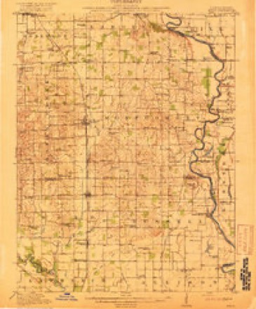
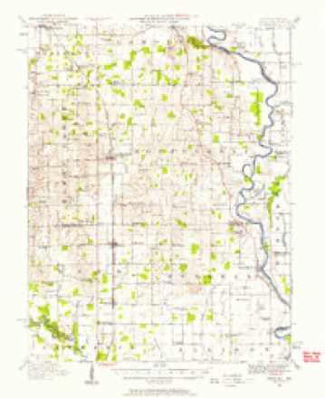
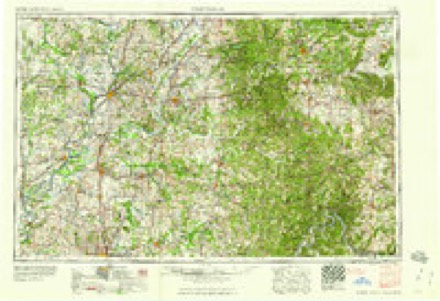
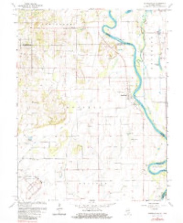
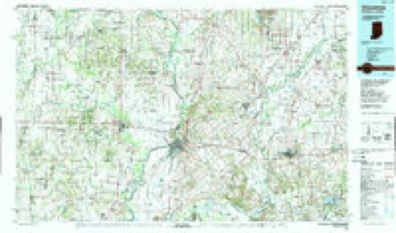
7 surveys from 14 printed sheetsMatched by testing this settlement's coordinate against the published boundary of every sheet in the United States Geological Survey's historical collection. Each opens the scanned sheet at the Survey.
- 1917 USGS Birds quadrangle1:62500, 2 printings
- 1942 USGS Birds quadrangle1:62500
- 1956 USGS Vincennes quadrangle1:250000, 4 printings
- 1957 USGS Vincennes quadrangle1:250000
- 1958 USGS Vincennes quadrangle1:250000, 2 printings
- 1964 USGS Russellville quadrangle1:24000, 2 printings
- 1986 USGS Vincennes quadrangle1:100000, 2 printings
In the county-history sources
4,244 words on this townshipCombined History of Edwards, Lawrence and Wabash Counties, Illinois. With Illustrations ... and Biographical Sketches of Some of Their Prominent Men and Pioneers, published 1883 names this settlement in its chapter on Russell Township. These are the passages that mention it, exactly as the scans read.
USSELL township is bounded on the north by Crawford county, on the east by the Wabash, on the south by Allison, and on the west by Lawrence and Bond. The northern and western portions were originally, and are still, to some extent, heavily timbered. A part of Purgatory Swamp is embraced by the township, in the southwest. Most of congressional township 4 north, range 10 west, is an elevated sandy plain. Sugar creek flowing into Purgatory Swamp, and Flat creek emptying into the Wabash at Russellville, are the principal sources of drainage.
Passage source: Combined History of Edwards, Lawrence and Wabash Counties, Illinois. With Illustrations ... and Biographical Sketches of Some of Their Prominent Men and Pioneers, published 1883.
They came from Kentucky with families. Samuel's | children were Daniel, John, Isaac, Richard, Samuel, Jr., I Nancy, Lydia, and Phebe. Jonathan had three sons, protection against the Indians, and stood in what | is now the northern part of Russellville It was | projected and built by Samuel Allison. About this whom became inmates of the fort, and probably assisted in its construction. Mills was from Kentucky and had eight children, viz., Edward, John, Thomas, Jr., Mary, Lydia, Amy, Rebecca, and Matilda. He had prior to entering the fort made an improvement about two hundred yards north of its site, to which in the spring of 1815, he returned, and which was his permanent home. Stockwell was likewise a Teunesseean. Hischilden were Wm., Jesse, Henry, Thompson, Michael, Rachel, and Eliza. The brothers Kuykendall came from Ohio. Henry was married and lived on the present site of Russellville. Hogue immigrated from Kentucky, and had one son, Jeremiah. He settled on the N. W. } of section 28, township 5, range 10, and subsequently moved to a point opposite Terre Haute, and there died. McBane had one son and two daughters, Mary and Ellen. He located about three-fourths of a mile north of Russellville. The Ind'an hostilities checked immigration till 1815. Then came Peter Price from Ohio, with nine children, Henry, Peter, Jr , Michael, David, George, John, William, Mary, and Sarah, and settled on the N E. i of the S. W. \ of section 15, township 4, range 10. In 1818 he moved to the E. i of S. E. } of section 33, township 5, range 11. With Price came his cousin Jeremiah Price, also a married man. One Garner, from Ohio, about this time, 1815, settled on the S. W. J of section 10, township 4, range 10. In the same neighborhood lived a family of Manns, who came from Ohio. Joseph and James Baird, probably as early as 1814, settled on the N. W. \ of section 18. James was shot by an Indian while plowing. William Miller, in 1816, brought from Ohio, a family of nine children, viz , Robert, John, Jane, Thomas A., Samuel, Elizabeth, Rachel, and Belinda, and settled on the N. W. i of section 28, township 5, range 10. Israel Price came with Miller, and settled in the township. Samuel and Eli Harris, came from Tennessee, with families, in 1815, and settled on section 13, in what was known as the Christian settlement. Samuel had two sons, John and Perzas, and two daughters. Eli was one of the earliest teachers in Centre school-house, and also taught singing school there. Chas. Emmons, formerly from Virgiuia, came to the township from Kentucky, in 1818, and settled permanently on the W. i of section 3. He brought with him nine children, William, Wesley, Charles, Sinclair, Thornton, Wyley, Martha, Elizabeth, and Fannie. In this year, came the Pinkstaff families, from Kentucky. Andrew Pinkstaff settled on the S. \ of the N. W. i of section 2, where he made his permanent home, and died at the age of about ninety-nine years. He had served as a soldier in the war of the revolution. His son, John, brought five children, Andrew, John, Owen, Nancy, and Cynthia, and settled on the~N. E. } of the S. E. 1 of section 3, township 4, range 11, where he died at the age of about seventy-five years. The Pinkstaff family is a quite j numerous one in the northern part of the county. John j Felton, came from Pennsylvania, a single man, in 1818. j Married Huldah Harrimau, and settled on the S. E. } I of section 29, township 5, range 11. The Harriman family came from New York. The children were John, Luke, Stephen, and Huldah, just mentioned, and Clarissa. John was a mechanic. Samuel Haskins, also I from New York, in 1818, had a family of five children, Robert, Hiram, Samuel, Abigail, and Maria. He settled about a mile southeast of Russellville, and kept a hotel. | One Lamfere, with a family, was among the earliest j arrivals. About 1818, he established a ferry a short 1 distance below the present site of Russellville. It continned in operation about ten or twelve years. The boat was sufficient to carry a team and wagon. Austin Tann, a negro, who had been an inmate of the fort, and was afterward a member of the Shaker community, about 1820, settled on the N. W. i of section 10, township 4, range 11. He was quite intelligent, and was influential among those of his own race. The central portion of so much of Allison prairie, as lies in the township, was but little settled until about 1829 or '30. At this time Adam Lackey, John Ashbrook, and John Organ, all settled in section 8. Peyton Moler settled on the S. \ of section 5 ; James Vance, on the N. W. 1 of section 9 ; Jas. Fisher, on the N. W. \ of section 17 ; Abijah Emmons, on section 18 ; and James Mickey, on the S. W. t of that section. The latter was from Pennsylvania with a family of seven children.
Passage source: Combined History of Edwards, Lawrence and Wabash Counties, Illinois. With Illustrations ... and Biographical Sketches of Some of Their Prominent Men and Pioneers, published 1883.
In 1817 a school was taught in an old cabin that stood on the northwest quarter of the southeast quarter of section 4, township 4, range 10. A round log school-house was built about 1822 on ihe southwest quarter of section 5. Samuel Borden, a young man from New Jersey, taught the first school. The first school in the western part of the township was taught by Borden in a log school-house about 1821. Little Village Cemetery was laid out by John Mills m 1818, just north of Russellville. Old Mr. McBane was the first person buried here ; the next was Samuel Allison, and the third, Daniel Kuykendall.
Passage source: Combined History of Edwards, Lawrence and Wabash Counties, Illinois. With Illustrations ... and Biographical Sketches of Some of Their Prominent Men and Pioneers, published 1883.
Machine-read from a century-old scan, so expect the errors a machine makes: misspelled names, dropped words, stray characters.
Read the whole chapter on Russell Township - it names this place 3 more 3 times.
Fires near this place
2 since 2009Regional context, not property-specific evidence. The federal wildfire occurrence database lists 2 fires within 5 miles of Russellville in 2009, burning about 6 acres in total. None started naturally. None was recorded as arson. Distance is straight-line from the map coordinates, so a fire counted here may appear on a neighbouring settlement's page as well.
| Reported cause | Fires |
|---|---|
| Missing data/not specified/undetermined | 1 |
| Debris and open burning | 1 |
The most recent of them, most recent first, with the day each was reported and the service that recorded it.
| Date | Cause | Size | Reported by | Name on the report |
|---|---|---|---|---|
| 8 November 2009 | Missing data/not specified/undetermined | 2.0 acres | Illinois Division of Forestry Resources | EDINGTON2 |
| 25 October 2009 | Debris and open burning | 4.0 acres | Illinois Division of Forestry Resources | EDINGTON |
Settlements close enough to share some of these fires:
Mines and quarries near this place
3 within 5 milesRegional context, not property-specific evidence. The federal mineral resources record lists 3 workings within 5 miles of Russellville: 2 past producers, 1 producer. 1 still produces. What was taken out: Sand and Gravel, Construction. Distance is straight-line from the map coordinates, so a quarry counted here may appear on a neighbouring settlement's page as well.
| Where | Site | Commodity | Status | Recorded |
|---|---|---|---|---|
| Lawrenceville Dredge - H & B Gravel | Sand and Gravel, Construction | Past Producer | ||
| North Knox Materials, Inc. | Sand and Gravel, Construction | Producer | ||
| Valenco Pit | Sand and Gravel, Construction | Past Producer |
Storms near this place
11 since 2002Regional context, not property-specific evidence. The National Weather Service names Russellville in 11 storm reports between 2002 and 2022: 5 thunderstorm wind, 2 hail, 2 flash flood, 2 flood. No death or injury is recorded in these reports. Each account below is quoted exactly as the forecast office filed it, from the NOAA Storm Events Database, and each date opens the federal record of that event.
| When | Event | Place named | Harm | What the report says |
|---|---|---|---|---|
| April 2011 | Thunderstorm Wind | Russellville | $50,000 | A barn was destroyed 3 miles northwest of Russellville at County Road 1850N and County Road 1800E. |
| January 2013 | Thunderstorm Wind | Russellville | $15,000 | A garage was severely damaged in Russellville. |
| November 2011 | Thunderstorm Wind | Russellville | $15,000 | Numerous 4-inch diameter tree limbs were blown down in Russellville. |
| July 2022 | Flash Flood | Russellville | - | Flooding on Route 33 south of Russellville. |
| May 2017 | Flood | Russellville | - | Rain amounts of 2.00 to 3.00 inches in about a two hour period during the evening hours, on already saturated ground, resulted in flash flooding across northwest Lawrence County. Numerous rural roads, highways and creeks in the county were flooded, particularly in the vicinity of Chauncey. An additional 1.00 to 1.50 inches of rain occurred on April 30th, keeping many roads and creeks flooded. As a result, areal flooding continued until the late morning hours of May 1st. |
| April 2017 | Flood | Russellville | - | Rain amounts of 2.00 to 3.00 inches in about a two hour period during the evening hours, on already saturated ground, resulted in flash flooding across northwest Lawrence County. Numerous rural roads, highways and creeks in the county were flooded, particularly in the vicinity of Chauncey. An additional 1.00 to 1.50 inches of rain occurred on April 30th, keeping many roads and creeks flooded. As a result, areal flooding continued until the late morning hours of May 1st. |
| June 2013 | Flash Flood | Russellville | - | Slow moving thunderstorms produced 2 to 4 inches of rain on already saturated ground during the early morning hours of June 1st. Most rural roads in the county were flooded. Numerous streets in the city of Lawrenceville were also flooded. The flash flooding subsided by the early afternoon of June 1st. |
| August 2006 | Thunderstorm Wind | Russellville | - | A tree was blown down across power lines. |
| April 2002 | Thunderstorm Wind | Russellville | - | Several large trees were blown down. |
| April 2007 | Hail | Russellville | - | no account filed |
| May 2006 | Hail | Russellville | - | no account filed |
Nearest settlements
The eight closest, with where each one stands in the county. Distances are straight-line, computed from the Geographic Names Information System coordinates.
| Map | Place | Distance | Sheets |
|---|---|---|---|
| Riddleville | 6.7 miles | 13 | |
| Birds | 7.3 miles | 13 | |
| Pinkstaff | 7.5 miles | 13 | |
| Jackson | 9.2 miles | 17 | |
| Lawrenceville | 10.1 miles | 17 | |
| Grisold (historical) | 10.9 miles | 17 | |
| Charlottsville (historical) | 11.9 miles | 12 | |
| Westport | 12.1 miles | 12 |
Elsewhere
Matched on this settlement's Geographic Names Information System number rather than its name, so it cannot be a different place of the same name in another state.
| Wikipedia article on Russellville | An encyclopaedic summary. Its text is share-alike, so it is linked here rather than copied. |
| Wikidata item Q2672291 | The structured record the population and elevation above come from. Public domain (CC0). |
Provenance
This settlement is recorded in the Geographic Names Information System as feature 417068. The sheet list is computed by point-in-boundary test against the United States Geological Survey's historical topographic inventory. Both are works of the United States government and carry no copyright under 17 U.S.C. 105.
Wildfire. Short, Karen C. 2022. Spatial wildfire occurrence data for the United States, 1992-2020 [FPA_FOD_20221014]. 6th Edition. Fort Collins, CO: Forest Service Research Data Archive. https://doi.org/10.2737/RDS-2013-0009.6 Collected with United States Government funding and usable without additional permissions or fees.
Mines and quarries. USGS Mineral Resources Data System (MRDS) https://mrdata.usgs.gov/mrds/ A work of the United States government, no copyright under 17 U.S.C. 105.
Storms. NOAA National Centers for Environmental Information, Storm Events Database https://www.ncei.noaa.gov/stormevents/ A work of the United States government, no copyright under 17 U.S.C. 105. Narratives are quoted verbatim from the National Weather Service report and are not edited or summarised.