 Block
Tremont, Illinois
15 topographic sheets cover this place, the earliest surveyed in 1928 and the latest in 1995. It stands in Tremont Township. It lies in ZIP code area 61568. The Survey maps it on the Morton quadrangle. 2,277 people lived here at the 2020 count. It stands 641 feet above sea level.
On record in Tremont
Buildings and businesses the archive holds for this place. Each opens its own page, with the source record it came from.
On the National Register 1 record
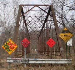 Waltmire Bridgelisted 1999
Population over time
3 figuresTremont grew from 2,029 to 2,277 between 2000 and 2020. These are the recorded population figures Wikidata holds for this place, reached through the Geographic Names Information System number this page is keyed on rather than by name, so they belong to this place and not to another of the same name. Most are census counts, but not all are: an early figure may be a founding or settlement estimate, and an estimate published within five years of a census is left out. The change column is computed, and is left blank where more than 20 years separate a figure from the one before it, because a gap that long is not a change between two counts.
| Year | People | Change |
|---|---|---|
| 2000 | 2,029 | |
| 2010 | 2,236 | +207 (+10%) |
| 2020 | 2,277 | +41 (+2%) |
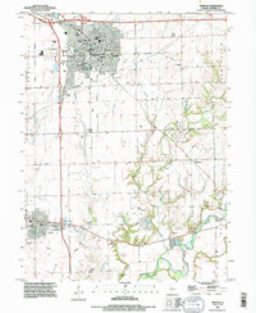
Topographic sheets covering this place
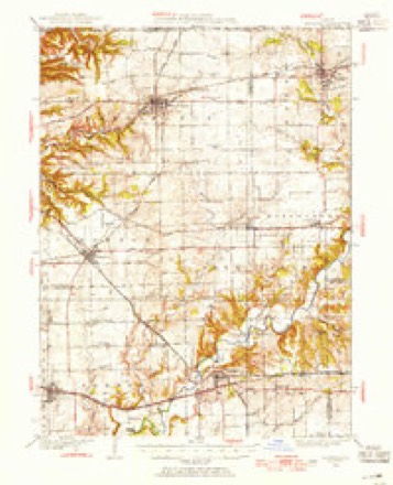
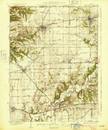
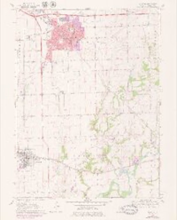
10 surveys from 15 printed sheetsMatched by testing this settlement's coordinate against the published boundary of every sheet in the United States Geological Survey's historical collection. Each opens the scanned sheet at the Survey.
- 1928 USGS Mackinaw quadrangle1:62500
- 1932 USGS Mackinaw quadrangle1:62500, 2 printings
- 1958 USGS Peoria quadrangle1:250000, 4 printings
- 1961 USGS Peoria quadrangle1:250000
- 1963 USGS Peoria quadrangle1:250000
- 1970 USGS Morton quadrangle1:24000, 2 printings
- 1985 USGS Peoria quadrangle1:100000
- 1989 USGS Peoria quadrangle1:100000
- 1990 USGS Peoria quadrangle1:250000
- 1995 USGS Morton quadrangle1:24000






In the county-history sources
8,114 words on this townshipHistory of Tazewell County, Illinois ; Together with Sketches of Its Cities, Villages and Townships, Educational, Religious, Civil, Military, and Political History; Portraits of Prominent Persons and Biographies of Representative Citizens. History of Illinois ... Digest of State Laws, published 1879 names this settlement in its chapter on Tremont Township. These are the passages that mention it, exactly as the scans read.
This township has a fair proportion of timber land, and is well drained by numerous streams, among which are Mackinaw river, Prairie creek. Deer creek. Mud creek, etc. The township was settled at a very early date, and has been brought to a very high state of cultivation. Among the first settlers Avas Hezekiah Davis, who was born in Virginia, Dec. 3, 1798. He came to Illinois in 1819, and to Tazewell Co. in 1826. He bought out Thomas Cameron, who had started in the tannery business, but had not finished any leather. In July, the 17th, 1827, Mr. Davis moved his tannery to Pleasant Grove, sec. 2, Elm Grove township. He carried on the business there until the Tremont colony came. The colonists bought up all the timber land and he could get no more bark, and was compelled to abandon the business. It took him about a year and a half to tan hides, as the fires that ran througli the timber liad weakened the bark. Mr. Davis could do nothing at his business during the winter of the deep snow. He was away from home, and was unable to get home for two months. It is supposed that James Chapman was the first settler in the township. Among other early settlers were Michael Trout, David Lackland, Wm. Stcarling, William and James Broyhill, the former of whom bought the improvements made by Chapman. For some years nothing of interest occurred in the history of the township. It was not until 1834, when the purchasing committee of the Tremont colony appeared, that anything of interest is noted. This committee was composed of Josiah L. James, John H. Harris and Wjlliam Sampson. They selected a fine body of land on the prairie in the western part of this and Elm Grove townships. There was no settlement on this prairie at that time, save a place known as the Auburn house, which was near the center of the township. The Tremont colony was formed in New York City and in Providence, R. I., and came here in 1835. It was composed of about fifty persons. They brought with them the culture, refinement and enterprise of the East. The town prospered at first, and soon secured the public buildings of the county, which gave an impetus to its growth that was remarkable. But soon the long, eventful and disastrous contention arose between Pekin and Tremont, which not only retarded its growth at the time, but injured the bright prospects of both towns. We speak of this portion of Tremont's history in the second chapter of this book, and will, therefore, make no repetition.
Passage source: History of Tazewell County, Illinois ; Together with Sketches of Its Cities, Villages and Townships, Educational, Religious, Civil, Military, and Political History; Portraits of Prominent Persons and Biographies of Representative Citizens. History of Illinois ... Digest of State Laws, published 1879.
Nathan Kinsey delivered the first load of lumber in Tremont for the first house, which was Col. Chas. Oakley's, and Josiah Matthews completed the first house. The old county buildings still stand, and are owned by the town. The court-house was used for a number of years as a high-school building, and many of the men and women who are to-day actively engaged at various callings throughout the county, received much of their education in attendance upon the the Tremont High School.
Passage source: History of Tazewell County, Illinois ; Together with Sketches of Its Cities, Villages and Townships, Educational, Religious, Civil, Military, and Political History; Portraits of Prominent Persons and Biographies of Representative Citizens. History of Illinois ... Digest of State Laws, published 1879.
Phillips Bros, have a saw-mill on the Mackinaw, on the line between Hopedale and Tremont townships, on sec. 3 of the former and 34 of the latter. They have good facilities and are doing a good business. They have a twenty horse-power engine, and a capacity of turning out 4,500 feet of lumber per day.
Passage source: History of Tazewell County, Illinois ; Together with Sketches of Its Cities, Villages and Townships, Educational, Religious, Civil, Military, and Political History; Portraits of Prominent Persons and Biographies of Representative Citizens. History of Illinois ... Digest of State Laws, published 1879.
Machine-read from a century-old scan, so expect the errors a machine makes: misspelled names, dropped words, stray characters.
Read the whole chapter on Tremont Township - it names this place 22 more 22 times.
Mines and quarries near this place
9 within 5 milesRegional context, not property-specific evidence. The federal mineral resources record lists 9 workings within 5 miles of Tremont: 7 past producers, 2 producers. 2 still produce. What was taken out: Sand and Gravel, Construction. Distance is straight-line from the map coordinates, so a quarry counted here may appear on a neighbouring settlement's page as well.
| Where | Site | Commodity | Status | Recorded |
|---|---|---|---|---|
| Adwell Pit | Sand and Gravel, Construction | Past Producer | ||
| Ben Bollinger Pit | Sand and Gravel, Construction | Past Producer | ||
| C. Frank Pit | Sand and Gravel, Construction | Past Producer | ||
| Clouse Sand & Gravel | Sand and Gravel, Construction | Producer | ||
| Hurley Pit No. 1 | Sand and Gravel, Construction | Past Producer | ||
| Lee Pit | Sand and Gravel, Construction | Past Producer | ||
| Lucy Bolliger Pit #1 | Sand and Gravel, Construction | Past Producer | ||
| Lucy Bolliger Pit #2 | Sand and Gravel, Construction | Producer | ||
| Mackinaw Plant & Sand Pit | Sand and Gravel, Construction | Past Producer |
Storms near this place
25 since 1994Regional context, not property-specific evidence. The National Weather Service names Tremont in 25 storm reports between 1994 and 2026: 12 thunderstorm wind, 11 hail, 2 tornado. The reports record 25 injuries. Each account below is quoted exactly as the forecast office filed it, from the NOAA Storm Events Database, and each date opens the federal record of that event.
| When | Event | Place named | Harm | What the report says |
|---|---|---|---|---|
| May 1995 | Tornado (F3) | Tremont | 25 hurt, $4,000,000 | A tornado touched down along the Illinois River (3 NE of Goofy Ridge) and traveled to the northeast for 25 miles before lifting and dissipating in Tremont (Tazwell County). The tornado damaged or destroyed over 36 homes and mobile homes in Mason County and injured 23 people. Numerous trees were blown down, especially in the Sand Ridge State Forest, as well as, numerous power poles. In Tazwell County, 25 homes were either damaged or destroyed (seven homes were destroyed in a subdivision 1 S of South Pekin were two people suffered minor injuries). Numerous silos and machine sheds were destroyed. Damage was estimated around $4 million. |
| June 2015 | Thunderstorm Wind | Tremont | $2,000 | A 14 to 16-inch diameter tree was blown down onto Townline Road at the Mackinaw River Bridge. |
| April 2025 | Tornado (EF1) | Tremont | - | A tornado touched down just southwest of the intersection of Red Shale Hill Road and Locust Road about 2 miles south of Tremont at 8:49 PM CDT. It tracked northeastward through mainly rural areas, damaging numerous trees and a couple power poles. The most intense part of the tornado occurred when it uprooted a 3-foot diameter tree, snapped a power pole, and peeled the top off a grain bin. It continued northeastward, then dissipated in a field northeast of the intersection of Dee Mack Road and Cooper Road about 2 miles north of Deer Creek at 9:05 PM CDT. |
| December 2025 | Thunderstorm Wind | Tremont | - | Several power poles were snapped. |
| May 2023 | Thunderstorm Wind | Tremont | - | A large tree branch was blown down, damaging a house. |
| August 2022 | Thunderstorm Wind | Tremont | - | A power outage occurred at the time of the wind gust. |
| August 2022 | Thunderstorm Wind | Tremont | - | A large portion of a corn field was flattened due to strong winds. |
| August 2022 | Thunderstorm Wind | Tremont | - | Numerous tree limbs were blown down. |
| June 2012 | Thunderstorm Wind | Tremont | - | A tree was blown onto a house in Tremont. Several power lines were knocked down around town as well. |
| April 2010 | Hail | Tremont | - | The hail lasted for 3 minutes and a 42 mph wind gust was also observed. |
| April 2006 | Thunderstorm Wind | Tremont | - | Two large two-wheel grain hauling trailers were flipped over. |
| May 2006 | Thunderstorm Wind | Tremont | - | Numerous large tree limbs and several highway signs were blown down near Mackinaw. |
| June 1994 | Hail | Tremont | - | A television crew taped a brief tornado touchdown at Spring Street in East Peoria. Near Washington, a two mile wide path of crop damage was caused by thunderstorm winds and several houses had siding damaged. At Creve Coeur, three inch diameter limbs were blown down and a vent stack was blown off the roof of Wesleyan Church. At Pekin, large tree limbs were blown down and trees were blown down along Highway 98. Marble- to golf ball-size hail covered the ground at Tremont. Crops were damaged by high winds. Large trees were blown down at Townline and Schrader Roads. Winds also damaged siding on several houses. |
| March 2026 | Hail | Tremont | - | no account filed |
| March 2026 | Hail | Tremont | - | no account filed |
| March 2022 | Thunderstorm Wind | Tremont | - | no account filed |
| May 2011 | Hail | Tremont | - | no account filed |
| May 2011 | Hail | Tremont | - | no account filed |
| June 2009 | Hail | Tremont | - | no account filed |
| June 2009 | Hail | Tremont | - | no account filed |
| June 2008 | Thunderstorm Wind | Tremont | - | no account filed |
| June 2005 | Hail | Tremont | - | no account filed |
| February 2003 | Thunderstorm Wind | Tremont | - | no account filed |
| April 2001 | Hail | Tremont | - | no account filed |
| December 1996 | Hail | Tremont | - | no account filed |
Nearest settlements
The eight closest, with where each one stands in the county. Distances are straight-line, computed from the Geographic Names Information System coordinates.
| Map | Place | Distance | Sheets |
|---|---|---|---|
| Dillon | 4.3 miles | 13 | |
| Towne Oaks | 4.8 miles | 18 | |
| Groveland | 5.0 miles | 18 | |
| Allentown | 5.4 miles | 15 | |
| Pekin Heights | 6.1 miles | 18 | |
| Morton | 6.1 miles | 15 | |
| Walnut | 7.1 miles | 13 | |
| Mackinaw | 7.2 miles | 14 |
Elsewhere
Matched on this settlement's Geographic Names Information System number rather than its name, so it cannot be a different place of the same name in another state.
| Wikipedia article on Tremont | An encyclopaedic summary. Its text is share-alike, so it is linked here rather than copied. |
| Wikidata item Q579320 | The structured record the population and elevation above come from. Public domain (CC0). |
Provenance
This settlement is recorded in the Geographic Names Information System as feature 419828. The sheet list is computed by point-in-boundary test against the United States Geological Survey's historical topographic inventory. Both are works of the United States government and carry no copyright under 17 U.S.C. 105.
Mines and quarries. USGS Mineral Resources Data System (MRDS) https://mrdata.usgs.gov/mrds/ A work of the United States government, no copyright under 17 U.S.C. 105.
Storms. NOAA National Centers for Environmental Information, Storm Events Database https://www.ncei.noaa.gov/stormevents/ A work of the United States government, no copyright under 17 U.S.C. 105. Narratives are quoted verbatim from the National Weather Service report and are not edited or summarised.