 Block
Vandalia, Illinois
9 topographic sheets cover this place, the earliest surveyed in 1945 and the latest in 1985. It stands in Vandalia Township. It lies in ZIP code area 62471. It stands on Bear Creek. The Survey maps it on the Vandalia quadrangle. 7,458 people lived here at the 2020 count. It stands 518 feet above sea level.
Research this city
On record in Vandalia
Buildings and businesses the archive holds for this place. Each opens its own page, with the source record it came from.
On the National Register 3 records
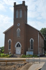 First Presbyterian Churchlisted 1982
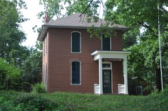 Little Brick Houselisted 1973
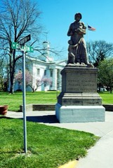 Vandalia Statehouselisted 1974
Population over time
2 figuresVandalia grew from 7,042 to 7,458 between 2010 and 2020. These are the recorded population figures Wikidata holds for this place, reached through the Geographic Names Information System number this page is keyed on rather than by name, so they belong to this place and not to another of the same name. Most are census counts, but not all are: an early figure may be a founding or settlement estimate, and an estimate published within five years of a census is left out. The change column is computed, and is left blank where more than 20 years separate a figure from the one before it, because a gap that long is not a change between two counts.
| Year | People | Change |
|---|---|---|
| 2010 | 7,042 | |
| 2020 | 7,458 | +416 (+6%) |
Topographic sheets covering this place
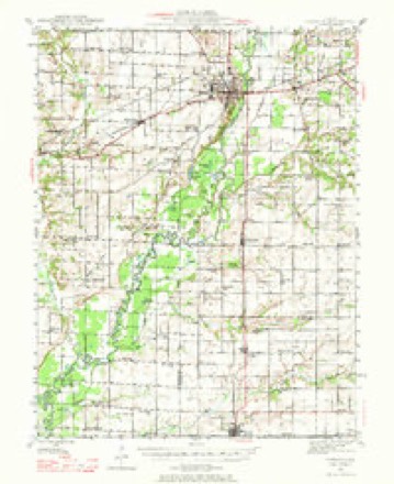
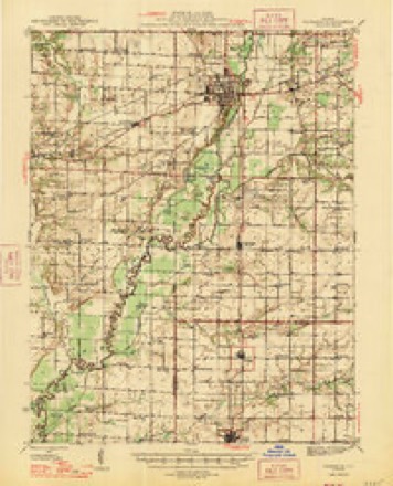
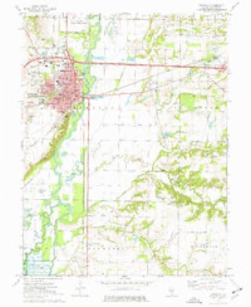
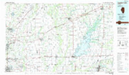
6 surveys from 9 printed sheetsMatched by testing this settlement's coordinate against the published boundary of every sheet in the United States Geological Survey's historical collection. Each opens the scanned sheet at the Survey.
- 1945 USGS Vandalia quadrangle1:62500
- 1947 USGS Vandalia quadrangle1:62500
- 1958 USGS Belleville quadrangle1:250000, 3 printings
- 1962 USGS Belleville quadrangle1:250000
- 1974 USGS Vandalia quadrangle1:24000
- 1985 USGS Carlyle Lake quadrangle1:100000, 2 printings


In the county-history sources
1,792 words on this townshipHistory of Fayette County, Illinois, published 1878 names this settlement in its chapter on Vandalia Township. These are the passages that mention it, exactly as the scans read.
This town was surveyed aul laid out in July, 1819, by Wm. C. Greenup, Beal Greenup, and John McCullom, and was for about twenty years the seat of Government for the state. In the year 1820 the state capital re¬ moved here from Kaskaskia, and the village at once became a place of im¬ portance, and boasted a population of 2,000 people. In 1839 the capital was removed to Springfield, and Vandalia rapidly declined until its popula¬ tion numbered less than 500, at which figure it remained for many years. - However, on the building of the Ill. Central R. R. it began to grow in com¬ mercial and manufacturing importance, and bids fair to become an important and thriving city.
Passage source: History of Fayette County, Illinois, published 1878.
The following is a statement of the course of study, number of teachers and pupils, the different departments, the names of teachers and number of pupils in each department of the Vandalia Public Schools for the term ending December 21, 1877. Principal - J. D. Collins.*
Passage source: History of Fayette County, Illinois, published 1878.
Machine-read from a century-old scan, so expect the errors a machine makes: misspelled names, dropped words, stray characters.
Read the whole chapter on Vandalia Township - it names this place 2 more 2 times.
Mines and quarries near this place
7 within 5 milesRegional context, not property-specific evidence. The federal mineral resources record lists 7 workings within 5 miles of Vandalia: 5 past producers, 2 producers. 2 still produce. What was taken out: Sand and Gravel, Construction, Stone. Distance is straight-line from the map coordinates, so a quarry counted here may appear on a neighbouring settlement's page as well.
| Where | Site | Commodity | Status | Recorded |
|---|---|---|---|---|
| Fayette City Pit | Stone | Past Producer | ||
| Vandalia City Pit | Stone | Past Producer | ||
| Dugan Pit | Sand and Gravel, Construction | Past Producer | ||
| Hudson Brothers Pit | Sand and Gravel, Construction | Producer | ||
| Lutz Pit and Loading Dock | Sand and Gravel, Construction | Past Producer | ||
| North American Pit | Sand and Gravel, Construction | Producer | ||
| Perkins Pit | Sand and Gravel, Construction | Past Producer |
Storms near this place
47 since 1994Regional context, not property-specific evidence. The National Weather Service names Vandalia in 47 storm reports between 1994 and 2025: 31 thunderstorm wind, 11 hail, 3 tornado, 1 funnel cloud. No death or injury is recorded in these reports. Each account below is quoted exactly as the forecast office filed it, from the NOAA Storm Events Database, and each date opens the federal record of that event.
| When | Event | Place named | Harm | What the report says |
|---|---|---|---|---|
| February 1999 | Hail | Vandalia | $50,000 | no account filed |
| March 2008 | Flood | Vandalia | $20,000 | no account filed |
| May 2000 | Tornado (F0) | Vandalia | $15,000 | A small tornado formed in Fayette County south of Vandalia. One mobile home was destroyed, a boat dock at a pond destroyed and several trees downed. Power lines were also downed. |
| October 1996 | Thunderstorm Wind | Vandalia | $15,000 | no account filed |
| June 2022 | Thunderstorm Wind | Vandalia | $10,000 | Thunderstorm winds blew down numerous large tree limbs as well as trees were blown down between Vandalia and the south side of Herrick. |
| June 1994 | Thunderstorm Wind | Vandalia | $500 | The county sheriff reported several large trees blown down at Vandalia Lake. |
| August 1995 | Thunderstorm Wind | Vandalia | $300 | A local newspaper reported several large trees down along with power lines. |
| August 2023 | Hail | Vandalia | - | There were numerous hail reports between Vandalia and Brownstown at around 6PM CST. Hail in Vandalia was sub-severe, but the storm intensified and produced 1.00 to 1.25 in diameter hail in Brownstown. |
| June 2017 | Thunderstorm Wind | Vandalia | - | Thunderstorm winds caused a wide swath of damage from Vandalia to near Stanbery Lake. Numerous large trees, tree limbs and power lines were blown down. In Vandalia, several homes sustained moderate to major damage from the fallen trees. Near Stanbery Lake, a home was destroyed by two large trees. One home owner was briefly trapped in the home, but was rescued unharmed from the home. |
| May 2016 | Thunderstorm Wind | Vandalia | - | Thunderstorm winds blew down numerous large tree limbs around town. |
| July 2016 | Thunderstorm Wind | Vandalia | - | Thunderstorm winds blew down numerous trees, tree limbs and power lines in Vandalia, Brownstown, and St. Elmo. A few of the fallen trees blocked U.S. Highway 51 in Vandalia. |
| May 2013 | Thunderstorm Wind | Vandalia | - | Thunderstorm winds blew down a large tree limb onto U.S. Highway 51 about a mile north of Vandalia. |
| June 2011 | Thunderstorm Wind | Vandalia | - | Thunderstorm winds blew down numerous large tree limbs and one large tree. |
| June 2010 | Thunderstorm Wind | Vandalia | - | Thunderstorm winds blew down numerous large trees, tree limbs and power lines in Vandalia and St. Elmo. |
| June 2009 | Thunderstorm Wind | Vandalia | - | Thunderstorm winds blew down several large tree limbs and power lines around town. Also, the winds blew over a semi on Interstate 70. No injuries were reported. |
| August 2009 | Thunderstorm Wind | Vandalia | - | National Weather Service personnel did a survey of the damage in the Vandalia area and determined that it was straight line wind damage. Numerous large tree limbs, trees and power lines were blown down. Overall the damage was produced by 50 to 60 mph winds. However, there were two areas of damage that suggested slightly higher wind speeds. One area was a corn field about a mile west of the U.S. Highway 40-Interstate 70 interchange that was completely flattened. The other area of slightly higher winds was over southern sections of Vandalia. Tree damage here was a bit more extensive and two large trees were totally uprooted by the winds. There was also some minor damage to two metal roofs in the area. |
| June 2008 | Thunderstorm Wind | Vandalia | - | Numerous large tree limbs were blown down throughout town. |
| April 2006 | Funnel Cloud | Vandalia | - | The Illinois State Police reported a funnel cloud just north of Vandalia. |
| April 2006 | Thunderstorm Wind | Vandalia | - | Thunderstorm wind gusts downed trees and destroyed several outbuildings. |
| November 2005 | Thunderstorm Wind | Vandalia | - | The County Sheriff reported some trees and power lines down. |
| June 2002 | Tornado (F0) | Vandalia | - | A small tornado formed just east of Vandalia. Several power poles and trees were downed by the tornado. There were no structures in the path. |
| June 2002 | Tornado (F0) | Vandalia | - | A small tornado hit northwest of Vandalia. A couple of machine sheds were damaged and one two-story home suffered roof damage. Several trees were downed along the path as well. |
| April 2001 | Hail | Vandalia | - | One inch hail was reported in the west side of Vandalia. |
| October 2001 | Thunderstorm Wind | Vandalia | - | The County Sheriff reported trees down southeast of Vandalia. |
| June 2000 | Thunderstorm Wind | Vandalia | - | The County Sheriff reported several large trees and power lines down. One home was damaged by falling trees. |
| June 2000 | Thunderstorm Wind | Vandalia | - | Local law enforcement reported scattered trees and power lines down. |
| April 1994 | Hail | Vandalia | - | The Illinois State Police reported one inch diameter hail west of Vandalia along Interstate 70. |
| March 2025 | Hail | Vandalia | - | no account filed |
| June 2009 | Hail | Vandalia | - | no account filed |
| August 2009 | Hail | Vandalia | - | no account filed |
| April 2006 | Hail | Vandalia | - | no account filed |
| April 2006 | Hail | Vandalia | - | no account filed |
| January 2005 | Thunderstorm Wind | Vandalia | - | no account filed |
| August 2005 | Thunderstorm Wind | Vandalia | - | no account filed |
| May 2004 | Thunderstorm Wind | Vandalia | - | no account filed |
| June 2002 | Thunderstorm Wind | Vandalia | - | no account filed |
| June 1999 | Thunderstorm Wind | Vandalia | - | no account filed |
| April 1999 | Thunderstorm Wind | Vandalia | - | no account filed |
| June 1999 | Thunderstorm Wind | Vandalia | - | no account filed |
| November 1998 | Thunderstorm Wind | Vandalia | - | no account filed |
| July 1998 | Thunderstorm Wind | Vandalia | - | no account filed |
| July 1998 | Thunderstorm Wind | Vandalia | - | no account filed |
| June 1998 | Thunderstorm Wind | Vandalia | - | no account filed |
| June 1998 | Hail | Vandalia | - | no account filed |
| June 1998 | Thunderstorm Wind | Vandalia | - | no account filed |
| January 1996 | Thunderstorm Wind | Vandalia | - | no account filed |
| May 1996 | Hail | Vandalia | - | no account filed |
Nearest settlements
The eight closest, with where each one stands in the county. Distances are straight-line, computed from the Geographic Names Information System coordinates.
| Map | Place | Distance | Sheets |
|---|---|---|---|
| Bluff City | 2.5 miles | 9 | |
| Hagarstown | 4.1 miles | 9 | |
| Pinhook (historical) | 4.7 miles | 9 | |
| Vera | 5.2 miles | 11 | |
| Shafter | 6.1 miles | 11 | |
| Shobonier | 6.3 miles | 10 | |
| Jimtown | 6.6 miles | 9 | |
| Augsburg | 7.8 miles | 10 |
Elsewhere
Matched on this settlement's Geographic Names Information System number rather than its name, so it cannot be a different place of the same name in another state.
| Wikipedia article on Vandalia | An encyclopaedic summary. Its text is share-alike, so it is linked here rather than copied. |
| Wikidata item Q577674 | The structured record the population and elevation above come from. Public domain (CC0). |
Provenance
This settlement is recorded in the Geographic Names Information System as feature 420228. The sheet list is computed by point-in-boundary test against the United States Geological Survey's historical topographic inventory. Both are works of the United States government and carry no copyright under 17 U.S.C. 105.
Mines and quarries. USGS Mineral Resources Data System (MRDS) https://mrdata.usgs.gov/mrds/ A work of the United States government, no copyright under 17 U.S.C. 105.
Storms. NOAA National Centers for Environmental Information, Storm Events Database https://www.ncei.noaa.gov/stormevents/ A work of the United States government, no copyright under 17 U.S.C. 105. Narratives are quoted verbatim from the National Weather Service report and are not edited or summarised.