 Block
Washington, Illinois
15 topographic sheets cover this place, the earliest surveyed in 1928 and the latest in 1995. It stands in Washington Township. It lies in ZIP code area 61571. The Survey maps it on the Washington quadrangle. 16,071 people lived here at the 2020 count. It stands 758 feet above sea level.
On record in Washington
Buildings and businesses the archive holds for this place. Each opens its own page, with the source record it came from.
On the National Register 3 records
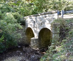 Cemetery Road Bridgelisted 1998
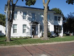 Dement-Zinser Houselisted 2002
 Denhart Bank Buildinglisted 2005
Population over time
2 figuresWashington grew from 15,134 to 16,071 between 2010 and 2020. These are the recorded population figures Wikidata holds for this place, reached through the Geographic Names Information System number this page is keyed on rather than by name, so they belong to this place and not to another of the same name. Most are census counts, but not all are: an early figure may be a founding or settlement estimate, and an estimate published within five years of a census is left out. The change column is computed, and is left blank where more than 20 years separate a figure from the one before it, because a gap that long is not a change between two counts.
| Year | People | Change |
|---|---|---|
| 2010 | 15,134 | |
| 2020 | 16,071 | +937 (+6%) |
Topographic sheets covering this place
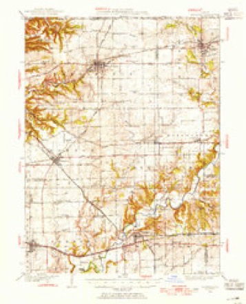
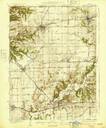
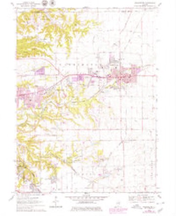
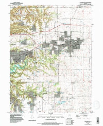
10 surveys from 15 printed sheetsMatched by testing this settlement's coordinate against the published boundary of every sheet in the United States Geological Survey's historical collection. Each opens the scanned sheet at the Survey.
- 1928 USGS Mackinaw quadrangle1:62500
- 1932 USGS Mackinaw quadrangle1:62500, 2 printings
- 1958 USGS Peoria quadrangle1:250000, 4 printings
- 1961 USGS Peoria quadrangle1:250000
- 1963 USGS Peoria quadrangle1:250000
- 1970 USGS Washington quadrangle1:24000, 2 printings
- 1985 USGS Peoria quadrangle1:100000
- 1989 USGS Peoria quadrangle1:100000
- 1990 USGS Peoria quadrangle1:250000
- 1995 USGS Washington quadrangle1:24000






In the county-history sources
20,168 words on this townshipHistory of Tazewell County, Illinois ; Together with Sketches of Its Cities, Villages and Townships, Educational, Religious, Civil, Military, and Political History; Portraits of Prominent Persons and Biographies of Representative Citizens. History of Illinois ... Digest of State Laws, published 1879 names this settlement in its chapter on Washington Township. These are the passages that mention it, exactly as the scans read.
The first settler in Washington township was William Holland, Sen., a native of North Carolina, and who emigrated from that State, and settled in Edwardsville, Madison county. 111., in 1815. He remained there for three years, when he removed to Sangamon Co., and after two years residence there moved to Peoria, then Fort Clark, in the spring of 1820. He crossed the river to the flats, now Fond du Lac township, and occupied an old shanty. Here he raised a crop during the summer of the same year. He cut logs, which he hauled across the river and erected a double log cabin. This was the second dwelling built in Peoria. Prior to his settling in Peoria, and during his residence in Sangamon, he was employed by a man named Cramer, who had contracts with the Government to do blacksmithing for the Indians. But completing the erection of his abode, he, himself, formed negotiations with the Government, and commenced at his trade, blacksmithing. In the spring of 1825, he came to this township, and built a log house on section 23, and on the present site of A. G. Danforth's residence. Here the family were surrounded by a dense wilderness, and were the only white occupants of this township until 1826. Holland commenced improving a farm on sec. 24, town 26, range 3, just east of the town of Washington, and embracing a part of the Holland, Dorsey, Walthan and Robinson addition to the town. His nearest neighbors were located on Farm creek, three miles east of Peoria, where the first settlement was made in this section. Amono' them were Wm. Blanchard, Elza Bethard, Jack Phillips, and his son William, Austin and Horace Crocker, and Thomas Camlin, whose cabin was located nearest Holland's Gove. There are others, the exact data of whose coming seems quite impossible to determine. In 1824 Jacob Wilson, Sr., Joshua Walker, Thomas Banks, and Elisha Green, all settled on Farm creek. Cyrus J. Gibson followed in 1830, and Thomas Trimble, whose sons are now prominent among the residents of Washington City, settled there in 1834. William Thompson, a native of Indiana, came in 1826, and settled on the farm now occupied by John Johnson and made some improvements. The same year William Weeks came from Indiana, and settled on the present estate of Peter Portman, where he erected a rude habitation, which has since given place to the fine residence of its owner. In the fall of the same year, John Redman, also from Indiana, settled near the farm of 'Squire Baker.
Passage source: History of Tazewell County, Illinois ; Together with Sketches of Its Cities, Villages and Townships, Educational, Religious, Civil, Military, and Political History; Portraits of Prominent Persons and Biographies of Representative Citizens. History of Illinois ... Digest of State Laws, published 1879.
With the coming of the spring and summer months of 1833, there came a general rush of immigrants, and ere the first snows of winter fell, the whole of the timbered sections of the township were nterspersed with cal)ins and settlers. A large ])ortion of the lands bearing timber, and the smaller groves, were claimed, if not occupied, while the prairie, for most part, was left untouched and unsought. The })rairie land was regarded as Avorthless for purposes of agriculture, and considered a useless waste. There were hundreds of men w^ho believed it would never be occupied. If any of the settlers at that time had located on the prairie he would have been regarded as extremely visionary, if not absolutely crazy. Of those whose names appear among the early pilgrims, many removed from the township ere many years had flown ; others followed from year to year, in other localities; others have passed to the Shining Shore of the Beautiful River, while many others still remain in the enjoyment of the homes of their industry, endurance, and enterprise ; fashioned and founded in the beautiful lands of Washington. The surroundings of piom^er life arc well calculated to test the true inwardness of the human heart, and the trials, sufferings, and endurance, incident to the founding and building of homes, unite them in the strongest and deepest feelings of friendship, that grows and strengthens with their years. Raven locks may bk'ach and whiten ; full round cheeks wither and waste away ; the fires of intelligence vanish from the organs of vision ; the brow become wrinkled with care and age, and the erect form bowed with accumulating years, but the true friends of long ago will be remembered as long as life and reason endure.
Passage source: History of Tazewell County, Illinois ; Together with Sketches of Its Cities, Villages and Townships, Educational, Religious, Civil, Military, and Political History; Portraits of Prominent Persons and Biographies of Representative Citizens. History of Illinois ... Digest of State Laws, published 1879.
The oldest living settler of this township is Lawson Holland, eldest son of William Holland, Sr., who was born in Lincoln Co., N. C, in 1812, and came to this county with his parents. From him we gather many incidents connected with the early settlement of the township. He was married in Oct., 1833, to Miss Elizabeth Bandy, daughter of Reuben Bandy, who came from Kentucky in 1831, and bought out the claim of Ira Crosby. They were married by Rev. Nathan Curtis, a Methodist minister. This was the fourth marriage in the township. The first in the neighborhood was in 1828, between James Hendricks and Miss Sallie Redman, daughter of John Redman, They were united by Daniel Meek, Justice of the Peace and resident of Waterloo. The same day Terrill Hall was married to Miss Jane Redman, second daughter of John Redman. The first funeral was that of a child of Plenson Thomas. It was buried in the graveyard on the 'Squire Baker farm. The first death of an adult was a Mr. Pembrock, a stranger, who had stopped at the residence of William Heath, where he died. He Avas also laid away in the same grounds. The first physician was Dr. Goodwin, who came from Vermont in 1832, where he was a student with the late Dr. G. P. Wood, and with whom he associated a business relation in 1835, in this city. They were the originators of Goodwin & Wood's addition to Washington. He is now a resident of Kendall Co., 111. James Huggins, of North Carolina, came in 1833. Jle learned wagon-making in the same shop in which Holland worked at blacksmithing. He engaged in the practice of medicine until 1859, Avhen he removed to Peoria, where he died in 1870. In 1834, Joseph Kelso and George D. Gibson came in, and are all of the living relics of that date. In 1835, Anthony Field, deceased, came in and located on sec. 34, where he resided until his death, in 1878. His widow still occupies the homestead. Thos. Cress came in the fall of the same year, and has secured an impregnable j)osition in the public history of this township, having beeuelected Collector twenty-four consecutive years.
Passage source: History of Tazewell County, Illinois ; Together with Sketches of Its Cities, Villages and Townships, Educational, Religious, Civil, Military, and Political History; Portraits of Prominent Persons and Biographies of Representative Citizens. History of Illinois ... Digest of State Laws, published 1879.
Machine-read from a century-old scan, so expect the errors a machine makes: misspelled names, dropped words, stray characters.
Read the whole chapter on Washington Township - it names this place 62 more 62 times.
Fires near this place
7 since 2010Regional context, not property-specific evidence. The federal wildfire occurrence database lists 7 fires within 5 miles of Washington between 2010 and 2014, burning about 28 acres in total. None started naturally. None was recorded as arson. Distance is straight-line from the map coordinates, so a fire counted here may appear on a neighbouring settlement's page as well.
| Reported cause | Fires |
|---|---|
| Debris and open burning | 4 |
| Missing data/not specified/undetermined | 3 |
The most recent of them, most recent first, with the day each was reported and the service that recorded it.
| Date | Cause | Size | Reported by | Name on the report |
|---|---|---|---|---|
| 23 September 2010 | Missing data/not specified/undetermined | 15 acres | Illinois Division of Forestry Resources | 10207 |
| 23 March 2013 | Missing data/not specified/undetermined | 1.0 acres | Illinois Division of Forestry Resources | COLLETT |
| 17 March 2012 | Debris and open burning | 6.0 acres | Illinois Division of Forestry Resources | ZEHR |
| 15 March 2014 | Debris and open burning | 2.0 acres | Illinois Division of Forestry Resources | NEHRING |
| 10 December 2010 | Debris and open burning | 1.0 acres | Illinois Division of Forestry Resources | WAGNER |
| 10 November 2010 | Missing data/not specified/undetermined | 1.0 acres | Illinois Division of Forestry Resources | LIST |
| 8 October 2011 | Debris and open burning | 2.0 acres | Illinois Division of Forestry Resources | BELL |
Settlements close enough to share some of these fires:
Storms near this place
56 since 1993Regional context, not property-specific evidence. The National Weather Service names Washington in 56 storm reports between 1993 and 2025: 26 thunderstorm wind, 25 hail, 3 tornado, 2 flash flood. No death or injury is recorded in these reports. Each account below is quoted exactly as the forecast office filed it, from the NOAA Storm Events Database, and each date opens the federal record of that event.
| When | Event | Place named | Harm | What the report says |
|---|---|---|---|---|
| June 2015 | Thunderstorm Wind | Washington | $50,000 | Several trees and power lines were blown down. |
| October 2010 | Thunderstorm Wind | Washington | $40,000 | Power poles were blown down in Washington. |
| June 2009 | Thunderstorm Wind | Washington | $35,000 | Power lines were blown down in Washington. Numerous large tree branches were downed as well. |
| June 2010 | Thunderstorm Wind | Washington | $30,000 | A tree and several powerlines were blown down at Route 24 and Pleasantview Road. |
| April 2006 | Thunderstorm Wind | Washington | $30,000 | Power lines blown down in Washington. Local Wal Mart lost $30,000 in food due to loss of power. |
| August 2009 | Thunderstorm Wind | Washington | $15,000 | Numerous tree limbs were blown down in Washington. |
| June 1994 | Thunderstorm Wind | Washington | $5,000 | no account filed |
| August 2009 | Thunderstorm Wind | Washington | $2,000 | Large tree branches were blown down near Beverly Manor School in Washington. |
| June 2014 | Thunderstorm Wind | Washington | $1,000 | A 5 to 6-inch diameter tree branch was blown down. |
| March 2025 | Thunderstorm Wind | Washington | - | Large trees were blown down on the south side of Washington. |
| April 2025 | Thunderstorm Wind | Washington | - | Several 2 to 3-inch diameter tree branches were snapped on South Market Street. |
| July 2024 | Thunderstorm Wind | Washington | - | Six inch diameter tree limbs were blown down. |
| July 2024 | Thunderstorm Wind | Washington | - | Several tree brances were blown down near South Market Street and Logan Street. |
| June 2024 | Thunderstorm Wind | Washington | - | A few tree branches were blown down. |
| May 2023 | Thunderstorm Wind | Washington | - | A large tree branch was blown down on Lynn Street. |
| June 2023 | Thunderstorm Wind | Washington | - | A large tree branch was blown down in Washington. |
| September 2022 | Thunderstorm Wind | Washington | - | Several 4 to 5-inch diameter tree limbs were blown down. |
| August 2022 | Hail | Washington | - | Hail resulted in damage to siding. |
| August 2022 | Thunderstorm Wind | Washington | - | Estimated winds gusts to 60 mph. |
| August 2022 | Hail | Washington | - | Hail shredded leaves. |
| August 2022 | Hail | Washington | - | Public report from mPING. |
| August 2022 | Flash Flood | Washington | - | Six to 15 inches of water reported over several roadways in Washington. |
| June 2022 | Thunderstorm Wind | Washington | - | Corn crops were flattened and a large dead tree limb was blown down just north of Business 24. |
| June 2019 | Thunderstorm Wind | Washington | - | A power line was blown down. |
| June 2012 | Thunderstorm Wind | Washington | - | A tree and several tree limbs were blown down in Washington. |
| May 2008 | Hail | Washington | - | One to two inch diameter hail was reported between East Peoria, Morton, and Washington. |
| June 2006 | Thunderstorm Wind | Washington | - | No damage was reported. |
| May 2005 | Thunderstorm Wind | Washington | - | Large tree blown down. |
| May 2004 | Tornado (F0) | Washington | - | A tornado briefly touched down in a field. No damage or injuries were reported. |
| May 2003 | Hail | Washington | - | Large hail fell from northwest of Washington through Washington, then southeast to Mackinaw. Hundreds of cars sustained damage, as well as, hundreds of homes with siding damage. No injuries were reported. |
| May 2003 | Thunderstorm Wind | Washington | - | Numerous trees were blown down in Washington. Some landed on buildings causing minor to moderate damage. |
| May 2003 | Tornado (F0) | Washington | - | As the tornado crossed from Woodford into Tazewell County, 3 miles north northwest of Washington, it continued to blow down numerous trees and power lines. It destroyed a shed before lifting and dissipating 2 miles north of Washington. No injuries were reported. |
| May 2003 | Tornado (F0) | Washington | - | A tornado first touched down in Tazewell County 3 miles southeast of Washington. It damaged a couple of homes and businesses, as well as blowing down numerous trees, power poles and power lines. The tornado then moved into Woodford County where it increased in intensity. No injuries were reported. |
| May 2002 | Flash Flood | Washington | - | Several roads and basements in the Deer Ridge Subdivision were flooded due to between 3 and 4 inches of rain in a short amount of time. |
| August 1993 | Thunderstorm Wind | Washington | - | Large tree limbs were blown down at Creve Coeur. Wind gusted to 60 mph at Washington. |
| March 2023 | Hail | Washington | - | no account filed |
| April 2023 | Hail | Washington | - | no account filed |
| May 2023 | Hail | Washington | - | no account filed |
| August 2022 | Hail | Washington | - | no account filed |
| August 2022 | Hail | Washington | - | no account filed |
| August 2022 | Hail | Washington | - | no account filed |
| August 2022 | Hail | Washington | - | no account filed |
| May 2020 | Hail | Washington | - | no account filed |
| May 2020 | Hail | Washington | - | no account filed |
| September 2019 | Hail | Washington | - | no account filed |
| March 2017 | Hail | Washington | - | no account filed |
| April 2017 | Hail | Washington | - | no account filed |
| April 2017 | Hail | Washington | - | no account filed |
| April 2013 | Hail | Washington | - | no account filed |
| September 2012 | Hail | Washington | - | no account filed |
| June 2008 | Hail | Washington | - | no account filed |
| May 2006 | Hail | Washington | - | no account filed |
| March 2005 | Hail | Washington | - | no account filed |
| June 2003 | Hail | Washington | - | no account filed |
| June 1998 | Thunderstorm Wind | Washington | - | no account filed |
| August 1993 | Hail | Washington | - | no account filed |
Nearest settlements
The eight closest, with where each one stands in the county. Distances are straight-line, computed from the Geographic Names Information System coordinates.
| Map | Place | Distance | Sheets |
|---|---|---|---|
| Cooper | 3.0 miles | 15 | |
| Beverly Manor | 3.2 miles | 15 | |
| Harvard Hills | 4.3 miles | 15 | |
| Crandall | 5.1 miles | 15 | |
| Sunnyland | 5.4 miles | 21 | |
| Robein | 5.6 miles | 21 | |
| Farmdale | 6.1 miles | 21 | |
| Mayfair | 6.1 miles | 15 |
Elsewhere
Matched on this settlement's Geographic Names Information System number rather than its name, so it cannot be a different place of the same name in another state.
| Wikipedia article on Washington | An encyclopaedic summary. Its text is share-alike, so it is linked here rather than copied. |
| Wikidata item Q575163 | The structured record the population and elevation above come from. Public domain (CC0). |
Provenance
This settlement is recorded in the Geographic Names Information System as feature 420550. The sheet list is computed by point-in-boundary test against the United States Geological Survey's historical topographic inventory. Both are works of the United States government and carry no copyright under 17 U.S.C. 105.
Wildfire. Short, Karen C. 2022. Spatial wildfire occurrence data for the United States, 1992-2020 [FPA_FOD_20221014]. 6th Edition. Fort Collins, CO: Forest Service Research Data Archive. https://doi.org/10.2737/RDS-2013-0009.6 Collected with United States Government funding and usable without additional permissions or fees.
Storms. NOAA National Centers for Environmental Information, Storm Events Database https://www.ncei.noaa.gov/stormevents/ A work of the United States government, no copyright under 17 U.S.C. 105. Narratives are quoted verbatim from the National Weather Service report and are not edited or summarised.