 Block
Woodbine, Illinois
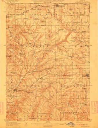
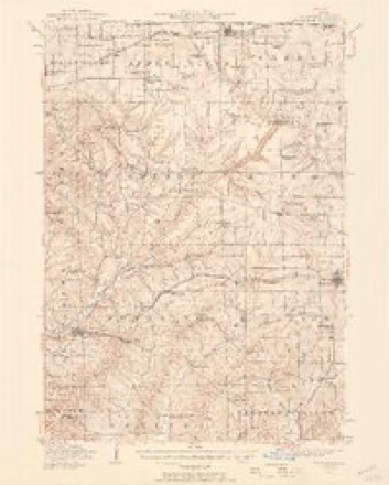
14 topographic sheets cover this place, the earliest surveyed in 1911 and the latest in 1984. It stands in Woodbine Township. It lies in ZIP code area 61028. It lies near Welsh Hollow. The Survey maps it on the Elizabeth quadrangle.
Topographic sheets covering this place
8 surveys from 14 printed sheetsMatched by testing this settlement's coordinate against the published boundary of every sheet in the United States Geological Survey's historical collection. Each opens the scanned sheet at the Survey.
- 1911 USGS Elizabeth quadrangle1:62500, 2 printings
- 1936 USGS Elizabeth quadrangle1:62500, 2 printings
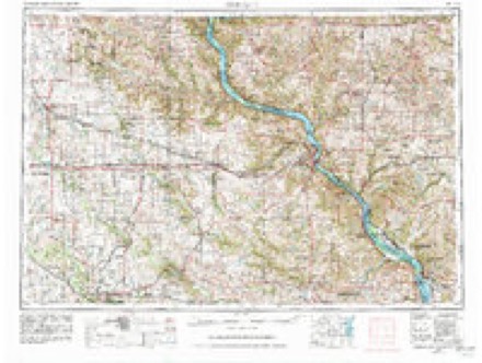
- 1959 USGS Dubuque quadrangle1:250000
- 1961 USGS Dubuque quadrangle1:250000
- 1962 USGS Dubuque quadrangle1:250000, 2 printings
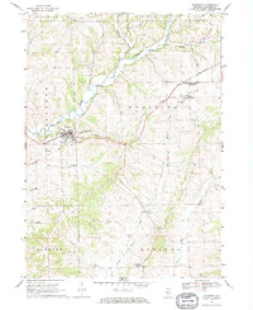
- 1968 USGS Elizabeth quadrangle1:24000
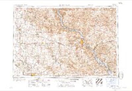
- 1976 USGS Dubuque quadrangle1:250000
- 1984 USGS Dubuque South quadrangle1:100000, 4 printings
In the county-history sources
5,944 words on this townshipThe History of Jo Daviess County, Illinois, Containing a History of the County, Its Cities, Towns, Etc., a Biographical Directory of Its Citizens, War Record of Its Volunteers in the Late Rebellion ... History of the Northwest, History of Illinois ... Constitution of the United States, published 1878 names this settlement in its chapter on Woodbine Township. These are the passages that mention it, exactly as the scans read.
Ill miMH H II J05IX, Farmer; Sec. 14; P. O. Woodbine; born in Rottenburg, Germany, June, 18, 1830; came to Pa. in 1848; lived there about two years, and married Miss Margaret Barager in 1850; she was born in Briar Creek, Pa.; they moved to Ogle Co. in 1865, and soon after to this Co. and settled in Woodbine ; have ten children living: Lavina, William, John, Alexandria, Charles, George E., Philip, Jacob, Annie C., Margaret; owns 100 acres of land; William, the eldest son, since he grew to manhood has been in Whiteside Co. about one year; wentto Nebraska in 1873; returned and has been engaged in farming and running a threshing machine for several years, and by his untiring industry and energy, coupled with commendable economy, has, from small beginnings, become able to purchase the Woodbine Store, of which he is sole proprietor; he is doing a thriving business in Dry Goods, Groceries, Boots and shoes ; he proposes by honest dealing to furnish every thing in his line as cheap as the cheapest; he has lately been appointed Postmaster of the Woodbine Post-office, which he keeps in his store.
Passage source: The History of Jo Daviess County, Illinois, Containing a History of the County, Its Cities, Towns, Etc., a Biographical Directory of Its Citizens, War Record of Its Volunteers in the Late Rebellion ... History of the Northwest, History of Illinois ... Constitution of the United States, published 1878.
REYNOLDS WM. LAW, Farmer; Sec. 14; P. O. Woodbine; born in Hertfordshire, England, Nov. 23, 1829 ; came to America in 1851; remained one year in Vermont and two years in Rochester, N. Y. ; came to Jo Daviess Co. in 1856 ; married Miss Mary Green June 7, 1857 ; she was born in Yorkshire, England, Oct. 15, 1836 ; came to Wisconsin with her parents in 1842 ; Mr. R. served in the army during the war ; was mustered into the 124th Regt. I. y. I. at Dixon ; was at Camp Butler, Vicksburg; was at the siege of Spanish Fort, a severe engagement, lasting 13 days and nights ; went to Montgomery, and returned to Vicksburg where he was honorably discharged at the close of the war; have three children : Martha, Anne E., George W., and Jessie Green; has 110 acres of land.
Passage source: The History of Jo Daviess County, Illinois, Containing a History of the County, Its Cities, Towns, Etc., a Biographical Directory of Its Citizens, War Record of Its Volunteers in the Late Rebellion ... History of the Northwest, History of Illinois ... Constitution of the United States, published 1878.
ROGERS JAMES, Farmer; Sec. 14; P. O. Woodbine; born in Cornwall, Eng., in 1820 ; married Miss Eliza Roberts in Jan., 1842; she was born in Cornwall, Eng., Feb. 4, 1819; they came direct to Jo Daviess Co. in 1846, settling at Scales Mound ; Mr. R. has always taken an active interest in the advancement of .the M. E. Church ; was one of four men who instituted and set on foot the erection of Scales Mound M. E. Church in 1851 ; was a miner in the old country, and has been engaged in the same business here till some years since ; turned his attention to farming, in which he is now engaged; owns 271 acres land; took an active part in the organization of Jewl's Prairie M. E. Church, of which they are prominent members; have four children living: Mrs. Jane Potter, Walter, George and John J. C. ; lost two children, buried at Veto Grand Burying Ground, afterwards removed to Scales Mound.
Passage source: The History of Jo Daviess County, Illinois, Containing a History of the County, Its Cities, Towns, Etc., a Biographical Directory of Its Citizens, War Record of Its Volunteers in the Late Rebellion ... History of the Northwest, History of Illinois ... Constitution of the United States, published 1878.
Machine-read from a century-old scan, so expect the errors a machine makes: misspelled names, dropped words, stray characters.
Read the whole chapter on Woodbine Township - it names this place 3 more 3 times.
Fires near this place
9 since 2008Regional context, not property-specific evidence. The federal wildfire occurrence database lists 9 fires within 5 miles of Woodbine between 2008 and 2010, burning about 31 acres in total. None started naturally. 1 was recorded as arson. Distance is straight-line from the map coordinates, so a fire counted here may appear on a neighbouring settlement's page as well.
| Reported cause | Fires |
|---|---|
| Missing data/not specified/undetermined | 5 |
| Debris and open burning | 2 |
| Equipment and vehicle use | 1 |
| Arson/incendiarism | 1 |
The most recent of them, most recent first, with the day each was reported and the service that recorded it.
| Date | Cause | Size | Reported by | Name on the report |
|---|---|---|---|---|
| 27 September 2010 | Arson/incendiarism | under an acre | Illinois Division of Forestry Resources | WURSTER |
| 12 September 2008 | Missing data/not specified/undetermined | under an acre | Illinois Division of Forestry Resources | ELECTRIC |
| 16 July 2010 | Debris and open burning | under an acre | Illinois Division of Forestry Resources | TREE |
| 5 April 2010 | Missing data/not specified/undetermined | 12 acres | Illinois Division of Forestry Resources | HASS |
| 2 April 2008 | Missing data/not specified/undetermined | 1.0 acres | Illinois Division of Forestry Resources | WHEELERIGHT |
| 25 March 2008 | Missing data/not specified/undetermined | 3.0 acres | Illinois Division of Forestry Resources | BALDERINI |
| 18 March 2010 | Debris and open burning | 15 acres | Illinois Division of Forestry Resources | WOODBINE |
| 15 November 2010 | Missing data/not specified/undetermined | under an acre | Illinois Division of Forestry Resources | OAKS |
Settlements close enough to share some of these fires:
Mines and quarries near this place
6 within 5 milesRegional context, not property-specific evidence. The federal mineral resources record lists 6 workings within 5 miles of Woodbine: 4 past producers, 1 unknown, 1 producer. 1 still produces. What was taken out: Stone, Crushed/Broken, Lead, Zinc, Lead, Zinc. Distance is straight-line from the map coordinates, so a quarry counted here may appear on a neighbouring settlement's page as well.
| Where | Site | Commodity | Status | Recorded |
|---|---|---|---|---|
| Kansas Mine | Lead, Zinc | Unknown | Galena, Sphalerite | |
| Wishon Mine | Lead, Zinc | Past Producer | 1865, 1910 | |
| Blakely Quarry | Stone, Crushed/Broken | Past Producer | ||
| Brudi Quarry | Stone, Crushed/Broken | Past Producer | ||
| Millershane Quarry | Stone, Crushed/Broken | Past Producer | ||
| Schultz Quarry | Stone, Crushed/Broken | Producer |
Storms near this place
12 since 1999Regional context, not property-specific evidence. The National Weather Service names Woodbine in 12 storm reports between 1999 and 2026: 7 thunderstorm wind, 2 hail, 1 flood, 1 flash flood. No death or injury is recorded in these reports. Each account below is quoted exactly as the forecast office filed it, from the NOAA Storm Events Database, and each date opens the federal record of that event.
| When | Event | Place named | Harm | What the report says |
|---|---|---|---|---|
| February 1999 | Thunderstorm Wind | Woodbine | $40,000 | no account filed |
| June 2025 | Thunderstorm Wind | Woodbine | - | Personal weather station measured gust of 59.4 mph. |
| May 2024 | Hail | Woodbine | - | Pea to penny size hail reported. |
| July 2024 | Thunderstorm Wind | Woodbine | - | A public report of thunderstorm wind damage. |
| July 2024 | Tornado (EF1) | Woodbine | - | A tornado developed just east of Woodbine in Jo Daviess County, and moved southeast along an intermittent 8 mile path. The tornado downed numerous trees along S. Massbach Road. The tornado was rated EF-1 with maximum winds around 100 mph and was 50 yards wide. |
| July 2022 | Thunderstorm Wind | Woodbine | - | A trained spotter reported a51 knot gust measured by there personal weather station. |
| August 2020 | Thunderstorm Wind | Woodbine | - | A Davis weather station on a rooftop measured a peak wind of 77 mph. This blew down a tree nearby. |
| September 2019 | Flash Flood | Woodbine | - | A trained spotter reported minor flooding on the Apple River overnight. 1 to 3 inches of rain fell across the area overnight. |
| August 2010 | Thunderstorm Wind | Woodbine | - | Wind gusts estimated to be 60 mph blew down several large tree limbs in Woodbine, IL around 4 pm CDT August 13. |
| March 2007 | Thunderstorm Wind | Woodbine | - | Sheriffs department reported many trees down, some blocking roads in the Woodbine area. |
| March 2026 | Hail | Woodbine | - | no account filed |
| June 2000 | Flood | Woodbine | - | no account filed |
Nearest settlements
The eight closest, with where each one stands in the county. Distances are straight-line, computed from the Geographic Names Information System coordinates.
| Map | Place | Distance | Sheets |
|---|---|---|---|
| Elizabeth | 4.4 miles | 14 | |
| Schapville | 4.9 miles | 15 | |
| Apple Canyon Lake | 5.4 miles | 15 | |
| Derinda Center | 6.2 miles | 14 | |
| Weston (historical) | 6.6 miles | 18 | |
| Massbach | 6.7 miles | 21 | |
| Pleasant Hill (historical) | 7.2 miles | 14 | |
| Stockton | 7.4 miles | 14 |
Provenance
This settlement is recorded in the Geographic Names Information System as feature 421416. The sheet list is computed by point-in-boundary test against the United States Geological Survey's historical topographic inventory. Both are works of the United States government and carry no copyright under 17 U.S.C. 105.
Wildfire. Short, Karen C. 2022. Spatial wildfire occurrence data for the United States, 1992-2020 [FPA_FOD_20221014]. 6th Edition. Fort Collins, CO: Forest Service Research Data Archive. https://doi.org/10.2737/RDS-2013-0009.6 Collected with United States Government funding and usable without additional permissions or fees.
Mines and quarries. USGS Mineral Resources Data System (MRDS) https://mrdata.usgs.gov/mrds/ A work of the United States government, no copyright under 17 U.S.C. 105.
Storms. NOAA National Centers for Environmental Information, Storm Events Database https://www.ncei.noaa.gov/stormevents/ A work of the United States government, no copyright under 17 U.S.C. 105. Narratives are quoted verbatim from the National Weather Service report and are not edited or summarised.