 Block
Alpine, Indiana
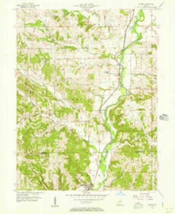
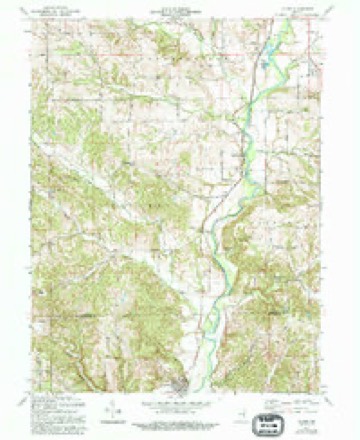
10 topographic sheets cover this place, the earliest surveyed in 1953 and the latest in 1986. It stands in Columbia Township. It lies in ZIP code area 47331. It stands on North Branch Garrison Creek. The Survey maps it on the Alpine quadrangle. It stands 761 feet above sea level.
Topographic sheets covering this place
5 surveys from 10 printed sheetsMatched by testing this settlement's coordinate against the published boundary of every sheet in the United States Geological Survey's historical collection. Each opens the scanned sheet at the Survey.
- 1953 USGS Cincinnati quadrangle1:250000, 3 printings
- 1956 USGS Alpine quadrangle1:24000
- 1957 USGS Cincinnati quadrangle1:250000
- 1971 USGS Alpine quadrangle1:24000, 3 printings
- 1986 USGS New Castle quadrangle1:100000, 2 printings



In the county-history sources
15,482 words on this townshipHistory of Fayette County, Indiana: Containing a History of the Townships, Towns, Villages, Schools, Churches, Industries, Etc.; Portraits of Early Settlers and Prominent Men; Biographies, Etc., Etc. .., published 1885 names this settlement in its chapter on Columbia Township. These are the passages that mention it, exactly as the scans read.
The settlers who came in 1811, 1812 and 1813 settled along the streams named, and were with little, if any, exception, from the State of Kentucky. Those of whom any definite or satisfactory information could be obtained are William Helm, who on the 10th of March, 1811, with family emigrated from Mason County, Ky. He and his wife had been inmates of Bryant's Station during its memorable siege by the Indians, and the husband had been engaged for some time in the border wars. At the beginning' of the war of 1812 he was commissioned Major, and placed in command of the troops guarding the frontier. Judge Helm was deeply imbued with the hospitality of his countrymen. He was a strong and good man, and for a number of years was one of the Associate Judges of the county. "His judgment was sound, and his integrity above question.'' He was the father of Meredith Helm, of this county. Dr. Jefferson Helm, of Rush, and Robert D. Helm, of Wabash.
Passage source: History of Fayette County, Indiana: Containing a History of the Townships, Towns, Villages, Schools, Churches, Industries, Etc.; Portraits of Early Settlers and Prominent Men; Biographies, Etc., Etc. .., published 1885.
The old residence built and occupied by Judge Webb about 1817 still stands, occupying a site on the fertile bottom land along Whitewater River, a situation commanding a beautiful view. It is of the second class of pioneer cabins, constructed of hewed logs, two stories high and the building in size being about 18x28 feet; on the north end of the building is a large chimney constructed of stone of various sizes, built on the outside of the house; two doors from without open into the house, one on either side. Below on either side is one window, though of different sizes, and on the east side of the second floor are two half or garret windows. Within the house are three apartments, one above and two below, each floor being provided with one fireplace, large below and small on the second floor. This is said to have been the substantial house of that day in the settlement.
Passage source: History of Fayette County, Indiana: Containing a History of the Townships, Towns, Villages, Schools, Churches, Industries, Etc.; Portraits of Early Settlers and Prominent Men; Biographies, Etc., Etc. .., published 1885.
The first mill in the township is thought to have been a saw-mill erected by Allen Crisler. It stood not far from the present site of the barn of William Seals, at the north end of Alpine. This mill was in operation in the summer of 1815, and was built not far from that time, likely in 1814. Dr. Mason in his autobiography speaks of framing a mill-house for Allen Crisler in the summer of 1816. The Doctor traded his farm for the mill that fall, and thus speaks of it: "There was a very good saw-mill, with a separate building, a good stone wall for the first story, on which stood the frame I had put up for a mill-house, with one run of common granite millstones, and a bolting chest with a small bolt, which was turned by hand for bolting flour made from wheat." The mills were operated by the Doctor and his brother Horatio, who became a partner, until in the fall of 1818, when the same parties resumed their old possessions - trading back. In about 1817 John A. White commenced as the miller at this mill. Subsequently a still-house and hemp-mill were added, and all four operated by Col. Crisler, until a change in the coarse of the river destroyed the power and all vrent into disuse.
Passage source: History of Fayette County, Indiana: Containing a History of the Townships, Towns, Villages, Schools, Churches, Industries, Etc.; Portraits of Early Settlers and Prominent Men; Biographies, Etc., Etc. .., published 1885.
Machine-read from a century-old scan, so expect the errors a machine makes: misspelled names, dropped words, stray characters.
Read the whole chapter on Columbia Township - it names this place 15 more 15 times.
Mines and quarries near this place
4 within 5 milesRegional context, not property-specific evidence. The federal mineral resources record lists 4 workings within 5 miles of Alpine: 4 producers. All of them still produce. What was taken out: Limestone, Dimension, Sand and Gravel, Construction. Distance is straight-line from the map coordinates, so a quarry counted here may appear on a neighbouring settlement's page as well.
| Where | Site | Commodity | Status | Recorded |
|---|---|---|---|---|
| Connersville Pit | Sand and Gravel, Construction | Producer | ||
| Booher Stone Quarry | Limestone, Dimension | Producer | ||
| Ogle Stone Quarry | Limestone, Dimension | Producer | ||
| Rabbit Hollow Quarry | Limestone, Dimension | Producer |
Storms near this place
18 since 1996Regional context, not property-specific evidence. The National Weather Service names Alpine in 18 storm reports between 1996 and 2025: 8 hail, 6 thunderstorm wind, 2 flash flood, 2 flood. No death or injury is recorded in these reports. Each account below is quoted exactly as the forecast office filed it, from the NOAA Storm Events Database, and each date opens the federal record of that event.
| When | Event | Place named | Harm | What the report says |
|---|---|---|---|---|
| April 2006 | Hail | Alpine | $6,000 | no account filed |
| November 1998 | Thunderstorm Wind | Alpine | $5,000 | Trees and power lines down. |
| April 2016 | Thunderstorm Wind | Alpine | $1,500 | Tree limbs were knocked down in the area. |
| March 2025 | Thunderstorm Wind | Alpine | $1,000 | A tree was downed. |
| June 2024 | Thunderstorm Wind | Alpine | $1,000 | A tree was downed near the intersection of State Road 121 and Alpine Road. |
| May 2014 | Thunderstorm Wind | Alpine | $1,000 | Siding was blown off of a house due to thunderstorm winds. |
| August 2010 | Thunderstorm Wind | Alpine | $1,000 | Large limbs were reported down due to damaging thunderstorm winds. |
| July 2025 | Flood | Alpine | - | High water was reported near 650 West, just south of the Mary Gray Bird Sanctuary. |
| May 2022 | Flash Flood | Alpine | - | Little Bear Road was impassable due to water rushing across it. |
| December 2013 | Flood | Alpine | - | One road remained closed near Alpine due to high water caused by earlier heavy rainfall. |
| July 2006 | Flash Flood | Alpine | - | State Route 121 was flooded and closed. |
| April 2019 | Hail | Alpine | - | no account filed |
| April 2016 | Hail | Alpine | - | no account filed |
| May 2014 | Hail | Alpine | - | no account filed |
| April 2011 | Hail | Alpine | - | no account filed |
| May 2011 | Hail | Alpine | - | no account filed |
| May 2003 | Hail | Alpine | - | no account filed |
| June 1996 | Hail | Alpine | - | no account filed |
Nearest settlements
The eight closest, with where each one stands in the county. Distances are straight-line, computed from the Geographic Names Information System coordinates.
| Map | Place | Distance | Sheets |
|---|---|---|---|
| Nulltown | 2.0 miles | 10 | |
| Columbia | 2.3 miles | 10 | |
| Everton | 4.6 miles | 11 | |
| Bunker Hill | 5.8 miles | 9 | |
| Connersville | 6.3 miles | 9 | |
| Orange | 6.9 miles | 9 | |
| Tyner Crossing | 7.0 miles | 9 | |
| Longwood Crossing | 7.5 miles | 9 |
Elsewhere
Matched on this settlement's Geographic Names Information System number rather than its name, so it cannot be a different place of the same name in another state.
| Wikipedia article on Alpine | An encyclopaedic summary. Its text is share-alike, so it is linked here rather than copied. |
| Wikidata item Q4735456 | The structured record the population and elevation above come from. Public domain (CC0). |
Provenance
This settlement is recorded in the Geographic Names Information System as feature 430115. The sheet list is computed by point-in-boundary test against the United States Geological Survey's historical topographic inventory. Both are works of the United States government and carry no copyright under 17 U.S.C. 105.
Mines and quarries. USGS Mineral Resources Data System (MRDS) https://mrdata.usgs.gov/mrds/ A work of the United States government, no copyright under 17 U.S.C. 105.
Storms. NOAA National Centers for Environmental Information, Storm Events Database https://www.ncei.noaa.gov/stormevents/ A work of the United States government, no copyright under 17 U.S.C. 105. Narratives are quoted verbatim from the National Weather Service report and are not edited or summarised.